Sign In
Upload
Manuals
Brands
Lowrance Manuals
GPS
LCX-17M
Lowrance LCX-17M Manuals
Manuals and User Guides for Lowrance LCX-17M. We have
2
Lowrance LCX-17M manuals available for free PDF download: Installation And Operation Instructions Manual, Operating Instructions Manual
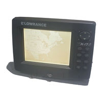
Lowrance LCX-17M Installation And Operation Instructions Manual (204 pages)
Fish-finding Sonar & Mapping GPS
Brand:
Lowrance
| Category:
GPS
| Size: 8.57 MB
Table of Contents
Table of Contents
3
Section 1: Read Me First
9
Capabilities and Specifications: LCX-17M
11
How Your Sonar Works
14
How Your GPS Works
15
Introduction to GPS and WAAS
16
How to Use this Manual: Typographical Conventions
19
Section 2: Installation & Accessories
21
Preparations
21
Transducer Installation
21
Selecting a Transducer Location
22
How Low Should You Go
24
Shoot-Thru-Hull Vs. Transom Mounting
24
Transom Transducer Assembly and Mounting
25
Trolling Motor Bracket Installation
31
Transducer Orientation and Fish Arches
32
Shoot-Thru-Hull Preparation
32
Shoot-Thru-Hull Installation
35
Speed/Temperature Sensors
37
GPS Antenna/Receiver Module
38
Power Connections
41
Powering a Nmea 2000 Buss
42
NMEA 2000 Cable Connections
44
Connecting to a NMEA 2000 Network
44
NMEA 0183 Wiring (Data Cable)
44
Mounting the Unit: Bracket or In-Dash
46
MMC or SDC Memory Card Installation
50
Other Accessories
51
Face Cover
53
Section 3: Basic Sonar Operation
55
Keyboard
55
Power/Lights on and off
56
Main Menu
57
Satellite Status Page
58
Navigation Page
59
Map Page
59
Sonar Page
60
LCX-17M Sonar Quick Reference
63
Sonar Operations
64
Fish Symbols Vs. Full Sonar Chart
66
Other Free Training Aids
66
Section 4: Sonar Options & Other Features
69
ASP (Advanced Signal Processing)
69
Alarms
70
Depth Alarms
70
Zone Alarm
71
Fish Alarm
72
Calibrate Speed
72
Chart Speed
73
Depth Cursor
74
Depth Range - Automatic
74
Depth Range - Manual
75
Depth Range - Upper and Lower Limits
75
Fastrack
77
Fish I.D. (Fish Symbols & Depths)
77
Fishtrack
79
Frequency (Change Transducer Frequency)
80
Grayline
81
Hyperscroll
82
Log Sonar Chart Data
82
Noise Rejection
83
Overlay Data
83
Ping Speed & Hyperscroll
86
Reset Options
87
Reset Water Distance
88
Set Keel Offset
88
Sensitivity & Auto Sensitivity
89
Sonar Chart Mode
91
Sonar Page & Sonar Chart Display Options
91
Full Sonar Chart
92
Split Zoom Sonar Chart
93
Split Frequency Sonar Chart
93
Digital Data/Chart
94
Customize Page Displays
94
Flashgraf
95
Map with Sonar Split Screen
96
Sonar Simulator
97
Stop Chart
98
Surface Clarity
99
Upper and Lower Limits
100
Zoom & Zoom Bar
100
Zoom Pan
101
Section 5: Sonar Troubleshooting
103
Section 6: Basic GPS Operations
107
Keyboard
107
Power/Lights on and off
108
Main Menu
108
Sonar Page
110
Satellite Status Page
110
Navigation Page
112
Map Page
114
GPS Quick Reference
119
Find Your Current Position
120
Moving Around the Map: Zoom & Cursor Arrow Keys
120
Selecting any Map Item with the Cursor
121
Searching
121
Set a Waypoint
123
Navigate to a Waypoint
125
Set man Overboard (MOB) Waypoint
126
Navigate Back to MOB Waypoint
126
Navigate to Cursor Position on Map
127
Navigate to a Point of Interest
128
Creating and Saving a Trail
129
Displaying a Saved Trail
130
Navigating Trails
131
Visual Trailing
131
Navigate a Trail (Forward)
131
Navigate a Back Trail (Backtrack, or Reverse)
134
Transfer Custom Maps and GPS Data Files
134
Custom Maps
134
GPS Data Files
134
Cancel Navigation
136
Section 7: Advanced GPS Operations
137
Find Distance from Current Position
137
Find Distance from Point to Point
137
Icons
137
Create Icon on Map
138
Create Icon at Current Position
138
Delete an Icon
138
Navigate to an Icon
139
Routes
139
Create and Save a Route
140
PC-Created Routes
140
Routes Created in the Unit
140
Delete a Route
142
Edit a Route
142
Navigate a Route
143
Navigate a Route in Reverse
144
Trails
145
Delete a Trail
145
Edit a Trail Name
145
Edit a Trail Color
145
Edit a Trail Pattern
145
Utilities
146
Alarm Clock
146
Sun/Moon Rise & Set Calculator
146
Trip Calculator
146
Trip down Timer
146
Trip up Timer
146
Waypoints
146
Delete a Waypoint
146
Edit a Waypoint (Name, Symbol, Position)
147
Selecting a Waypoint
147
Set a Waypoint by Average Position
147
Set a Waypoint by Projecting a Position
148
Section 8 System & GPS Setup Options
149
Alarms
149
Auto Satellite Search
150
Check MMC Files and Storage Space
150
Communications Port Configuration
151
Configure NMEA
151
Coordinate System Selection
152
Map Fix
153
Customize Page Displays
155
GPS Simulator
156
Simulating Trail or Route Navigation
156
Hide GPS Features
157
Initialize GPS
157
Map Auto Zoom
158
Map Data
158
Pop-Up Map Info
158
Fill Water with White
159
Map Overlays (Range Rings; Lat/Long Grid)
159
Map Datum Selection
159
Map Boundaries
159
Map Detail Category Selection
160
Map Orientation
161
Navionics Charts
162
Port Information
163
Tidal Current Information
164
Tide Information
166
Pop-Up Help
167
Reset Options
168
Screen Contrast and Brightness
168
Set Language
169
Set Local Time
170
Show WAAS Alarm
171
Software Version Information
171
Sounds and Alarm Sound Styles
171
Track Smoothing
172
Trail Options
173
Delete All Trails
173
Update Trail Option
173
Delete Trail
174
New Trail
175
Trail Visible/Invisible and Other Trail Options
175
Units of Measure
175
Section 9: Searching
177
Find Addresses
177
Find any Item Selected by Map Cursor
180
Find Interstate Highway Exits
180
Find Map Places or Points of Interest (POI)
183
Find Streets or Intersections
184
Find Waypoints
188
Section 10: Supplemental Material
191
Fcc Compliance
195
How to Obtain Service
202
Visit Our Web Site
204
Advertisement
Lowrance LCX-17M Operating Instructions Manual (134 pages)
Fish-Finding Sonar & Mapping GPS
Brand:
Lowrance
| Category:
Fish Finder
| Size: 6.7 MB
Table of Contents
Table of Contents
2
Section 3: Basic Sonar Operation
7
Power/Lights on and off
8
Main Menu
9
Satellite Status
10
Navigation
11
Sonar
12
LCX-17M Sonar Quick Reference
15
Sonar Operations
16
Fish Symbols Vs. Full Sonar Chart
18
Section 4: Sonar Options & Other Features
21
Alarms
22
Depth Alarms
22
Zone Alarm
23
Fish Alarm
24
Calibrate Speed
24
Chart Speed
25
Depth Cursor
26
Depth Range - Automatic
26
Depth Range - Manual
27
Depth Range - Upper and Lower Limits
27
Fastrack
29
Fish I.D. (Fish Symbols & Depths)
29
Fishtrack
31
Frequency (Change Transducer Frequency)
32
Grayline
33
Hyperscroll
34
Log Sonar Chart Data
34
Noise Rejection
35
Overlay Data
35
Ping Speed & Hyperscroll
38
Reset Options
39
Transducer Installation
40
Reset Water Distance
40
Set Keel Offset
40
Sensitivity & Auto Sensitivity
41
Sonar Chart Mode
43
Sonar Page & Sonar Chart Display Options
43
Full Sonar Chart
44
Split Zoom Sonar Chart
45
Split Frequency Sonar Chart
45
Digital Data/Chart
46
Customize Page Displays
46
Flashgraf
47
Map with Sonar Split Screen
48
Sonar Simulator
49
Stop Chart
50
Surface Clarity
51
Upper and Lower Limits
52
Zoom & Zoom Bar
52
Zoom Pan
53
Section 5: Sonar Troubleshooting
55
Section 6: Basic GPS Operations
59
Keyboard
59
Main Menu
60
Sonar Page
62
Satellite Status Page
62
Navigation Page
64
Map Page
66
Power/Lights on and off
60
GPS Quick Reference
71
Find Your Current Position
72
Moving Around the Map: Zoom & Cursor Arrow Keys
72
Selecting any Map Item with the Cursor
73
Searching
73
Set a Waypoint
75
Navigate to a Waypoint
77
Set man Overboard (MOB) Waypoint
78
Navigate Back to MOB Waypoint
78
Navigate to Cursor Position on Map
79
Navigate to a Point of Interest
80
Creating and Saving a Trail
81
Displaying a Saved Trail
82
Navigating Trails
83
Visual Trailing
83
Navigate a Trail (Forward)
83
Navigate a Back Trail (Backtrack, or Reverse)
86
Transfer Custom Maps and GPS Data Files
86
Custom Maps
86
GPS Data Files
86
Cancel Navigation
88
Section 7: Advanced GPS Operations
89
Find Distance from Current Position
89
Find Distance from Point to Point
89
Icons
89
Create Icon on Map
90
Create Icon at Current Position
90
Delete an Icon
90
Navigate to an Icon
91
Routes
91
Create and Save a Route
92
PC-Created Routes
92
Routes Created in the Unit
92
Delete a Route
94
Edit a Route
94
Navigate a Route
95
Navigate a Route in Reverse
96
Trails
97
Delete a Trail
97
Edit a Trail Name
97
Edit a Trail Color
97
Edit a Trail Pattern
97
Utilities
98
Alarm Clock
98
Sun/Moon Rise & Set Calculator
98
Trip Calculator
98
Trip down Timer
98
Trip up Timer
98
Waypoints
98
Delete a Waypoint
98
Edit a Waypoint (Name, Symbol, Position)
99
Selecting a Waypoint
99
Set a Waypoint by Average Position
99
Set a Waypoint by Projecting a Position
100
Section 8 System & GPS Setup Options
101
Alarms
101
Auto Satellite Search
102
Check MMC Files and Storage Space
102
Communications Port Configuration
103
Configure NMEA
103
Coordinate System Selection
104
Map Fix
105
Customize Page Displays
107
GPS Simulator
108
Simulating Trail or Route Navigation
108
GPS Antenna/Receiver Module
109
Hide GPS Features
109
Initialize GPS
109
Map Auto Zoom
110
Map Data
110
Pop-Up Map Info
110
Map Boundaries
111
Fill Water with White
111
Map Overlays (Range Rings; Lat/Long Grid)
111
Map Datum Selection
111
Map Detail Category Selection
112
Map Orientation
113
Navionics Charts
114
Port Information
115
Tidal Current Information
116
Tide Information
118
Pop-Up Help
119
Reset Options
120
Screen Contrast and Brightness
120
Set Language
121
Set Local Time
122
Show WAAS Alarm
123
Software Version Information
123
Sounds and Alarm Sound Styles
123
Track Smoothing
124
Trail Options
125
Delete All Trails
125
Update Trail Option
125
Delete Trail
126
New Trail
127
Trail Visible/Invisible and Other Trail Options
127
Units of Measure
127
Section 9: Searching
129
Find Addresses
129
Find any Item Selected by Map Cursor
132
Find Interstate Highway Exits
132
Advertisement
Related Products
Lowrance LCX-110C
Lowrance LCX-16CI
Lowrance LCX-15 MT
Lowrance LCX-104C
Lowrance LCX-111C HD
Lowrance LCX-15 CI
Lowrance LCX-15 CT
Lowrance LCX-16 CI
Lowrance LCX-15 Series
Lowrance LCX-16 Series
Lowrance Categories
GPS
Sonar
Fish Finder
Marine Equipment
Accessories
More Lowrance Manuals
Login
Sign In
OR
Sign in with Facebook
Sign in with Google
Upload manual
Upload from disk
Upload from URL