
Related Manuals for Humminbird 531438-1_A


Summary of Contents for Humminbird 531438-1_A
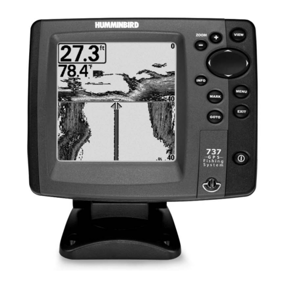
- Page 1 531438-1_A - 737_EnglishOnly.qxd 9/25/2005 7:51 PM Page 1 737 GPS 737 GPS Chartplotter Operations Manual Chartplotter Operations Manual 531438-1_A...
-
Page 2: Table Of Contents
Your Humminbird® is designed for trouble-free use in even the harshest marine environment. In the unlikely event that your Humminbird® does require repairs, we offer an exclusive Service Policy - free of charge during the first year after purchase, and available at a reasonable rate after the one-year period. - Page 3 531438-1_A - 737_EnglishOnly.qxd 9/25/2005 Table of Contents Key Functions POWER/LIGHT Key ... 29 VIEW Key ... 30 INFO Key ... 30 MENU Key ... 30 4-WAY Cursor Control Key ... 31 MARK Key... 31 GOTO Key... 32 ZOOM (+/-) Key ... 32 EXIT Key ...
- Page 4 NOTE: Entries in this Table of Contents which list (with Temp/Speed or GPS Receiver), or (with PC Connect Cable Only) or (with optional-purchase WideSide® transducer) or (with optional-purchase MMC/SD card) require the purchase of separate accessories. You can visit our website at www.humminbird.com to order these accessories online or contact our Customer Resource Center at 1-800-633-1468.
-
Page 5: How Sonar Works
531438-1_A - 737_EnglishOnly.qxd 9/25/2005 How Sonar Works Sonar technology is based on sound waves. The 700 Series™ Fishing System uses sonar to locate and define structure, bottom contour and composition, as well as depth directly below the transducer. Your 700 Series™ Fishing System sends a sound wave signal and determines distance by measuring the time between the transmission of the sound wave and when the sound wave is reflected off of an object;... -
Page 6: Quadrabeam™ Sonar
531438-1_A - 737_EnglishOnly.qxd 9/25/2005 QuadraBeam™ Sonar Your 700 Series™ Fishing System supports QuadraBeam™ sonar. QuadraBeam™ sonar provides an extremely wide 90° area of coverage. QuadraBeam™ starts with two 45° 455 kHz beams for a continuous 90° of uninterrupted side to side coverage to 160 feet. -
Page 7: How Gps And Cartography Work (With Optional-Purchase Gps Receiver)
531438-1_A - 737_EnglishOnly.qxd 9/25/2005 How GPS and Cartography Work (with optional-purchase GPS Receiver) With the purchase of an additional GPS Receiver, your 700 Series™ Fishing System also supports GPS and chartplotting. With a GPS Receiver, your 737 uses GPS and sonar to determine your position, display it on a grid, and provide detailed underwater information. -
Page 8: What's On The Display
531438-1_A - 737_EnglishOnly.qxd 9/25/2005 What’s On the Display The 700 Series™ Fishing System can display a variety of useful information about the area Depth - water depth; can be set to alarm Cursor - available in Freeze Frame and can when the water becomes too shallow. -
Page 9: Views
NOTE: WideSide® View requires the purchase of the WideSide® transducer. You can visit our website at www.humminbird.com to order accessories online or contact our Customer Resource Center at 1-800-633-1468. NOTE: Navigation views require the purchase of the GPS Receiver. You can visit our website at www.humminbird.com to order these accessories online or contact our Customer Resource Center... -
Page 10: Understanding Sonar History
531438-1_A - 737_EnglishOnly.qxd 9/25/2005 Understanding Sonar History It is important to understand the significance of the 700 Series™ Fishing System display. The display does NOT show a literal 3-dimensional representation of what is under the water. Each vertical band of data received by the control head and plotted on the display represents something that was detected by a sonar return at a particular time. -
Page 11: Sonar Zoom View
531438-1_A - 737_EnglishOnly.qxd 9/25/2005 Inverse is a method where weak returns are shown with dark pixels and strong returns with lighter pixels. This has the benefit of ensuring that weak signals will be clearly visible on the display. Structure ID® represents weak returns as light pixels and strong returns as dark pixels. -
Page 12: 200/83 Khz Split Sonar View
531438-1_A - 737_EnglishOnly.qxd 9/25/2005 200/83 kHz Split Sonar View Split Sonar View displays sonar returns from the 83 kHz wide beam on the left side of the screen and displays sonar returns from the 200 kHz narrow beam on the right side of the screen. Depth is always displayed in the upper left hand corner. -
Page 13: Screen Snapshot View
531438-1_A - 737_EnglishOnly.qxd 9/25/2005 Screen Snapshot View When Screen Snapshot is enabled (from the Accessories menu tab), pressing the MARK key creates a saved screen capture (when you have an optional-purchase MMC/SD card installed). Screen Capture View Taking a screen snapshot is a three step process: 1. -
Page 14: Wideside® View (With Optional-Purchase Wideside® Transducer)
531438-1_A - 737_EnglishOnly.qxd 9/25/2005 WideSide® View (with optional-purchase WideSide® transducer) WideSide® View is only available if you have purchased and connected an optional-purchase WideSide® transducer accessory and when Transducer Select is set to WideSide® (see Sonar Menu Tab: Transducer Select). The WideSide® View displays information from the 455 kHz WideSide®... -
Page 15: Chart View (With Optional-Purchase Gps Receiver)
531438-1_A - 737_EnglishOnly.qxd 9/25/2005 Chart View (with optional-purchase GPS receiver) Chart View - This view is only available if you have purchased and connected a GPS Receiver, and shows cartography from the built-in World Map or an optional MMC map for the area surrounding your current position. -
Page 16: Viewing Cartography (With Optional-Purchase Gps Receiver)
NOTE: Navigation requires the purchase of the GPS receiver. You can visit our website at www.humminbird.com to order this accessory online or contact our Customer Resource Center at 1-800-633-1468. Waypoints, Routes and Tracks Waypoints are stored positions that allow you to mark areas of interest or navigation points. -
Page 17: Save, Edit Or Delete A Waypoint
531438-1_A - 737_EnglishOnly.qxd 9/25/2005 Routes link two or more waypoints together to create a path for navigation, and are used in trip planning. You can link individual waypoints together by using the GOTO key. A route represents your intended navigation and shows the shortest path from each waypoint to the next. As you travel a route, staying on the route line is the most efficient way to get to your destination, although you should always look out for obstacles not shown on the chart. -
Page 18: Add A Waypoint Target Or Trolling Grid
531438-1_A - 737_EnglishOnly.qxd 9/25/2005 Add a Waypoint Target or Trolling Grid (with optional-purchase GPS receiver) Waypoint Target Add or Remove a Waypoint Target: From the Waypoints submenu, select Target and press the RIGHT Cursor key to display a list of waypoints. Select the waypoint you want to target. -
Page 19: Key Functions
531438-1_A - 737_EnglishOnly.qxd 9/25/2005 Edit Track dialog box appears, use the Cursor keys to move between fields. In the Track Name field, the UP and DOWN Cursor keys change the letter or number. All upper and lower case letters are available, as well as digits 0-9 and some punctuation characters. -
Page 20: Way Cursor Control Key
Operations Manual for additional details. NOTE: Accessories to enable WeatherSense®, GPS Functionality and the SmartCast® Wireless Sonar Link require separate purchases. You can visit our website at www.humminbird.com or contact our Customer Resource Center at 1-800-633-1468 for additional details. Accessory Bus Use the Accessory Bus to expand the functionality of the 700 Series™... - Page 21 531438-1_A - 737_EnglishOnly.qxd 9/25/2005 Powering Up the Unit Turn on your 700 Series™ Fishing System by pressing the POWER/LIGHT key. The Title screen is displayed until the Fishing System begins operation. Your Fishing System will begin Normal or Simulator operation, depending on the presence or absence of a transducer.
- Page 22 531438-1_A - 737_EnglishOnly.qxd 9/25/2005 Start-Up Options Menu Press the MENU key when the Title screen is displayed to access the Start-Up Options menu. Use the UP or DOWN 4-WAY Cursor keys to position the cursor, then the RIGHT Cursor key to select one of the following choices.
- Page 23 PC Connect Cable. Complete instructions are included with the PC Connect Cable accessory. NOTE: The PC Connect Cable requires a separate purchase. For more information visit our website at www.humminbird.com or contact our Customer Resource Center at 1-800-633-1468. Exit PC Connect mode by powering the Fishing System off. Satellite Being...
- Page 24 Select) and can only be accessed from the Sonar X-Press NOTE: Side requires the purchase of the WideSide® transducer. You can visit our website at www.humminbird.com to order this accessory online or contact our Customer Resource Center at 1-800-633-1468. To adjust the Side: 1.
- Page 25 531438-1_A - 737_EnglishOnly.qxd 9/25/2005 Sensitivity Sensitivity controls how much detail is shown on the display and will adjust the sensitivity of all sonar frequencies. Increasing the sensitivity shows more sonar returns from small baitfish and suspended debris in the water; however, the display may become too cluttered.
- Page 26 WideSide® view. NOTE: The Side Beam Range requires the purchase of the WideSide® transducer. You can visit our website at www.humminbird.com to order this accessory online or contact our Customer Resource Center at 1-800-633-1468. To adjust the Side Beam Range: 1.
- Page 27 531438-1_A - 737_EnglishOnly.qxd 9/25/2005 Bottom View Bottom View selects the method used to represent bottom and structure on the display. Inverse represents weak returns as dark pixels and strong returns as lighter pixels. This has the benefit of ensuring that weak signals will be clearly visible on the display.
- Page 28 531438-1_A - 737_EnglishOnly.qxd 9/25/2005 Navigation X-PressTM Menu (optional-purchase GPS receiver, navigation views only) The Navigation X-Press menu provides access to the settings most frequently used. Press the MENU key once while in the Bird's Eye View, the Chart or the Combo View to access the Navigation X-Press menu.
-
Page 29: Clear Current Track
531438-1_A - 737_EnglishOnly.qxd 9/25/2005 Cursor to Waypoint (Chart or Combo view only) Cursor to Waypoint allows you to quickly move the cursor to any saved waypoint, so that you can locate it or edit it. NOTE This X-Press menu item appears only if you have saved waypoints. -
Page 30: Remove Target (Only If Target Is Active)
531438-1_A - 737_EnglishOnly.qxd 9/25/2005 Remove Target (only if a Target is Active) Remove Target removes the waypoint target from the display. This menu choice will only appear when a target has already been applied to a waypoint. NOTE: See Add a Waypoint Target or Trolling Grid for more information. -
Page 31: (Screen Snapshot View Only)
531438-1_A - 737_EnglishOnly.qxd 9/25/2005 Screen Snapshot X-Press (Screen Snapshot View only) The Screen Snapshot X-Press Delete Image and Delete All Images functions. Press the MENU key once while in the Screen Snapshot View to access the Screen Snapshot Screen Snapshot X-Press menu. -
Page 32: Fish Id+ Tm
531438-1_A - 737_EnglishOnly.qxd 9/25/2005 Beam Select Beam Select sets which sonar returns from the transducer will be displayed on the screen. When set to 200/83 kHz, the returns from both beams are blended by starting with the 83 kHz wide beam return, dimming it, and then overlaying it with the 200 kHz narrow beam return. The darker 200 kHz wide beam sonar returns will stand out from the paler 83 kHz narrow beam sonar returns. -
Page 33: Fish Id Sensitivity
531438-1_A - 737_EnglishOnly.qxd 9/25/2005 Fish ID Sensitivity Fish ID Sensitivity adjusts the threshold of the Fish ID+ detection algorithms. Selecting a higher setting allows weaker returns to be displayed as fish. This is useful for identifying smaller fish species or baitfish. Selecting a lower setting displays fewer fish from weak sonar returns. -
Page 34: 455 Khz Balance (Advanced)
Tab: Transducer Select) and User Mode is set to Advanced (see Setup Menu Tab: User Mode). NOTE: The WideSide® Sensitivity requires the purchase of the WideSide® transducer. You can visit our website at www.humminbird.com to order this accessory online or contact our Customer Resource Center at 1-800-633-1468. -
Page 35: Surface Clutter (Advanced)
531438-1_A - 737_EnglishOnly.qxd 9/25/2005 Surface Clutter (Advanced) Surface Clutter adjusts the filter that removes surface clutter noise caused by algae and aeration. The lower the setting, the less surface clutter will be displayed. The Surface Clutter menu choice is available when User Mode is set to Advanced (see Setup Menu Tab: User Mode). -
Page 36: Water Type (Advanced)
531438-1_A - 737_EnglishOnly.qxd 9/25/2005 Water Type (Advanced) Water Type configures your unit for operation in fresh or salt water. The Water Type menu choice is available when User Mode is set to Advanced (see Setup Menu Tab: User Mode). NOTE: In salt water, what would be considered a large fish might be 2 to 10 times bigger than a large fish in fresh water (depending on the type of fish you are seeking). -
Page 37: Saved Tracks
531438-1_A - 737_EnglishOnly.qxd 9/25/2005 Current Track Current Track allows you to view the Current Track submenu. To view the Current Track Submenu: 1. Highlight Current Track on the Navigation main menu. 2. Use the RIGHT 4-WAY Cursor Control keys to view the Current Track submenu. -
Page 38: Routes
531438-1_A - 737_EnglishOnly.qxd 9/25/2005 Routes Routes allows you to view the Routes submenu. To view the Routes Submenu: 1. Highlight Routes on the Navigation main menu. 2. Use the RIGHT 4-WAY Cursor Control keys to view the Routes submenu. Routes Submenu The Routes Submenu contains the following menu choices: Create allows you to create a new, empty route and add waypoints to it immediately. -
Page 39: Course Projection Line
531438-1_A - 737_EnglishOnly.qxd 9/25/2005 Track Min Distance (Advanced) Track Min Distance allows you to set a minimum distance of travel before a trackpoint is added to the track. The Track Min Distance menu choice is only available when User Mode is set to Advanced (see Setup Menu Tab: User Mode). -
Page 40: Chart Detail Level
531438-1_A - 737_EnglishOnly.qxd 9/25/2005 Chart Menu Tab (with optional-purchase GPS Receiver only) Press the MENU key twice to access the Main Menu System and then press the RIGHT Cursor key to select the Chart tab. NOTE: Menu choices will vary depending on system settings such as whether the unit is set for Advanced User mode. -
Page 41: Lat/Lon Grid
531438-1_A - 737_EnglishOnly.qxd 9/25/2005 Lat/Lon Grid Lat/Lon Grid allows you to display or hide a grid showing latitude and longitude lines. To change the Lat/Lon Grid setting: 1. Highlight Lat/Lon Grid on the Chart main menu. 2. Use the LEFT or RIGHT 4-WAY Cursor Control keys to change the Lat/Lon Grid setting. -
Page 42: Depth Alarm
531438-1_A - 737_EnglishOnly.qxd 9/25/2005 Alarms Menu Tab From any view, press the MENU key twice to access the Main Menu System. The Alarms tab will be the default selection. NOTE: When an alarm is triggered, you can silence it by pressing any key. -
Page 43: Low Battery Alarm
531438-1_A - 737_EnglishOnly.qxd 9/25/2005 Low Battery Alarm Low Battery Alarm sounds when the input battery voltage is equal to or less than the menu setting. The battery alarm will only sound for the battery that is connected to the 700 Series™ Fishing System. The Low Battery Alarm should be set to warn you when the battery voltage drops below the safety margin that you have determined. -
Page 44: Alarm Tone
531438-1_A - 737_EnglishOnly.qxd 9/25/2005 Drift Alarm (with optional-purchase GPS receiver) Drift Alarm sounds when the boat has exceeded the distance from the boat’s anchored position, based on the menu setting, and will only appear in the Alarms menu when an optional-purchase GPS receiver is connected. -
Page 45: Units - Depth
531438-1_A - 737_EnglishOnly.qxd 9/25/2005 Units - Depth Units - Depth selects the units of measure for all depth- related readouts. To change the Units - Depth setting: 1. Highlight Units - Depth on the Setup menu. 2. Use the LEFT or RIGHT 4-WAY Cursor Control keys to change the Units - Depth setting. -
Page 46: Restore Defaults
531438-1_A - 737_EnglishOnly.qxd 9/25/2005 Triplog Reset (with Temp/Speed or optional-purchase GPS receiver) Triplog Reset resets the Triplog to zero, and will appear in the menu if a Temp/Speed Accessory is connected and the paddlewheel has moved at least once, or if an optional-purchase GPS Receiver is connected. -
Page 47: Temp Offset (Advanced)
531438-1_A - 737_EnglishOnly.qxd 9/25/2005 Depth Offset (Advanced) Depth Offset will adjust the digital depth readout to indicate depth from the waterline or boat's keel. Enter a positive vertical measurement from the transducer to the waterline to read the depth from the waterline. Enter a negative vertical measurement from the transducer to keel to read the depth from the keel. -
Page 48: Time Format (Advanced, International And Optional-Purchase Gps Receiver Only)
531438-1_A - 737_EnglishOnly.qxd 9/25/2005 Time Format (Advanced, International and optional-purchase GPS receiver only) Time Format changes the time format used by the unit This menu choice is available only when in Advanced User Mode (see Setup Menu Tab: User Mode) and when an optional-purchase GPS receiver is connected. -
Page 49: Views Menu Tab
(with optional-purchase GPS receiver). NOTE: The Bird's Eye, Chart, Combo and GPS Diagnostic views require the purchase of the GPS receiver. You can visit our website at www.humminbird.com to order this accessory online or contact our Customer Resource Center at 1-800-633-1468. -
Page 50: 700 Series™ Doesn't Power Up
Page 98 Troubleshooting Before contacting the Humminbird®Customer Resource Center, please read the following section. Taking the time to review these troubleshooting guidelines may allow you to solve a performance problem yourself, and therefore avoid sending your unit back for repair. -
Page 51: Display Problems
531438-1_A - 737_EnglishOnly.qxd 9/25/2005 Display Problems There are several main conditions or sources of possible interference that may cause problems with the quality of the information displayed on the control head. Look in the following table for some symptoms of display problems and possible solutions:... -
Page 52: 700 Series™ Fishing System Accessories
Be sure to check out our website www.humminbird.com for additional new and exciting accessories to grow your 700 Series™ Fishing System! NOTE: Each accessory requires a separate purchase. You can visit our website at www.humminbird.com or contact our Customer Resource Center at 1-800-633-1468 for additional details. -
Page 53: Sonar Terms
When speed input is available, the Big Digits View also shows the TripLog. See TripLog. Bottom Black: Bottom Black is a Humminbird® feature that "fills in" the area of the display below the bottom contour. Bottom Black is preferred by some anglers because of its high contrast and easy readability, even though it can obscure bottom hardness information. -
Page 54: Bottom View
531438-1_A - 737_EnglishOnly.qxd 9/25/2005 Freeze Frame: Freeze Frame is a Humminbird® feature that pauses the sonar scrolling so that the image on screen can be studied with greater detail. See Instant Image Update. Frequency: Frequency is a measure of the number of sound wave cycles per second of a sound impulse transmitted underwater. - Page 55 Quick Disconnect Mount: The Quick Disconnect Mounting system is an exclusive Humminbird® feature that permits the unit to be easily removed from the mounting base by pressing a release button, and re-installed by simply snapping it back into place. All cable connections are made when installing, so that no separate wiring connections are required.
- Page 56 TrueArch®: TrueArch® is a Humminbird® feature that provides true fish arches, not artificial arches or symbols. Humminbird® units are capable of producing fish arches due to the wide 60° sonar beam of DualBeam PLUS™, an extremely sensitive sonar receiver. See Fish Arch.
-
Page 57: Gps & Navigation Terms
MMC is a very rugged format suitable for the marine environment, but it is not waterproof. The MMC is removable from Humminbird® products, and can be used in a PC that is equipped with an... - Page 58 Greenwich England. (UTC is equivalent to Greenwich Mean Time (GMT)). To display the correct Local Time in a Humminbird® GPS unit, the user must use the Local Time Zone menu and select the time zone (i.e. EST, CST).
-
Page 59: Contact Humminbird
7:53 PM Page 116 else the user may want to return to. Humminbird® products offer the ability to name and assign Contact Humminbird® a symbol to the saved location. Depth, Date and Time of Day when the waypoint was created is also saved.