Magellan Meridian Series User Manual
Hide thumbs
Also See for Meridian Series:
- User manual (89 pages) ,
- Frequently asked questions manual (30 pages) ,
- Quick start manual (21 pages)

Related Manuals for Magellan Meridian Series


Summary of Contents for Magellan Meridian Series
- Page 1 User Manual User Manual User Manual User Manual User Manual Meridian Series of GPS Meridian Series of GPS Meridian Series of GPS Meridian Series of GPS Meridian Series of GPS Receivers Receivers Receivers Receivers Receivers...
-
Page 2: License Agreement
Radionavigation Plan. Accuracy can also be affected by poor satellite geometry. USE PROPER ACCESSORIES Use only Magellan cables and antennas; the use of non-Magellan cables and antennas may severely degrade performance or damage the receiver, and will void the warranty. -
Page 3: Table Of Contents
Satellite Status Screen ................... 11 Accessing the Navigation Screens ............12 Saving a Waypoint ................12 Using GOTO Routes ................14 Creating a GOTO Route ................14 Navigating on a GOTO Route ..............16 Summary ....................17 Magellan Meridian GPS Receiver... - Page 4 Auto vs. Auto Detailed ................29 Using Vertical Profile ................... 30 Selecting Vertical Profile ................. 30 Track History Description ..............30 Route Vertical Profile Description ............31 Highlighted Road Vertical Profile Description ........31 Path Check Description ................. 31 Magellan Meridian GPS Receiver...
- Page 5 Editing a User Waypoint ................44 Viewing a Map Object on the Map .............. 44 Viewing a User Waypoint on the Map ............44 Saving a Map Object as a User Waypoint ............. 45 Searching for a Street Address ..............45 Magellan Meridian GPS Receiver...
- Page 6 Clearing Memory .................. 57 Clearing Track History ................57 Clearing Wpts/Routes ................57 Clearing All Routes .................. 57 Resetting Meridian to Factory Defaults ............ 57 Clearing All Memory in the Meridian ............57 Changing Languages ................58 Magellan Meridian GPS Receiver...
- Page 7 Waypoints/Database ................64 Navigation Screens ................65 Routes ....................65 Alarms ....................66 Output Data ..................66 Appendix Troubleshooting ..................67 Waypoint Icons ..................68 Contacting Magellan ................69 Specifications ..................70 Accessories .................... 71 Magellan Meridian GPS R eceiv er...
- Page 8 Installing Memory Card ................ 72 Connecting to External Devices ............73 WAAS ....................75 Glossary ....................76 Magellan Meridian GPS Receiver...
-
Page 9: About This User Manual
The Meridian has all the features that a sailor, fisherman, hiker, hunter, or any person involved with outdoor recreational activities has come to expect from a Magellan GPS receiver. In addition to these features, the Meridian offers the ability to display your location on detailed city maps providing you with a complete navigation tool that will last you for years to come. - Page 10 The most important thing to us is to be sure that you are completely satisfied with your Meridian and the accompanying documentation. If you have any ideas, suggestions or even a complaint, please pass them along to us through our web site (www.magellangps.com) or by mail. Magellan Meridian GPS Receiver...
-
Page 11: Installing The Batteries
Setting up the Meridian is a simple three-step process: installing the batteries, selecting the language to be used and initializing the Meridian. The Magellan Meridian uses two AA batteries that are installed from the back through the battery cover. You can expect to get up to 14 hours of usage on two AA batteries with the backlight turned off. -
Page 12: Selecting Language
(stored in permanent memory) to estimate what satellites are overhead and which ones it should be looking for. Follow these instructions to initialize the Meridian. Press [PWR] The Meridian turns on and displays the start-up screen and a warning screen. Magellan Meridian GPS Receiver... -
Page 13: Enter Your Approximate Position
Be sure that you set the AM/PM indicator. Note: After the Meridian starts to pick up signals from any satellite, it will automatically update the time using the satellite’s atomic clock. Magellan Meridian GPS Receiver... - Page 14 Basic Operation described in the next chapter or you can turn the Meridian off. If you turn the Meridian off, all of the information you just entered will be saved. To turn the Meridian off, press [PWR]. Magellan Meridian GPS Receiver...
-
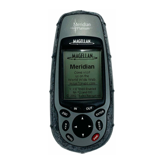
Page 15: Meridian Gps Receiver
GOTO is used to create a direct route PWR- Turns the to any waypoint Meridian on/off. Also stored in memory. used to turn the display This key is also used backlight on/off. to MARK a position. Magellan Meridian GPS Receiver... -
Page 16: Turning Power On/Off
Meridian will turn the backlight off when there has been no button presses for 4 minutes. Pressing any button will turn the backlight back on in this instance. You can change the time delay for the backlight in Setup. Magellan Meridian GPS Receiver... -
Page 17: Adjusting The Contrast
Large Data screen, Position screen, Road screen, Data screen, Speedometer screen and Sat Status screen. They will be described briefly here. More detailed information on the different screens can be found in the Reference chapter of the User Manual. Magellan Meridian GPS Receiver... -
Page 18: Map Screen
Ideal for when you have your Meridian mounted on the dashboard of a boat using the optional swivel mounting bracket. Even from a distance the information can be read with ease. Magellan Meridian GPS Receiver... -
Page 19: Position Screens
The bar graph shows you the relative signal strength being received for each satellite. At the bottom of the display is an indication of the battery life remaining. When you are using external power, it will be indicated here as well. Magellan Meridian GPS Receiver... -
Page 20: Accessing The Navigation Screens
From any screen, press and hold [GOTO] for 2 seconds. Use the UP/DOWN arrows and notice that the highlight moves from field to field and then back to “Save.” Highlight the Icon field using the UP/DOWN arrows. Press [ENTER]. Magellan Meridian GPS Receiver... - Page 21 As many as 200 waypoints can have a message assigned to it. This comes in handy in further identifying the waypoint. If this was a waypoint for a friend’s house or business, you could add a phone number or any other information that you find useful. Magellan Meridian GPS Receiver...
-
Page 22: Using Goto Routes
The example shown here is a sample of a City Waypoint List. This is a sample of a Nearest City Waypoint list for Magellan. Your screen will look different. Use the UP/DOWN arrows to highlight your choice of waypoint to be your destination and press [ENTER]. - Page 23 [ENTER]. For this example, you would highlight Los Angeles and press [ENTER]. The Map screen is displayed and the Meridian will begin computing all of the necessary information needed to get you to your destination. Magellan Meridian GPS Receiver...
-
Page 24: Navigating On A Goto Route
GOTO. Routes, however, are stored in memory. If you need to make a GOTO but expect to turn the Meridian off before arriving, you might consider making a 1-leg route using the route menu. Magellan Meridian GPS Receiver... -
Page 25: Summary
An ideal way to get used to using the Magellan Meridian is to go outside your house and obtain a position fix. (An easy way to see that you are computing a position fix is to view the Sat Status screen. -
Page 26: Power/Backlight/Contrast
(See “Setup” to Button Sequence change the settings for the automaic timer). 1st Press Light On (low) 2nd Press Light On (high) 3rd Press Light Off Magellan Meridian GPS Receiver... -
Page 27: Adjusting The Display Contrast
Two customizable data fields are presented at the bottom of the display. If you require to see more of the map you can also turn off these data fields. Information as to how to customize this screen follows this brief description of the Map screen. Magellan Meridian GPS Receiver... - Page 28 Reference Present Position Icon Track History Map Scale Indicator Data Fields Position Mode Magellan Meridian GPS Receiver...
- Page 29 To return to the Position Mode, press [ESC]. The cursor will disappear and the present position icon will appear centered on the map. Cursor Icon Map Scale Waypoint Indicator Name Cursor Information Block Cursor Mode Magellan Meridian GPS Receiver...
-
Page 30: Setting The Map Detail
- light gray Lakes - dark gray Swamps - light gray grid Railroads - light gray Interstate Roads - double black line U.S. Routes - black line Roads - black line National Parks - light gray grid Magellan Meridian GPS Receiver... -
Page 31: Customizing The Map Display
Map Setup ENTER Turning On/Off Topographic Lines — [Available only if a map has been uploaded from a Magellan MapSend Topo for the United States CD-ROM] This function will hide all topo lines and topographic information. Default is On. ENTER... -
Page 32: Turning On/Off Displayed Poi's
Reference Turning On/Off Displayed POI’s — [Available only if a map has been uploaded from a Magellan MapSend Streets and Destinations or MapSend Topo for the United States CD-ROM] Allows you to select which, if any, POIs that have been uploaded from a MapSend product to be displayed. -
Page 33: Turning Data Fields On/Off
(BRG) and distance (DIS) to the cursor is shown in the bottom left corner of the map replacing the scale. (Note: if you have uploaded topographic information from Magellan’s MapSend Topo for the United States CD-ROM, the elevation at the cursor’s location is displayed, not the bearing and distance.) If the cursor happens to be on a map object,... - Page 34 This is the direction you need to turn to put you on the shortest distance to your destination from your present position. Elevation This is the distance above sea level that you are presently at. Time Local time. Date Current date. Magellan Meridian GPS Receiver...
-
Page 35: Street Information Description
(This function requires that map data has been uploaded from Magellan MapSend Topo for the United States and that your present position as well as the projected horizon falls within the area uploaded.) -
Page 36: Changing The Map Orientation
Reference been uploaded from Magellan MapSend Topo for the United States and that your present position as well as the projected horizon falls within the area uploaded.) Like Horizontal Profile, you must be zoomed in to a scale of 0.80 miles or closer for the projected terrain to be displayed. -
Page 37: Selecting Track Mode
Auto, but has the base rate of track points saved increased. This allows a more detailed track then Auto to be taken, while at the same time saving memory over a fixed rate. Magellan Meridian GPS Receiver... -
Page 38: Using Vertical Profile
Track History Description — This option displays the vertical profile of the track that is stored in the Meridian. If you have cleared your track, either with the Clear Track option or clearing memory, Track History cannot be accessed. Magellan Meridian GPS Receiver... -
Page 39: Route Vertical Profile Description
Route Vertical Profile Description — (Available only with map data uploaded from Magellan MapSend Topo for the United States.) If you have at least one route stored in memory, you can view the vertical profile for the route. After selecting Vertical Profile, you will be asked to select the route you want to plot. -
Page 40: Compass Screen
Reference Destination Name Data Fields Heading Marker Destination Icon Sun/Moon Position Markers Compass Magellan Meridian GPS Receiver... -
Page 41: Customizing The Data Fields
VMG, CTS, ETA, ETE, XTE, turn, elevation, time, or date) for any of the two fields. (See explanation of Data Types in the Map Screen section.) MENU ENTER ENTER Customize ENTER Destination Data Fields Name Magellan Meridian GPS Receiver... -
Page 42: Customizing The Data Fields
Position screen. You can change the coordinate system displayed by following the instructions in Setup - Selecting the Coordinate System. Resetting the Trip Odometer — Resets the trip odometer to 0000.00. MENU ENTER ENTER Reset Trip Magellan Meridian GPS Receiver... -
Page 43: Customizing The Data Fields
1 of 13 data options (bearing, distance, speed, heading, VMG, CTS, ETA, ETE, XTE, turn, elevation, time, or date) for any of the two fields. (See explanation of Data Types in the Map Screen section.) Magellan Meridian GPS Receiver... -
Page 44: Gps Status Messages
Position Screens. These functions perform identically to the same functions described in the Setup section of this manual. Simply described, you press [MENU] from either Position screen, select the option, press [ENTER] and follow the prompts. Magellan Meridian GPS Receiver... -
Page 45: Road Screen
This familiar indication of where you are in regards to your planned route will provide you with the knowledge required for you to keep on track. Destination Name Customizable Data Fields Compass Scale Indicator Road Magellan Meridian GPS Receiver... -
Page 46: Customizing The Data Fields
VMG, CTS, ETA, ETE, XTE, turn, elevation, time, or date) for any of the four fields. (See explanation of Data Types in the Map Screen section.) MENU ENTER ENTER Customize ENTER Destination Name Customizable Data Fields Compass Magellan Meridian GPS Receiver... -
Page 47: Customizing The Data Fields
VMG, CTS, ETA, ETE, XTE, turn, elevation, time, or date) for any of the six fields. (See explanation of Data Types in the Map Screen section.) MENU ENTER ENTER Customize ENTER Destination Name Customizable Data Fields Speedometer Magellan Meridian GPS Receiver... -
Page 48: Customizing The Data Fields
(See explanation of Data Types in the Map Screen section.) MENU ENTER ENTER Customize ENTER Satellite Position Position Graph Mode Satellite Position Satellite Signal Strength Chart WAAS Satellites Power Battery Life Source Indicator ° ° Magellan Meridian GPS Receiver... -
Page 49: Waypoints / Database
Selecting “OK” and pressing enter brings up a listing of the waypoints, starting with the one you entered at the top. Note: When selecting the User category, the Meridian does not use the keyboard display. Magellan Meridian GPS Receiver... -
Page 50: Selecting Waypoints Nearest To The Cursor
ENTER. You are then placed into the Edit Mode. Using the method described in “Getting Started” you can personalize the waypoint, making it easy to remember what it is.) Magellan Meridian GPS Receiver... -
Page 51: Creating New Waypoint Manually
ENTER. You are then placed into the Edit Mode.) Deleting a User Waypoint — Deletes a waypoint that you have created. MENU ENTER Database User ENTER MENU ENTER Delete ENTER Magellan Meridian GPS Receiver... -
Page 52: Editing A User Waypoint
User waypoints. MENU ENTER ENTER Database ENTER Viewing a User Waypoint on the Map — Locates and displays on the Map the selected User Waypoint. MENU ENTER ENTER Database User ENTER ENTER Magellan Meridian GPS Receiver... -
Page 53: Saving A Map Object As A User Waypoint
(MARK) or view it on the Map Screen. NOTE: The option is available ONLY if you have uploaded one or more detailed maps from the Magellan MapSend Streets CD-ROM. ENTER ENTER From... -
Page 54: Routes
Meridian to “retrace” your steps. A good example of using a backtrack would be if you were out hiking or jogging with your Meridian turned on and computing position fixes. After 30 minutes Magellan Meridian GPS Receiver... -
Page 55: Creating A Multileg Route
(Note: these routes have been termed “multileg” in an effort to make the understanding of them a little clearer, however you could create a 1-leg route and save it in the Meridian’s memory.) Magellan Meridian GPS Receiver... - Page 56 Reference MENU ENTER ENTER Routes ENTER ENTER ENTER ENTER ENTER ENTER ENTER Sample Route List Sample Route Create (Bold route indicates “Active” route) Magellan Meridian GPS Receiver...
-
Page 57: Activating/Deactivating A Route
Viewing a Route and then use the instructions for inserting, deleting, replacing or appending a leg as appropriate. When you are done with editing the route, use the Up/Down arrows to highlight the “Save Route” button and press ENTER. Magellan Meridian GPS Receiver... -
Page 58: Inserting A Leg
Your route would then be “A” to “B” to “E” to “C” to “D”. Deleting a Leg — Deletes a leg from the route. MENU ENTER Delete Replacing a Leg — Replaces the destination of an existing leg with a new destination. MENU ENTER ENTER Replace ENTER Magellan Meridian GPS Receiver... -
Page 59: Appending A Leg
Routes ENTER Reverse Deleting a Route — Enables the deletion of any route in memory. Useful when you want to add a new route but no “EMPTY” routes are available. MENU ENTER MENU Routes ENTER Delete Magellan Meridian GPS Receiver... -
Page 60: Viewing A Route On The Map Screen
Two such instances would be travelling over 500 miles with your Meridian turned off or complete loss of memory. ENTER MENU ENTER Setup Initialize ENTER ENTER ENTER ENTER ENTER Magellan Meridian GPS Receiver... -
Page 61: Turning The Nav Screens On/Off
Available coordinate systems are: Lat/Lon, UTM, OSGB, Irish, Swiss, Swedish, Finnish, German, French, or User Grid. MENU ENTER ENTER Setup Coord System ENTER ENTER Default: Primary - Lat/Lon DEG.MIN.MMM Secondary - UTM Magellan Meridian GPS Receiver... -
Page 62: Selecting A Map Datum
ENTER Default: 3D Selecting the Time Format — Enables you to choose from three different time formats: Local 24 Hr (military time), Local AM/PM or UTC. MENU ENTER ENTER Setup Time Format ENTER Default: Local AM/PM Magellan Meridian GPS Receiver... -
Page 63: Selecting Nav Units
Times available are: 30 seconds, 1 Minute, 2 Minutes, 4 Minutes, 10 Minutes or Timer Off. MENU ENTER ENTER Setup Light Timer ENTER Default: 4 Minutes Magellan Meridian GPS Receiver... -
Page 64: Turning The Beeper On/Off
Meridian’s output port. The baud rate sent out must match the baud rate that the receiving device is set for. You can choose from 1200 baud, 4800 baud, 9600 baud or 19200 baud. MENU ENTER ENTER Setup Baud Rate ENTER Default: 4800 Baud Magellan Meridian GPS Receiver... -
Page 65: Clearing Memory
Clearing All Memory in the Meridian — This clears all memory from the Meridian. After completing these instructions, the Meridian will shut off. The next time it is turned on, it will prompt you that it needs to be initialized. MENU ENTER ENTER Setup Clear Memory ENTER ENTER Magellan Meridian GPS Receiver... -
Page 66: Changing Languages
User category in the waypoint database. All times displayed are local times to your present position. MENU ENTER Sun/Moon Changing the Sun/Moon Date — Allows you to change the date for the sun/moon information for the position selected. MENU ENTER ENTER Sun/Moon ENTER Magellan Meridian GPS Receiver... -
Page 67: Changing The Sun/Moon Position
ENTER Changing the Fish/Hunt Position — Allows you to change the position that you want to view the fishing/hunting times for. The default is “Position” which is your present position. MENU ENTER ENTER Fish/Hunt ENTER ENTER Magellan Meridian GPS Receiver... -
Page 68: Meridian Alarms
Meridian has lost its ability to compute position fixes due to loss of signal from the satellites. This is handy in that it alerts you that you may need to move to an area that has a clearer view of the sky. Magellan Meridian GPS Receiver... -
Page 69: Using The Simulator
MENU ENTER ENTER Setup Simulate ENTER ENTER ENTER Turning the Simulator Off — Turns the simulator off and returns the Meridian to normal operation. MENU ENTER ENTER Setup Simulate ENTER Magellan Meridian GPS Receiver... -
Page 70: About
ENTER About Help Screen You can view help tips for Nav Screens, Map, Routes, Setup, Database, User Waypoints and Misc Topics. Each topic has a number of tips available that can be viewed. MENU ENTER Help Magellan Meridian GPS Receiver... -
Page 71: Frequently Asked Questions
No. The time transmitted by the satellites atomic clock are UTC (Universal Time Coordinated) and provides no correction for daylight savings. When daylight savings time changes (or when you move to a new time zone), you need to go into Setup — Magellan Meridian GPS R eceiv er... -
Page 72: Waypoints/Database
Meridian. Waypoints/Database What waypoints come preloaded on my Meridian’s database? The Database contains cities, highways, airports, waterways and national parks. Magellan Meridian GPS R eceiv er... -
Page 73: Navigation Screens
How do I know which route is active? Access the route menu by pressing the MENU button and select the option Routes. The route menu lists all of the routes in memory with the active route displayed in bold characters. Magellan Meridian GPS R eceiv er... -
Page 74: Alarms
Meridian’s baud rate (See Setup - Changing the Baud Rate.) Can I interface my Meridian with a Macintosh computer? Magellan does not supply cabling or software for the Macintosh line of computers. For information on a cable or software that may meet your requirements, visit GPSy at www.gpsy.com on... - Page 75 Use map data for reference and do not rely completely on it. Data was not saved or was corrupted. This can be caused because you removed the batteries or removed external power with the Meridian turned on. Magellan Meridian GPS Receiver...
- Page 76 Large City Amusement Small City Lighthouse Sounding Major City Auto Repair Sports Arena Marina Boating Tourist Info Medium City Camping Truck Service Museum Exit Ramp Winery Obstruction First Aid Wreck Park Fixed Nav Aid Resort Floating Buoy Magellan Meridian GPS Receiver...
-
Page 77: Troubleshooting
Representatives are available Monday through Friday from 7 AM to 5 PM, PST. Faxes can be sent to Customer Service at (909) 394-7070. If necessary, you can also return your receiver to Magellan for repair. Before returning the receiver you must get a Return Materials Authorization (RMA) from Magellan. - Page 78 Weatherproof construction, wraparound rubber armor Temp. Range Operating 14˚F to 140˚F to (-10˚C to 60˚C) Storage -4˚F to 158˚F (-20˚C to 70˚C) Power: Source 2 AA alkaline batteries or 9-35 VDC with power cable Battery Life Up to 14 hours Magellan Meridian GPS Receiver...
-
Page 79: Accessories
Appendix Accessories for your receiver are available from your Magellan dealer or you can order directly from Magellan at (800) 669-4477 (press 3 to place an order). Swivel Mounting Bracket: Mounts the receiver on a surface, allowing for hands- free operation. - Page 80 Appendix The Magellan Secure Digital (SD) Memory Cards can be added to any of the Meridian line of GPS receivers through the battery compartment. Magellan offers the memory cards in 8, 16, 32 and 64 MB configurations. The addition of...
- Page 81 Connecting directly to the Meridian. Using the captive screw that is attached to the plug, tighten into the back of the receiver. Magellan Meridian GPS Receiver...
- Page 82 Pin 2: Data Out Pin 3: Data In Pin 5: Ground Cable Wiring Color Code Power Red: Power + Black: GND Data (Power/Data, PC cable & Data cable only) Yellow: Data In Orange: Data Out Black: GND Magellan Meridian GPS Receiver...
-
Page 83: Waas
Appendix Your Magellan GPS receiver has been upgraded to include the latest WAAS (Wide Area Augmentation System) technology. With WAAS your GPS receiver can compute position locations with an accuracy never before possible in a commercial receiver. What is WAAS? WAAS is a means of improving the accuracy of GPS beyond the standard civilian signal. - Page 84 The value or setting automatically chosen by the unit unless otherwise directed. Can be changed in Setup. Distance. Distance from position to destination. Estimated Time of Arrival. The estimated time of day the leg’s destination waypoint will be reached. Magellan Meridian GPS Receiver...
- Page 85 OSGB A coordinate system describing only Great Britain, similar to UTMs. Used with GRB36 datum. Position fix Position coordinates as computed by the Meridian. Speed Over Ground. The speed at which the receiver is moving. Temperature. Magellan Meridian GPS Receiver...
- Page 86 Used to create routes. Cross Track Error. The perpendicular distance between the present position and the courseline. Given as a distance, right or left, of course when facing the destination. Magellan Meridian GPS Receiver...