Sign In
Upload
Manuals
Brands
geo-FENNEL Manuals
Measuring Instruments
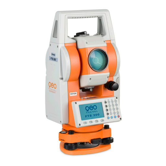
TOTALSTATION FTS 300
geo-FENNEL TOTALSTATION FTS 300 Manuals
Manuals and User Guides for geo-FENNEL TOTALSTATION FTS 300. We have
1
geo-FENNEL TOTALSTATION FTS 300 manual available for free PDF download: User Manual
geo-FENNEL TOTALSTATION FTS 300 User Manual (163 pages)
Brand:
geo-FENNEL
| Category:
Measuring Instruments
| Size: 14 MB
Table of Contents
Foreword
2
General Handling Precautions
2
Display for Safe Use
3
User
4
Exceptions from Responsibility
4
Table of Contents
5
Nomenclature and Functions
8
Nomenclature
8
Display
10
Operating Key
11
Function Key (Soft Key)
12
Star Key Mode
13
Serial Signal RS232-C Connector
14
Preparation for Measurement
15
Setting Instrument up for Measurement
15
Power Switch Key on
16
Battery Power Remaining Display
17
Vertical Angle Tilt Correction
18
How to Enter Alphanumeric Characters
20
Angle Measurement
22
Measuring Horizontal Angle Right and Vertical Angle
22
Switching Horizontal Angle Right/Left
23
Measuring from the Required Horizontal Angle
23
Setting by Holding the Angle
23
Setting a Horizontal Angle from the Keys
24
Vertical Angle Percent Grade(%) Mode
24
Repetition Angle Measurement
25
Buzzer Sounding for Horizontal Angle °90 Increment
26
Compasses (Vertical Angle)
27
Distance Measurement
28
Setting of the Atmospheric Correction
28
Setting of the Correction for Prism Constant
28
Distance Measurement (Continuous Measurement)
28
Distance Measurement (N-Time Measurement/Single Measurement)
29
Fine Mode/Tracking Mode/Coarse Mode
30
Stake out (S.O)
31
Offset Measurement
32
Angle Offset
33
Distance Offset Measurement
35
Plane Offset Measurement
37
Column Offset Measurement
39
Coordinate Measurement
41
Setting Coordinate Values of Occupied Point
41
Setting Height of the Instrument
42
Setting Height of Target (Prism Height)
42
Execution of Coordinate Measuring
43
SPECIAL MODE (Menu Mode)
44
Application Measurement (PROGRAMS)
45
Remote Elevation Measurement (REM)
45
Missing Line Measurement (MLM)
48
Setting Z Coordinate of Occupied Point
51
Area Calculation
54
Point to Line Measurement
57
Setting the GRID FACTOR
59
Setting Illumination of Display and Cross Hairs
60
Setting Mode1
61
Setting Minimum Reading
61
Auto Power off
61
Vertical Angle Tilt Correction( Tilt ON/OFF)
61
Heater ON/OFF
63
Setting RS232-C Communication with External Device
64
Setting Contrast of Display
65
Road
66
Input Start Point
66
Input Road Data
68
Search Data
72
Edit Data
72
Set OCC and BS
73
Setout Road
75
Select a File
76
Initialize ROAD Data
76
Data Collection
77
Preparation
79
Selecting a File for Data Collection
79
Selecting a Coordinate File for Data Collection
80
Occupied Point and Backsight Point
80
Data Collect Offset Measurement Mode
86
Angle Offset Measurement
86
Distance Offset Measurement
88
Plane Offset Measurement
90
Column Offset Measurement
92
NEZ Auto Calculation
93
Point to Line Measurement
94
To Change to the Point to Line Measurement
94
Executing a Point to Line Measurement
95
Editing PCODE Library [PCODE INPUT]
96
Setting Parameter of Data Collect [CONFIG]
97
Layout
98
Preparation
100
Setting the GRID FACTOR
100
Selecting Coordinate Data File
101
Setting Occupied Point
102
Setting Backsight Point
103
Executing a Layout
105
Layout of Coordinates of Point to Line
107
Setting a New Point
108
Side Shot Method
108
Resection Method
110
Memory Manager Mode
114
Display Internal Memory Status
115
Searching Data
116
Measured Data Searching
116
Coordinate Data Searching
118
PCODE LIBRARY Searching
119
File Maintenance
120
Rename a File
121
Searching Data in a File
121
Deleting a File
122
Coordinate Data Directkey Input
123
Coordinate Data Input
123
PTL (Point to Line) Data Input
124
Delete a Coordinate Data from a File
125
Editing PCODE Library
126
Data Communications
127
Sending Data
127
Loading Data
128
Setting Parameter of Data Communications
129
Set Audio Mode
131
Setting the Prism Constant Value
132
Setting Atmospheric Correction
133
Calculation of Atmospheric Correction
133
Setting of Atmospheric Correction Value
133
Correction for Refraction and Earth Curvature
138
Distance Calculation Formula
138
Power Source and Charging
139
Detach/Attach of Tribrach
141
Selecting Mode
142
Items of the Selecting Mode
142
How to Set Selecting Mode
144
Check and Adjustment
146
Checking and Adjusting of Instrument Constant
146
Checking the Optical Axis
147
Checking/Adjusting the Theodolite Functions
148
Checking/Adjusting the Plate Level
149
Checking/Adjusting the Circular Level
149
Adjustment of the Vertical Cross-Hair
150
Collimation of the Instrument
151
Checking/Adjusting the Optical Plummet Telescope
152
Adjustment of Vertical Angle 0 Datum
153
How to Set the Instrument Constant Value
154
Reference Frequency Check Mode
155
Prism System
156
Error Displays
157
Specifications
159
Appendix
162
Precaution When Charging or Storing Batteries
162
Advertisement
Advertisement
Related Products
geo-FENNEL FL 70 Premium Liner
geo-FENNEL FL 190A
geo-FENNEL FHM 10
geo-FENNEL FL 270VA TRACKING
geo-FENNEL FSM 130+
geo-FENNEL FR-DIST 30
geo-FENNEL FET 402K-L
geo-FENNEL EasyGRADE FL 300HV-G
geo-FENNEL FR 75-MM
geo-FENNEL FR 55
geo-FENNEL Categories
Measuring Instruments
Laser Level
Thermometer
Analytical Instruments
Receiver
More geo-FENNEL Manuals
Login
Sign In
OR
Sign in with Facebook
Sign in with Google
Upload manual
Upload from disk
Upload from URL