Sign In
Upload
Manuals
Brands
Garmin Manuals
GPS
GPSMAP 3010C
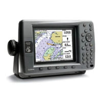
Garmin GPSMAP 3010C Manuals
Manuals and User Guides for Garmin GPSMAP 3010C. We have
7
Garmin GPSMAP 3010C manuals available for free PDF download: Owner's Manual, Installation Instructions Manual, Quick Reference Manual, Specification
Garmin GPSMAP 3010C Owner's Manual (130 pages)
Color Chartplotter
Brand:
Garmin
| Category:
GPS
| Size: 4 MB
Table of Contents
Installing Your GPSMAP 3006C/3010C
3
About this Manual
3
Table of Contents
4
Product Registration
7
Contact Garmin
7
Software License Agreement
7
Warnings
8
Important Information
8
Getting Started
9
Unit Overview
9
Using the GPSMAP 3006C/3010C Keypad
10
Using the Optional Marine Remote Control
11
Installing the Remote Control Batteries
11
Using Soft Keys
12
Using Data Entry/Shortcut Keys
12
Status Bar
12
Turning on the GPSMAP 3006C/3010C
13
Adjusting the Backlight
13
Initializing the GPS Receiver
14
Receiver Status and Accuracy
15
GPS Setup
15
Using Simulator Mode
16
Basic Operation
17
Using the GPSMAP 3006C/3010C
17
Understanding the Features
17
Selecting Options and Entering Data
18
Using Additional Map Data
19
Using the Map Pointer
19
Finding an Item
21
Creating and Using Waypoints
22
Creating Waypoints Using the ENTER/MARK Key
22
Creating Waypoints Using the Map
22
Creating Waypoints Manually
23
Reviewing and Editing Waypoints
24
Moving a Waypoint
26
Using Waypoint Lists
26
User Waypoints
27
Deleting Waypoints
27
Proximity Waypoints
28
Navigating to a Destination
29
Selecting a Map Item Go to Destination
29
Follow Track and Tracback Navigation
30
Tracback Tips
32
Man Overboard (MOB)
33
Creating and Using Routes
33
Creating a New Route
33
Navigating a Saved Route
34
Creating a Quick NAV Route
35
Copying a Route
35
Deleting a Route
36
Editing a Route
36
Planning Routes
39
Main
40
Configuring Main Pages
41
Using Function Windows
43
Function Window Adjustments
43
Viewing a Main Page in Full-Screen Mode
44
Map Page
44
Selecting Map Ranges
45
Cartography
46
Map Page Options
47
Measuring Distance
47
Map Split Page
49
Compass Page
49
3D Highway Page
50
Changing the Highway Perspective Range
51
Highway
51
Highway Page Options
51
Showing or Hiding Maps
51
Video Page
52
Video Page Options
52
Main Menu
53
GPS Tab
53
Tide Tab
54
Tide Sub Tab
54
Viewing Tide Information
55
Current Sub Tab
56
Celestial Tab
57
Trip Tab
58
Weather Tab
59
Points Tab
59
Routes Tab
60
Tracks Tab
61
DSC (Digital Selective Calling) Tab
62
Understanding DSC Distress Calls
63
Understanding Position Reports
63
Review DSC Waypoint
63
DSC Directory
64
Setting up DSC
64
Using the NAV Key
64
Card Tab
65
Messages Tab
66
Viewing Detailed Message Information
66
Alarms Tab
66
System Alarms
67
Nav (Navigation) Alarms
67
Sonar Alarms
68
Weather Alarms
68
System Tab
69
General Sub Tab
69
NMEA Interface
73
Update Sub Tab
74
Network Tab
74
Pages Tab
75
Map Tab
76
AIS Sub Tab
79
Source Sub Tab
79
Radar Tab
80
Temp (Temperature) Tab
81
Sonar Tab
81
Highway Tab
82
XM Tab
82
Using Favorites
83
Using Sonar
84
Understanding Sonar
84
Using Dual Frequency
84
Using Dual Beam
84
Understanding the Sonar Display
85
Sonar Page
86
Configuring the Sonar Page
87
Using the Sonar Adjustment Menu
88
Using the Pointer on the Sonar Page
90
Marking an Underwater Waypoint
90
Sonar Tab
90
General Sub Tab
91
Graph Sub Tab
92
Water Temp Sub Tab
93
XM WX Weather
94
Customizing Preset Weather Displays
94
Weather Tab
96
Marine Bulletins Sub Tab
96
Using Radar
97
Understanding Radar
97
Understanding the Radar Display
98
Heading Line
98
Radar Page
99
Configuring the Radar Page
99
Using the Radar Adjustment Menu
100
Sea Clutter
100
Rain Clutter
100
Target Expansion
101
Map Page Radar Overlay
105
Radar Tab
105
General Sub Tab
106
Display Sub Tab
106
MARPA Sub Tab
107
Advanced Sub Tab
108
Specifications
109
Physical Specifications
109
Appendix
109
Installing and Removing Data Cards
110
Satellite Information
111
What Is WAAS/EGNOS
111
WAAS Capability
112
Digital Selective Calling (DSC)
112
What Is DSC
112
How Are Mmsi Assignments Obtained
113
LORAN TD System
114
Caring for the GPSMAP 3006C/3010C
115
Cleaning the Case
115
Cleaning the Screen
115
Water Immersion
115
Navigation Terms
116
Messages and Alarms
118
Optional Accessories
120
Limited Warranty
121
FCC Compliance
122
Industry Canada Compliance
122
Declaration of Conformity (Doc)
122
XM Satellite Radio Service Agreement
122
Weather Data Warranty
123
European License Requirements
124
Index
125
Advertisement
Garmin GPSMAP 3010C Owner's Manual (116 pages)
Color Chartplotters
Brand:
Garmin
| Category:
GPS
| Size: 3 MB
Table of Contents
Installing Your GPSMAP 3006C/3010C
3
About this Manual
3
Manual Conventions
3
Table of Contents
4
Product Registration
7
Contact Garmin
7
Software License Agreement
7
Warning
8
Caution
8
Getting Started
9
Unit Overview
9
Using the GPSMAP 3006C/3010C Keypad
10
Using the Optional Marine Remote Control
11
Using Soft Keys
12
Using Data Entry/Shortcut Keys
12
Status Bar
12
Turning on the GPSMAP 3006C/3010C
13
Adjusting the Backlight
13
Initializing the GPS Receiver
14
Receiver Status and Accuracy
15
GPS Setup
15
Using Simulator Mode
16
Basic Operation
17
Using the GPSMAP 3006C/3010C
17
Understanding the Features
17
Selecting Options and Entering Data
18
Using Additional Map Data
19
Using the Map Pointer
19
Finding an Item
21
Creating and Using Waypoints
22
Creating Waypoints Using the ENTER/MARK Key
22
Creating Waypoints Using the Map
22
Creating Waypoints Manually
23
Reviewing and Editing Waypoints
24
Moving a Waypoint
26
Using Waypoint Lists
26
User Waypoints
27
Proximity Waypoints
28
Navigating to a Destination
29
Selecting a Map Item Go to Destination
29
Follow Track and Tracback Navigation
30
Tracback Tips
32
Man Overboard (MOB)
33
Creating and Using Routes
33
Creating a New Route
33
Navigating a Saved Route
34
Creating a Quick NAV Route
35
Copying a Route
35
Deleting a Route
36
Editing a Route
36
Planning Routes
39
Main
40
Configuring Main Pages
41
Using Function Windows
43
Function Window Adjustments
43
Viewing a Main Page in Full-Screen Mode
44
Map Page
44
Selecting Map Ranges
45
Cartography
46
Map Page Options
47
Map Split Page
49
Compass Page
49
Highway Page
50
Changing the Highway Perspective Range
51
Highway Page Options
51
Showing or Hiding Cartography
51
Video Page
52
Video Page Options
52
Main Menu
53
GPS Tab
53
Tide Tab
54
Tide Sub Tab
54
Current Sub Tab
56
Celestial Tab
57
Trip Tab
58
Weather Tab
59
Points Tab
59
Routes Tab
60
Tracks Tab
61
DSC (Digital Selective Calling) Tab
62
Understanding DSC Distress Calls
63
Understanding Position Reports
63
Review DSC Waypoint
63
Setting up DSC
64
Using the NAV Key
64
Card Tab
65
Messages Tab
66
Viewing Detailed Message Information
66
Alarms Tab
67
System Alarms
67
Nav (Navigation) Alarms
68
Sonar Alarms
68
System Tab
69
Update Sub Tab
74
Network Tab
74
Pages Tab
75
Map Tab
76
AIS Sub Tab
79
Source Sub Tab
79
Temp (Temperature) Tab
81
Sonar Tab
81
Highway Tab
82
XM Tab
82
Using Favorites
83
Using Sonar
84
Understanding Sonar
84
Using Dual Frequency
84
Using Dual Beam
84
Understanding the Sonar Display
85
Sonar Page
86
Configuring the Sonar Page
87
Using the Sonar Adjustment Menu
88
Using the Pointer on the Sonar Page
90
Marking an Underwater Waypoint
90
Sonar Tab
90
General Sub Tab
91
Graph Sub Tab
92
Water Temp Sub Tab
93
XM WX Weather
94
Customizing Preset Weather Displays
94
Weather Tab
96
Marine Bulletins Sub Tab
96
Appendix
97
Specifications
97
Installing and Removing Data Cards
98
Satellite Information
99
What Is WAAS/EGNOS
99
WAAS Capability
100
Digital Selective Calling (DSC)
100
What Is DSC
100
How Are Mmsi Assignments Obtained
101
How Can Garmin Help You with Dsc
101
LORAN TD System
102
Caring for the GPSMAP 3006C/3010C
103
Navigation Terms
104
Messages and Alarms
106
Optional Accessories
108
Limited Warranty
109
FCC Compliance
110
Industry Canada Compliance
110
Declaration of Conformity (Doc)
110
XM Satellite Radio Service Agreement
110
Weather Data Warranty
111
Index
112
Garmin GPSMAP 3010C Owner's Manual (96 pages)
Color Chartplotter
Brand:
Garmin
| Category:
GPS
| Size: 3 MB
Table of Contents
About this Manual
3
Introduction Introduction
3
Customer Service Product Registration
3
Table of Contents Welcome
3
Table of Contents
4
Warnings and Cautions
7
Packing List & Accessories
8
Map Data/Installation/Manual Conventions
9
Using Additional Map Data
9
Unit Features
10
3006C/3010C Keypad Usage
11
3006C/3010C Data Entry/Shortcut/Soft Keys
12
Remote Control Batteries
13
Using the Optional Marine Remote
13
Understanding the Features
14
Adjusting the Backlight
15
Power and Backlighting
15
How to Select Options
16
Selecting Options
16
Entering Data
17
How to Enter Data
17
Initializing the Receiver
18
Status Bar
19
Main Pages
20
Confi Guring Main Pages
21
Function Adjustments
23
Using Function Windows
23
Using Functions/Data Key
23
Changing the Name
24
Creating Waypoints Introduction
24
Entering a Comment
25
Basic Navigation
26
Going to a Waypoint
26
Navigating to a Waypoint
26
Using the Compass Page
27
Using the Map Cursor
29
Selecting Map Ranges
30
Map Page Options
31
Using the Compass Page
35
Using the Highway Page
36
Highway Page Setup
37
Video Page
37
Creating and Using Waypoints
38
Marking Your Present Position
38
Creating Waypoints Graphically
39
Additional Options for Creating Waypoints
40
Reviewing and Editing Waypoints
41
Waypoint Lists
43
Proximity Waypoint List
44
Going to a Destination
46
Selecting a 'Go To' Graphically
46
Follow Track and Tracback Navigation
47
Man Overboard
49
Creating a Route
50
Following a Route
51
Reviewing a Route
52
Route List Page
52
Editing a Route
53
Planning a Route
55
Using the FIND Key
56
Main Menu Page
57
Reference
57
Main Menu: GPS Tab
58
Receiver Status and Accuracy
59
WAAS Capability
59
Main Menu: Tide Tab
61
Main Menu: Celestial Tab
62
Main Menu: Trip/Tracks Tabs
63
Main Menu: DSC Tab
65
What Is a Maritime Mobile Service Identity (MMSI)
65
How ARE MMSI Assignments Obtained
66
DSC Directory
68
Main Menu: Cards Tab
69
Main Menu: Alarms Tab
70
Main Menu-System Tab
71
NMEA Interface
75
Main Menu-Temp Tab
76
Introduction Appendices
77
Table of Contents Appendix A: Time Offsets
77
Appendix A: Time Offsets
78
Appendix B: Messages
78
Appendix C: Map Datums
80
Appendix D: Loran TD
82
Loran TD System
82
Using the LORAN TD Format
82
Appendix E: Specifi Cations/Unit Care
84
Appendix F: Installing/Removing Data Cards
85
Appendix G: Regulatory Information
86
FCC Compliance
86
Appendix G: Software License Agreement
87
Appendix G: Limited Warranty
88
Appendix H: Index
89
Advertisement
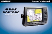
Garmin GPSMAP 3010C Installation Instructions Manual (19 pages)
Garmin GPSMAP 3006C: Installation Instruction
Brand:
Garmin
| Category:
GPS
| Size: 2 MB
Table of Contents
Safety Information
2
Limited Warranty
2
Installation
4
Installation Instructions
5
Installing the GPS
6
Wiring and Cables
8
Power/Data Cable Wiring
9
Garmin Wiring Diagram
10
Garmin Marine Network
13
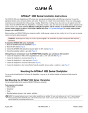
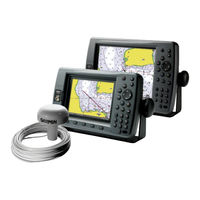
Garmin GPSMAP 3010C Installation Instructions Manual (10 pages)
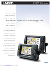
GPSMAP 3000 Series
Brand:
Garmin
| Category:
GPS
| Size: 1 MB
Table of Contents
Installing the GPS Antenna
3
Wiring and Cables
5
Power/Data Cable Wiring
6
Garmin Marine Network
9
Updating the Chartplotter Software
10
Garmin GPSMAP 3010C Quick Reference Manual (2 pages)
Garmin GPSMAP 3006C: Quick Reference
Brand:
Garmin
| Category:
GPS
| Size: 0 MB
Table of Contents
Finding an Item
1
Marking a Waypoint
1
Navigating to a Destination
1
Using the MOB (man Overboard) Feature
1
To Turn on the GPSMAP 3006C/3010C
2
Startup/Shutdown Sequence
2
To Change a Setting Using the Main Menu
2
Using the Main Menu
2
Using the GPSMAP 3006C/3010C Keypad
2
Viewing Main Pages
2
Adjusting the Backlight
2
Garmin GPSMAP 3010C Specification (2 pages)
GPSMAP 3000 series
Brand:
Garmin
| Category:
GPS
| Size: 1 MB
Advertisement
Related Products
GARMIN GPSMAP 3010
Garmin Edge 305CAD - Cycle GPS Receiver
Garmin GPSMAP 3005C
Garmin 300XL TSO
Garmin Oregon 300
Garmin 3000 Series
Garmin 300XL
Garmin GPSMAP 3006
Garmin Nuvi 30CE
Garmin eTrex 30x
Garmin Categories
GPS
Watch
Car Navigation system
Avionics Display
Marine Equipment
More Garmin Manuals
Login
Sign In
OR
Sign in with Facebook
Sign in with Google
Upload manual
Upload from disk
Upload from URL