Sign In
Upload
Manuals
Brands
Avidyne Manuals
GPS
IFD410 FMS/GPS
User Manuals: Avidyne IFD410 FMS/GPS Avionics GPS
Manuals and User Guides for Avidyne IFD410 FMS/GPS Avionics GPS. We have
3
Avidyne IFD410 FMS/GPS Avionics GPS manuals available for free PDF download: Pilot's Manual, Quick Reference
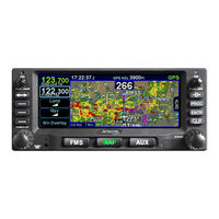
Avidyne IFD410 FMS/GPS Pilot's Manual (380 pages)
Brand:
Avidyne
| Category:
Avionics Display
| Size: 11 MB
Table of Contents
Table of Contents
3
System Overview
9
Intended Function
10
Ifd440
10
Ifd410
11
Functional Overview
12
Basic Concepts
14
Page Keys
14
Line Select Keys
14
Right Knob Labeling
15
Color Philosophy
15
General Ifd Operations
17
IFD440 Bezel Layout
17
IFD410 Bezel Layout
17
Power Control
19
Brightness Controls
20
Start-Up Sequence
21
Database Currency States
23
Page Layout and Formats
24
Com-Nav
26
Frequency List
33
Transponder Control and Display
34
Direct-To Operations
37
Function Keys
39
Touch Screen
41
Operations with Wireless Devices
44
Dual IFD Operations
49
SBAS Vs Non-SBAS Operations
53
Interaction with External Devices
54
Before Takeoff Techniques
55
FMS Subsystem
57
Fpl (Flight Plan) Tab
58
FMS Basic Concepts
58
Creating a New Flight Plan
64
Previewing Flight Plans
65
Selecting a Departure
66
Inserting a Waypoint
68
Inserting an Airway
69
Deleting a Waypoint
70
Editing a Waypoint
71
Adding Altitude Constraints
71
Direct-To
72
Entering and Intercepting a Radial
76
Deleting a Flight Plan
77
Creating a Holding Pattern
78
Circular Orbits
79
Deleting a Holding Pattern
81
Editing a Holding Pattern
81
Activating a Flight Plan
81
Flight Plan Sequencing
82
Lateral Offsets
83
Flight Plan Discontinuities
84
Enroute Descents
86
Entering an Arrival and Approach
88
Visual Approaches
92
Activating a Leg
94
Use of the Map FPL Split Page
96
Info Tab
97
Route Tab
101
Creating a New Route
102
Editing a Route
102
Naming a Route
102
Copying a Route
103
Inverting a Route
104
Activating a Route
104
Deleting a Route
105
Wpt (User Waypoints) Tab
107
Creating a User Waypoint
107
Naming a User Waypoint
108
Deleting a User Waypoint
108
Designating a User Waypoint as an Airfield
108
Nrst (Nearest) Tab
110
Map Subsystem
113
Map Tab
114
Map Controls
114
Other Map Features
117
Fuel Range Rings
121
Decluttering the Map
123
Map Panning
123
Graphical Flight Planning ("Rubber Banding")
124
Altitude Constraints on Map
126
Map Information Pop-Up Boxes
126
Datalink Weather Overlays and Operations
128
Tafs
130
Airmets
130
Sigmets
130
Tfrs
130
Lightning
130
Datalink Radar
131
Weather Overlays on Map
133
Cloud Tops
134
Turbulence
134
Metars
135
Sigmets
135
Tfr
137
Indications of Data Age
137
Tfrs
137
Traffic Display
138
Traffic Sensor Control
146
Terrain Awareness
148
Forward Looking Terrain Avoidance (FLTA)
150
Altitude Callout
152
Helicopter Taws (Htaws)
153
HTAWS Self-Test
154
Synthetic Vision (Svs) / Taws Tab
155
Flight Plan Display
156
HTAWS Control
158
Self-Test
159
Aux Subsystem
161
Audio Tab
162
Volume Control
162
Satellite Radio Tuning
164
Com Presets
166
Util (Utilities) Tab
168
Timers
168
Calculators
171
Electronic Checklist
176
Setup Tab
180
Category Structure
180
Item Structure
181
Item Editing
181
Alerts Category
184
Connectivity Category
187
Datablocks Category
195
Display Category
209
FMS Category
212
Map Category
217
Radio Category
222
Terrain Category
223
Time Category
225
Transponder Category
227
Units Category
228
User Profile Category
231
Presets
232
Sys (System) Tab
238
Fuel Management
238
System Status
240
Alert Tab
251
Navigation
253
Nav Source Knob/Button
257
Obs Mode
261
Vor Course Depiction
264
Armed Vs Engaged/Active Indications
265
Fms Hooks
266
Course Changes and Holds
269
Auto Vloc Tuning
270
Transition Altitudes/Levels
271
Navigation Mode/CDI Scale Changing
273
Approach Procedures
274
Automatic Mode Switching
275
Precision Approaches
276
Non-Precision Approaches
277
Back Course Approaches
277
SBAS Approaches
277
Visual Approaches
281
Missed Approach
283
Retry Approach
285
Enroute Vertical Navigation (Vnav)
287
Allowing Enroute VNAV
287
Defining the Enroute VNAV Altitude Target
287
Defining the Descent Path
288
Vertical Direct-To
289
Enroute Vnav Indications
290
Recommended Icao Equipment Codes
292
General
293
Crew Alerting System (Cas) / Alerts
294
Master Caution Lamp
294
Alert Message Bar
295
Self Test Output
319
System Failures
320
Power Distribution
320
Loss of IFD
320
Loss of Display
321
Loss of Bezel Controls
322
Loss of Touchscreen Control
322
Loss of GPS (Dead Reckoning)
323
Other Anomalies
324
Subscriptions
325
Night Operations
326
IFD Display Brightness
326
IFD Bezel Brightness
326
Display of Terrain on Map
326
High Temperature Operations
327
Cold Temperature Operations
328
Low Power Operations
329
High Power Operations
330
Use of Gloves
331
Charging from the Usb
333
Integration with the Ifd100 Mobile App
334
Demo Mode
335
Data Transfer To/From External Devices
338
Regulatory Compliance Statements
342
Radio Regulatory Compliance Statements
342
Déclaration(S) de Conformité Réglementaire
343
FIS-B Weather
344
Maintenance Mode
345
Starting Maintenance Mode at Power up
345
Starting Maintenance Mode from Flight Mode
345
Exiting Maintenance Mode
347
Database Updates
348
Software Updates
354
Datalogs Download
355
User Data Backup/Restoration Procedure
360
Saving User Data
360
Reloading Previously Stored User Data
361
Transferring User Waypoints
362
Uploading User Waypoints
362
Downloading User Waypoints
363
Pairing a Bluetooth Keyboard
365
Verification of Successful Pairing
367
Cleaning the Display
370
Slide-In Replacement Details
371
Advertisement
Avidyne IFD410 FMS/GPS Pilot's Manual (282 pages)
Integrated Flight Display
Brand:
Avidyne
| Category:
GPS
| Size: 8 MB
Table of Contents
Table of Contents
4
System Overview
9
Intended Function
10
Functional Overview
10
Basic Concepts
11
Page Function Keys
11
Line Select Keys
12
Right Knob Labeling
12
Color Philosophy
13
General Ifd Operations
14
Bezel Layout
14
Power Control
15
Brightness Controls
16
Start-Up Sequence
17
Database Currency States
20
Page Layout and Formats
21
Frequency List
23
Transponder Control and Display
24
Direct-To Operations
28
Function Keys
30
Touch Screen
31
Use of External Keyboard
34
Dual IFD Operatons
36
Wifi Operations
40
WAAS Vs Non-WAAS Operations
43
Interaction with External Devices
44
Before Takeoff Techniques
45
Fms
47
Fpl (Flight Plan) Tab
47
FMS Basic Concepts
47
Creating a New Flight Plan
49
Selecting a Departure
53
Saving/Naming a Flight Plan
55
Activating a Flight Plan
56
Copying a Flight Plan
56
Inverting a Flight Plan
56
Preview Flight Plans
56
Modifying a Flight Plan
57
Inserting a Waypoint
57
Deleting a Waypoint
58
Editing a Waypoint
59
Adding a Vertical Constraint
59
Entering and Intercepting a Radial
60
Deleting a Flight Plan
61
Creating a Holding Pattern
61
Circular Orbits
63
Deleting a Holding Pattern
65
Editing a Holding Pattern
65
Flight Plan Sequencing
66
Lateral Offsets
67
Gaps or Discontinuities in Flight Plans
68
Enroute Descents
68
Entering an Arrival and Approach
71
Activating a Leg
74
Use of the Map-FPL Split Page
75
Info Tab
76
Route Tab
79
Creating a New Route
79
Naming a Route
80
Copying a Route
81
Inverting a Route
82
Activating a Route
82
Deleting a Route
83
Wpt (User Waypoints) Tab
83
Creating a User Waypoint
84
Naming a User Waypoint
85
Deleting a User Waypoint
85
Designating a User Waypoint as an Airfield
85
Nrst (Nearest) Tab
86
Map
89
Map Tab
89
Map Controls
89
Other Map Features
93
Decluttering the Map
98
Map Panning
99
Graphical Flight Planning ("Rubber Banding")
99
Altitude Constraints on Map
102
Map Information Pop-Up Boxes
102
Datalink Weather Overlays and Operations
105
Datalink RADAR
106
Weather Overlays on Map
107
Tfrs
112
Indications of Data Age
113
Weather Radar Selection for Map Overlay
114
Terrain
116
Terrain Awareness (TA)
116
Forward Looking Terrain Alerting (FLTA)
118
500' Callout
120
Traffic Display
122
Synthetic Vision (Svs) Tab
129
Radar Tab
133
Aux
141
Audio Tab
141
Volume Control
141
Satellite Radio Tuning
142
Utilities Tab
145
Timers
145
Calculators
148
Electronic Checklist
151
Setup Tab
155
Datablock Setup
155
Map Setup
169
FMS Setup
170
User Options
171
Custom User Settings
184
System Tab
185
Fuel Management
185
System Status
186
Navigation
193
General
193
Levels of Integration
193
Nav Source Button
196
Obs Mode
197
Armed Vs Engaged/Active Indications
200
Fms Hooks
201
Course Changes and Holds
203
Transition Altitudes/Levels
203
Navigation Mode/CDI Scale Changing
205
Approach Procedures
206
Precision Approaches
207
Non-Precision Approaches
207
Missed Approach
213
Retry Approach
215
Rnp/Rnav Operations
216
Recommended Icao Equipment Codes
217
General
219
Caution Advisory System (Cas) / Alerts
219
Master Caution Lamps
219
Warning-Caution-Advisory Message Bar
220
Alerts Tab
221
Exceedances | Warnings Red
222
Exceedances | Cautions Yellow
223
Exceedances | Advisories CYAN
228
Night Operations
237
IFD Display Brightness
237
IFD Bezel Brightness
237
Display of Terrain on Map
237
System Failures
238
Power Distribution
238
Loss of IFD
238
Loss of Display
239
Loss of Bezel Controls
240
Loss of Touchscreen Control
240
Loss of GPS (Dead Reckoning)
241
Other Anomalies
242
Subscriptions
242
Data Updates
243
Data Transfer To/From External Devices
249
Integration with the Ifd100 Mobile App
253
User Data Backup/Restoration Procedure
254
Saving User Data
254
Reloading Previously Stored User Data
255
Datalogs Download
256
Software Updates
260
High Temperature Operations
260
Cold Temperature Operations
260
Low Power Operations
261
Charging from the Usb
262
Plug and Play Details
263
Cleaning the Display
265
Pairing a Bluetooth Keyboard
266
Self Test Output
270
Use of Gloves
271
Demo Mode
274
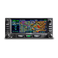
Avidyne IFD410 FMS/GPS Quick Reference (28 pages)
Brand:
Avidyne
| Category:
Avionics Display
| Size: 14 MB
Table of Contents
Overview Diagram
2
Inserting a Waypoint
5
Direct-To Operation
8
Selecting a Departure
9
Selecting an Approach
10
Decluttering the Map
15
Updating Databases
19
Advertisement
Advertisement
Related Products
Avidyne IFD5 Series
Avidyne IFD4 Series
Avidyne IFD540
Avidyne IFD440
Avidyne IFD550
Avidyne IFD545
Avidyne IFD510
Avidyne IFD100
Avidyne IFD5000i
Avidyne 700-00004 Series
Avidyne Categories
Avionics Display
Monitor
GPS
Marine Radio
Car Navigation system
More Avidyne Manuals
Login
Sign In
OR
Sign in with Facebook
Sign in with Google
Upload manual
Upload from disk
Upload from URL