
Related Manuals for Blaupunkt New York 800 Truck


Summary of Contents for Blaupunkt New York 800 Truck
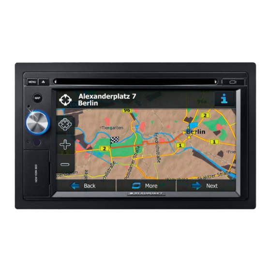
- Page 1 Multimedia Navigation New York 800 Truck Operating instructions – Navigation...
- Page 2 Navigation right away. This document is the detailed description of the navigation software. You can easily discover Blaupunkt Navigation while you are using it; however, we still recommend that you read this manual to fully understand the screens and features.
-
Page 3: Table Of Contents
Table of contents 1 Warnings and Safety information ................. 6 2 Getting started ......................7 2.1 Buttons and other controls on the screen ............... 8 2.1.1 Using keyboards ........................9 2.1.2 Beyond single screen tap ....................10 2.2 Map screen ........................ - Page 4 3.1.5 Selecting one of the most likely destinations (Smart History) ........... 45 3.1.6 Selecting a recent destination from the History ..............46 3.1.7 Entering the coordinate of the destination ................. 47 3.1.8 Building a route from the list of destinations (Create Route) ..........48 3.2 Viewing the entire route on the map ................
- Page 5 6.3.1 Sound and Warnings ......................74 6.3.2 Customise Quick menu ...................... 77 6.3.3 Lorry settings ........................77 6.3.4 Driving time management....................77 6.3.5 Traffic settings ........................78 6.3.6 Route settings ........................78 6.3.7 Map settings ........................82 ...
-
Page 6: Warnings And Safety Information
The navigation system helps you find your way to your destination with the built-in GPS receiver. Blaupunkt Navigation does not transmit your GPS position; others cannot track you. If you accept it when first using the application, Blaupunkt Navigation collects usage information and GPS logs that may be used for improving the application and the quality and coverage of maps. -
Page 7: Getting Started
2 Getting started Blaupunkt Navigation is optimised for in-car use. You can use it easily by tapping the screen buttons and the map with your fingertips. When using the navigation software for the first time, an initial setup process starts automatically. -
Page 8: Buttons And Other Controls On The Screen
Later you can turn them on or off individually in Log collection settings (page 85). After the initial setup, the Map screen appears and you can start using Blaupunkt Navigation. 2.1 Buttons and other controls on the screen When you are using Blaupunkt Navigation, you usually tap buttons on the touch screen. -
Page 9: Using Keyboards
• Slider When a feature can be set to Drag the different values in a range, handle to move Blaupunkt Navigation shows the slider to its an indicator on a gauge that new position. displays and sets the value. •... -
Page 10: Beyond Single Screen Tap
Entering numbers and symbols to switch to a keyboard offering numeric and symbol characters. Finalising the keyboard entry (accepting the suggested search result) Finalising the keyboard entry (opening the list of search results) Finalising the keyboard entry (saving your input) Cancelling the keyboard entry (returning to the previous screen) 2.1.2 Beyond single screen tap... -
Page 11: Map Screen
2.2 Map screen 2.2.1 Navigating on the map The Map screen is the most frequently used screen of Blaupunkt Navigation. A small live map is displayed on the Navigation menu, as a part of the button. To enlarge this small map and open the Map screen, tap This map shows the current position (the Vehimarker, a blue arrow by default), the recommended route (an blue line), and the surrounding map area. - Page 12 If Blaupunkt Navigation is capable of receiving live traffic information, the calculation takes into account traffic delays affecting your route if they are received. However, this calculation is rarely accurate.
-
Page 13: Position Markers
2.2.3 Objects on the map 2.2.3.1 Streets and roads Blaupunkt Navigation shows the streets in a way that is similar to how the paper road maps show them. Their width and colours correspond to their importance: you can easily tell a motorway from a small street. - Page 14 There is a field in the top left corner that displays the next manoeuvre. Both the type of the event (turn, roundabout, exiting motorway, etc.) and its distance from the current position are displayed. A smaller icon shows the type of the second next manoeuvre if it is near the first one. Otherwise, only the next manoeuvre is displayed.
-
Page 15: Lane Information And Signposts
When navigating on multilane roads, it is important to take the appropriate lane in order to follow the recommended route. If lane information is available in the map data, Blaupunkt Navigation displays the lanes and their directions using small arrows at the bottom of the map. -
Page 16: Object Types
3D buildings 3D block representation of full city building data containing actual building size and position on the map. 2.2.3.7 Elements of the active route Blaupunkt Navigation shows the route in the following way: Symbol Name Description Current GPS position and Your current position displayed on the map. -
Page 17: Traffic Events
You can choose whether you want to use or excluded from the navigation avoid certain road types (page 78). However, when Blaupunkt Navigation cannot avoid such roads, the route will include them and it will show them in a colour that is different from the route colour. -
Page 18: Manipulating The Map
Zooming in and out Changes how much of the map is displayed on the screen. Blaupunkt Navigation uses high-quality vector maps that let you examine the map at various zoom levels, always with optimised content. It always displays street names and other text... -
Page 19: Quick Menu
Compass in 3D The direction of the compass shows North. map view mode Tap the button to switch to North-up view, and then tap again to rotate the map in the previous direction. Location Tap this button to open a new screen with information information about the selected map point, the Cursor. - Page 20 This switch mutes all sounds of the device. Tap again More / Settings / to re-enable sounds. Sound and Warnings / Volume / Master switch Find / Find Places / This function lets you search for a Place along your Quick Search (page route or around your current location if there is no route calculated.
- Page 21 Tap the Traffic icon in This button opens the Traffic Summary screen. the Navigation menu or on the Map screen My Route / This button lets you bypass parts of the recommended Avoidances route. More / Trip Monitor This button opens the Trip Monitor screen where you (page 72) can manage your previously saved trip logs and track logs.
-
Page 22: Checking The Details Of The Current Position (Where Am I?)
2.2.6 Checking the details of the current position (Where Am I?) This screen contains information about the current position (or about the last known position if GPS reception is not available) and a button to search for useful Places nearby. You can access this screen from the map in one of the following ways: •... -
Page 23: Navigation Menu
: Petrol stations Tap any of the buttons, select a Place from the list, and navigate to it. 2.3 Navigation menu You can reach all parts of Blaupunkt Navigation from the Navigation menu. You have the following options: • to select your destination by entering an address or selecting a place of interest, a location on the map or one of your Favourite destinations. -
Page 24: On-Road Navigation
3 On-road navigation When first started, Blaupunkt Navigation calculates routes using the road network of the high quality vector maps provided with the product. You can set up your route in different ways: • If you need a route for immediate navigation, you can select the destination and start navigating to it right away (normal navigation). -
Page 25: Entering An Address
Navigation menu. In the Navigation menu, tap the following buttons: By default, Blaupunkt Navigation proposes the country and city/town where you are. If needed, tap , enter the first few letters of the country name on the keyboard, and select one country from the list of results. - Page 26 • The most likely street name is always shown in the input field. To accept it, tap • If the desired name does not show up, the names that match the string appear in a list after entering a couple of characters (to open the list of results before it appears automatically, tap ).
-
Page 27: Entering The Midpoint Of A Street As The Destination
Tip! If you know that you will use this destination frequently, before tapping to confirm the destination, put it on the list of your Favourites first: tap then , give a name for the new Favourite, and tap to save the location. The map with the destination returns automatically. -
Page 28: Selecting An Intersection As The Destination
Instead of entering the house number, tap . The midpoint of the street is selected as the destination. A full screen map appears with the selected point in the middle. If necessary, tap the map somewhere else to modify the destination. The Cursor ( ) appears at the new location. - Page 29 • If the desired name does not show up, the names that match the string appear in a list after entering a couple of characters (to open the list of results before it appears automatically, tap ). Select the street from the list. Enter the intersecting street name: •...
-
Page 30: Selecting A City/Town Centre As The Destination
3.1.1.4 Selecting a city/town centre as the destination The city/town centre is not the geometric centre of the city/town but an arbitrary point the map creators have chosen. In towns and villages, it is usually the most important intersection; in larger cities, it is one of the important intersections. -
Page 31: Entering An Address With A Postal Code
new location. Tap to confirm the destination, or tap to select a different destination. After a short summary of the route parameters, the map appears showing the entire route. The route is automatically calculated. Tap to modify route parameters, or tap and start your journey. - Page 32 Enter the street name: Start entering the street name on the keyboard. Find the street you need: • The most likely street name is always shown in the input field. To accept it, tap • If the desired name does not show up, the names that match the string appear in a list after entering a couple of characters (to open the list of results before it appears automatically, tap ).
-
Page 33: Tips On Entering Addresses Quickly
3.1.2 Selecting the destination from the Places of Interest You can select your destination from the Places of Interest included with Blaupunkt Navigation. Using the same screen, you can find a Place in different ways: •... -
Page 34: Quick Search For A Place Of Interest
3.1.2.1 Quick search for a Place of Interest The Quick search feature lets you quickly find a Place by its name. The search is always carried out • along the recommended route if it exists or • around your current location if there is no destination given. Start the Quick search function: •... -
Page 35: Searching For A Place Of Interest Using Preset Categories
If necessary, tap the map somewhere else to modify the destination. The Cursor ) appears at the new location. Tap to confirm the destination, or tap to select a different destination. After a short summary of the route parameters, the map appears showing the entire route. - Page 36 • If there is no active route (destination is not selected), they are searched around the current position. • If the current position is not available either (no GPS signal), they are searched around the last known position. • • If an active route exists, restaurants are searched along the route.
-
Page 37: Searching For A Place Of Interest By Category
3.1.2.3 Searching for a Place of Interest by category You can search for Places of Interest by their categories and subcategories. If you are on the Map screen, tap to return to the Navigation menu. In the Navigation menu, tap the following buttons: Select the area around which the Place should be searched for: •... - Page 38 Select one of the main Place categories (e.g. Accommodation) or tap to list all Places around the selected location or along the route. Select one of the Place subcategories (e.g. Hotel or Motel) or tap to list all Places in the selected main category around the selected location or along the route.
-
Page 39: Searching For A Place Of Interest By Name
11. Browse the list if necessary and tap one of the list items. A full screen map appears with the selected point in the middle. The name and address of the Place is displayed at the top of the screen. 12. - Page 40 • to search for a place around the destination of the active route. (The result list will be ordered by the distance from the destination.) • to search along the active route, and not around a given point. This is useful when you search for a later stopover that results in a minimal detour only, such as searching for upcoming petrol stations or restaurants.
- Page 41 Using the keyboard, start entering the name of the Place. 10. After entering a few letters, tap to open the list of Places with names containing the entered character sequence. 11. (optional) The Places in the list are ordered by their distance from the current or last known position, from the selected city/town, from the destination or by the length of the necessary detour.
-
Page 42: Selecting Nearby Assistance From 'Where Am I
3.1.2.5 Selecting nearby assistance from 'Where Am I?' You can quickly search for nearby assistance from the 'Where Am I?' screen. On the Map screen, tap to open the Quick menu. , and then Preset search categories appear, all for searching around the current position (or around the last known position if the current position is not available): •... -
Page 43: Selecting A Map Location As The Destination
(optional) The Places in the list are ordered by their distance from the current or last known position, from the selected city/town, from the destination or by the length of the necessary detour. If you need to reorder the list, tap Browse the list if necessary and tap one of the list items. -
Page 44: Selecting The Destination From Your Favourites
to select the Cursor as the destination. After a short summary of the route parameters, the map appears showing the entire route. The route is automatically calculated. Tap to modify route parameters, or tap and start your journey. 3.1.4 Selecting the destination from your Favourites You can select a location that you have already saved as a Favourite to be your destination. -
Page 45: Selecting One Of The Most Likely Destinations (Smart History)
After a short summary of the route parameters, the map appears showing the entire route. The route is automatically calculated. Tap to modify route parameters, or tap and start your journey. 3.1.5 Selecting one of the most likely destinations (Smart History) The destinations that you have set earlier appear in the History list. -
Page 46: Selecting A Recent Destination From The History
3.1.6 Selecting a recent destination from the History The destinations that you have set earlier appear in the History. Access the History: • If you are on the Map screen, tap and then tap • If you are in the Navigation menu, tap and then tap The list of recent destinations appears. -
Page 47: Entering The Coordinate Of The Destination
3.1.7 Entering the coordinate of the destination You can also select a destination by entering its coordinate. Do as follows: If you are on the Map screen, tap to return to the Navigation menu. In the Navigation menu, tap Open the menu and tap You can enter the latitude and longitude values in any of the following formats: decimal degrees;... -
Page 48: Building A Route From The List Of Destinations (Create Route)
After a short summary of the route parameters, the map appears showing the entire route. The route is automatically calculated. Tap to modify route parameters, or tap and start your journey. 3.1.8 Building a route from the list of destinations (Create Route) You can also build your route destination by destination from the My Route menu. -
Page 49: Viewing The Entire Route On The Map
3.3 Checking route parameters and accessing route related functions You can check different parameters of the route recommended by Blaupunkt Navigation. If you are on the Map screen, tap to return to the Navigation menu. -
Page 50: Modifying The Route
• The total length of the route. • Estimated delay calculated from traffic events on your route. • The symbol of the vehicle type used in route calculation. • The route planning method (e.g. Fast). You have the following options on this screen (for detailed instructions on how to use them, see the next chapter): •... -
Page 51: Setting A New Starting Position For The Route
• to plan a new route to the newly selected location. The previous destination and waypoint(s) are deleted. • to add the newly selected location as an intermediate destination to your route. The other destinations of the route remain intact. Note: the new waypoint is placed among destinations to keep the route optimal. -
Page 52: Editing The List Of Destinations (Edit Route)
The first line is the start of the route, normally the current GPS position. Tap confirm your action at the warning message. The Destination menu appears and you can select the start point of the route the same way you select a destination. When the new start point is set, tap The map returns with a transparent Vehimarker (showing that there is no GPS reception). -
Page 53: Pausing The Active Route
3.4.4 Pausing the active route You do not need to pause the active route: when you start driving again, Blaupunkt Navigation restarts the voice instructions from your position. 3.4.5 Cancelling the active route To cancel the navigated route, do one of the following: •... -
Page 54: Checking Route Alternatives When Planning The Route
Or if you cannot find a good alternative, tap and scroll down for routes with different routing methods. Select one of the route alternatives and tap to return to the previous screen. Blaupunkt Navigation recalculates the route. The blue line now shows the new recommended route. -
Page 55: Checking Route Alternatives For An Existing Route
Select one of the route alternatives then tap and hold for a few seconds to return to the Map screen. Blaupunkt Navigation recalculates the route. The blue line now shows the new recommended route. -
Page 56: Changing The Vehicle Used In Route Planning
• • • Blaupunkt Navigation recalculates the route optimised for the new vehicle type. The blue line now shows the new recommended route. 3.4.9 Changing the road types used in route planning To recalculate the active route with different road type preferences, do as follows. These changes can also be made in Settings (page 78). -
Page 57: Saving A Location As A Favourite Destination
Blaupunkt Navigation plans the best toll-free route. • - Blaupunkt Navigation includes ferries in a planned route by default. However, a map does not necessarily contain information about the accessibility of temporary ferries. You might also need to pay a fare on ferries. -
Page 58: Watching The Simulation Of The Route
to save the location as a new Favourite destination. 3.6 Watching the simulation of the route You can run a simulated navigation that demonstrates the active route. Do as follows: If you are on the Map screen, tap to return to the Navigation menu. - Page 59 • : Jump to the next route event (manoeuvre). • : Pause the simulation. • : Jump to the previous route event (manoeuvre). • : Tap to increase the speed of the simulation to 4, 8 or 16 times faster. Now tap again to return to the normal speed.
-
Page 60: Off-Road Navigation
4 Off-road navigation When first started, Blaupunkt Navigation calculates routes using the road network of the high quality vector maps provided with the product. You can switch the application to off-road mode in Navigation settings in one of the following ways: •... -
Page 61: Lorry Navigation
You are obliged to always obey the restrictions displayed on the road. 5.1 Setting up vehicle parameters When you use Blaupunkt Navigation with a lorry, you need to select a lorry type vehicle profile in Route settings and enter the parameters of your vehicle. These parameters are used in route calculation to bypass roads that are restricted for your lorry. - Page 62 There is one Default Lorry profile at the end of the list. You can either: • tap the button at the Default Lorry profile or • create a new profile by tapping then and selecting Lorry as the vehicle type. The list of vehicle profile parameters appear.
-
Page 63: Setting Up Waiting Time At Waypoints
Tip! When you often use your vehicle with typical configurations of parameters (for example with or without a trailer that also affects the length, the height, the number of axles and the weight), it is better to create different vehicle profiles for the typical setups and change between the profiles instead of always modifying parameters. - Page 64 In the Navigation menu, tap , and then and set the driving timer defaults for the driver. (optional) Tap the switch to use the vehicle with two drivers. The timer defaults are the same but the timers will count down for each driver individually. When finished, tap and hold to return to the Map screen.
-
Page 65: Reference Guide
While driving without an active route: Smart Zoom will zoom in if you drive slowly and zoom out when you drive at high speed. 6.1.2 Daytime and night colour themes Blaupunkt Navigation uses different colour themes during the day and during the night for both the map and the menu screens. •... - Page 66 • : Results in a route with fewer turns and no difficult manoeuvres. With this option, you can make Blaupunkt Navigation to take, for example, the motorway instead of a series of smaller roads or streets. •...
-
Page 67: Green Routing
Real-time Traffic events are also taken into account and sometimes greatly modify the route. Blaupunkt Navigation automatically recalculates the route if you deviate from the proposed itinerary or if a newly received Traffic event concerns a part of the recommended route. -
Page 68: Road Safety Cameras And Other Proximity Alert Points
There is a special proximity warning for road safety cameras (like speed or red light cameras) and other proximity alert points (like schools or railroad crossings). These alert points are not part of Blaupunkt Navigation. You can download them from www.naviextras.com or you can upload points in a specific text file if needed. -
Page 69: Speed Limit Warning
6.1.6 Speed limit warning Maps may contain information about the speed limits of the road segments. Blaupunkt Navigation is able to warn you if you exceed the current limit. This information may not be available for your region (ask your local dealer), or may not be fully correct for all roads in the map. -
Page 70: Traffic Information In Route Planning
6.1.8.1 Historical traffic If statistical traffic information is stored with the map data, Blaupunkt Navigation can take them into account when planning a route. In normal cases, these statistics help you avoid usual traffic jams on the given day of week in the given hour but in some cases like on public holidays that fall on normal weekdays, they can be misleading. - Page 71 If public Traffic data is broadcast at your location, Blaupunkt Navigation automatically takes into account the traffic events received. You do not need to set anything in the program. The receiver will automatically search the FM radio stations for TMC data, and the decoded information will immediately be used in route planning.
-
Page 72: More' Menu
Button Description You can configure the program settings, and modify the behaviour of Blaupunkt Navigation. Fine-tune route planning options, change the look of the Map screen, turn on or off warnings, or restart the Configuration wizard, etc. See the next chapter for details. -
Page 73: Settings Menu
You can also access program usage statistics. 6.3 Settings menu You can configure the program settings, and modify the behaviour of Blaupunkt Navigation. Tap the following buttons: The Settings menu has several options. Tap or scroll with your finger to see the full list. -
Page 74: Sound And Warnings
These settings determine how routes will be calculated. Select the type of vehicle you are driving, the road types used in route planning, and the route planning method. You can fine-tune the appearance of the Map screen. Adjust the map view to your needs, choose suitable colour themes from the list for both daytime and night use, change the blue arrow to a 3D car model, show or suppress 3D buildings, turn track logging on or off, and... - Page 75 Maps may contain information about the speed limits of the road segments. Blaupunkt Navigation is able to warn you if you exceed the current limit. This information may not be available for your region (ask your local dealer), or may not be fully correct for all roads in the map.
- Page 76 This feature allows you to receive a warning when approaching a Road Safety Camera or other alert points like school zones or railroad crossings. You must ensure on your own liability that using this feature is legal in the country where you intend to use it. You can choose what alert point sources you want to use.
-
Page 77: Customise Quick Menu
Controls for each sound type: Button Description Volume slider Adjusts the volume of the related sound. Use the switch to mute the related sound. The slider becomes inactive. Tap again to re-enable. 6.3.2 Customise Quick menu The content of the Quick menu (page 19) is fully customisable. Tap the button you want to change, and select its new function from the list. -
Page 78: Traffic Settings
When calculating a new route, or when recalculation becomes necessary based on the received Traffic events, Blaupunkt Navigation avoids traffic events if it makes sense. You can also set the minimum delay that triggers route recalculation, and you can instruct the application if you want to confirm every recalculation. - Page 79 They can be enabled or disabled separately from toll roads. Blaupunkt Navigation includes toll roads (pay roads where there is a per-use charge) in the routes by default. If you disable toll roads, Blaupunkt Navigation plans the best toll-free route.
- Page 80 Button Description Tap this button to rename the profile for something meaningful. Enter the average consumption of your vehicle when used in built-up areas. The unit for consumption can be set in Regional Settings. Enter the average consumption of your vehicle when used on highways. The unit for consumption can be set in Regional Settings.
- Page 81 • Private roads and resident-only roads are used only they are inevitable to reach the destination. • Walkways are excluded from routes. • • All manoeuvres are available in intersections. • Directional constraints are taken into account the way that opposite direction is allowed with a low speed.
-
Page 82: Map Settings
Results in a route with fewer turns and no difficult manoeuvres. With this option, you can make Blaupunkt Navigation to take, for example, the motorway instead of a series of smaller roads or streets. 6.3.7 Map settings You can fine-tune the appearance of the Map screen. -
Page 83: Visual Guidance Settings
Show or suppress 3D landmarks, 3D artistic or block representations of prominent or well-known objects. Show or suppress 3D city models, 3D artistic or block representation of full city building data containing actual building size and position on the map. Turn on or off track log saving, that is, saving the sequence of the locations your journeys go through. -
Page 84: Display Settings
The application will restart if you change this setting; you are asked to confirm this. You can set the distance units to be used by the program. Blaupunkt Navigation may not support all the listed units in some voice guidance languages. -
Page 85: Trip Monitor Settings
6.3.11 Trip monitor settings Trip logs contain useful information about your trips. Trip logs can be saved manually when you reach your destination or you can turn on the automatic saving here. You can access these logs in the Trip monitor. Trip monitor is available from the More menu. Trip monitor can record statistical data of your trips. -
Page 86: Glossary
Colour theme Blaupunkt Navigation comes with different colour themes for daytime or night use of the map and menu screens. Themes are custom graphic settings and they can have different colours for streets, blocks or surface waters in 2D and 3D modes, and they display shades or shadows in different ways in 3D mode. - Page 87 Road Safety Camera Special alert points for speed, red light or bus lane cameras. Different data sources are available. You can configure Blaupunkt Navigation to warn you when you approach one of these cameras. Detecting the location of Road Safety Cameras is prohibited in certain countries. It is the sole responsibility of the driver to check whether this feature can be used during the trip.
-
Page 88: Copyright Note
This manual may not, in whole or in part, be reproduced or transmitted in any form either electronically or mechanically, including photocopying and recording, without the express written consent of Blaupunkt. © 2011 - Blaupunkt Data Source © 2006-2010 Tele Atlas. All rights reserved. This material is proprietary and the subject of copyright protection, database right protection and other intellectual property rights owned by Tele Atlas or its suppliers. - Page 89 Blaupunkt AudioVision GmbH & Co. KG Robert-Bosch-Straße 200 D-31139 Hildesheim http://www.blaupunkt.com 04/11...
Need help?
Do you have a question about the New York 800 Truck and is the answer not in the manual?
Questions and answers