
Related Manuals for Adventure Pilot iFLY GPS


Summary of Contents for Adventure Pilot iFLY GPS
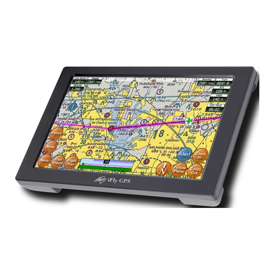
- Page 1 Adventure Pilot O wner ’s Ma n ua l Copyright 2012 by Adventure Pilot, LLC. iFly GPS is a trademark used by Adventure Pilot, LLC. Version 7 .5.2, Rev 092512...
-
Page 2: Table Of Contents
Contents Overview Specifications............3 Custom.Waypoints..........26 Features..............3 Custom.Waypoints.Form........ 26 Warnings..............5 Alerts Unit.Overview............6 Alert. T ypes............27 Mounting.on.a.Windscreen......7 Collision.Alerts............. 27 Connecting.to.Power........7 Setting.Collision.Alert. T hresholds....27 Powering.On............. 7 More.about. T errain.Alerts......28 Updating.your.iFly.GPS........ -
Page 3: Overview
Overview Specifications Dimensions ........................7 .25 x 4.5 x 0.75 inches Weight ..............................12 ounces Current ............................600mA @ 12V Power Input ............................. DC 12V~28V GPS ..............................SiRF Star – III Operating Temperature ...................14°F to 140°F (-10°C to 60°C) Storage Temperature ....................-4°F to 176°F (-20°C to 80°C) Specifications are subject to change and improvement without notice. -
Page 4: Airport Information
GPS or recommended by Adventure Pilot with quick reference numbers LLC. Traffic patterns with pattern altitude (if Do not leave the iFly GPS in extremely high published) or low temperatures. Do not use in a humid Georeferenced FAA Airport Diagrams for over environment or submerge in water. -
Page 5: Warnings
Do not install the iFly GPS where it obstructs the pilot’s field of view or interferes with operating controls. The flight indicators shown on the iFly GPS are based on GPS-derived data and may differ from the aircraft’s instruments. -
Page 6: Unit.overview
Camera – Connect an external camera (not included) AV In – Connect external video or audio device Headphone Jack USB Port SD/MMC Memory Card Slot Connect USB memory storage device • Included SD card contains iFly GPS applications and data Power Jack • Card must be inserted for unit to operate Connect Cigarette Lighter Adapter or AC Adapter •... -
Page 7: Mounting.on.a.windscreen
Loosen the two arm adjustment knobs, position the unit as desired, and re-tighten the arm adjustment knobs. Notes: • Do not install the iFly GPS where it obstructs your field of view or interferes with operating controls. • After installation, make sure the unit is firmly secured. -
Page 8: Updating.your.ifly.gps
Note: This process only works with a Windows computer running Internet Explorer. With your iFly GPS powered off, eject the SD card (this is the postage-sized memory chip on the left side of the iFly. To eject the SD card, gently push it in and release, it will pop out like toast from a toaster) Insert the SD card into your PC. -
Page 9: Main.display
Overview Main Display Ground Speed Track Location Icon Navigation Instruments The direction your aircraft Indicates your Use Menu Setup to toggle Available when a flight plan is active is moving relative to true current location on between Miles, Kilometers, (see page 15) North the sectional and Nautical Miles... -
Page 10: Using The Touch-Screen
Overview Using the Touch-Screen Panning the view Panning Swipe your finger across the map to move (or “pan”) the view to another area. Panning temporarily hides all the instruments and buttons on the map. This can be useful if you need to see text or an image that is behind something else on the map. -
Page 11: Main.menu
Overview Main Menu Access by touching Menu on the bottom left-hand corner of the map display. Quickly set a route by entering the airport code or name in the Fly Direct To Fly Direct To Screen (see page 17). Find Nearest... Find the airport or NAVAID closest to your current location (see page 14). Setup Customize display settings (see page 23). - Page 12 Overview Possible Actions Menu continued Targets a waypoint and bypasses other points in the plan. Direct to this Waypoint Note: This can only be used to target “future waypoints. ” (Shown if an existing waypoint is Waypoints that have already been passed cannot be targeted with touched.) this option.
-
Page 13: Airport.information.screen
Overview Airport Information Screen Access by touching the Find Airport button and selecting an airport from the list. This screen provides important information about an airport, including: Airport code and name Latitude/Longitude Public/private status If a control tower is present, and what hours that tower is open All utilized communication frequencies A list of runways with detailed information about each runway’s orientation, condition, lighting, traffic pattern, IFR equipment, markings, and obstructions... -
Page 14: Find.nearest
Note: The FAA publishes updated sectionals one day prior to the sectional’s expiration date. Adventure Pilot makes every effort to get new sectionals ready for download within 24 hours. Shows the current software version of your iFly GPS, as well as Version and Contact Adventure Pilot copyright and contact information. -
Page 15: Flight Planning
Flight Planning Options The iFly GPS includes an intuitive flight planning utility appropriate for VFR flight. A flight plan consists of a departure point, zero or more waypoints, and a destination. These points make up a collection of “routes. ” For example, a flight plan with two points (a departure and a destination) will have one route. -
Page 16: Option 1: Create A Point-To-Point Plan By Touching The Screen
Flight Planning Option 1: Create a point-to-point plan by touching the screen Pan the map until you find your desired airport Touch the destination and hold for 2 seconds to or other flying destination. display the Possible Actions menu. Select the “Fly Direct to Here” option. If there are any airports or NAVAIDS near your selected destination, you will be given a list to select from. -
Page 17: Option.2:.Find.an.airport.by.code.or.keyword
Continue touching “Perform full text to see previous search” below Begin searching Limits search entire Adventure Pilot to airport and Airport database NAVIAD codes Searches airport and city Check to include indicated Return to map display names for the entered text... -
Page 18: Option.3:.Use.the.flight.planner
Flight Planning Option 3: Use the Flight Planner The Flight Planner can be used to create a flight plan from scratch, tweak a current flight plan, change the order of waypoints, cancel a flight plan, save plans, or load previously saved plans. It can also be used to review flight time and fuel consumption estimates. - Page 19 Flight Planning Next to each point in the flight plan is an Opts (options) button. Touch Opts to open a menu if you want to see available waypoint information, remove, change, move, or insert additional waypoints. Touch Aircraft Profile at the top/right of the Flight Plan Screen to modify the estimated speed,fuel burn, climb rate, and descent rate of your aircraft.
-
Page 20: Option.4:.Rubber-Band.route.modification
Flight Planning Option 4: Rubber-band route modification After creating your initial flight plan, it may be tweaked by touching and dragging a route line or waypoint. You may need to tweak a flight plan if you find that it travels through areas or airspaces that should be avoided (such as a TFR, restricted airspaces, undesired controlled airspaces, etc.). -
Page 21: Option.5:.Vertical.flight.planning
Flight Planning Option 5: Vertical flight planning Vertical flight planning allows you to view or modify your flight plan in relation to terrain highlights based on a defined altitude. You can view the Flight Plan in relation to the terrain from a relative (bird’s-eye) view or a vertical profile view. -
Page 22: Checking Your Flight Plan's Airspaces
Flight Planning Checking Your Flight Plan’s Airspaces Use the Airspace Information form to walk through all the airspaces that your flight plan crosses, one by one, in order to get detailed information on the airspaces and to adjust your flight plan if necessary. Access by touching Airspaces? button in the Flight Planner. -
Page 23: Settings
Shown to draw a trail showing where you’ve flown in the current flight plan. The iFly GPS remembers all past flights and lists them with the date and time stamp of departure. Select one and touch to draw the flight trail on the map. -
Page 24: Instrument.settings
Settings Instrument Settings Selecting Instruments Mode Activate Basic, Extended, or a Custom instrument group (see below). Access by touching Menu Setup Select Instruments Mode. Customizing Instruments Allows you to customize instrument appearance: hide, show, or change location, size, and color. Access by touching Menu ... - Page 25 Settings Full Instrument Abbreviated Description Name Name Distance from the current position to the Final Destination. (Can be in Distance to Final Dist: Final Knots, Miles, Kilometers.) Distance to Next Distance from current position to the Next Waypoint. (Can be in Knots, Dist: wpoint Waypoint Miles, Kilometers,)
-
Page 26: Custom.waypoints
Settings Custom Waypoints Access by touching Menu Custom Waypoints. Create New Custom Opens the Custom Waypoints Form (see below). Waypoint Displays a list of your saved Custom Waypoints so you can edit or Edit Custom Waypoint delete them. Allows you to choose whether to show or hide your Custom Show on Map? (Yes/No) Waypoints on the map. -
Page 27: Alerts
Alerts Alert Types The IFly GPS offers several types of audio and visual alerts, which can be customized in a variety of ways. Each of these alert types are explained in more detail in the sections that follow. refer to terrain, ground obstacles, and traffic (see page 27). -
Page 28: More About Terrain Alerts
120 knots per hour, the alert will sound when you are within 2 nm of the terrain. In low altitude situations, the iFly GPS will also append other audible messages based on your flight phase and rate of climb. -
Page 29: Managing.active.collision.alerts
Alerts Managing Active Collision Alerts You have several options when a collision alert pops during flight: Change Collision Alert Hold and drag to Close the Active Alert window Thresholds or Airspace move the Active Alert settings View the next alert Alert window View more information... -
Page 30: Airspace.alerts
Alerts Airspace Alerts Setting Airspace Alerts Airspace Alerts provide a warning before you fly into an airspace. To control how Airspace Alerts pop for each airspace type, touch Menu Setup Alerts and Warnings Airspace Alerts. The following options are available: 1) Alert Modes – Select the airspace types that will pop an alert box. –... -
Page 31: Terrain.highlights
5 seconds target altitude Warning: Your aircraft’s pressure altimeter shows the altitude based on the air pressure recorded at ground level. The iFly GPS shows altitude above sea level. These altitudes can vary by as much as 10%. If there is a discrepancy, always use your pressure-indicated altitude as the correct source, ... -
Page 32: Customizing Vertical Speed To Target Settings
Alerts Customizing Vertical Speed to Target Settings Vertical Speed to Target is an instrument that pops to show the ascent / descent rate in feet per minute required to reach the target altitude of the waypoints in your flight plan. the Vert. Speed (Vertical Speed to Target) instruments to your display using the Instrument Setup form. -
Page 33: Map Modes
Note: After night mode use, select Day Mode to remove the 50% darkening layer. If you increase the brightness with the remote or menus, the iFly GPS will not be at 100% brightness and could be difficult to view in daylight conditions. -
Page 34: Weather.mode
Map Modes Weather Mode To view Weather Mode, touch Mode Weather from the Main Screen. Weather information is shown on the map as a shaded circle over each FAA weather reporting station. The circle’s color will indicate the conditions: Green: VFR Blue: Marginal VFR Red: IFR Magenta: Limited IFR... -
Page 35: Traffic.mode
The iFly GPS will show traffic down to the ground. Note: Information about other aircraft is broadcast sporadically. The iFly GPS will automatically estimate the current position of the nearby airplane based on the last known speed and bearing. -
Page 36: Plates.&.Diagrams.mode
Map Modes Plates & Diagrams Mode The Plate Viewer Screen displays additional graphical information published by the FAA for a specific airport. Access by touching the View Plates button on the Airport Information Screen. Or from the Main Screen, touch Mode Plates & Diagrams. The first time you select Plates & Diagrams, you will be prompted to select a plate or diagram to view: shows list of recently viewed plates Recently Viewed: Destinations:... -
Page 37: Instruments.panel
Map Modes Instruments Panel To view the Instruments Panel, touch Mode Instruments Panel from the Main Screen. This is an interactive and customizable screen showing a “6-pack” of instruments. It can be viewed in both Landscape and Portrait Modes and will show Alerts. Groundspeed Vertical Profile Altimeter... -
Page 38: Extra Features
Setting up the PDF Viewer With your iFly GPS powered off, eject the SD card and insert it card into your PC. If your PC does not have an SD card reader, you can buy one from your local electronic shop. -
Page 39: External.devices
Note: If the device does not have a USB connector, but has an RS232 serial adapter, connect using the “USB to Serial Cable” available in the iFly GPS store at www.iFlyGPS.com. Once connected, the iFly GPS will automatically begin updating weather information in Weather Mode. If available, PIREPs will also populate in Weather Mode. -
Page 40: Device.status
Extra Features Device Status To check the status of your external devices, touch Menu About Connected Devices. The resulting dialog provides information about the device, including the quantity and time of data coming through the ADS-B device. Touch a device in the list to get more details (especially useful for watching ADS-B data coming in) View and modify how the iFly... -
Page 41: Additional Information
Why does it look like my plane is flying on the legend area of a sectional? When you approach the edge of a sectional, the iFly GPS will attempt to automatically switch to the appropriate map. If this does not happen correctly, touch the “Switch Maps” button to change to a more appropriate map. -
Page 42: Fcc.information
Connect the equipment into an outlet on a circuit different from that to which the receiver is connected. Consult the dealer or an experienced radio/TV technician for help. Changes or modifications not expressly approved by Adventure Pilot, LLC may cause interference and void the user’s authority to operate the equipment. -
Page 43: Warranty
It is likely that such data, software, or other materials will be lost or reformatted during service and Adventure Pilot, LLC will not be responsible for any such damage or loss.
Need help?
Do you have a question about the iFLY GPS and is the answer not in the manual?
Questions and answers