Table of Contents
Advertisement
Advertisement
Table of Contents

Related Manuals for Fine Digital Finedrive 500

Summary of Contents for Fine Digital Finedrive 500
- Page 1 U s e r ’ s M a n u a l 2005 © 2005 Fine Digital USA, Inc. or its subsidiaries.
-
Page 2: Table Of Contents
C o n t e n t s INTRODUCTION ..............................3 1.1. ? ............................3 HAT IS IN THE 1.2............................3 YSTEM EQUIREMENTS 1.3............................... 4 OWNLOADING 1.3.1. Downloading Map via SD card reader ..................4 1.4........................... 6 NSTALLATION RECAUTION 1.5. - Page 3 4.3.2. Viewing the Route List......................27 TECHNICAL SUPPORT............................27 APPENDIX................................28 6.1. FCC C ..............................28 OMPLIANCE 6.2............................29 YSTEM PECIFICATIONS Page 2...
-
Page 4: Introduction
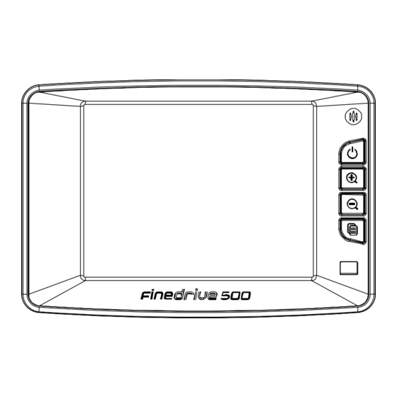
I n t r o d u c t i o n 1.1. What is in the Box? The Navigation System box includes the following items: 1. Finedrive 500 Navigation Unit 2. GPS Receiver 3. DC12V In-car Cigarette Lighter Adapter 4. -
Page 5: Downloading Map
1.3. Downloading Map 1.3.1. Downloading Map via SD card reader * When downloading map data for the first time to a blank SD card using the SD card reader. SD CARD INSTALLATION CHECK LIST: * Installation Requirements: NAVIGATION unit SD Card Reader Installation &... - Page 6 3. When the Map Loader program installation has completed, click "Finish" 4. Map Loader program will launch automatically. You can also execute the software later by double clicking on the Map Loader icon ( ) located on the Desktop. Page 5...
-
Page 7: Installation Precaution
5. Insert a SD card into the SD card reader. Select and download maps to SD card. 6. Insert the SD card into your navigation unit. Enjoy your drive. (Refer to "HARDWARE INSTALLATION GUIDE") 1.4. Installation Precaution • Choose a mounting location in your vehicle where this unit will not distract or otherwise interfere with the driver’s ability to control the vehicle. -
Page 8: Navigation Hardware Installation
navigation system. 1.5. Navigation hardware installation 1. Installing navigation in the Car Although the Finedrive 400 can be installed on any glass surface in your vehicle, we recommend that you install the unit below the-center of the windshield, between the driver and passenger seats. Make sure the windshield is clean and dry to ensure a tight grip. - Page 9 3. Plug in the Cigarette Jack Connector 4. Slide the navigation into the holder 5. Turning power on/off Once the power is turned on, wait for a couple of seconds and then the WARNING sign will appear as follows: When the warning sign has appeared, read the message and proceed by tapping the "OK"...
-
Page 10: Checking Gps
C h e c k i n g G P S When you first use navigation unit, it can take from five to fifteen minutes to receive a satellite signal. Thereafter, it should take approximately 90 seconds to receive signals. G e t t i n g A c q u a i n t e d w i t h y o u r N a v i g a t i o n S y s t e m When you start navigation System, the downloaded map displays in Map View. -
Page 11: Moving Around The Map
If you are not receiving a signal, the default map is shown. The varying colors of the vehicle icon indicate the number of satellite signals available. In this case, the vehicle icon is shown at the bottom of the map. To view detailed vehicle location information: Tap on the locator bar at the bottom of the map. -
Page 12: Using The Menus
3.2. Using the Menus 3.2.1. Main Menu Options Description Destination Sets the destination by address, intersection, points of interest, favorite locations, or recent locations. Route Options Manages your route preferences. Simulation Starts/stops the current routing simulation. Display Sets the map orientation, screen color on the navigation unit, automatic Options or manual guidance, and the display of POI icons. -
Page 13: Map View
3.3.1. Map View 1. To display the map in Map View, tap the Menu button > Return to Map icon. The Map View screen displays. 2. The orientation of a map is set in the Display Options screen: Heading Up to automatically orient the map in the direction of vehicle travel. North Up to maintain the map in a North/South position. -
Page 14: Setting Route Options
3.3.3. Setting Route Options Route Option enables you to use the navigation system in a number of different ways for determining your optimal route: Quickest Route to calculate a route with minimum travel time. Shortest Route to calculate a route with minimum travel distance. Major to include major roads, such as highways. -
Page 15: Entering A Start Location
4.1. Entering a Start Location The navigation system defaults to the current location as the starting point for route calculation, as specified by the GPS signal. You can enter a start location if you are not connected to a GPS receiver, do not have a GPS signal, or want another point of origin. To enter a start location, do one of the following: Tap and hold the pointer on the map location. -
Page 16: Setting A Destination By Address
4.2.1. Setting a Destination by Address 1. Tap Address on the Set Destination screen. The Select Input Method screen displays. 2. Select an Input Method as follows: Tap Street First to enter a street address, including the house number. Tap City First to enter the city name and street address, including the house number. -
Page 17: Setting A Destination By Intersection
Tap in characters using the keypad at the bottom of the screen. 4. Tap on the OK button after each entry. 5. To select an entry, tap on it in the Select Address List. 6. Tap on one of the following buttons at the bottom of the screen: Nav to calculate the route and center in on the map location. - Page 18 2. Select an Input Method as follows: Tap Street First to enter the names of two intersecting streets. Tap City First to enter the city name and two intersecting streets. When entering an address, do not enter the street type or direction, such as Ave, St, N, or When you enter a street or city, dialog boxes similar to the following display: For an intersection, there are two address dialog boxes for the two intersecting streets.
-
Page 19: Setting A Destination By Point Of Interest
As you tap in characters, the system updates and displays the Select Address List. 5. To select an entry, tap on it in the Select Address List. 6. Tap on one of the following buttons at the bottom of the screen: Nav to calculate the route and center in on the map location. -
Page 20: Selecting A Poi Alphabetically
Selecting a POI By Distance section. Select a POI By City. For more information, refer to the Selecting a POI By City section. 4.2.4. Selecting a POI Alphabetically 1. Tap Alphabetical on the Points of Interest Options screen. The Enter POI Name screen displays. -
Page 21: Selecting A Poi By City
1. Tap By Distance on the Points of Interest Options screen. A POI List with the points of interest within a 25 mile radius displays. Select an entry by scrolling through the list and tapping on it. 2. Tap on one of the following buttons at the bottom of the screen: Nav to calculate the route and center in on the map location. -
Page 22: Setting A Destination From The Favorites Location List
2. Select a city, as follows: Scroll through the list using the scroll keys at the right of the list. Tap in characters using the keypad at the bottom of the screen. 3. Tap on the OK button. The Enter POI Name screen displays. 4. -
Page 23: Setting A Destination From The Recent Destinations List
You can also tap on the map location and tap Save This Location from the pop up menu. 2. Tap on one of the following buttons at the bottom of the screen: Nav to calculate the route and center in on the map location. Map to set this location as the starting route point for your trip. -
Page 24: Managing The Destination And Route
4.2.9. Managing the Destination and Route The navigation system calculates the route after a destination is entered. To manage your destination and route, do one of the following: Tap on the Menu button > Destinations icon. Tap File > Destinations. The Destination Options screen displays. Tap on one of the following buttons: Detour to enter roads to avoid along the route. -
Page 25: Entering Stopovers
system recalculates the route to exclude the detour area. A warning displays if there is no detour for the current route. 1. Tap the Detour button at the bottom of the screen. The Avoid Roads list displays. 2. Tap the road to avoid. 3. -
Page 26: Clearing A Selected Destination
2. Tap on a Stopover Category. 3. Enter the Stopover information. Refer to the Entering a Destination section for the steps to enter information for a specific category. 4.2.12. Clearing a Selected Destination To cancel a selected destination, do one of the following: 1. -
Page 27: Using Day Vs. Night Display
A list of route instructions. Map View is the default for guidance. Depending on the preferences you select, the view automatically changes to Guidance View as you approach a maneuver. 4.3.1. Using Day vs. Night Display The navigation system can display the map or guidance view in one of the following modes: Day Mode to set the screen color for daylight driving conditions. -
Page 28: Viewing The Route List
The map displays in map panning mode. T e c h n i c a l S u p p o r t Please visit our website at http://www.finedigitalusa.com for FAQ’s, tips, troubleshooting and latest updates. Fine Digital, Inc. http://www.finedigitalusa.com • Phone: 866-346-3344(866-FINEDIGITAL) • Email: help@finedigitalusa.com... -
Page 29: Appendix
Consult the dealer or and experienced technician for help. The navigation does not contain any user-serviceable parts. Repairs should only be made by an authorized Fine Digital service center. Unauthorized repairs or modifica tions could result in permanent damage to the equipment, and void your warranty... -
Page 30: System Specifications
and your authority to operate this device under Part 15 regulations. 6.2. System Specifications OS : Microsoft® Windows CE.NET 4.2. CPU : Samsung ARM9-200MHz Main Memory : 64 MB NAND Flash : 128MB(available 80 MB for MAP DB in 128MB MAND Flash) SD card for external storage. - Page 31 Operating -23° ~ 122°F Storage -4° ~ 158°F Humidity Up to 90% non-condensing Page 30...
Need help?
Do you have a question about the Finedrive 500 and is the answer not in the manual?
Questions and answers