Garmin GPSMAP 76S Owner's Manual
Chartplotting receiver
Hide thumbs
Also See for GPSMAP 76S:
- Quick start manual (19 pages) ,
- Specification sheet (2 pages) ,
- Declaration of conformity (1 page)
Table of Contents
Advertisement
Advertisement
Table of Contents

Related Manuals for Garmin GPSMAP 76S


Summary of Contents for Garmin GPSMAP 76S
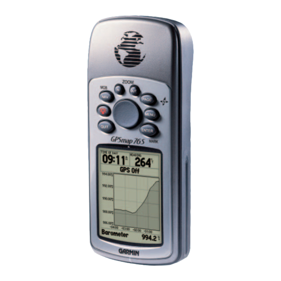
- Page 1 GPSMAP 76S chartplotting receiver owner’s manual reference guide...
- Page 2 Information in this document is subject to change without notice. Garmin reserves the right to change or improve its products and to make changes in the content without obligation to notify any person or organization of such changes or improvements.
-
Page 3: Introduction
Thanks for choosing the GARMIN GPSMAP 76S. If you have any questions or comments regarding the use of the GPSMAP 76S you can visit our website or contact our Customer Service Department M-F, 8:00-5:00 CST (except holidays) at 1-800-800-1020. -
Page 4: Warnings And Cautions
Introduction Warnings and Cautions WARNING: If you choose to use the GPSMAP 76S in a vehicle, it is the sole responsibility of the owner/operator of the GPSMAP 76S to secure the GPS unit so that it will not cause damage or personal injury in the event of an accident. Do not mount the GPSMAP 76S over airbag panels or in a place where the driver or passengers are likely to have an impact with it in an accident or collision. -
Page 5: Fcc Compliance Statement
(2) this device must accept any interference received, including interference that may cause undesired operation. The GPSMAP 76S does not contain any user-serviceable parts. Repairs should only be made by an authorized GARMIN service center. Unauthorized repairs or modifi... -
Page 6: Software License Agreement
Software are valuable trade secrets of GARMIN and that the Software in source code form remains a valuable trade secret of GARMIN. You agree not to decompile, disassemble, modify, reverse assemble, reverse engineer or reduce to human readable form the Software or any part thereof or create any derivative works based on the Software. -
Page 7: Table Of Contents
FCC Compliance Statement ... 3 Features... 4 Table of Contents ...5 Unit Features... 6 Section Two: Reference ...7-54 Initializing the GPS Receiver... 7-8 GPS Information Page ... 8-11 Map Page... 12-13 Map Page Setup Options ... 13-19 Pointer Page ... 21-22 Highway Page... -
Page 8: Introduction
GARMIN’ s friendly user interface will allow you to be navigating with your new GPS in no time. Your GPSMAP 76S can provide one more critical benefi t, peace of mind. With your GPSMAP 76S you will know where you are, where you’ve been and where you’re going. -
Page 9: Getting Started
Main Page and it’ s Option Menu in detail. Initializing the GPS Receiver Before the GPSMAP 76S can be used for GPS navigation, the GPS receiver must be initialized. The GPS receiver should only need to be initialized the fi rst time the unit is used, or if it has been stored several months. -
Page 10: Initialization Options
Initializing the GPS Receiver Initialization Options Initialization Options If the GPSMAP 76S is unable to determine its location, an options menu will be displayed. Depending on the situation, select the appropriate option to help the unit acquire satellites. Use With GPS Off — This option will turn the GPS receiver Off. Select this option if you are indoors and can not receive satellite signals, or if you wish to use only the sensors. - Page 11 Simulating GPS — Indicates the GPSMAP 76S is running in Simulator Mode and the GPS receiver is turned off. It is important to remember when you are using the Simulator, the GPSMAP 76S can not be used for actual navigation. GPS Off — Indicates that the GPS receiver is turned off.
- Page 12 Since the GPS clock is derived from timing information sent from the satellite, the GPS clock is also very accurate. When the GPS receiver has achieved a 2D or 3D GPS Location, the current location will be displayed in the selected Location Format.
- Page 13 MENU Key. To select an option, highlight the desired selection then press ENTER. Use With GPS On/Off — This option turn the GPS receiver On of Off. Select this option if you are indoors and can not receive satellite signals, or if you wish to use only the sensors.
-
Page 14: Map Page
Zoom Scale Map Page The GPSMAP 76S comes with a built-in basemap of North America that includes a database of Cities, Interstate, State and County Highways, Exit infor- mation, Lake and River outlines and Railway Lines. The standard basemap can be enhanced using GARMIN’... -
Page 15: Map Page Setup Options
Show Next Street — This option adds a window below the Data Fields that will display the name of the next cross street. This will only function if ‘Lock Reference to Road’ is ‘On’ (see Setup Map — ‘Other’ Tab on page 33) and MapSource Getting Started Metroguide or City Navigator data is loaded in the unit. -
Page 16: Map Page Options
Zoom Scales for the map. If you select ‘Off’, the items for that option will not be displayed on the Map Page. If you select ‘Auto’, the GPSMAP 76S will automatically determine the Map Page Options zoom level at which to display the selected items. -
Page 17: Map Page Options
Colors — This option gives you the ability to confi gure the map to display either land or water as white. If you select ‘Land’ the land portion of the Reference display will be lighter in color than the water. If you select ‘Water’ the water Getting Started portion of the display will be lighter in color than the land. - Page 18 Reference Map Page Options Setup Map — ‘Waypoint’ Tab Setup Map — ‘Point’ Tab Setup Map — ‘Waypoint’ Tab The ‘Waypoint’ Tab contains the Waypoint, and Active Route Waypoint option settings. Each of the options has a ‘Text’ and ‘Zoom’ setting. To change a setting, highlight the appropriate fi...
- Page 19 Setup Map — ‘Marine’ Tab The ‘Marine’ Tab contains ‘Text’ settings for Spot Soundings, Navaids, Tide Reference Stations, and Services and ‘Zoom’ settings for Navaids, Tide Stations and Getting Started Services. Spot Soundings — are depth readings shown in MapSource BlueChart data. Map Page Options Navaids —...
- Page 20 Reference Map Page Options Setup Map — ‘Area’ Tab Setup Map — ‘Topo’ Tab Setup Map — ‘City’ Tab Setup Map — ‘Area’ Tab The ‘Area’ Tab contains the ‘Text’ and ‘Zoom’ settings for River/Lakes, Parks, Other, and Metro. To change a setting, highlight the fi eld then press ENTER. Make your new selection, then press ENTER to accept the selection.
- Page 21 Setup Map — ‘Road’ Tab The ‘Road’ Tab contains the ‘Text’ and ‘Zoom’ settings for Local Road Names and ‘Zoom’ settings for Freeway, Highway, and Local Roads. To change a setting, highlight the appropriate fi eld then press ENTER. Make your new selection, then press ENTER to accept the selection.
-
Page 22: Compass Page
Compass. If the unit’ s speed exceeds 10 mph, the unit will automatically switch to the GPS receiver for navigation. When the unit’ s speed drops below 10 mph for more than 90 seconds, the unit will revert to using the Electronic Com- pass for navigation. -
Page 23: Pointer Page
Compass Page Options To access the Compass Page Options, with the Compass Page displayed press the MENU Key. Setup Page Layout — This option allows you to select the number of data fi eld rows and the size of text used in the fi elds. You have the option of displaying, None, Small (1 Row), Small (2 Rows), Small (3 Rows), Medium (1 Row), Medium (2 Rows), Medium (3 Rows), Large (1 Row), or Large (2 Rows). -
Page 24: Highway Page
Reference Highway Page Highway Page Highway Page Options Highway Page The Highway Page is best used for navigation when a straight line course can be followed. The Highway Page has User Selectable Data Fields along the top, a Status Bar, and the Highway Display. The Highway Page shares many features with the Map Page. -
Page 25: Highway Page Options
Setup Highway — This option contains the Highway Setup features. The fea- tures are arranged on a tab menu making it easy to locate the different setup Reference items. To select an option from a Menu Tab, highlight the desired selection Getting Started then press ENTER. -
Page 26: Active Route/Goto Page
Reference Active Route — Plot Page Active Route Page Plot Page Active Route/Goto Page The Active Route/Goto Page will show the waypoint(s) that are currently being used for navigation. If you are navigating using a ‘Go To’, then the active waypoint will be displayed with the distance remaining displayed on the right side of the display. - Page 27 To pan along the length of the plot, press the ROCKER key to the Left or Right. This will display a crosshair that will track along the plot. Data for the selected plot point will be shown in labels along the vertical and horizontal scales. To exit the panning mode, press the QUIT key.
-
Page 28: Main Menu
Reference Plot Page Options — Main Menu Calibrate Altimeter Page Main Menu Page Change Data Fields — This option allow you to select the type of data that you want displayed in the data fi elds. To change a data type, place the high- light over the desired data fi... -
Page 29: Trip Computer
Trip Computer The Trip Computer Page has two tabs along the top, Horizontal and Vertical. Bothe the Horizontal and Vertical Tab have eight data fi elds. Pressing the MENU key will display the options for the selected tab. Horizontal Tab Data Fields Trip Odom —... -
Page 30: Trip Computer
Reference Trip Computer Options — Tracks Horizontal Tab Options Vertical Tab Options Vertical Tab Data Fields T otal Ascent — The Total Ascent fi eld will show the Total Ascent of the trip in the units selected. This fi eld indicates the total off all ascents. Total Descent —... -
Page 31: Track Page Options
Name — this fi eld will allow you to change the Saved Track Name. When tracks are saved the GPSMAP 76S will use a date as the default track name. Distance — shows the total distance of the Saved Track. -
Page 32: Tracks
Reference Track Information Page Points Page Track Information Page TIP: If you know that you are going to want to use the TracBack feature for a return trip, clear the Track Log before you start the trip. This will ensure that you are only navigating along the most recent Track. -
Page 33: Creating Waypoints
fi eld or scrolling through the Waypoint List. As you enter a waypoint name, the GPSMAP 76S will update the waypoint list to show waypoint names that coincide with the letters that have been entered. - Page 34 Reference Creating & Editing Waypoints Symbol Field Name Field There are four buttons at the bottom of the ‘Mark Way- point’ Page, ‘Delete’, ‘Map’, ‘Goto’ and ‘OK’. If you wish to delete the waypoint, highlight the ‘Delete’ button and press ENTER. If you want to see the waypoint on the map, highlight the ‘Map’...
-
Page 35: Editing Waypoints
Changing the Name — Place the highlight over the name fi eld and press ENTER. Using the ROCKER (up/down) scroll through the alpha-numeric Reference list and make a selection. To move the next placeholder press the ROCKER Getting Started to the right. When fi nished, press ENTER to accept the changes. Changing the Location, Elevation or Depth —... - Page 36 Project Location — When this option is selected the Project Location Page will be displayed. The Project Location Page has four fi elds, ‘Location’, Reference ‘From’, ‘Distance’, and ‘Bearing’. The ‘From’ fi eld allows the user to select where they would like to project a waypoint from, the choices are ‘Current Location’, ‘Use Map’...
-
Page 37: Points Of Interest
Points Of Interest Will only be available when MapSource CD data that contains Points of Interest information is loaded in the unit. When ‘Points of Interest’ is selected, the Points of Interest Selection Page is displayed. To select a Points of Interest item, highlight the desired selection then press ENTER. -
Page 38: Cities
Reference Points — Cities & Exits City Information Page Exit Options Cities When ‘Cities’ is selected, a list of ‘Nearest Cities’ or ‘Find by Name’ list is displayed. The list can be switched by pressing the MENU key and selecting the alternate option. -
Page 39: Addresses
If you would like to select a different road for exit information, press MENU, highlight ‘Select Exit Road’ then press ENTER. A list of roads is displayed, enter the road name then press ENTER to accept the selection. If you have MapSource CD map data loaded in the unit, you can choose which map data to use for creat- ing the Exits List. -
Page 40: Intersections
fi nish, but can contain as many as fi fty. The GPSMAP 76S can store fi fty routes. On the Routes Page you can create ‘New’ routes, determine how many empty routes that you have left, and review a list of existing routes. -
Page 41: Creating A New Route
Routes Page Options With the Routes Page displayed, press MENU to view the available options. Start/Stop Navigation — Will start navigation of a highlighted route. Will stop navigation of an Active Route. Copy Route — Will make a copy of a highlighted route. Delete Route —... -
Page 42: Editing A Route
If you place the Map Pointer on a Map Feature (road, park, intersection, etc.) the GPSMAP 76S will store that location only to the route using the feature name as a reference. These points are not stored in the User Waypoint List. If you would like to save a Map Feature Point as a User Waypoint, highlight the point in the route, press ENTER, this will display an Information Page. - Page 43 Route Edit Options Use Map — This will display the Map Page with the Route Line active and the Map Pointer located on the waypoint highlighted on the Route Page. ‘Review’ Route Waypoint — To review information on a route waypoint, place the Map Pointer on the waypoint then press ENTER.
-
Page 44: Routes
‘Move’ a Waypoint — Only User Waypoints can be moved. To move a waypoint, place the Map Pointer on the waypoint then press ENTER. This Reference will display an options menu. Highlight ‘Move’, then press ENTER. Place the Map Pointer at the desired new location and press ENTER to move the waypoint. -
Page 45: Proximity
Proximity Proximity waypoints can be used to alert you when you are approaching a predetermined area. When you place a waypoint in the Proximity List, you will enter a ‘Radius’ that will determine when a Proximity Alarm will be displayed. You can turn the Proximity Alarm On or Off for your convenience. -
Page 46: Celestial
Reference Main Menu — Celestial Celestial Selections Celestial The Celestial Menu lets you view information for Tides, Sun and Moon, or Hunt and Fish. Local Time Max Level Current Tide Level Low Tide Curve Min Level Station Time Tides — Displays a graphical chart which displays tide station information in a 24 hour span starting at midnight station time. - Page 47 Along the top of the page are the Date and Tide Station that are being refer- enced. The top of the chart will show a 24-hour block of local time (LCL) for Reference your position, with the reported station time (STA) appearing at the bottom. Getting Started Daylight (light bar) and night (dark bar) will show across the time scale, with the time progressing from left to right.
- Page 48 Reference Main Menu — Celestial Location Options Sun and Moon — The Sun and Moon Page displays data for Sunrise/Sunset, Moonrise/Moonset, and the approximate location of the Sun and Moon on a skyview. The moon phase will display the current visible portion of the moon in a light color.
-
Page 49: Mapsource Info
To select a data fi eld on a tab, user the ROCKER Key (up/down) to highlight the fi eld then press ENTER. To restore the GPSMAP 76S to the factory settings for items on the tab, press MENU and with ‘Restore Defaults’... - Page 50 Pacifi c Ocean and Atlantic Ocean. You must have a clear unobstructed view of the sky for the GPSMAP 76S to be able to receive a WAAS signal, even then, at times it may not be possible to receive a WAAS signal.
-
Page 51: Setup Menu-Altimeter Tab
Setup Menu — ‘Altimeter’ Tab The ‘Altimeter’ Tab contains settings for Altimeter Auto Calibration, Pressure Units and the Barometer Mode. To change a setting, highlight the fi eld then press ENTER. Make you selection then press ENTER to activate the selection. ‘... -
Page 52: Setup Menu-Compass Tab
fi eld then press ENTER. Make your selection then press ENTER to activate the selection. ‘ Time Format’ — Using this setting you can have the GPSMAP 76S display time in a 12 or 24 hour format. ‘ Time Zone’ — The ‘Time Zone’ setting has nine options, Atlantic, Eastern, Central, Mountain, Pacifi... -
Page 53: Setup Menu-Units Tab
‘ Elevation’ — Can be set to show in ‘Feet’ or ‘Meters’. ‘ Depth’ — Can be set to display in ‘Feet’, ‘Fathoms’ and ‘Meters’. The GPSMAP 76S cannot measure depth on its own. The depth input has to come from a NMEA device providing the “DPT” sentence. -
Page 54: Setup Menu-Location Tab
Reference Setup Menu — Location Tab Location Formats India Zone IVB hddd.ddddd° Irish Grid hddd°.mm.mmm’ LORAN TD hddd°.mm’ s s.s’’ Maidenhead British Grid MGRS Dutch Grid New Zealand Finnish Grid QNG Grid German Grid RT 90 India Zone 0 Swedish Grid India Zone IA Swiss Grid India Zone IB... -
Page 55: Setup Menu-Alarms Tab
WARNING: If ‘User’ is selected, you must periodically update the magnetic variation at your present position. Failure to update this setting may result in substantial differences between the information displayed on your unit and external references, such as a magnetic compass. -
Page 56: Setup Menu-Interface Tab
The baud (speed of communication in bits per second) is displayed in the Baud fi eld. • Text Out — Allows the GPSMAP 76S to output simple text data that includes, date, time, position, and velocity information. The Baud can be set to 1200, 2400, 4800, or 9600 bps. -
Page 57: Appendices
AGC/3AG - 2.0 Amp The temperature rating for the GPSMAP 76S may exceed the usable range of some batteries. Alkaline batteries can rupture at high temperatures. Alkaline batteries lose a signifi cant amount of their capacity as temperature decreases. Use lithium batteries when operating the GPSMAP 76S in below-freezing conditions. -
Page 58: Appendix B: Wiring & Interfacing
Approved sentences — GPRMC, GPGGA, GPGSA, GPGSV, GPGLL, GPBOD, GPRTE, and GPWPL; Proprietary sentences — PGRME, PGRMZ, and PSLIB. The GPSMAP 76S will accept NMEA input with support for the DPT, MTW, and VHW sentences. You can dowload a copy of GARMIN’ s proprieatry communication protocol on the Help and Support section of our website at www.garmin.com... -
Page 59: Appendix C: Time Offsets
The chart below gives an approximate UTC (Universal Time Coordinate) time offset for the various longitudinal zones. Check with local charts for more detailed information. If you are in daylight savings time, add one hour to the offset. Longitudinal Zone Offset W180.0º... -
Page 60: Appendix D: Map Datums
Appendix D Map Datums Adindan Adindan- Ethiopia, Mali, Senegal, Sudan Afgooye Afgooye- Somalia AIN EL ABD ‘70 AIN EL ANBD 1970- Bahrain Island, Saudi Arabia Anna 1 Ast ‘65 Anna 1 Astro ‘65- Cocos I. ARC 1950 ARC 1950- Botswana, Lesotho, Malawi, Swaziland, Zaire, Zambia RC 1960 Kenya, Tanzania Ascnsn Isld ‘58 Ascension Island ‘58- Ascension Island... -
Page 61: Appendix D: Map Datums
Midway Ast ‘61 Midway Astro ‘61- Midway Minna Minna- Nigeria NAD27 Alaska North American 1927- Alaska NAD27 Bahamas North American 1927- Bahamas NAD27 Canada North American 1927- Canada and Newfoundland NAD27 Canal Zone North Am. 1927- Canal Zone NAD27 Caribbn North American 1927- Caribbean (Barbados, Caicos Islands, Cuba, Dom. -
Page 62: Appendix E: Navigation Terms
Avg Speed— The average of all second-by-second speed readings since last reset. Bearing (BRG)— The compass direction from your current location to a destina- Appendix E tion. Course— The desired course between the active ‘from’ and ‘to’ waypoints. Navigation Terms Distance (Dist)—... -
Page 63: Navigation Terms
Moving Trip Timer— Total time the unit has been moving. Odometer— A running tally of distance travelled, based upon the distance Appendix E between second-by-second position readings. Getting Started Off Course— The distance you are off a desired course in either direction, left or right. -
Page 64: Appendix F: Messages
Narrow the search using the city or postal code. Database Error — Internal problem with the unit. Contact your dealer or GARMIN Customer Service to have the unit repaired. Deep Water — The water is deeper than the amount set in the Deep Water Alarm. - Page 65 Route Memory Full — No additional routes can be saved. Route Truncated — Uploaded route from another device has more than 50 Appendix F waypoints. Getting Started Route Waypoint Memory Full — No additional route waypoints can be saved. Messages Shallow Water —...
-
Page 66: Appendix G: Loran Td
Setup TD fi eld, the active waypoint information will refl ect those changes. Since the GPSMAP 76S does not rely on the LORAN signal for navigation, it can reference a different GRI chain and/or... - Page 67 Remember that the GPS is not relying on the LORAN signal for navigation. The GPSMAP 76S converts the TD coordinate to a LAT/LON coordinate before storing a waypoint to memory. Because of this the unit can navigate to a converted TD coordinate anywhere in the world.
-
Page 68: Standard Accessories
PC Data Cable Allows for serial data transfer with a PC. Cigarette Lighter Adapter Allows the GPSMAP 76S to operate from external auto power. Remote Antenna MapSource® Map Data CD-ROMs Enhance the Basemap and Map Data, create waypoints and routes from your PC. -
Page 69: Appendix I: Index
Accessories ...66 Accuracy ...19 Accuracy Circle ...19 Active Route Page ...24 Addresses ...37 Alarms Tab ...53 Altimeter Auto Calibration ...49 Altimeter Tab ...49 Anchor Drag ...53 Append To Route ...34 Auto Zoom ...14 Backlight Timeout ...48 Basemap ...15 Battery Saver ...47 Bearing Line ...17 Beeper ... - Page 70 Highway Page ...22 Highway Page Options ...22, 23 Horizontal Tab ...27 Horizontal Tab Options ...27 Hunt and Fish ...45 Initialization Options ... 8 Initializing the GPS Receiver... 7 Interface Tab ...54 Intersections ...38 Language ...48 Lat Lon Grid ...15 Local Roads ...19 Location, 2D Differential ...
- Page 71 Magnetic Variation ...53 Main Menu ...26 Map Orientation ...14 MapSource ...15 MapSource Info ...47 Map Datum ...52 Map Datums ...58, 59 Map Page ...13 Map Page Options ... 14-19 Mark Waypoint Page ...31 Messages ...62, 63 Moonrise/Moonset ...46 Navaids ...17 Navigation Terms ...60, 61 nearest waypoints ...31 New Location ...11...
- Page 72 Appendix I Index Setup Menu ...54 Shallow Water ...53 Sight ‘N Store ...34 Simulating GPS ...9 Simulator ...47 Software Licenese Agreement ...4 Specifi cations ...55 Speed ...9 Speed Filter ... 51 Spot Soundings ... 17 Start/Stop Simulator ... 11 Stored w/o Batteries ... 8 Sunrise/Sunset ...46 Sun and Moon ...46 Symbol 32...
-
Page 73: Limited Warranty
GARMIN Corporation warrants this product to be free from defects in materi- als and manufacture for one year from the date of purchase. GARMIN will, at its sole option, repair or replace any components that fail in normal use. Such repairs or replacement will be made at no charge to the customer for parts or labor. - Page 74 Notes...
- Page 76 For the latest free software updates (excluding map data) throughout the life of your Garmin products, visit the Garmin web site at www.garmin.com. © Copyright 2000-2003 Garmin Ltd. or its subsidiaries Garmin International, Inc. 1200 East 151 Street, Olathe, Kansas 66062, U.S.A.
Need help?
Do you have a question about the GPSMAP 76S and is the answer not in the manual?
Questions and answers