Table of Contents
Advertisement
Quick Links
GPSMAP
9000 SERIES
®
INSTALLATION INSTRUCTIONS
Important Safety Information
WARNING
Failure to follow these warnings, cautions, and notices could result in personal injury, damage to the vessel or
device, or poor product performance.
Failure to install this device according to these instructions could result in personal injury, damage to the vessel
or device, or poor product performance.
See the Important Safety and Product Information guide in the product box for product warnings and other
important information.
CAUTION
For the best possible performance and to avoid potential injury, damage to the device, or damage to your vessel,
installation by a qualified marine installer is recommended.
To avoid possible personal injury, always wear safety goggles, ear protection, and a dust mask when drilling,
cutting, or sanding.
To avoid possible personal injury or damage to the device and vessel, disconnect the vessel's power supply
before beginning to install the device.
To avoid possible personal injury or damage to the device or vessel, before applying power to the device, make
sure that it has been properly grounded, following the instructions in the guide.
To avoid possible personal injury or damage to this device and vessel, only install this device when the vessel is
on land, or when properly secured and docked in calm water conditions.
NOTICE
When drilling or cutting, always check what is on the opposite side of the surface to avoid damaging the vessel.
Read all installation instructions before proceeding with the installation. If you experience difficulty during the
installation, contact Garmin
®
Product Support.
Contacting Garmin Support
• Go to
support.garmin.com
for help and information, such as product manuals, frequently asked questions,
videos, and customer support.
• In the USA, call 913-397-8200 or 1-800-800-1020.
• In the UK, call 0808 238 0000.
• In Europe, call +44 (0) 870 850 1241.
September 2023
GUID-362063E3-8AC2-4215-B619-3EC8450544EF v1
Advertisement
Table of Contents

Related Manuals for Garmin GPSMAP 9000 Series


Summary of Contents for Garmin GPSMAP 9000 Series
- Page 1 When drilling or cutting, always check what is on the opposite side of the surface to avoid damaging the vessel. Read all installation instructions before proceeding with the installation. If you experience difficulty during the installation, contact Garmin ® Product Support.
-
Page 2: Software Update
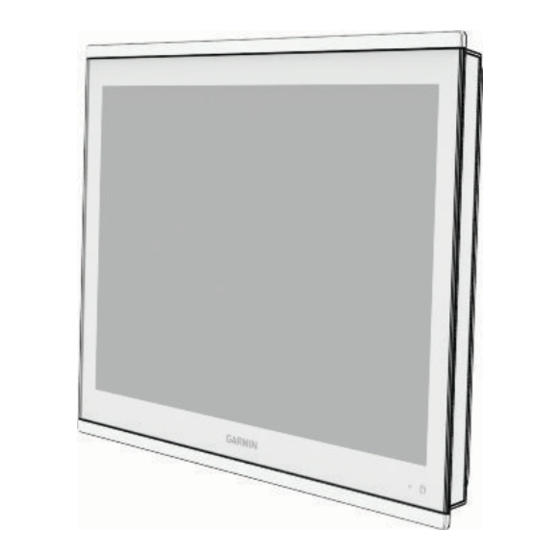
You may need to update the chartplotter software after installation. For the instructions on how to update the software, see the owner's manual at garmin.com/manuals/GPSMAP9000. Connector View The connectors and locations are the same across all of the GPSMAP 9000 series models. A GPSMAP 9x22 model is shown below. 2 microSD memory card slots, 32 GB max. -
Page 3: Tools Needed
Tools Needed • Drill and drill bits ◦ 3.2 mm ( in.) drill bit, if using wood screws ◦ 3.6 mm ( in.) drill bit, if using the nut plate ◦ 7.2 mm ( in.) drill bit, if using the nut plate • #2 Phillips screwdriver •... -
Page 4: Mounting The Device
Mounting the Device NOTICE Be careful when cutting the hole to flush mount the device. There is only a small amount of clearance between the case and the mounting holes, and cutting the hole too large could compromise the stability of the device after it is mounted. - Page 5 15 Starting in one corner of the mounting location, place a nut plate on the back of the mounting surface, lining up the large and small holes. The raised portion of the nut plate should fit into the larger hole. 16 Secure the nut plate to the mounting surface by fastening an included M3 screw through the smaller 3.6 mm (...
- Page 6 Installing the Gasket and Hard Stops NOTICE Whether you install the mounting gaskets or not, you should apply marine sealant between the device and the mounting surface to help prevent water intrusion behind the mounting surface. Mounting gaskets are provided with the device, but are not required for installation. If you install the gaskets, you must also install the included hard stops to prevent over-compression of the gaskets, unless you are replacing a previous model of chartplotter installed in the same location.
-
Page 7: Connection Considerations
Connection Considerations When connecting this device to power and to other Garmin devices, you should observe these considerations. • The power and ground connections to the battery must be checked to make sure they are secured and cannot become loose. -
Page 8: Station Connection Considerations
11 m (36 ft.) maximum extension Station Connection Considerations This device can be set up in conjunction with other compatible Garmin devices to work together as a station. When planning stations on your boat, observe these considerations. • Devices earlier than the GPSMAP 8000 series and GPSMAP 8500 series cannot be used in a station. -
Page 9: Nmea 2000 Considerations
• The NETWORK ports on the device each act as a Garmin BlueNet network switch. Any Garmin BlueNet device can connect to any NETWORK port to share data with all devices on the boat connected by a Garmin BlueNet cable. - Page 10 Item Description NMEA 2000 compatible Garmin device GPS antenna Ignition or in-line switch NMEA 2000 power cable NMEA 2000 drop cable 12 Vdc power source NMEA 2000 terminator or backbone cable NMEA 2000 T-connector NMEA 2000 terminator or backbone cable...
-
Page 11: Nmea 0183 Connection Considerations
® stereos. This cable can be purchased from garmin.com your local Garmin dealer. You can connect the RCA connector to the AUX input of the stereo. Audio received from the HDMI input to the chartplotter is output to the stereo. - Page 12 Wire Function Wire Color NMEA 0183 Rx/A (In +) White/orange NMEA 0183 Rx/B (In -) White NMEA 0183 Tx/B (Out -) Pink NMEA 0183 Tx/A (Out +) Gray Ground Black Alarm Yellow Accessory on Orange Ground (shield) Brown Audio Left Channel White Audio Common Blue/red...
- Page 13 This diagram illustrates two-way connections for both sending and receiving data. You can also use this diagram for one-way communication. To receive information from a NMEA 0183 device, refer to items , and when connecting the Garmin device. To transmit information to a NMEA 0183 device, refer to items , and when connecting the Garmin device.
- Page 14 Lamp or Horn Connections The device can be used with a lamp, a horn, or both, to sound or flash an alert when the chartplotter displays a message. This is optional, and the alarm wire is not necessary for the device to function normally. When connecting the device to a lamp or horn, observe these considerations.
-
Page 15: J1939 Engine Network Connection Considerations
J1939 Engine Network Connection Considerations NOTICE You must use a Garmin GPSMAP J1939 accessory cable when connecting the chartplotter to the J1939 engine network to prevent corrosion due to moisture. Using a different cable voids your warranty. If you have an existing engine network on your boat, it should already be connected to power. Do not add any additional power supply. -
Page 16: Hdmi Video Considerations
GPSMAP 8000 series chartplotter and the USB DRD port on a GPSMAP 9000 series chartplotter can supply up to 2.5 W to power a media player stick. The USB port on a GPSMAP 9000 series chartplotter can supply up to 4.5 W to power a media player stick... -
Page 17: Composite Video Considerations
• The CVBS IN port uses a BNC connector. You can use a BNC to RCA adapter to connect a composite-video source with RCA connectors to the CVBS IN port. • Video is shared across the Garmin Marine Network, but it is not shared across the NMEA 2000 network. Touchscreen Controls for a Connected Computer... - Page 18 Devices Item Device Computer GPSMAP chartplotter Connections From Cable Garmin HDMI Cable Computer's HDMI OUT port Chartplotter's HDMI IN port Garmin USB Cable Chartplotter's USB port Computer's USB port...
- Page 19 Max. power usage 60 W Typical current draw at 12 Vdc 4.6 A Typical current draw at 24 Vdc 2.3 A Compass-safe distance 46 cm (18 in.) The device withstands incidental exposure to water of up to 1 m for up to 30 min. For more information, go to www.garmin.com/waterrating.
- Page 20 9x22 Models Specification Measurement Dimensions (W × H × D) 52.9 × 34.6 × 6.9 cm (20.8 × 13.6 × 2.7 in.) Display size (W × H × diagonal) 47.5 × 26.7 × 54.5 cm (18.7 × 10.5 × 21.5 in.) Weight 7.96 kg (17.55 lb.) Max.
-
Page 21: Nmea 2000 Pgn Information
NMEA 2000 PGN Information Transmit and Receive Description 059392 ISO acknowledgment 059904 ISO request 060160 ISO transport protocol: Data transfer 060416 ISO transport protocol: Connection management 060928 ISO address claimed 065240 Commanded address 126208 Request group function 126996 Product information 126998 Configuration information 127237... - Page 22 Description 130312 Temperature (obsolete) Transmit Description 126464 Transmit and receive PGN list group function 126984 Alert response 127497 Trip parameters: Engine Receive Description 065030 Generator average basic AC quantities (GAAC) 126983 Alert 126985 Alert text 126987 Alert threshold 126988 Alert value 126992 System time 127251...
- Page 23 Description 129798 AIS SAR aircraft position report 129799 Radio frequency/mode/power 129802 AIS safety-related broadcast message 129808 DSC call Information 129809 AIS class B "CS" static data report, part A 129810 AIS class B "CS" static data report, part B 130313 Humidity 130314 Actual pressure...
-
Page 24: Nmea 0183 Information
NMEA 0183 Information Transmit Sentence Description GPAPB APB: Heading or track controller (autopilot) sentence "B" GPBOD BOD: Bearing (origin to destination) GPBWC BWC: Bearing and distance to waypoint GPGGA GGA: Global positioning system fix data GPGLL GLL: Geographic position (latitude and longitude) GPGSA GSA: GNSS DOP and active satellites GPGSV... - Page 25 Receive Sentence Description Depth Depth below transducer Water temperature Water speed and heading Waypoint location Digital selective calling information Expanded digital selective calling Heading, deviation, and variation Heading, magnetic Wind direction and speed Meteorological composite Wind speed and angle AIS VHF data-link message You can purchase complete information about National Marine Electronics Association (NMEA) format and sentences from www.nmea.org.
- Page 26 J1939 Information The chartplotter can receive J1939 sentences. The chartplotter cannot transmit over the J1939 network. Description Engine percent load at current speed 61443 Engine speed 61444 Engine manifold exhaust gas temperature - right manifold 65031 2433 Engine manifold exhaust gas temperature - left manifold 65031 2434 Engine auxiliary coolant...
- Page 27 物質宣言 有毒有害物质或元素 邻苯二甲酸 邻苯二甲 部件名称 多溴二苯 邻苯二甲 邻苯二甲 铅 汞 镉 六价铬 多溴联苯 二(2-乙基 酸二异丁 醚 酸丁苄酯 酸二丁酯 己)酯 酯 印刷电路板组件 屏幕/背光 金属零件 电缆 电缆组件 连接器 塑料和橡胶零件 本表格依据 SJ/T11364 的规定编制。 : 代表此种部件的所有均质材料中所含的该种有害物质均低于 (GB/T26572) 规定的限量 产品 : 代表此种部件所用的均质材料中, 至少有一类材料其所含的有害物质高于 (GB/T26572) 规定的限量 * 该产品说明书应提供在环保使用期限和特殊标记的部分详细讲解产品的担保使用条件。...
- Page 28 電 話:(02)2642-8999 客服專線:(02)2642-9199 © 2023 Garmin Ltd. or its subsidiaries Garmin , the Garmin logo, and GPSMAP are trademarks of Garmin Ltd. or its subsidiaries, registered in the USA and other countries. Garmin BlueNet is a trademark of ® ® ™...
Need help?
Do you have a question about the GPSMAP 9000 Series and is the answer not in the manual?
Questions and answers