
Related Manuals for Lowrance iFINDER GO


Summary of Contents for Lowrance iFINDER GO
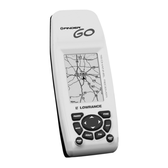
- Page 1 Pub. 988-0148-731 www.lowrance.com iFINDER Go Handheld Mapping GPS Receiver Advanced Users Guide...
- Page 2 Ltd. Exit Authority and eXitSource are trademarks of Zenrin Co. Ltd. Lowrance Electronics may find it necessary to change or end our policies, regulations and special offers at any time. We reserve the right to do so without notice. All features and specifications subject to change without notice.
-
Page 3: Table Of Contents
Section 1: Read Me First! ... 1 Capabilities and Specifications: iFINDER How iFINDER Works ... 3 Introduction to GPS and WAAS... 4 How to Use this Manual: Typographical Conventions... 6 Section 2: Installation & Accessories... 9 Power ... 9 Batteries ... 9 Cigarette Lighter Power Adapter... - Page 4 Pages ... 32 Satellite Status Page ... 32 Position Page... 33 Navigation Page ... 34 Map Page... 35 Moving Around the Map: Zoom & Cursor Arrow Keys ... 35 Find Distance From Current Position To Another Location ... 36 Find Distance From Point to Point ... 36 Find Your Current Position...
- Page 5 Select a Waypoint ... 54 Delete a Waypoint... 54 Edit a Waypoint (Name, Symbol, Position or Altitude) ... 54 Section 5: System & GPS Setup Options ... 55 Alarms ... 55 Auto Satellite Search... 56 Com Port Configuration ... 57 Coordinate System Selection...
- Page 6 When a GPS unit is used in a vehicle, the vehicle operator is solely re- sponsible for operating the vehicle in a safe manner. Vehicle operators must maintain full surveillance of all pertinent driving, boating or fly- ing conditions at all times.
-
Page 7: Section 1: Read Me First
The manual is organized into six sections. This first section is an intro- duction to Lowrance GPS. It tells you the basics you need to know be- fore you can make the unit look around and tell you where you are. -
Page 8: Capabilities And Specifications: Ifinder Go, Go2
When you come to a GPS menu command on the iFINDER screen, you can look it up in the manual by skimming over the table of contents or index, just flipping through Section 3 or scanning through the command portion of Section 4. -
Page 9: How Ifinder Works
(But if you already have a working understanding of GPS receivers and the GPS navigation system, skip on ahead to Section 2, Installation & Accessories on page 9. If you're new to GPS, read on, and you can later impress your friends with your new-found knowledge.) First, think of your iFINDER as a small but powerful computer. -
Page 10: Introduction To Gps And Waas
This pocket-sized computer also contains an antenna and specialized scanning receiver, something like your car radio. But instead of your favorite dance tunes, this receiver tunes in to a couple of dozen GPS satellites circling the earth. (It will also listen in to the WAAS satellites in orbit, but more about that in the upcoming segment introducing you to GPS and WAAS.) - Page 11 — it will. There will simply be more "wandering" of the data shown on the display. GPS is plenty accurate for route navigation, but the U.S. Federal Avia- tion Administration has special needs for aircraft traffic control that go...
-
Page 12: How To Use This Manual: Typographical Conventions
GPS. The FAA has a plan under way to boost GPS per- formance even further with its Wide Area Augmentation System, or WAAS. This GPS add-on will include a time control element that will help airliners fly closer together while avoiding collisions. In addition to... - Page 13 Next, press the down arrow key to scroll down the menu and select (high- light) the Navigate Trail menu command. Finally, press the Enter key." Also note that throughout this text, we will refer to the iFINDER Go as iFINDER, or simply as the unit.
- Page 14 Notes...
-
Page 15: Section 2: Installation & Accessories
Section 2: Installation & Accessories Power The iFINDER operates from two AA batteries or on 3 volts DC using an optional external power cable with a cigarette lighter adapter. If the power cable is used, the iFINDER automatically switches to it if the external power is greater than the battery voltage. -
Page 16: Cigarette Lighter Power Adapter
Release the latch to remove iFINDER battery cover. When the latch clicks free, lift the battery compartment cover away from the unit. Install the batteries according to the decal in the battery compartment, which shows the correct polarity. Replace the battery compartment cover. Align the two tabs in the bot- tom of the cover with two small sockets in the base of the unit. -
Page 17: R-A-M Bracket Mounting System
Attach external power cable to iFINDER. R-A-M Bracket Mounting System A R-A-M mounting bracket is available for your iFINDER. The mounting arm and cradle can swivel on a ball for easy viewing in any type of vehicle. R-A-M mounting system. Other Accessories Other iFINDER accessories include a belt holster with a see-through cover, as well as other cable connections. - Page 18 See-through belt holster for the iFINDER Go.
-
Page 19: Section 3: Easy Mode Operation
Section 3: Easy Mode Operation This section addresses Easy Mode operation for iFINDER's main GPS functions. The principles are the same in both operating modes, so this discussion also serves as a good introduction to Advanced Mode work. Before you turn on iFINDER and find where you are, it's a good idea to learn about the different keys, the three Page screens and how they all work together. -
Page 20: Power/Lights On And Off
But, if you want to learn about the various options, see Sec. 5, System Setup and GPS Setup Options. Main Menu, Easy Mode. -
Page 21: Satellite Status Page
No matter what page you are on, a flashing current position indica- tor/question mark symbol and flashing GPS data displays indicate that satellite lock has been lost and there is no position confirmed. This page shows you the quality and accuracy of the current satellite lock-on and position calculation. -
Page 22: Navigation Page
The GPS receiver is tracking satellites that are in bold type. The re- ceiver hasn't locked onto a satellite if the number is grayed out, there- fore it isn't being used to solve the position. - Page 23 tory, or path you've taken, is depicted by the line extending from the arrow. The arrow pointing down at the top of the compass rose indicates the current track (direction of travel) you are taking. Track or compass heading indicator, showing direction of travel Present position arrow...
-
Page 24: Map Page
Travel Time is the time that it will take to reach your destination at your present closing speed. Arrival Time is the local time that it will be when you arrive at the destination, based upon your present closing speed and track. Current track or heading, shown in degrees... - Page 25 Zooming in any closer will reveal no more map details. The map data loaded in your iFINDER Go contains a low-detail world map and a medium detail USA map. The Go2 model contains the same maps plus high detail USA lake, river and coastal shoreline data.
-
Page 26: Ifinder Easy Mode Quick Reference
iFINDER Easy Mode Quick Reference 1. Install two AA batteries in the battery compartment on back of case. 2. To turn on iFINDER, press and release 3. Opening screen displays map of North America at the 4,000 mile zoom range. Rotate through the three main Page screens (Map Page, Satellite Status Page, Navigation Page) by repeatedly pressing key. -
Page 27: Find Your Current Position
NOTE: "Clear sky" means open sky, unobstructed by terrain, dense foliage or structures. Clouds do not restrict GPS signal reception. If for some reason satellite acquisition takes longer, you may be inside a structure or vehicle or in terrain that is blocking signal reception. To correct this, be sure you are positioned so that the unit has as clear a view of the sky as possible, then turn the unit off and back on again. -
Page 28: Searching
Now that you've seen how iFINDER can find where you are, let's search for something somewhere else. Searching is one of the most powerful features in the Lowrance GPS product line. In this example, we'll look for the body of water. For more information on different types of searches, refer to Sec. -
Page 29: Set Home Waypoint
Waypoint Information screen with the lake nearest our position, Skia- took Lake. Screen shows name, map category, latitude/longitude, dis- tance to the location and its compass bearing. Figure at left shows Go To command; right figure shows Find On Map command. 5. -
Page 30: Navigate Back Home
Save Home Waypoint menu, left. At right, Home waypoint, with X sym- bol and name. When selected by the cursor, the pop-up box appears. The example shows waypoint set at the cursor location. If cursor was not active, the point would be placed at the current position. Caution: Saving a new "Home"... -
Page 31: Navigate Back To Mob Waypoint
Navigate Back to MOB Waypoint Find your way back to the accident position with the Navigation Page or Map Page. When MOB is activated, the Navigation Page automati- cally shows the compass rose with its bearing arrow pointing toward the man overboard position, and the destination name says "Going To Man Overboard."... -
Page 32: Navigate To A Map Place
Navigate to cursor. In this example, the cursor has selected the town of Oologah, Oklahoma. 3. Press and iFINDER will begin navigating to the cursor MENU location. The Map Page will display a dotted line from your current position to the cursor position. -
Page 33: Creating And Saving A Trail
Another method involves searching for Map Places with the Find Map Places command, launched with the ample earlier in this section, or turn to Sec. 4, Advanced Mode Opera- tion, for detailed instructions on other search methods.) After you have looked up an item with the Find Map Places command, use the ←... -
Page 34: Navigating Or Backtracking A Trail
Navigating or Backtracking a Trail There are two methods for following your back trail. The simplest re- quires no menu commands at all, but provides no navigation informa- tion during the trip, such as the time to your destination. The other requires only three key strokes and provides a full range of navigation data. -
Page 35: Clearing Or Erasing A Trail
Trail point Back trail dotted line Navigate trail, map views: at left driver is southbound heading straight toward trail point 4; steer arrow says steer straight. At right, southbound driver has reached point 4 and must turn east to follow trail. -
Page 36: Switch To Advanced Mode
WARNING: Clearing a trail will erase the trail from iFINDER's memory. You will not be able to backtrack to that trail head if the trail is erased. If you need to preserve the trail, switch to Advanced Mode and use the instructions in Sec. -
Page 37: Section 4: Advanced Mode Operation
Section 4: Advanced Mode Operation Keypad iFINDER keypad. 1. PWR/LIGHT (Power & Light) – The PWR key turns the unit on and off and activates the backlight. Turn off the unit by pressing and hold- ing the key for 3 seconds. 2. -
Page 38: Power/Lights On And Off
But, if you want to learn about the various options, see Sec. 5, System Setup and GPS Setup Options. 1. To get to the main menu from any page: press . -
Page 39: Position Page
Satellite Status Page, left, Satellite Status Menu, right. Status Menu The Satellite Status Menu allows you to set your own GPS options such as power saving, track smoothing, and whether you want the GPS en- gine to stop searching (a power-saving function for use indoors). -
Page 40: Navigation Page
Position Page, left, Position Menu, right. Position Menu The Position Menu allows you to set your own coordinate system, change your map datum or even set your local time. Navigation Page This screen has a compass rose that not only shows your direction of travel, but also the direction to a recalled waypoint. -
Page 41: Map Page
Navigation Menu The Navigation Menu allows you to cancel navigation, set up alarms, and plan or edit your route. Map Page The map screens show your course and track from a “bird’s-eye” view. By default, this unit shows the map with north always at the top of the screen. -
Page 42: Find Distance From Current Position To Another Location
1. Press the key (zoom in) to move in closer and see greater detail in a smaller geographic area. 2. Press the key (zoom out) to move farther away and see less map ZOUT detail, but a larger geographic area. You can pan or scroll the map northward, southward, eastward or westward by using the arrow keys, which launches the cross-hair map cursor. -
Page 43: Find Your Current Position
NOTE: "Clear sky" means open sky, unobstructed by terrain, dense foliage or structures. Clouds do not restrict GPS signal reception. If for some reason satellite acquisition takes longer, you may be inside a structure or vehicle or in terrain that is blocking signal reception. To correct this, be sure you are positioned so that the unit has as clear a view of the sky as possible, then turn the unit off and back on again. -
Page 44: Create Icon At Current Position
Select Icon symbol menu. Create Icon at Current Position 1. While you are traveling, press and hold until the screen shows a "Save Icon" menu, then release the key. 3. Press ← or ↑ or → or ↓ to select your icon symbol, then press The icon appears on the map. -
Page 45: Navigate Back Home
Navigate Back Home You can navigate to the "Home" waypoint created in Easy Mode, but you must use Advanced Mode's procedure for navigating to a waypoint. See the entry later in this section on Navigate to a Waypoint. Navigate Back to Man Overboard Waypoint This unit has a man overboard feature that shows navigation data to the location where the feature was activated. -
Page 46: Navigate To A Waypoint
Whenever you locate a Map Place, the Waypoint Information screen appears (with name, position, etc.) and the lighted in the command box. To navigate to that Map Place, press iFINDER begins displaying navigation information to that location. Navigate to a Waypoint You can select any waypoint visible on the Map Page with the cursor, then use the Navigate to Cursor command. -
Page 47: Backtrack A Trail
The course from one waypoint to the next is a leg; routes are composed of one or more legs. The legs of all GPS routes are based on straight lines between waypoints. - Page 48 1. From the AVIGATION press |↓ to MENU MENU 2. Press |↓ to Page appears with the cursor showing. 3. Use the Zoom keys and arrow keys to move the map and cursor until the cursor is centered on the spot where you want your route to begin. (If you are starting at your current position or the current cursor posi- tion, you are already at the starting spot.) 4.
-
Page 49: Delete A Route
5. Move the cursor to the next point in the route, a spot where you need to turn or change direction, and press 6. Repeat step five until the route reaches your destination. 7. To save your route, press with the route automatically named "Route 1" and stored in iFINDER's internal memory. -
Page 50: Find Any Item Selected By Map Cursor
NOTE: You can search for items even if iFINDER hasn't acquired a posi- tion yet, or start from a position other than your own. When you do a search, distance and bearing to the selected item will be calcu- lated from iFINDER's current position. If iFINDER hasn't acquired a position, it will use the last known position. - Page 51 Find Exit using the Highway Name. 3. Once you have selected a highway name you can then select an exit. Press ↓ to switch to the Exit List, then press ↓ or ↑ until you highlight the exit you want, then press Selected exit.
-
Page 52: Find Map Places
Tip: You can also look up some additional information on the Exit Serv- ices located near this exit. Press ↓ to ice name| Find Map Places 1. Press |↓ to FIND 2. Press ↓ or ↑ to select a Map Place category then press row your search, press ←... -
Page 53: Find Streets Or Intersections
then press . B. Jump down to the lower selection list by , then press ↓ or ↑ to select a Map Place from the list, then pressing press to call up the Waypoint Information screen. Find by name option, left, Find by name menu, right. 5. - Page 54 Find streets or intersections menu, left, Find street by name, right. 3. The Find Streets menu reappears with the street you're searcing for in the First Street box. (In this example, it's 80th Street.) To search for that street, press ↓ to .
-
Page 55: Find Waypoints
4. Now fill in the second street. Press ↓ to and the ECOND TREET Find by Name menu appears again. Just like before, there are two op- tions: A. You can spell out the street in the top selection box. Press ↑ or ↓... - Page 56 Calculating message, left, and list of the nearest waypoints, right. 4. To see location information on the closest (highlighted) waypoint, press and the Waypoint Information screen appears. (If you wanted to, you could select another waypoint from the list with the ↑ or ↓ keys.) A.
-
Page 57: Switch To Easy Mode
B. To find the waypoint, press → to appears with the cursor highlighting the found waypoint. To clear these menus and return to the previous page, press Switch to Easy Mode To leave Advanced Mode and switch to Easy Mode: 1. -
Page 58: Delete A Trail
Delete a Trail This is the command Advanced Mode uses to erase or delete a trail: Press MENU MENU |← to ELETE RAIL Edit a Trail Name To edit a trail name: press . Press ↑ or↓ to change the first character, then press → name| to the next character and repeat until the name is correct. -
Page 59: Create Waypoint At Current Position
2. Press . The waypoint is saved and automatically given a name with a sequential number, such as "waypoint 001." The waypoint symbol and number appear on the map. Create Waypoint at Current Position 1. While you are traveling, press automatically given a name with a sequential number, such as "way- point 002."... -
Page 60: Select A Waypoint
5. Press ↓ to ROJECT simply save the new projected waypoint by pressing can edit the waypoint. (Press gin navigating to the new waypoint.) Select a Waypoint To select a waypoint on the map (for navigating to, for editing, etc.,) use the arrow keys and center the cursor over the waypoint. -
Page 61: Section 5: System & Gps Setup Options
Section 5: System & GPS Setup Options Alarms This unit has several GPS alarms. The factory default setting has all the alarms turned on. You can turn the alarms off and on and change their distance settings. You can set an arrival alarm to flash a warning message when you cross a preset distance from a waypoint. -
Page 62: Auto Satellite Search
It then searches for only those satellites. When your GPS receiver is turned on for the first time, it doesn't know what your position or elevation (altitude) is. The unit begins searching for the satellites using data that it acquired the last time it was turned on. -
Page 63: Com Port Configuration
Com Port Configuration iFINDER has one NMEA 0183 version 2.0 compatible communication port, or com port for short. The Com Port Menu, which is accessed from the System Setup Menu in Advanced Mode, allows you to configure the communications port to send data to another electronic device, such as an autopilot. - Page 64 If the Loran TD conversion is chosen, you must enter the local Lo- ran chain identification for the master and slaves. Do this by se- lecting "Setup Loran TD" at the bottom of the "Coordinate System" menu and select the ID. Press |↓ to GPS S ETUP YSTEM EXIT EXIT...
-
Page 65: Map Fix
Save the reference position as a waypoint. Exit from the waypoint screens. Now press |↓ to |↓ to MENU MENU GPS S ETUP ETUP . The following screens appear, and is highlighted. CALE Press and enter the map's scale. This is generally at the bottom of the paper map. -
Page 66: Customize Page Displays
Configure a map fix so iFINDER can find your position on a printed Press ↓ to ELECT ence point as a waypoint. Select the waypoint name that you assigned to the reference point and press formation screen with the command and the unit returns to the Configure Map Fix menu. -
Page 67: Gps Simulator
GPS Simulator The GPS simulator lets you use the unit as if you were outdoors navi- gating somewhere. You can set the starting location in lati- tude/longitude (Starting Position) or from a stored waypoint or Map Place (Select Starting Waypoint). You can steer your position on the map by using the arrow keys ( and speed in the boxes provided on simulator screen. -
Page 68: Map Auto Zoom
This menu lets you turn the map off, if desired (which turns the map screen into a GPS plotter) or choose another level of map detail; turn off or on the pop-up map info boxes; or fill land areas with gray. You can also turn on or off Map Overlays, which display latitude and longitude grid lines or range rings on the map. -
Page 69: Earth Map Detail
Earth Map Detail Press |↓ to MENU options. Choose how much information you want to appear on your screen. The options are High, Medium, Low, or Off. After the option is set, press to return to the page display. EXIT Pop-up Map Info Press |↓... -
Page 70: Map Detail Category Selection
To set range rings: Press . With the option highlighted, press INGS uncheck it (turn off.) After the option is set, press page display. To set Lat/Lon Grid: Press . With the option highlighted, press on) and uncheck it (turn off.) After the option is set, press turn to the page display. -
Page 71: Pop-Up Help
The Map Orientation menu with the North Up option selected. As we said, the default for this receiver is North Up – the unit shows the map with north always at the top of the screen. This is the way most maps and charts are printed on paper, which is fine if you're al- ways traveling due north. -
Page 72: Reset Options
2. To return to the last page displayed, press 3. You can return to this command and press ture off. |↓ to YSTEM ETUP key while you press |↓ to GPS S ETUP |↓ to ESET PTIONS to turn the unit on. |↓ to WAAS... -
Page 73: Screen Contrast And Brightness
Require WAAS command on the GPS Setup Menu, Advanced Mode. Screen Contrast and Brightness The adjustments work the same in both Easy and Advanced Mode, but you access the command differently in each mode: CREEN In Easy Mode, you first press |↓... - Page 74 Brightness bar on the Screen Menu. To adjust the screen's display mode: 1. Press ↓ to ISPLAY To adjust the display's back light delay options: 1. Press ↓ to IGHT 2. To leave screen settings and return to the last page displayed, press EXIT EXIT Light Delay menu.
-
Page 75: Set Language
Set Language This unit's menus are available in 10 languages: English, French, Ger- man, Spanish, Italian, Danish, Swedish, Russian, Dutch and Finnish. To select a different language: 1. Press MENU MENU 2. Press ↓ to ANGUAGE 3. Use ↓ or ↑ to select a different language and press now appear in the language you selected. -
Page 76: Software Version Information
Software Version Information From time to time, Lowrance updates the operating system software in some of its products. These software upgrades are usually offered to customers as free downloads from our web site, www.lowrance.com. -
Page 77: Track Smoothing
, you: Advanced Mode 1. Press MENU MENU 2. Read the information displayed on the screen. 3. To return to the previous page, press Track Smoothing This is a factory setting that should always be left on. When stopped or traveling at slow speeds (such as walking or trolling), Track Smoothing prevents wandering of trails, the steering arrow, compass rose and a map in track-up mode. -
Page 78: Flash Trails On Screen Option
Delete All Trails To remove all of the trails from memory: from the Trails Menu, press → |← to ELETE Flash Trails on Screen Option Press ↓ to LASH RAILS it (turn on) and uncheck it (turn off.) Trail Options menu: Flash Trails. Update Trail Option This menu lets you change the way the trail updates occur. -
Page 79: Trail Update Rate (Time, Distance)
traveling in a straight line. Once you deviate from a straight line, the unit "drops" a plot point (trail waypoint) onto the trail. This conserves plot trail points. If a plot trail uses all of the available points allotted to it, the beginning points are taken away and placed at the end of the trail. -
Page 80: New Trail
New Trail To manually start a new trail or delete a trail: From the Trail Options Menu, press → to . The trail menu appears as seen below: RAIL Trail menu. Trail Visible/Invisible and Other Trail Options The name, maximum number of points in the trail, activity, and visibility are all changed on the Edit Trail screen. - Page 81 To set Speed/Distance Unit of Measure: Press change the Speed/Distance, then press press to return to the page display. EXIT EXIT To set Heading: Press ↓ to heading, then press turn to the page display. To set Time Format: Press ↓ to change the time format, then press to return to the page display.
- Page 82 Notes...
-
Page 83: Fcc Compliance
Section 6: Supplemental Material This device complies with Part 15 of the U.S. Federal Communi- cations Commission (FCC) Rules. Operation is subject to the fol- lowing two conditions: (1) this device may not cause harmful in- terference, and (2) this device must accept any interference re- ceived, including interference that may cause undesired opera- tion. -
Page 84: Index
43, 51, 53, 66, 67, 69, 70, 71, 74 Switch To, 51 File Transfer, 3 Fill Land Gray (Map Data option), 63 GPS Data File, 4 Icons, 3, 4, 26, 37, 38, 39, 64, 66 Creating, 37, 38 Deleting, 38... - Page 85 Navigating, 7, 20, 24, 25, 26, 28, 29, 38, 39, 40, 41, 43, 56 A Route, 39 A Trail, 40, 41 Cancel, 14, 20, 24, 25, 26, 27, 29, 39, To Cursor Position, 25, 39 To Icon, 39 To Waypoint, 39, 40 Trail, 41 Navigation Menu, 34, 35 Nearest, 22, 23, 40, 44, 46, 49, 50...
- Page 86 40, 41, 42, 43, 44, 46, 47, 49, 50, 51, 52, 53, 54, 55, 56, 58, 59, 60, 61, 62, 64, 65, 66, 69, 73 Delete, 54 Edit, 54 Navigate, 39, 40 Save, 52, 53 Search, 43, 49 Zooming, 3, 14, 17, 19, 20, 21, 28, 31, 35, 42, 62 Auto Zoom, 62...
- Page 87 THIS IS A LEGAL AGREEMENT BETWEEN THE END-USER WHO FIRST PURCHASES THIS PRODUCT AS A CONSUMER ITEM FOR PERSONAL, FAMILY, OR HOUSEHOLD USE ("YOU") AND LOWRANCE ELECTRONICS, INC., THE MANUFACTURER OF THIS PRODUCT ("WE", "OUR", OR "US"). USING THE PRODUCT ACCOMPANIED BY THIS LICENSE AGREEMENT CONSTITUTES ACCEPTANCE OF THESE TERMS AND CONDITIONS.
- Page 88 DATABASES LIMITED WARRANTY "We", "our", or "us" refers to Lowrance Electronics, Inc., the manufacturer of this product. "You" or "your" refers to the first person who purchases the prod- uct as a consumer item for personal, family, or household use. The Databases Limited Warranty applies to the one or more databases that your product may contain.
- Page 89 LOWRANCE ELECTRONICS FULL ONE-YEAR WARRANTY "We," "our," or "us" refers to LOWRANCE ELECTRONICS, INC., the manufacturer of this product. "You" or "your" refers to the first person who purchases this product as a consumer item for personal, family or household use.
-
Page 90: How To Obtain Service
…in the USA: We back your investment in quality products with quick, expert service and genuine Lowrance parts. If you're in the United States and you have technical, return or repair questions, please contact the Factory Customer Service Department. Before any product can be returned, you must call customer service to determine if a return is necessary. -
Page 91: Accessory Ordering Information For All Countries
To locate a Lowrance dealer near you, visit our web site, and look for the Dealer Locator (www.lowrance.com/support/dealerlocator). Or, you can consult your telephone directory for listings. -
Page 92: Visit Our Web Site
Visit our web site: Lowrance Pub. 988-0148-731 © Copyright 2005 All Rights Reserved Printed in USA 050305 Lowrance Electronics, Inc.
Need help?
Do you have a question about the iFINDER GO and is the answer not in the manual?
Questions and answers