Table of Contents
Advertisement
Quick Links
Advertisement
Table of Contents

Related Manuals for Telemetry Solutions Quantum 4000

Summary of Contents for Telemetry Solutions Quantum 4000
- Page 1 Quantum 4000 February 26, 2009 Manual Rev. 4.1 Software v0.137...
-
Page 2: Table Of Contents
OLLAR EXPANDABILITY ......................6 SER REPLACEABLE BATTERIES INSTALL THE USER SOFTWARE ..................... 7 ............................ 7 OCATION PROGRAMMING YOUR QUANTUM 4000 GPS................7 ............................7 OLLAR ....................9 REATE PROGRAM IN CALENDAR MODE Upload the program to collar or pod ..................... 11 Set Time ............................ -
Page 3: Introduction
Introduction Thank you for choosing the Telemetry Solutions Quantum 4000 GPS system. We ask that you take the time to read this manual before working with your new equipment. This manual is for GPS collars, backpacks and pods. A pod is a GPS data logger without a transmitter or collar. -
Page 4: Standard Features
The GPS module in the Quantum 4000 is very fast and could turn off in 1 second. That is fine but you would be well advised to force the GPS to remain on for at least 30 seconds. -
Page 5: Mortality Indicator (Not Available To Quantum 4000 Gps Pods)
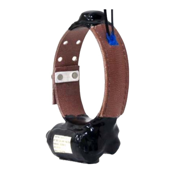
VHF Transmitter (not applicable to Quantum 4000 GPS pods) Your Quantum 4000 contains a VHF transmitter that will be on from the moment you remove the magnet at the bottom of the collar. Consult your packing list for the battery life of this transmitter. -
Page 6: On/Off Switches
On/Off Switches The VHF transmitter is controlled by a magnetically operated on/off switch. Remove the magnet at the bottom of the collar to activate the transmitter. To turn off the transmitter tune the frequency into your VHF receiver and replace the magnet on the VHF portion of the device. -
Page 7: Install The User Software
5. Move your location file into the collar sw folder (see next section). Location File Telemetry Solutions will email you a location file that we create based on the historical monthly average temperatures in your study area. This file will have the extension .tst. - Page 8 4. You must input various settings within this box. If this text box does not appear, from the file menu choose edit collar. 5. The collar model will be automatically selected because the software identifies the collar model when plugged in (If the collar or pod is not connected to your computer by USB cable please manually select your collar model based on the model identified on your packing list).
-
Page 9: Create Program In Calendar Mode
the collar first to determine how much time is required to obtain GPS positions in your study area. 10. If you are using the repeat mode then the calendar to and calendar from settings will not be used. 11. Dormancy and drop off options are not applicable to this product, ignore these. - Page 10 60 seconds should be all that is required in most conditions. Longer timeout settings will reduce the GPS battery life. Telemetry Solutions tests have shown that in open sky there is no reason to ever program the GPS past 60 seconds. Forested habitat or extreme terrain may warrant a 90 second setting.
-
Page 11: Upload The Program To Collar Or Pod
Upload the program to collar or pod 1. Keep the collar connected to your laptop or pc via the USB cable. 2. Open the file that you wish to upload to your collar. 3. From the collar menu click upload. A blue screen briefly appears on your screen indicating that the file is being uploaded. -
Page 12: Upload The Program To Collar Or Pod
Upload the program to collar or pod 1. Keep the collar connected to your laptop or pc via the USB cable. 2. From the collar menu click upload. A blue screen briefly appears on your screen indicating that the file is being uploaded. This only takes about 1 second. -
Page 13: Data And Turning Your Unit Off
Data and turning your unit off Downloading data 1. Remove the rubber plug from the USB port on the collar or pod and plug your GPS collar or pod into your pc with the USB cable provided. 2. Open the user software and navigate to the data page. 3. -
Page 14: Map Your Data On Google Maps
S3: Not applicable to this product, disregard this column. S4: Not applicable to this product, disregard this column. Map your data on Google maps You may map your data onto Google maps through the Telemetry Solutions website. 1. Navigate to C:\Program Files\Collar SW\data and remove the underscores from the file name. -
Page 15: Turning Your Gps Data Logger Off
12. Each point is numbered in a list on the right side of the screen. You can find the distance between two points by clicking on the calculate button then entering the point numbers into the text box that appears. 13. -
Page 16: Gauges, Indicators, Warranty And Glossary
Gauges, Indicators, Warranty and Glossary Battery gauges The settings page of your user software has 2 different battery displays: The real capacity and expected capacity. This battery information is available in the user software when you are connected directly from your laptop to the collar by USB cable. -
Page 17: Glossary
GPS acquisition time: The time it takes a GPS receiver to acquire satellite signals and determine the initial position. Interleaving: This feature, unique to The Quantum 4000 Enhanced, inserts additional GPS location attempts into the schedule using the battery power saved when very short acquisition times accrue to outperform the user set GPS timeout. - Page 18 Latitude: A position's distance north or south of the equator, measured by degrees from 0 to 90. One degree of latitude equals sixty nautical miles. One minute of latitude equals one nautical mile. Longitude: The distance east or west of the prime meridian measured in degrees.
Need help?
Do you have a question about the Quantum 4000 and is the answer not in the manual?
Questions and answers