Table of Contents
Advertisement
Advertisement
Table of Contents

Related Manuals for Syride SYS'Nav XL


Summary of Contents for Syride SYS'Nav XL
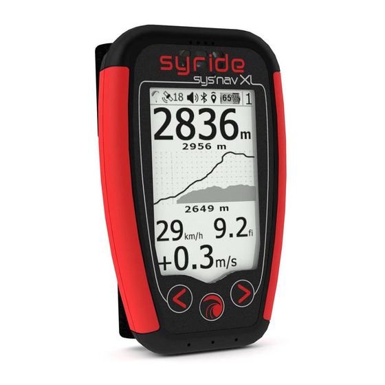
- Page 1 ® SYS’Nav XL User Guide...
- Page 2 As a member of the community, you will become to a key player in the evolution and continuous improvement of our flight instruments. The range of innovative sensors included in the SYS'NAV XL allows the development of future features… We encourage you to share with us your suggestions for your greater satisfaction.
-
Page 3: Table Of Contents
GPS Status ..................5 flight screens ................... 7 III. Configure your device ..............9 Advanced configuration ..............11 Customize your screens and vario sound ........12 Locate Airspaces ................13 VII. navigation ..................15 VIII. Bluetooth features ................ 19 Visualiser et supprimer un vol ............23 Warning and reset ................. - Page 4 Download the lastest version of the SYS PC Tool by checking the following webpage : http://www.syride.com/en/logiciel Follow the instructions to install it on your computer. Once installed, an icon shows in the task bar. It detects when your instrument is connected.
- Page 5 Place the instrument Syride suggests place your instrument on the risers. 2 velcros ables you to place it on any existing riser. Take care not to « lock » your rope or pulley accelerator.This position ables you to manipulate the instrument while flying without releasing the brakes.
- Page 6 Charging the battery Simply connect your instrument with the USB-C cable to a computer. A red led shows indicates the charging of the device. The led turns blue when the Charging while the device is fully charged. device is turned on and plugged in to a You can check the percentage of charge on the screen.
-
Page 7: Gps Status
You can check the status of It allows the acquisition of several GNNS constellations simultaneously. Bluetooth connectivity with this We advise you to turn on your SYS'Nav XL a few minutes before take icon. (see XII. Bluetooth off (during your preflight check). - Page 8 III. Menus Synoptic Flight Flight Flight Flight Navigation Flights Settings Bluetooth screen screen screen screen screen Screen Menu Menu Menu Menu See « XII. See « VI. Flight Screens » See « XIV. Bluetooth Display and features » delete a flight »...
-
Page 9: Flight Screens
Flight Screens Screens 1 to 4 allow you to display the flight information you want. If you're not getting enough GPS signal, a NO GPS indication will appear. Pressing the main button will turn OFF and ON the sound of the vario. This is useful when you need to concentrate on a transistion or a landing. - Page 10 Screen #5 (MAP screen) displays on the whole LCD area. You can see : • Your current position and heading on the middle of the screen • The topography grayscaled • Airspaces (if previously uploaded to the instrument) • Your GPS track for the last 10 minutes •...
-
Page 11: Configure Your Device
Configure your device Press the center button to start the instrument and display the main flight screen. Go to screen D using the keyboard arrows and press the center button (screen number is displayed in the top right) The first screen of the settings menu allows you to obtain the system information. - Page 12 The next 2 screens allow you to set the thresholds for the vario's climb and descent sounds. The threshold can be changed by pressing the center button. The next screen allows you to activate/deactivate the zero-ing function (Thermal Sniffer). The instrument will emit a specific beep in flight when you are in a no-climb (<0.1m/s) and no-descent (>-0.2m/s) zone.
-
Page 13: Advanced Configuration
Advanced configuration Connect your device to a computer with the SYS PC Tool to access to advanced setup page. You can: Change the airspace « pre-violation » warnings (HAS for Horizontal distance to AirSpace, VAS for Vertical distance to AirSpace) Adjust the security alarm based on the G-meter Activate the instant vario Change your device language…... -
Page 14: Customize Your Screens And Vario Sound
To customize your screen (tutorial video https://www.youtube.com/watch?v=D3lfZWiS13M Go to : http://www.syride.com/en/ssctool/NavXL Customize your screen by selecting an item with is font size and units, and then drag and drop it to the screen. Download the config file to your computer. -
Page 15: Locate Airspaces
VIII. Locate Airspaces To avoid an airspace violation, you can upload a database of airspaces with an OpenAir file format to your instrument. Here are some tips regarding airspaces : Airspaces are regularly modified (about once per month). We recommend you to check the version of file you are using and keep updated. - Page 16 In order to upload/update airspaces to your SYS’Nav XL: Go to the webpage https://www.syride.com/en/airspace Syride's online tool provides airspace databases in Open Air format by country. Download the file you want to your computer. Turn on and plug your SYS'Nav into the USB port of your computer.
-
Page 17: Navigation
To build a route with the « Route maker » : Go to http://www.syride.com/en/route Build your route in a few clicks, and then download it to your computer. - Page 18 OziExplorer and CompeGPS .wpt file format. Then, in the SYS'Nav XL, go to the Navigation menu (screen N°A) and then to Create route menu. You will have to give it a name (move the cursor with the arrows and change the letter or validate with the central button) and choose whether it is a route intended for competition or a classic one.
- Page 19 Here are the kind of Waypoints you can add in competition: • Take off: This waypoint is optional. It can only be selected as the first waypoint of a route. It is not taken into account in the navigation, and is only used to calculate the total distance of the task.
- Page 20 The minimum length of the line is 50m The competition route is finished when you have entered a "Goal" and pressed OK. Don't forget to go to the "Load Route" menu to start your navigation on the SYS'Nav XL.
-
Page 21: Bluetooth Features
Bluetooth features The SYS'Nav XL allows the pairing of a Bluetooth device. If you want to connect several devices at the same time (e.g. be live on Syride and connect to XCTrack), you will have to use the Syride application... - Page 22 If you wish to pair a device, click on the central button to access the Bluetooth menu. Select the pairing mode you wish to use (third party app or Syride app) and click on the central button. If you are already paired with another device, it will be disconnected.
- Page 23 - In the list of nearby Bluetooth devices, select your Sys'Nav XL - To use the GPS data from the Sys'Nav XL, don't forget to check "Use external GPS" - If the connection remains "pending" on the SYS'NAV XL, restart XCTrack...
- Page 24 Livetracking, weather reports and automatic flight upload can only work if the instrument is connected to the Syride app on your phone. Your phone must also be able to exchange data with the Syride server, which means there must be a mobile network.
-
Page 25: Visualiser Et Supprimer Un Vol
Press the center button when you are on Track already transferred screen C allows to check the data of to Syride.com flight in the instrument memory, delete a track and mark a flight as “not transferred yet” should you need to Track not transferred yet transfer it again. - Page 26 The battery is <3%. The SYS'Nav XL must be recharged. If you are in flight the instrument will record your track and turn off automatically. To force restart the instrument, insert a paperclip into the hole provided for this purpose at the back of the case. This action does not erase memory or your settings.
-
Page 27: Upload Your Flights
To use the advanced flight analyzer on syride.com, you must enter your email and password of your Syride account (create one on http://www.syride.com) Turn on your instrument and plug it with the USB cable to your computer. - Page 28 10. To watch your track, click on the picture. 11. You can make your flight invisible for the Syride community by clicking on the eye icon on the top right. It will stay on your profile but the Syride users won’t be able to see it.
- Page 29 12. You can track your personal evolution on the flight page through time. You can also compare your stats and performances to the other riders.
- Page 30 XIV. Parameters Here is a list of parameters preprogrammed in your instrument in order to improve its use and its operating time: • Flight tracks less than a minute long will be automatically deleted by the SYS PC Tool • When flying, your instrument will automatically stop recording the flight if neither a ground speed or a vario is detected, unless you’ve manually forced the recording see chapter V.
-
Page 31: Suggestion Of Use
Suggestion of use • We suggest you turn on your SYS'Nav XL while preparing your gear in order to make sure you get the GPS fix before taking-off. • Use the lanyard to secure your instrument while flying. • Electromagnetic... - Page 32 • Operating time and settings : The operating time very related to your settings. Here is a table allowing you to estimate the operating time of your instrument according to its settings: With GPS Eco mode Without GPS Eco mode Sinking sound Sinking sound Sinking sound...
- Page 33 Antarctic is not guaranteed!! DO NOT ATTEMPT RECHARGING THE DEVICE WITH A DIFFERENT Ensure that the product is well in position before taking off. Syride cannot USB CORD THAN THE ONE PROVIDED. RATING : 5VDC 500mA. be held responsible for the loss of the product during the flight (takeoff included).
- Page 35 EN 2.3/100821...
Need help?
Do you have a question about the SYS'Nav XL and is the answer not in the manual?
Questions and answers