Table of Contents
Advertisement
Quick Links
Advertisement
Table of Contents

Related Manuals for Geneq F90

Summary of Contents for Geneq F90
-
Page 1: User Manual
GENEQ F90 GNSS Receiver User Manual... -
Page 2: Table Of Contents
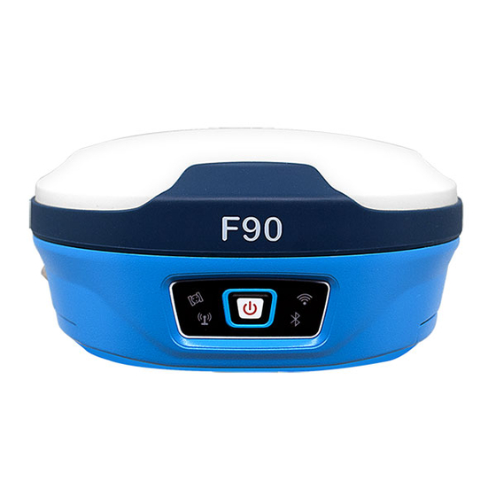
1 Introduction ....................... 4 5.3.1 Working mode ...............................24 1.1 Company Introduction ..............................4 5.3.2 Satellites setting ..............................28 1.2 Outstanding Features of CY F90 ..........................4 5.3.3 Device configuration ............................28 5.3.4 NMEA message ..............................29 2 General Information ....................6 5.3.5 View logs and configuration set ........................30 2.1 Outlook of F90 ...................................6... -
Page 3: Company Introduction
Inserted with high-sensitive E-bubble and brand-new tilt survey algorithm. F90 is calibration-free. 1.1 Company Introduction Immune to magnetic disturbance and free from limitation of tilt angles. F90 can measure points GENEQ is a company professional in surveying and mapping industry. Advanced and high-qual- where a vertical placement of the pole is not possible such as house corner. -
Page 4: General Information
2.1 Outlook of F90 Turn F90 on. This is the very first step to use F90. When the receiver has power, keep pressing power button for 4 seconds, then you will see the power button light up and hear beep.Turn F90 off. -
Page 5: Equipment List
3- Equipment List Supporting 25cm FRP Pole supporting pole 3.1 Packing List of Base CY F90 BASE SET 1. Main body Pallet Name Type Description Picture Weight Receiver main Mainboard : 1.2KG (with two body batteries inside) BD990 OEM729 P328 yellow, rigid 2. -
Page 6: Packing List Of Rover
2.Accessories Name Type Description Picture Pole No Logo 7.2V Lithium BP-5S Battery 3400mAH CY F90 Rover A Suite of Product(Without Pole) Carton Packing G.W. N.W. Volume(CBM) Charger CH-04 Battery charger 50*20*40CM 6.45KG 5.4KG 0.04 CY F90 Rover A Suite of Product(With Pole) -
Page 7: Setting Up
4- Setting Up 4.1 Setting Up Base Station 4.1.1 Choose a suitable place A suitable place is essential for base station to better receive the satellites and transmit the UHF signals. A suitable position should comply with following conditions : Figure 4-1 (1) Choose a wide open area in order to easy and better receive signal of satellites. -
Page 8: Transmit Signal Through External Radio
You can set the channel on the external radio directly. The external serial port baud The antenna height must be measured when we use F90 to collect static data or use it as base rate should be same as external radio. The baud rate for our device is 38400. If you use our radio, station. -
Page 9: Setting Up Rover Station
(1) Via Wi-Fi 4.3.1 Baseline network design F90 can be used as a hotspot, use controller to search the Wi-Fi signal of F90, the Serial NO. of F90 will show on controller, then select it to fi nish connect. (1) Synchronous pattern... -
Page 10: Outdoor Surveying
4.3.2 Outdoor surveying (1) Choose suitable points Suitable points is essential to make sure whole surveying work goes smoothly and effi ciently. The points should be fi xed only after you well analyze and collect full information of the surveying area. -
Page 11: Download Data
Data fi le name includes points name, day of year and F90 can be a Hotspot. You can connect it with phone, controller, PC or other devices through its surveying times. It is easy for you to distinguish. If the fi le name is 34661171.F14, the fi rst four Wi-Fi. -
Page 12: Datalink
5.2.3 Satellites In “Satellites” you can set the cutoff angle and can see satellites conditions. Figure 5-4 Figure 5-2 5.2.4 Information 5.2.2 Datalink In “Information”, you are able to check information details about this receiver, such as fi rmware In “Datalink” you can set the channel, frequency and protocol. And you can also do channel de- version of the receiver, GPS fi rmware version, UHF mode information, Network information etc. - Page 13 If you choose UHF datalink, you can choose record raw data or not. Select the radio channel and radio protocol as you prefer. F90 is compatible with various protocols, such as : SATEL,P- CC-GMSK, TrimTalk 450S, South 9600, TrimMark III(19200) , South 19200, Hi-target 9600,...
- Page 14 The baud rate for our device is 38400. Figure 5-11 Base mode Figure 5-9 Rover mode(External datalink) If use External, you can connect F90 with external radio via Bluetooth. Besides, F90 can also connect with other devices via Bluetooth.
- Page 15 5.3.2 Satellites setting In satellites setting, you can set the cutoff angle and select the satellites. Figure 5-12 5.3.3 Device configuration Device confi guration can help you set many confi guration. Such as select time zone, fi rst storage position etc. Figure 5-13 5.3.4 NMEA message You can set the NMEA message, turn them on/off.
- Page 16 In “Confi guration Set”, you can save current confi guration you set and you can also use previous setting directly if you had saved. Figure 5-16 5.4 Download data There are 2 kinds of data you can download--static data and backup data. For static data, you can convert it to Rinex.
- Page 17 6- Frequently Use Functions 5.4.2 Backup data Once you lose the data in controller. You can download backup data in WEB UI. The format for 6.1 Device registration backup data is “.RTK” The register code a 32 numbers and letters. For example : F90034804060,20180821, A7ECAC8BB90494F57A1F2FDFFCBA4896, A7EC-AC8 B-B904-94F5-7A1F-2FDF-FCBA-4896 ...
- Page 18 6.2 Download static data and Rinex change In WEB UI function, you can fi nd Download. Click Download, then see Raw data, and you can see page as below pic. Choose the data you need and click “Download”. Figure 6-6 6.4 Restore factory settings Figure 6-4 In WEB UI, “management”...
- Page 19 7- Technical Parameters Linux Memory Internal 8G, TF Extended, Max≥32G Items Specification Bluetooth V2.1+EDR / V4.1 Dual Mode, Class2 GPS Board OEM729 P328 BD990 WIFI 802.11 b/g/n Channel All areas without North America : GPS : L1 CA/L2E/L2C/L5 GPS : L1CA/L1C/L2C/L2P/L5 EC25-E, 4G North America : GLONASS :L1CA/L2CA/L3 GPS :L1CA/L1P/L1C/L2P/L2C/...
- Page 21 December 2018...
Need help?
Do you have a question about the F90 and is the answer not in the manual?
Questions and answers