Table of Contents
Advertisement
Advertisement
Table of Contents

Related Manuals for Leica Geosystems DD120 Series


Summary of Contents for Leica Geosystems DD120 Series
- Page 1 Leica DD120, DD130 Series Locators & Accessories User Manual Version 1.0 English...
- Page 2 Description myProducts Add all products that you and your company own and explore your world of Leica Geosystems: View detailed information on your products and update your products with the latest software and keep up- to-date with the latest documentation.
- Page 3 Service Description myService View the current service status and full service his- tory of your products in Leica Geosystems service centres. Access detailed information on the services performed and download your latest calibration cer- tificates and service reports. mySupport Create new support requests for your products that will be answered by your local Leica Geosystems Support Team.
-
Page 4: Table Of Contents
Table of Contents Safety Directions General Definition of Use Limits of Use Responsibilities Hazards of Use 1.5.1 General 1.5.2 Using the Product with a Signal Transmitter Electromagnetic Compatibility EMC FCC Statement, Applicable in U.S. Description of the System System Information System Components Locator Components Signal Transmitter Components... - Page 5 Depth Code Information Utility Current Measurement Connectivity Transmitter USB Connectivity Batteries Locators Batteries Charging the Li-Ion Battery Pack Operating Principles Functional Checks Locator Health Check Locator Functional Check Functional Check of the Transmitter Functional Check of the Trace Rod Functional Check of the Sonde Care and Transport 10.1 Transport...
-
Page 6: Safety Directions
▶ Refer to "A World Frequency Zones" for more information. ▶ Contact your agency or Leica Geosystems authorised service workshop if your unit is incorrectly configured for your region. Description The following directions enable the person responsible for the product, and the person who actually uses the equipment, to anticipate and avoid operational hazards. -
Page 7: Definition Of Use
Responsibilities Manufacturer of the Leica Geosystems AG, CH-9435 Heerbrugg, hereinafter referred to as Leica product Geosystems, is responsible for supplying the product, including the user man- ual and original accessories, in a safe condition. -
Page 8: Hazards Of Use
• To be familiar with local regulations relating to safety and accident preven- • tion. To inform Leica Geosystems immediately if the product and the application • becomes unsafe. • To ensure that the national laws, regulations and conditions for the opera- tion of the product are respected. - Page 9 WARNING Distraction/loss of attention During dynamic applications, for example stakeout procedures, there is a dan- ger of accidents occurring if the user does not pay attention to the environ- mental conditions around, for example obstacles, excavations or traffic. Precautions: ▶ The person responsible for the product must make all users fully aware of the existing dangers.
- Page 10 WARNING Inappropriate mechanical influences to batteries During the transport, shipping or disposal of batteries it is possible for inappro- priate mechanical influences to constitute a fire hazard. Precautions: ▶ Before shipping the product or disposing it, discharge the batteries by the product until they are flat.
- Page 11 • Precautions: ▶ Do not open the product! ▶ Only Leica Geosystems authorised service centres are entitled to repair these products. WARNING Improper disposal If the product is improperly disposed of, the following can happen: If polymer parts are burnt, poisonous gases are produced which may •...
-
Page 12: Using The Product With A Signal Transmitter
1.5.2 Using the Product with a Signal Transmitter DANGER Clipping a transmitter clamp around a live utility When a transmitter clamp is clipped around a live utility, a hazardous signal might be present on the utility or at the transmitter plug connector, causing you to receive an electric shock. -
Page 13: Electromagnetic Compatibility Emc
Precautions: ▶ Although the product meets the strict regulations and standards which are in force in this respect, Leica Geosystems cannot completely exclude the possibility that other equipment may be disturbed. CAUTION Use of the product with accessories from other manufacturers. For... -
Page 14: Fcc Statement, Applicable In U
Precautions: ▶ Although the product meets the strict regulations and standards which are in force in this respect, Leica Geosystems cannot completely exclude the possibility that other equipment can be disturbed or that humans or ani- mals can be affected. - Page 15 Consult the dealer or an experienced radio/TV technician for help. • CAUTION Changes or modifications not expressly approved by Leica Geosystems for compliance could void the user's authority to operate the equipment. Labelling DD120, DD130 loca-...
- Page 16 Labelling DA series transmitters 13298_001 Safety Directions...
-
Page 17: Description Of The System
Description of the System System Information General description Locators are used to detect buried conductive utilities that emit an electromag- netic signal. Such a signal is generated as an electrical current passes through the utility. Signal transmitters are used to apply a distinct signal to utilities with the fol- lowing intention: To improve the detection success. -
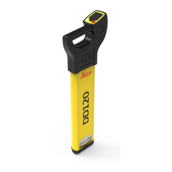
Page 18: Locator Components
6 x LR6 (AA) alkaline batteries are used. Replace all batteries when indicated. Case foot ☞ The case foot can be replaced if it is worn. Contact your agency or Leica Geosystems authorised service work- shop. Signal Transmitter Components Description of transmitter components... - Page 19 Connect the charger plug into the charge jack on the Li-Ion pack. 14479_001 Plug the connector into a suitable power 100-240 V source. 12/24 V 14480_001 ☞ The Li-Ion pack should be fully charged before use. Result: The small LED next to the charge jack flashes at a fast rate to indi- cate the wake up process, then flashes at a slower rate to indicate that the Li-Ion pack is active and charging.
-
Page 20: Operation Of The Locator
Operation of the Locator Display Panel Overview DD120, DD130 panel overview Signal Strength Indicator Indicates the response of the Locator to a signal (utility). Mode Indicators Displays the selected mode: Power, Radio, 8 kHz, 33 kHz, Auto, (512 Hz and 640 Hz on DD130 series model). As shown, from bottom to top. - Page 21 0016786_001 Locator settings The DD120, DD130 locators offer a range of settings which the operator can adjust to their own preference. It also displays additional service and contact information as detailed. Setting Description Performs a function check on the locators hardware and software, displaying PAS if the Locator is within predefined tolerance or ERR if the locator is not.
-
Page 22: Hazard Zone
Options are 50 or 60 Hz. ▶ Refer to "A World Frequency Zones" for more information. ▶ Contact your agency or Leica Geosystems authorised service workshop if your unit is incorrectly configured for your region. Changing the battery 0016745_001 Replace or Recharge the batteries when the battery status indicator is empty. -
Page 23: How To Locate A Utility
Status Description indicator Hazard zone on and is alarming. Hazard zone is switched off. How to Locate a Utility Status indicator Test pattern Info on label Audio Output On throughout test sequence Signal Strength indi- Scrolls through in cator sequence once Mode indicators Briefly illuminated Indicator Icons... - Page 24 Search Mode Description Signal Transmitter Used in conjunction with a signal transmitter: mode To improve the detectability of utilities. • • To trace a specific utility. To make a depth or current measurement. • ☞ Keep in mind the following: •...
-
Page 25: Operation Of The Transmitter
Operation of the Transmitter Keyboard Transmitter keyboard Power key Power Output key and LED indicators Low Battery LED indicator Connection Mode LED indica- Frequency key and LED indica- tors Mute key 13192_001 Turning On / Turning Off Turning on and off Press the Power key to turn the transmitter on or off. -
Page 26: Applications
Applications How to Pinpoint a Utility Pinpointing process To help you pinpoint a utility, the locator provides a visual and an audible response. 0016787_001 Visual response When the locator is positioned directly over a utility and at 90° to it, the Locate screen displays a peak reading. -
Page 27: How To Trace A Utility
☞ The signal strength indicators do not indicate the size, depth or type of a utility. ☞ To ascertain an estimated depth of the utility, use a signal transmitter or a sonde. Refer to "6 Estimating Depth and Current of a Utility". How to Trace a Utility Tracing process Pinpoint a utility by finding the peak reading. - Page 28 Set the locator to Power mode. 0016790_001 ☞ Ensure that the locator is held upright and close to the ground. Take care not to swing the locator. 0016791_001 Cross the site from left to right until the defined area is covered. 0016792_001 Turn through 90 °...
-
Page 29: Using The Transmitter In Induction Mode
☞ To conduct a one-step Sweep Search process or to provide a fast scan for large work areas, the locator can be used in Auto mode. To obtain an improved definition of a detected utility, use the locator in an indi- vidual mode. -
Page 30: Induction Mode: Nulling-Out Method
Select the required power output and frequency. 13280_001 Place the transmitter over the utility with the arrows running in line with the sus- pected direction of the utility. The internal aerial directly induces the tracing signal onto the utility. 13292_001 Set the locator to the required Signal Transmitter frequency. -
Page 31: Induction Mode: Parallel-Sweep Method
To confirm that the transmitter and the locator are on the same utility, place the signal transmitter upright and directly over the utility. ☞ Either the speaker or the con- nection socket should be on the ground. 13308_001 If the transmitter and the locater are on the same utility, the Numeric Peak Indi- cator on the locator significantly decrea- ses. -
Page 32: Induction Mode: Radial-Sweep Method
Both persons: Start walking parallel to each other. ☞ The tracing signal is induced directly onto the utility and indicated on the locator. 0016801_001 In the presence of a detectable utility, the locator emits a tone and the signal strength indicators rise and fall as you pass over the utility. -
Page 33: Using The Transmitter In Connection Mode
Both persons: Start walking parallel to each other, cir- cling the target area. ☞ The tracing signal is induced directly onto the utility and indicated on the locator. 0016805_001 In the presence of a detectable utility, the locator emits a tone and the signal strength indicators rise and fall as you pass over the utility. -
Page 34: Direct Connection Mode
☞ An extension cable is available to extend either the red or black cables on the connection cable set. ☞ Reducing the signal output helps to extend the battery life and to reduce the amount of signal applied to adjacent utilities. 5.5.2 Direct Connection Mode Using the transmitter... -
Page 35: How To Use The Trace Rod
Select the required frequency and power output. To indicate that the tracing signal rea- ches a good level, the Power Output LED indicator and the audible tone change from pulsed to continuous. 13280_001 Set the locator to the required Signal Transmitter frequency. -
Page 36: Locating A Utility Using The Trace Rod
Description of components 13204_001 Sonde Using Sonde mode, the sonde helps to pinpoint the end point of the trace rod. Line Flexible, glass-fibre sheathed rod, which incorporates copper wires to con- duct the signal. Using Line mode, the rod helps to trace the route of a utility. Connection terminals Used to connect to the signal transmitter. - Page 37 Ensuring that no utilities are below, push the Earth Pin into the ground and con- nect the black cable to the Earth Pin. ☞ For more safety, we recom- mend pushing the Earth pin into the ground at an angle of 45 degrees.
- Page 38 Using the trace rod in ☞ For ease of use practice the process above ground. Sonde mode ☞ For ease and convenience mark the ground every 3 to 4 metres. Insert the rod into the pipe, duct or con- duit until the desired length is in place. 14356_001 Plug the transmitters cable set into the connection socket.
-
Page 39: How To Use The Transmitter Clamps
Walk in line with the suspected direction of travel observing the display. The signal strength indicator rises and falls as you pass over the ghost signal at the back of the sonde, the peak signal directly over the sonde and the ghost signal at the front. -
Page 40: How To Use The Property Plug Connector
Open the jaws of the transmitter clamp and place it around the utility to be traced. ☞ Ensure that the jaws are fully engaged. 14438_001 Turn on the transmitter. ☞ Ensure that the battery level of the transmitter is adequate. 13268_001 Select the required frequency and power output. -
Page 41: Locating A Utility Using The Property Plug Connector
Description of components 13209_001 Mains plug connector In-line isolator Transmitter plug connector 5.8.2 Locating a Utility Using the Property Plug Connector Using the property Connect the property plug connector to plug connector the transmitter. 14342_001 Connect the property plug connector to a live mains outlet. -
Page 42: How To Use The Sondes
Set the locator to the required Signal Transmitter frequency. 0016797_001 Trace the length of the utility. Refer to "5.2 How to Trace a Utility". 0016815_001 How to Use the Sondes 5.9.1 General Information Description The sondes are signal transmitters used to trace pipes, ducts, conduit or drains. - Page 43 Set the locator and sonde to the same frequency and verify their performance. 0016797_001 ☞ Once the function of the sonde has been verified, con- nect it to drain rods or other means of guiding it. Insert the sonde into the pipe, duct, con- duit or drain.
-
Page 44: Estimating Depth And Current Of A Utility
Estimating Depth and Current of a Utility Utility Line Depth Taking a depth ☞ For utility line depth, the locator needs to be used in conjunction reading with a signal transmitter. Refer to "5.4 Using the Transmitter in Induction Mode" and "5.5 Using the Transmitter in Connection Mode". -
Page 45: Sonde Depth
Sonde Depth Taking a depth ☞ For sonde depth, the locators needs to be used in conjunction with a reading sonde. Refer to "5.9 How to Use the Sondes". Set the locator to the required Sonde frequency. 0016797_001 Position the locator directly over and in line with the sonde. -
Page 46: Utility Current Measurement
Information code Description Information on instrument label The service is too shallow to metres ft-inch register properly. metres ft-inch 0.3 m The service is too deep. metres ft-inch metres ft-inch 3.0 m 10ft The signal received by the Locator is too small to regis- ter properly. - Page 47 Identifying a utility The signal transmitter is used to apply a signal (current) to the utility to be traced. The signal can couple onto additional utilities making it difficult to dis- tinguish by conventional locating techniques. Current measurement helps to identify the utility to which the transmitter is attached by providing the highest current reading (mA).
- Page 48 0016950_001 Estimating Depth and Current of a Utility...
-
Page 49: Connectivity
Connectivity Transmitter USB Connectivity Connecting the The signal transmitter is provided with a USB port and can be connected to a transmitter using USB PC for one of the following reasons: To update software. • • To provide calibration and maintenance support. ☞... -
Page 50: Batteries
Use the transmitters with an authorised rechargeable Li-Ion battery pack. Locators Batteries Locator Batteries The DD120 series and DD130 series Locators are fitted with six LR6 (AA) alka- line batteries Changing the Battery Replace or recharge the batteries when the battery status indicator is empty. - Page 51 Lift the cover of the battery compart- ment and remove the Li-Ion battery pack. 14475_001 Connect the charger plug into the charge jack on the battery pack. 14479_001 Plug the connector into a suitable power 100-240 V source. ☞ The small LED next to the charge jack flashes to indicate that the battery pack is charg- 12/24 V...
-
Page 52: Operating Principles
It is normal for the battery to become warm during charging. Using the • chargers recommended by Leica Geosystems, it is not possible to charge the battery once the temperature is too high. For new batteries or batteries that have been stored for a long time •... -
Page 53: Functional Checks
Functional Checks Locator Health Check Checking the function Leica Geosystems accepts no responsibility for maintenance and calibration conducted by unauthorised persons. Locator depth test ☞ If the depth reading deviates from known depth of the test utility or if an error code is displayed, return the locator for service. -
Page 54: Functional Check Of The Transmitter
Observe the displayed output: PAS means unit is within set tolerances. • • ERR means unit is outside set tolerances and may need servic- ing. ☞ Repeat the test in a different location if the units displays ERR. • • The Locator will automatically repeat the function test if it fails. -
Page 55: Functional Check Of The Trace Rod
Checking the The purpose of the following procedure is to verify the performance of the performance transmitter. ☞ Conduct the test away from areas of electromagnetic interference or over buried utilities with a large signal radiating off them. Plug the transmitters cable set into the connection socket. Connect the black and red cable clips together, ensuring good metal to metal contact. -
Page 56: Functional Check Of The Sonde
Disconnect the black cable from the negative (-) terminal. The transmitter should emit a pulsed tone. ☞ If for any of these tests no output or a significantly different output is displayed, return the trace rod for service. Functional Check of the Sonde Checking the function Before you carry out any tests, it is vital to check the status of the unit, its bat- teries and its basic functionality. - Page 57 ☞ If for any of these tests no output or a significantly different output is displayed, return the sonde for service. Functional Checks...
-
Page 58: Care And Transport
Shipping When transporting the product by rail, air or sea, always use the complete orig- inal Leica Geosystems packaging, container and cardboard box, or its equiva- lent, to protect against shock and vibration. Shipping, transport of When transporting or shipping batteries, the person responsible for the prod-... -
Page 59: Technical Data
• national regulations • Hereby, Leica Geosystems AG declares that the product/s is/are in com- pliance with the essential requirements and other relevant provisions of the applicable European Directives. The full text of the EU declaration of conformity is available at the fol- lowing Internet address: http://www.leica-geosystems.com/ce. -
Page 60: Locator Technical Data
Mode Output Temperature Operating -20°C to +50°C, -4°F to +122°F Storage -40°C to +70°C, -40°F to +158°F Protection against water, Conforms to IP67 lid open or closed dust and sand Humidity 95% RH non condensing The effects of condensation are to be effec- tively counteracted by periodically drying out the product. - Page 61 8.192 (8) kHz 512 Hz (DD130 series models) 640 Hz (DD130 series models) Depth estimation Locator DD120 series DD130 series Depth range Line 0.3 m to 3 m Line 0.3 m to 3 m Line 0.3 m to 3 m Sonde 0.1 to 9.99 m...
-
Page 62: Conductive Rod Technical Data
Dimensions 85 mm/3.4 Inches 760 mm/30 Inches 250 mm/10 Inches 0016954_001 11.4 Conductive Rod Technical Data Conductive rod Description Value Typical detection range Both modes, line and sonde: Typical 3.0 m/10 ft Tracing distance 50 m/165 ft; 80 m/263 ft (maximum). Reel length dependant. - Page 63 Mode Output Temperature Operating -20°C to +50°C, -4°F to +122°F Storage -40°C to +70°C, -40°F to +158°F Protection against water, IP54 (IEC 60529) Dust-protected dust and sand Humidity 95% RH non condensing The effects of condensation are to be effec- tively counteracted by periodically drying out the product.
-
Page 64: Appendix A World Frequency Zones
Appendix A World Frequency Zones World Frequency North America Zones Canada 120 V / 60 Hz United States 120 V / 60 Hz Mexico 120 V / 50 Hz, 60 Hz Central America Bahamas 115 V / 60 Hz Barbados 115 V / 50 Hz Belize 110-220 V / 60 Hz... - Page 65 Europe Albania 230 V / 50 Hz Austria 230 V / 50 Hz Belgium 230 V / 50 Hz Belarus 230 V / 50 Hz Croatia 230 V / 50 Hz Cyprus 240 V / 50 Hz Czech Republic 230 V / 50 Hz Denmark 230 V / 50 Hz Estonia...
- Page 66 Africa Algeria 127-220 V / 50 Hz Angola 220 V / 50 Hz Benin 220 V / 50 Hz Botswana 220 V / 50 Hz Burkina Faso 220 V / 50 Hz Burundi 220 V / 50 Hz Cameroon 127-220 V / 50 Hz Central Africa Republic 220 V / 50 Hz Chad...
- Page 67 Asia Abu Dhabi 230 V / 50 Hz Afghanistan 220 V / 50 Hz Armenia 220 V / 50 Hz Azerbaijan 220 V / 50 Hz Bahrain 110-230 V / 50 Hz, 60 Hz Bangladesh 230 V / 50 Hz Brunei 240 V / 50 Hz Cambodia...
- Page 68 873882-1.0.0en Original text Published in Switzerland © 2018 Leica Geosystems AG, Heerbrugg, Switzerland Leica Geosystems AG Heinrich-Wild-Strasse CH-9435 Heerbrugg Switzerland Phone +41 71 727 31 31 www.leica-geosystems.com...
Need help?
Do you have a question about the DD120 Series and is the answer not in the manual?
Questions and answers