Table of Contents
Advertisement
Advertisement
Table of Contents

Related Manuals for Garmin BMW Motorrad Navigator VI


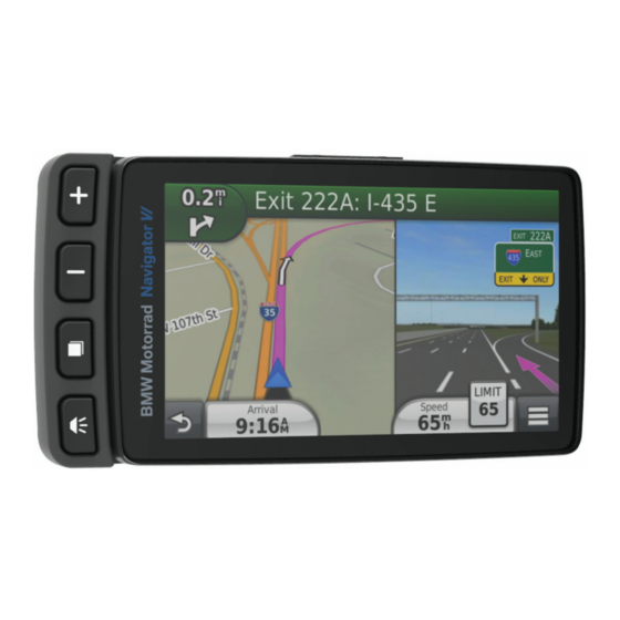
Summary of Contents for Garmin BMW Motorrad Navigator VI
- Page 2 © 2016 Garmin Ltd. or its subsidiaries All rights reserved. Under the copyright laws, this manual may not be copied, in whole or in part, without the written consent of Garmin. Garmin reserves the right to change or improve its products and to make changes in the content of this manual without obligation to notify any person or organization of such changes or improvements.
-
Page 3: Getting Started
Getting Started Turning On the Device NOTE: The device turns on automatically if it is in the optional WARNING motorcycle or automotive mount and external power is See the Important Safety and Product Information guide in the connected and turned on. product box for product warnings and other important Press the power key. -
Page 4: Adjusting The Volume
NOTE: Lifetime Maps entitle you to receive map updates when and as such updates are made available by Garmin during the Select to zoom in and out on the map. useful life of one compatible Garmin product or as long as... -
Page 5: Battery Information
Battery Information If applicable, select a destination from the Quick Search list. If necessary, select the appropriate destination. After the device is connected to power, it begins to charge. in the status bar indicates the status of the internal battery. Finding a Location Using the Search Bar You can use the search bar to search for locations by entering a Setting the Time... -
Page 6: Finding Parking
Select Where To? > Recent. If necessary, select a category, or select All Saved Places. Select a location. Clearing the List of Recently Found Locations Select Where To? > Recent > > Clear > Yes. Select Go!. Finding Parking Editing a Saved Location Select Where To? >... -
Page 7: About Shortcuts
You can add shortcuts to the Where To? menu. A shortcut can signs and to use safe driving judgment at all times. Garmin will point to a location, a category, or a search tool. -
Page 8: Map Pages
Using Suggested Routes Removing Buttons from the Map You can remove all buttons from the right side of the map. Before you can use this feature, you must save at least one location and enable the travel history feature. Select Settings > Map & Vehicle > Map Buttons. Using the myTrends ™... -
Page 9: Hands-Free Features
Select > Reset Field(s). Select your headset from the list, and select OK. Select an option: Your device sends navigation prompts to your headset as you navigate a route. • When not navigating a route, select Select All to reset every data field except the speedometer, on the first page. -
Page 10: Using The Apps
• To view weather for a favorite city, select a city in the list. About Garmin Live Services • To add a favorite city, select Add City, and enter a city Before you can use Garmin Live Services, your device must be name. connected to a supported phone running Smartphone Link. -
Page 11: Trip Planner
Tracker ID. If you invite a follower using an email address, that Up to 125 shaping points can be included between each via person must follow you using the Garmin website. If you invite a point. follower using a Garmin Tracker ID, that person can follow you using the Garmin Tracker app on their device. - Page 12 You can share trips with compatible Garmin devices using point. Bluetooth wireless technology. Select Apps > Trip Planner. Place your device within 33 ft. (10 m) of a compatible Garmin device. Select New Trip. Select Apps > Trip Planner >...
-
Page 13: Converting Units
Saving a Recent Track as a Trip Select OK. You can save a track as a trip, which you can navigate later Media Player using the trip planner (Navigating to a Saved Trip, page 10). The media player can play music or audio from these sources. NOTE: The TracBack app shows your most recent track. -
Page 14: Understanding Traffic Data
NOTICE NOTE: Different routes may be calculated based on traffic Garmin is not responsible for the accuracy or timeliness of the trends for the day of the week or the time of day. traffic information. -
Page 15: Customizing The Device
Display Timeout: Allows you to set the amount of idle time NOTE: For a removable drive or volume, you should not before your device enters sleep mode while using battery place files in the Garmin folder. power. Select Edit > Paste. -
Page 16: Proximity Alerts Settings
Cleaning the Touchscreen Use a soft, clean, lint-free cloth. Garmin Lock: Allows you to lock your device by entering a 4- digit PIN and setting a security location. If necessary, lightly dampen the cloth with water. -
Page 17: Troubleshooting
NOTICE Turn off the device. Garmin is not responsible for the accuracy of or the Hold your finger on the upper-right corner of the screen and consequences of using a red light or speed camera database. turn on the device. Continue holding the screen until the device starts. -
Page 18: Specifications
*The device withstands incidental exposure to water of up to 1 m not as a portable device. Windows versions prior to Windows XP for up to 30 min. For more information, go to www.garmin.com Service Pack 3 use USB mass storage mode. /waterrating. - Page 20 All rights reserved. Under the copyright laws, this manual may not be copied, in whole or in part, without the written consent of Garmin. Garmin reserves the right to change or improve its products and to make changes in the content of this manual without obligation to notify any person or organization of such changes or improvements.
Need help?
Do you have a question about the BMW Motorrad Navigator VI and is the answer not in the manual?
Questions and answers
reset password