Table of Contents
Advertisement
Advertisement
Table of Contents

Related Manuals for Garmin dezl 770 Series


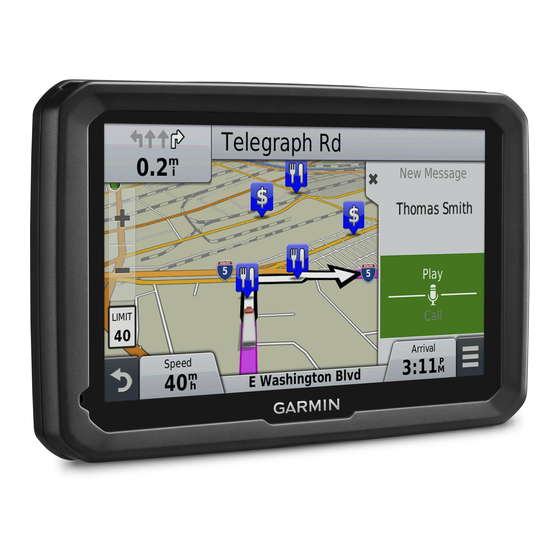
Summary of Contents for Garmin dezl 770 Series
- Page 1 dēzl 770 Series ™ Owner’s Manual July 2015 190-01805-00_0D...
- Page 2 All rights reserved. Under the copyright laws, this manual may not be copied, in whole or in part, without the written consent of Garmin. Garmin reserves the right to change or improve its products and to make changes in the content of this manual without obligation to notify any person or organization of such changes or improvements.
-
Page 3: Table Of Contents
Table of Contents Finding Recently Found Destinations ......... 7 Clearing the List of Recently Found Locations ...... 7 Finding Your Last Parking Spot ..........7 Getting Started............... 1 Viewing Current Location Information ........7 Connecting the Device to Vehicle Power ........1 Finding Emergency Services and Fuel ........ - Page 4 Guarantee™ ............18 About Hands-Free Calling ............13 Lifetime Subscriptions ............18 Pairing Your Phone .............. 13 Updating Maps and Software with Garmin Express .... 18 Placing a Call ............... 13 Data Management ..............19 Receiving a Call ..............13 File Types ................
-
Page 5: Getting Started
The Garmin logo on the mount should face right-side up. ® Select Off. Press the suction cup to the windshield, and flip the lever back toward the windshield. -
Page 6: Vehicle Profiles
The speed limit feature is for information only and does not Select replace your responsibility to abide by all posted speed limit signs and to use safe driving judgment at all times. Garmin will Select an option: not be responsible for any traffic fines or citations you receive for •... -
Page 7: Active Lane Guidance
Your device re-calculates the route to include the added location and guides you to the locations in order. Shaping Your Route Before you can shape your route, you must start a route (Starting a Route, page You can manually shape your route to change its course. This allows you to direct the route to use a certain road or go through a certain area without adding a stop or destination to the route. -
Page 8: Previewing Multiple Routes
• Select a point, such as a street, intersection, or address • To remove the location, select location. Editing and Saving Your Active Route Select Go!. If a route is active, you can use the trip planner to edit and save your route as a trip. -
Page 9: Avoiding Delays, Fees, And Areas
Avoiding Delays, Fees, and Areas Select Save Custom Avoidances Avoiding Traffic Delays on Your Route Before you can avoid traffic delays, you must be receiving traffic Avoiding a Road information (Receiving Traffic Data Using a Traffic Receiver, Select Settings > Navigation > Custom Avoidances. page 10). -
Page 10: Finding A Location Using The Search Bar
• Save your favorite locations to find them quickly in the future If necessary, select the appropriate destination. (Saving Locations, page Navigating to Points of Interest Within a Venue • Return to recently found locations (Finding Recently Found You can create a route to a point of interest (POI) within a larger Destinations, page venue, such as a store in a shopping mall or a specific terminal in an airport. -
Page 11: Custom Points Of Interest
POI Loader software. You can use the Where Am I? page to view information about Go to www.garmin.com/poiloader. your current location. This feature is helpful if you need to tell Follow the on-screen instructions. -
Page 12: Removing A Shortcut
The Where To? menu can contain up to 36 shortcut icons. NOTE: Categories appear in the saved locations menu after you have saved at least 12 locations. Select Where To? > Add Shortcut. Select Where To? > Saved. Select an item. Select a location. -
Page 13: Customizing The Up Ahead Categories
Customizing the Up Ahead Categories Viewing Traffic on the Map You can change the categories you search for, rearrange the The traffic map shows color-coded traffic flow and delays on order of the categories, and search for a specific business or nearby roads. -
Page 14: Alerts
Select Save. Traffic Receiver Traffic NOTICE Garmin is not responsible for the accuracy or timeliness of the traffic information. Traffic information may not be available in all areas or countries. For information about traffic receivers and coverage areas, go to www.garmin.com/traffic. -
Page 15: Positioning The Traffic Receiver
Vehicle and Driver Logs Connect the device to your computer. About IFTA Logging Open the "Garmin" drive or volume, and open the Reports folder. NOTE: This feature is not available in all areas. Open the IFTA folder. You can archive data needed for International Fuel Tax Open the .csv file. -
Page 16: Recording Your Duty Status
19). Follow the on-screen instructions. Select an option: Managing Driver Information • To view the logs on your device, open the "Garmin" drive Select Apps > Hours of Service. or volume, and open the Reports folder. Select a driver. • To view the logs on your memory card, open the drive or Select Driver Info. -
Page 17: Adding Service Categories
Calling a Location Using wireless technology, your device can send audio Select Apps > Phone > Browse Categories. navigation prompts to a wireless headset. For more information, go to http://www.garmin.com/bluetooth. Select a point of interest. Pairing a Wireless Headset Select Call. -
Page 18: Using The Call History
While the device is connected to the phone and receiving You can delete a paired Bluetooth device to prevent it from Garmin Live Services, you can disable hands-free calling. automatically connecting to your dēzl device in the future. Select Settings > Bluetooth. -
Page 19: Garmin Live Services
Garmin Live Services ecoRoute HD Accessory When connected to the ecoRoute HD accessory, your device Before you can use Garmin Live Services, your device must be can receive real-time vehicle information, such as error connected to a supported phone running Smartphone Link messages, RPM, and battery voltage. -
Page 20: Resetting Ecoroute Information
Select Apps > Weather. You can enable map products installed on your device. Select a day. TIP: To purchase additional map products, go to The detailed forecast for that day appears. http://buy.garmin.com. Select Settings > Map & Vehicle > myMaps. Customizing the Device... -
Page 21: Navigation Settings
Select a map. Brightness: Adjusts the display brightness. Display Timeout: Sets the amount of idle time before your Navigation Settings device enters sleep mode. To open the Navigation settings page, from the main menu, Screenshot: Allows you to take a picture of the device screen. select Settings >... -
Page 22: Restoring Settings
Cleaning the Touchscreen NOTE: Lifetime Maps entitle you to receive map updates when and as such updates are made available by Garmin during the Use a soft, clean, lint-free cloth. useful life of one compatible Garmin product or as long as If necessary, lightly dampen the cloth with water. -
Page 23: Data Management
Press it in until it clicks. instructions to complete the installation. Start Garmin Express. Connecting the Device to Your Computer Connect your Garmin device to your computer using a USB You can connect the device to your computer using a USB cable. cable. -
Page 24: Charging The Device
Click the Maps tab. such as a wall power adapter. Follow the on-screen instructions. You can purchase an approved Garmin AC-DC adapter suitable for home or office use from a Garmin dealer or Purchasing Accessories www.garmin.com. Go to http://buy.garmin.com. Changing the Fuse in the Vehicle Power Cable... -
Page 25: My Device Does Not Appear As A Portable Device On My Computer
• Select Settings > Bluetooth. The Bluetooth field must be set to Enabled. • Enable Bluetooth wireless technology on your phone and bring your phone within 33 ft. (10 m) of the device. • Go to www.garmin.com/bluetooth for more help. Troubleshooting... -
Page 26: Index
Garmin Express 18 disabling 14 viewing routes 2, 3 registering the device 18 history 14 memory card 19 updating software 18 home 14 microSD card, installing 19 Garmin Live Services 15 placing 13 mileage reports 15 subscribing to 15 cameras, safety 10 mount, removing 20 geocaching 7 changing search area 6 mounting the device going home 2, 8 charging the device 1, 20... - Page 27 Garmin Live Services 14 voice dial 14 software Loader 7 updating 18 points of interest (POI) 6, 7 version 17 custom 7 specifications 18 extras 7 subscriptions Loader 7 Garmin Live Services 15 trucking 6 nüMaps Lifetime 18 venues 6 traffic 18 power cables 19 suction cup 20 changing the fuse 20 vehicle 1 theft, avoiding 18 power key 1 time settings 17...
- Page 28 +34 93 275 44 97 +27 (0)11 251 9999 + 46 7744 52020 +886 2 2642-9199 ext 2 +49 (0) 89 858364880 0808 238 0000 zum Ortstarif - Mobilfunk +44 (0) 870 8501242 kann abweichen 913-397-8200 1-800-800-1020 © 2014–2015 Garmin Ltd. or its subsidiaries...