Kenwood DNX571TR Instruction Manual
Hide thumbs
Also See for DNX571TR:
- Instruction manual (139 pages) ,
- Quick start manual (213 pages) ,
- Quick start manual (76 pages)

Related Manuals for Kenwood DNX571TR


Summary of Contents for Kenwood DNX571TR
-
Page 1: Gps Navigation
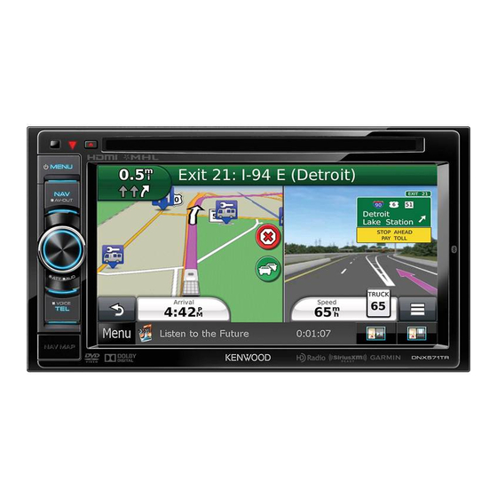
GPS NAVIGATION SYSTEM DNX571TR GPS NAVIGATION INSTRUCTION MANUAL © IM385_Nav_TR_K_En_00... -
Page 2: Table Of Contents
Contents Navigation End-User License Agreements Starting a Route Previewing Multiple Routes Following a Route Getting Started Your Route on the Map Using the Navigation System Using the Navigation Map Help When You Need It Adding a Point to a Route Searching Help Topics Taking a Detour Status Bar Icons... - Page 3 Using the Apps Traffic Information About Smartphone Link Traffic Subscription Activation Downloading Smartphone Link Understanding Traffic Connecting to Smartphone Link Traffic Data Using Smartphone Link Sending a Location from Your Phone About the Traffic Icon Disabling Calls While Connected Traffic on Your Route About Garmin Live Services Viewing Traffic on Your Route Subscribing to Garmin Live Services...
- Page 4 Contents Customizing the Settings Adding Truck or RV Profiles Activating Truck or RV Profiles Editing Truck or RV Profiles Changing the Map Settings Enabling Maps Changing the Navigation Settings Adjusting the Display Settings Route Preferences Updating the Time Settings Setting the Languages Adding Security Device and Privacy Settings Restoring Settings...
-
Page 6: Software License Agreement
Software License Agreement treaties. The Garmin Products are licensed, not sold. The structure, organization and code of BY USING THE DNX571TR, YOU AGREE TO BE the Software and Application are valuable trade BOUND BY THE TERMS AND CONDITIONS OF THE secrets of Garmin and/or its third-party providers. - Page 7 with vehicles, and which are capable of dispatch, in your business’ internal operations, and not fleet management or similar applications where for service bureau, time-sharing, resale or other the Content is used by a central control center in similar purposes. Accordingly, but subject to the dispatching a fleet of vehicles.
- Page 8 End-User License Agreements (if applicable), or (iii) as long as Garmin receives providers, channel partners, suppliers and affiliated Content from its third party content supplier, companies of Garmin and its licensors, DISCLAIM whichever of the three periods is shortest. A ANY WARRANTIES, EXPRESS OR IMPLIED, OF Garmin device’s “useful life”...
- Page 9 THROUGH THE SOFTWARE IS DONE AT YOUR or other Content by trade name, trademark, OWN DISCRETION AND RISK. YOU WILL BE manufacturer, supplier or otherwise does not SOLELY RESPONSIBLE FOR ANY DAMAGE TO YOUR necessarily constitute or imply its endorsement, ELECTRONIC COMMUNICATION DEVICE OR ANY sponsorship or recommendation by Garmin or LOSS OF DATA THAT MAY RESULT FROM THE...
- Page 10 End-User License Agreements reason, including, but not limited to, if Garmin by the laws of Kansas, without giving effect to (i) its finds that you have violated any of the terms of conflict of laws provisions, or (ii) the United Nations this Agreement.
- Page 11 access to Location Platform Services, by accessing such Location Platform Services you agree to application of the Nokia Terms of Service at http:// here.com/services/terms and the Nokia Privacy Policy at http://www.nokia.com/global/privacy/ privacy/policy/privacy-policy/. English...
- Page 12 agree to use it at your own risk. HERE or TPTP (and Traffic End User License Agreement their respective affiliates) and Garmin Ltd. (and Your Garmin product may be equipped to receive its subsidiaries) make no warranty of fitness or traffic data.
- Page 13 terms of this Agreement. Your traffic subscription agency, or any federal official refuses to use the may not be transferred to another person or legend provided herein, the Contracting Officer, another Garmin product. Traffic services are in federal government agency, or any federal official part geographically restricted to the reception must notify HERE prior to seeking additional or and transmission range of the radio transmitters in...
-
Page 14: Searching Help Topics
Getting Started The first time you use your Kenwood Navigation System, you need to set up your system. The Help menu provides additional information. Help When You Need It WARNING See "Safety Precautions and Important Information" Select Apps > Help to view information in the Quick Start Guide for product warnings and about using the device. - Page 15 Entering a Truck or RV Profile Satellite Signals After your vehicle is turned on, the navigation WARNING system begins acquiring satellite signals. The Entering your vehicle profile characteristics does system may need a clear view of the sky to acquire not guarantee that your vehicle's characteristics satellite signals.
-
Page 16: Searching Within A Category
Finding Locations The navigation system offers many methods for finding locations. The detailed maps loaded in your navigation system contain locations, such as restaurants, hotels, and auto services. You can use categories to browse for nearby businesses and attractions. Finding a Location by Category Enter a search term. -
Page 17: Finding A City
Finding an Address Enter the second street name, and select Next. • The order of the steps may change depending on the map data loaded on your device. If necessary, select the street. Select Where To? > Address. If necessary, select the intersection. Enter the address number, and select Done. -
Page 18: Finding A Location By Browsing The Map
Finding Locations Finding a Location by Browsing the Map If necessary, select the appropriate destination. Before you can find places included in the map data, such as restaurants, hospitals, and fuel stations, you must enable the map layer for places Saving a Home Location along the road (page... -
Page 19: Finding Rv Parks
Finding Parking Finding RV Services ⁄ Select Where To? > Categories > Parking. • This feature is available on the DNX571TR, but it is not available in all areas. Select a parking location. You can find nearby locations that offer repair, towing, and other services for RVs. -
Page 20: Saving Your Current Location
Finding Locations Saving Your Current Location Assigning Categories to a Saved Location You can add custom categories to organize your From the map, select the vehicle icon. saved locations. ⁄ Select Save. • Categories appear in the saved locations menu after you have saved more than 12 locations. -
Page 21: Starting A Route
Garmin and Select Go!. JVC KENWOOD will not be responsible for any traffic fines or citations you receive for failing to follow all If necessary, select a route. - Page 22 Using Suggested Routes • To view specific location categories, select and select a category icon. Before you can use this feature, you must save at • To center the map on your current location, least one location and enable the travel history select feature (page 19). • To view shortcuts for map and navigation Using the myTrends feature, your device predicts ™ features, select your destination based on your travel history, the day of the week, and the time of day.
-
Page 23: Disabling A Custom Avoidance
Navigation Navigating to an Exit Adding a Custom Avoidance Area Custom avoidances allow you to avoid specific From the map, select > Exit Services > areas and sections of road. You can enable and disable custom avoidances as needed. Select Go!. Select Settings >... -
Page 24: Deleting Custom Avoidances
Deleting Custom Avoidances Select Settings > Navigation > Custom Avoidances. Select an option: • To delete all custom avoidances, select • To delete one custom avoidance, select the avoidance, and select > Delete. Enabling Advanced Detours Select Settings > Navigation > Advanced Detours. Taking a Detour Around Specified Areas You can take a detour for a specified distance along your route or detour around specific roads. - Page 25 The Map Pages You can customize which data appear on the map and view upcoming turns and current location information. Customizing the Map Layers Changing the Map Perspective You can customize which data appear on the Select Settings > Map & Vehicle > Driving map, such as icons for points of interest and road Map View.
- Page 26 Viewing a List of Turns Viewing Junctions When you are navigating a route, you can view all While navigating a route, you can view the of the turns and maneuvers for your entire route junctions on major roadways. When you approach and the distance between turns.
- Page 27 The Map Pages Resetting Trip Information From the map, select > Trip Computer. Select > Reset All. Select an option: • When not navigating a route, select Select All to reset every data field, except the speedometer, on the page. • Select Reset Trip Data to reset the information on the trip computer. • Select Reset Max. Speed to reset the maximum speed. • Select Reset Trip B to reset the odometer. Viewing Current Location Information You can use the Where Am I? page to view information about your current location.
-
Page 28: Using The Apps
Before you can connect to Smartphone Link, you must download and install the Smartphone Link application on your phone. Start Smartphone Link on your phone. See your other Kenwood system manuals and your phone owner's manual for connection information. appears in the status bar on your device when Smartphone Link is connected. -
Page 29: About Garmin Live Services
About Garmin Live Services About ecoRoute Before you can use Garmin Live Services, your The ecoRoute™ feature calculates your vehicle device must be connected to a supported phone fuel economy, carbon footprint, and the fuel price running Smartphone Link (page 28). -
Page 30: Taking The Ecochallenge
Select Select OK. Exporting a Mileage Report Connect a USB mass storage device to your Resetting Your Score Kenwood unit. You can restart your current ecoChallenge. Select Apps > ecoRoute™ > Mileage Select Apps > ecoRoute > ecoChallenge. Report. Select >... -
Page 31: Setting Routes That Use Less Fuel
Setting Routes that Use Less Fuel Select > Weather Radar. ⁄ Viewing Weather Alerts • Less Fuel is available only in Automobile mode. While you are traveling with your device, weather Select Settings > Navigation > Calculation alerts may appear on the map. You can also Mode. -
Page 32: Navigating To A Saved Trip
Using the Apps Using the World Clock Select a saved trip. Select Apps > World Clock. Select an option: • To change the arrival or departure time, select a If necessary, select a city, enter a city location in the trip. name, and select Done. • To record how long you will stay at a location, select a location in the trip, and select Duration. • To view the trip on the map, select Map. Viewing the World Map Navigating to a Saved Trip Select Apps >... -
Page 33: Traffic Information
• Traffic information is not available in all areas. Traffic Data Using Smartphone Link NOTICE Garmin and JVC KENWOOD are not responsible for ⁄ the accuracy or timeliness of the traffic information. • This feature is not available in all areas. -
Page 34: Traffic On Your Route
Traffic on Your Route Viewing Traffic on the Map When calculating your route, the navigation The traffic map shows color-coded traffic flow system examines the current traffic and and delays on nearby roads. automatically optimizes the route for the shortest From the map, select time. -
Page 35: About Traffic Cameras
Traffic Information About Traffic Cameras The traffic subscription code cannot be reused. You must obtain a new code each ⁄ time you renew your service. If you own • This feature is not available in all areas. multiple FM traffic receivers, you must obtain a new code for each receiver. Before you can use this feature, you must subscribe to the photoLive service, and your Select Next on the device. device must be connected to a supported phone running Smartphone Link (page... -
Page 36: Trucking Features
About IFTA Logging Exporting a Jurisdiction Summary ⁄ Select Apps > IFTA Logging > Juridiction • This feature is available on the DNX571TR, but it is not Summary. available in all areas. You can archive data needed for International If necessary, select a truck. -
Page 37: About Hours Of Service
Select Apps > Hours of Service. ⁄ Select a • This feature is available on the DNX571TR, but it is not available in all areas. Follow the on-screen instructions. • Before you can use Hours of Service, you must be in Truck mode, and you must create a driver profile. -
Page 38: Adding Shipments
If necessary, select Start Day. If necessary, select End Day. Select Save. Managing Shipments ⁄ • This feature is available on the DNX571TR, but it is not available in all areas. Select Apps > Hours of Service. Select a driver. Select Manage Shipments. -
Page 39: Customizing The Settings
Customizing the Settings You can customize the settings of your GPS navigation system. Adding Truck or RV Profiles Editing Truck or RV Profiles Before you can activate a profile, you must WARNING activate a different profile. Entering your vehicle profile does not guarantee that your vehicle's characteristics will be accounted Select Settings >... -
Page 40: Changing The Navigation Settings
Changing the Navigation Settings Updating the Time Settings Select Settings > Navigation. Select Settings > Units & Time. • Calculation Mode—sets route preference. • Current Time—select Automatic to update the time automatically. When Automatic is not selected, you can • Avoidances—sets road features to avoid on a route. adjust the time in 15-minute increments. -
Page 41: Restoring Settings
Customizing the Settings Restoring Settings You can restore a category of settings or all settings to the factory default values. Select Settings. If necessary, select a settings category. Select > Restore. English... -
Page 42: Appendix
Before you can update the navigation system No Trailers Allowed software, you must have an SD card and a USB mass storage device, and an Internet connection. No Hazardous Materials Allowed Go to www.garmin.com/kenwood. No Flammables Allowed Select Update. No Water Pollutants Allowed No Left Turn Follow the on-screen instructions. -
Page 43: Updating The Map Data
Garmin POI Loader to install the POIs onto a You can purchase updated map data from Garmin USB mass storage device. Use the USB mass or ask your Kenwood dealer or Kenwood service storage device to load the POIs. The POI Loader is center for details. - Page 44 For the latest free software updates (excluding map data) throughout the life of your Garmin products, visit the Garmin Web site at www.garmin.com/kenwood. © 2014 Garmin Ltd. or its subsidiaries Garmin International, Inc. 1200 East 151st Street, Olathe, Kansas 66062, USA Garmin (Europe) Ltd.