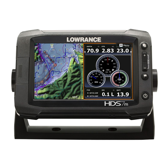
Lowrance HDS-12m Gen2 Touch Operator's Manual
Hide thumbs
Also See for HDS-12m Gen2 Touch:
- Manual (9 pages) ,
- Quick start manual (8 pages) ,
- Manual (20 pages)
Table of Contents

Related Manuals for Lowrance HDS-12m Gen2 Touch


Summary of Contents for Lowrance HDS-12m Gen2 Touch
- Page 1 HDS Gen2 Touch Chartplotter Operator manual ENGLISH lowrance.com...
- Page 2 All Rights Reserved offers at any time. We reserve the right to do so without notice. All features and specifications subject to change without Lowrance® and Navico® are registered notice. trademarks of Navico. Fishing Hot Spots® is a registered trademark IMPORTANT NOTE ABOUT RESTRICTED of Fishing Hot Spots Inc.
- Page 3 Please contact your Lowrance dealer if you require any further assistance. It is the owner’s sole responsibility to install and use the instrument and transducers in a manner that will not cause accidents, personal injury or property damage.
-
Page 4: About This Manual
About this manual This manual is a reference guide for operating the Lowrance HDS Gen 2 Touch system. It assumes that all equipment is installed and configured, and that the system is ready to use. The manual does not cover basic background information about how equipment such as radars and AIS work. -
Page 5: Table Of Contents
Using the cursor on the chart page Panning the chart Zooming Chart menu Chart options Chart overlay Chart Settings Navionics chart options Navionics settings Waypoints, routes & trails The waypoints, route and trails screens Routes Trails Contents | Lowrance HDS Gen2 Touch... - Page 6 The video page Setting up the video page The Alarm system The alarms dialog Acknowledging an alarm Utilities Vessels Sun/moon Trip Calculator Find Alarms Waypoints/routes/trails Tides Satellites Files Settings System Settings Changing system settings Units Contents | Lowrance HDS Gen2 Touch...
- Page 7 Viewing information about AIS targets Vessel alarms The vessel settings panel Networking Auto configuration Data sources Device list Diagnostics SIRIUS status (US only) NMEA 2000 NMEA 0183 Fuel Vessel setup Fuel used Find fuel Contents | Lowrance HDS Gen2 Touch...
- Page 8 Enabling audio The audio media bar Operating the audio source Audio controls Using the FM/AM radio Using SIRIUS radio Maintenance Preventive maintenance Simple maintenance procedures Software upgrades Troubleshooting Backing up your system data Index Contents | Lowrance HDS Gen2 Touch...
-
Page 9: Hds Gen2 Touch Screen And Keys
Man Overboard (MOB) waypoint at the vessel’s position. Power key A long press turns the unit ON/OFF. A short press brings up the backlight and power dialog. Repeated short presses toggles between preset brightness levels. Introduction | Lowrance HDS Gen2 Touch... -
Page 10: The Hds Gen2 Touch Home Screen
Tap a page icon to view the page full screen. Press and hold a page icon to view quick split combo page options. More Tap to see the full menu. Back button Tap to exit the home screen and return to the previous page. Local time Water depth Introduction | Lowrance HDS Gen2 Touch... -
Page 11: Basic Operation
Maybe later. Tap Close to manually configure settings. Using the touchscreen Basic touchscreen operation on the different pages is shown in the table. The Pages section later in this manual has more information about page-specific touchscreen operation. Basic Operation | Lowrance HDS Gen2 Touch... -
Page 12: Menus
Page menus can be hidden to allow pages to be displayed full screen. Drag the menu to the right to hide the menu. ¼ Note: When the cursor is active, some features on page menus will be replaced with cursor mode features. 10 | Basic Operation | Lowrance HDS Gen2 Touch... - Page 13 Hidden system menu The page menu for each operation mode has a hidden system menu. To access the hidden system menu, place your finger on the top menu item and drag down. | 11 Basic Operation | Lowrance HDS Gen2 Touch...
-
Page 14: Dialog Boxes
A dialog is closed by tapping the Close button. Numeric and alphanumeric keyboards will automatically be displayed when required for entering user information in dialogs. A virtual keyboard is operated by tapping the virtual keys. 12 | Basic Operation | Lowrance HDS Gen2 Touch... -
Page 15: Positioning A Man Overboard Waypoint
MOB waypoint is positioned at the vessel’s position • the display switches to a zoomed chart page, centered on the vessel position • the unit displays navigation information back to the MOB waypoint | 13 Basic Operation | Lowrance HDS Gen2 Touch... -
Page 16: Screen Capture
By default, screen captures are saved to internal memory. Refer to the Utilities section of this manual for information on viewing screen captures and saving files to a SD card. 14 | Basic Operation | Lowrance HDS Gen2 Touch... -
Page 17: Pages
Ethernet connection. Selecting pages, quick splits Tap a page icon to view the page full screen. Press and hold a page icon to view quick split combo page options. | 15 Pages | Lowrance HDS Gen2 Touch... -
Page 18: Selecting Active Panel
Select a panel configuration Save the page layout by tapping Save. ¼ Note: Tap Clear to cancel changes and select a new panel configuration. Tap Discard to cancel changes and return to the homescreen. 16 | Pages | Lowrance HDS Gen2 Touch... - Page 19 ¼ Note: You can cycle through favorite pages by pressing the key. editing favorites Tap Customize on the Favorites panel Tap an existing favorite Drag a page icon from the preview Tap Save | 17 Pages | Lowrance HDS Gen2 Touch...
-
Page 20: Data Overlay
Tap Save Customizing overlay data You can toggle the overlay data type between an analog and digital display, select data size, and change previously configured data from the Edit overlay configuration menu. 18 | Pages | Lowrance HDS Gen2 Touch... -
Page 21: Chart
Without a heading sensor installed, the icon will position itself using COG (Course over Ground). If no GPS is available the vessel symbol will include a question mark. | 19 Chart | Lowrance HDS Gen2 Touch... -
Page 22: Chart Scale
You Zoom in to see less of the map with more detail; zoom out to see more of the map with less detail. You can also use the dedicated +/- keys to zoom. 20 | Chart | Lowrance HDS Gen2 Touch... -
Page 23: Chart Menu
Save the route by tapping Save on the menu measuring distance The cursor can be used to measure the distance between your vessel and a selected position, or between two points on the chart. | 21 Chart | Lowrance HDS Gen2 Touch... -
Page 24: Chart Options
The chart orientation symbol in the upper right corner of the page indicates the north direction. North up Displays the chart with the north direction upward. Corresponds to the usual orientation of nautical charts. North up Heading up Course up 22 | Chart | Lowrance HDS Gen2 Touch... - Page 25 The camera angle is by default as seen from your eye position, look- ing toward the vessel. The vessel’s rotation on the chart is defined by the chart orientation settings. Chart tilted in rotate mode | 23 Chart | Lowrance HDS Gen2 Touch...
- Page 26 When you remove your finger from the chart the view will remain in the selected position. imagery Lowrance mapping can be displayed in two different imagery styles, either as 2D basic mapping style, or with shaded relief presenting chart including terrain imaging.
- Page 27 Tap the onscreen basic information display or tap the info button to view all available information for the item. ¼ Note: Popup information has to be enabled to see basic item information. | 25 Chart | Lowrance HDS Gen2 Touch...
-
Page 28: Chart Overlay
Selecting chart data This unit can use built-in Lowrance map data as well as Navionics, Fishing Hotspots, legacy LakeMaster and other third-party mapping cards. Tap Change to Navionics or Change to Lowrance to switch chart data the unit is using. -
Page 29: Navionics Chart Options
SD card cartography when a card is inserted.. orientation Several options are available for how the chart is rotated on the page. The chart orientation symbol in the upper right corner of the page indicates the north direction. | 27 Chart | Lowrance HDS Gen2 Touch... - Page 30 The availability of such photos is limited to certain regions and only available on certain Navionics mapping cards. You can view photo overlays in either 2D or 3D modes. 28 | Chart | Lowrance HDS Gen2 Touch...
- Page 31 Navionics Fish’n Chip This unit supports Navionics Fish’n Chip (US only) chart feature. For more information, see www.navionics.com. Change to Lowrance Switches map display from Navionics SD card data to Lowrance mapping data. | 29 Chart | Lowrance HDS Gen2 Touch...
-
Page 32: Navionics Settings
The safety depth sets the limit for which depths that shall be drawn without blue shading. Contours depth Determines which contours you see on the chart down to the selected safety depth value. 30 | Chart | Lowrance HDS Gen2 Touch... -
Page 33: Waypoints, Routes & Trails
A waypoint is used to mark a position you later may want to return to. Two or more waypoints can also be combined to create a route. | 31 Waypoints, Routes & Trails | Lowrance HDS Gen2 Touch... - Page 34 Using the edit waypoint dialog This dialog is activated by tapping the waypoint and then tapping the waypoint name display on the screen. The dialog can also be activated from the Waypoint list. 32 | Waypoints, Routes & Trails | Lowrance HDS Gen2 Touch...
-
Page 35: Routes
Tap the chart screen to activate the cursor Tap new on the page menu Tap new route Tap the screen to position routepoints Tap Save on the menu | 33 Waypoints, Routes & Trails | Lowrance HDS Gen2 Touch... -
Page 36: Edit A Route
If you tap on a leg a new point will be added between existing routepoints To move existing routepoints, drag them to the desired location Tap Save on the menu 34 | Waypoints, Routes & Trails | Lowrance HDS Gen2 Touch... -
Page 37: Trails
¼ Note: The Trails option must also be turned ON in the chart settings to be visible. | 35 Waypoints, Routes & Trails | Lowrance HDS Gen2 Touch... -
Page 38: Navigating
When navigating a route, the active route leg will be colored red. The red arrow on the route leg shows the selected navigation method (forward or reverse) you are using to navigate the route. Upcoming route legs are colored orange. 36 | Navigating | Lowrance HDS Gen2 Touch... -
Page 39: Navigation Settings Panel
You can start navigating the route from the first or last routepoint (forward or reverse), or from a selected routepoint. Cancel navigation You cancel navigation from the Navigation menu. Navigation settings panel | 37 Navigating | Lowrance HDS Gen2 Touch... -
Page 40: Arrival Radius
Defines Loran chains (GRI) and preferred station for waypoint entry and cursor position. The graphic example shows cursor position window with Loran position information. For more information refer to your Loran system documentation. 38 | Navigating | Lowrance HDS Gen2 Touch... -
Page 41: Steer Page
If the XTE exceeds the defined off course limit this will be indicated with a red arrow including the distance from the track line. If the off course alarm is enabled, the alarm will activate if the XTE exceeds the defined off course limit. | 39 Navigating | Lowrance HDS Gen2 Touch... -
Page 42: Structuremap
StructureMap can be used in Live mode or Saved mode. Live mode allows you to view real-time StructureMap data on the screen. Saved mode is used to display StructureMap data previously saved to a SD card. 40 | StructureMap | Lowrance HDS Gen2 Touch... -
Page 43: Live Mode
It can be used when revisiting an area that has already been scanned in order to assist the user in positioning the vessel or locating specific points of interest. | 41 StructureMap | Lowrance HDS Gen2 Touch... -
Page 44: Structure Options
Transparency Increases/decreases the visibility of Structure overlay so underlying chart detail may be revealed/obscured. This is helpful when using marine mapping cards. Minimum transparency Maximum transparency 42 | StructureMap | Lowrance HDS Gen2 Touch... -
Page 45: Logging Structure Data
To record structure data, steer your boat over an area and select Log Sonar from the Structure options menu. ¼ NOTE: For best results, we recommend turning off Auto Range when recording a structure sonar log (.sl2). | 43 StructureMap | Lowrance HDS Gen2 Touch... -
Page 46: Converting Files
Using StructureMaps with mapping cards StructureMap allows you to maintain full chart capability and can be used with embedded cartography as well as Navionics, Insight and other third-party charting cards compatible with HDS units. 44 | StructureMap | Lowrance HDS Gen2 Touch... -
Page 47: Scanning Fishing Areas
Steer the boat so the structure will be on the left or right side of your boat. • Set your structure range to a significantly greater level (two-to-three times) than the water depth to ensure a complete scan and to maxi- mize conversion accuracy. | 45 StructureMap | Lowrance HDS Gen2 Touch... -
Page 48: The Instruments Panels
You can also set limits of analog gauges. All edit options are available from the Instrument panel menu. Available editing options will depend on the data sources that are connected to your system. 46 | Instruments | Lowrance HDS Gen2 Touch... - Page 49 Tap Edit on the Instrument page menu Tap the gauge you want to change. The selected gauge will be shaded in blue Tap Select info Tap a data category Tap a data type Tap Save on the menu | 47 Instruments | Lowrance HDS Gen2 Touch...
-
Page 50: Using Video (9" And 12" Units Only)
Video input can be set to display a mirrored image. This setting can be helpful for rear-facing cameras used to back-down the vessel. The video standard This unit supports NTSC and PAL video. Check the local video standard or the standard of your cameras. 48 | Video | Lowrance HDS Gen2 Touch... -
Page 51: The Alarm System
Sets thresholds for alarms that when exceeded will trigger the alarm. Thresholds are not used on all alarms. If an alarm supports thresholds, the Set Limit button will be active when the alarm is selected. | 49 Alarms | Lowrance HDS Gen2 Touch... - Page 52 3 alarms. The alarms are listed in the order they occur with the alarm activated first at the top. The remaining alarms are available in the Alarms dialog. 50 | Alarms | Lowrance HDS Gen2 Touch...
-
Page 53: Acknowledging An Alarm
Alarms dialog. There is no time-out on the alarm message or siren. These remain until you acknowledge it or until the reason for the alarm is removed. | 51 Alarms | Lowrance HDS Gen2 Touch... -
Page 54: Utilities
Vessels Status listing List of all AIS, MARPA, and DSC vessels with available information. Message listing List of all messages received from other AIS vessels with time stamp. 52 | Utilities | Lowrance HDS Gen2 Touch... -
Page 55: Sun/Moon
List of all available alarm options in the system, with current settings. Waypoints/routes/trails List of waypoints, routes and tracks with details. Tap on the waypoint, route or track you wish to edit or delete. | 53 Utilities | Lowrance HDS Gen2 Touch... -
Page 56: Tides
Viewing screenshots When viewing a screenshot full screen, you can drag your finger across the screen to view other screenshots. Press Zoom In to return to the file list. 54 | Utilities | Lowrance HDS Gen2 Touch... -
Page 57: Settings
You can copy screenshots and logs to a SD card. You can also export system settings and waypoints, routes and trails to a SD card. Ex- porting files is covered in the Maintenance section. Copying all files Settings Opens the system settings menu. | 55 Utilities | Lowrance HDS Gen2 Touch... -
Page 58: System Settings
Most paper charts are made in the WGS84 format, which also is used by your unit. If your paper charts are in a different format, you can change the datum settings accordingly to match your paper charts. 56 | System Settings | Lowrance HDS Gen2 Touch... -
Page 59: Units
Advanced Shows a dialog with more advanced settings. About Displays unit software information. Units Controls unit of measure used for various data types. Units are accessed from the Settings panel. | 57 System Settings | Lowrance HDS Gen2 Touch... -
Page 60: Using The Simulator
You can select which data files to be used by the simulator. A set of source files is included in your system, and you can import files by using an SD card inserted into the unit’s card reader. 58 | Simulator | Lowrance HDS Gen2 Touch... -
Page 61: Advanced Simulator Settings
Used to enter values when GPS source is set to Simulated course or Simulated route. Otherwise, GPS data including speed and course comes from the selected echosounder or radar files. Set start position Moves the simulated vessel position to the cursor position. | 59 Simulator | Lowrance HDS Gen2 Touch... -
Page 62: Using The Radar (Optional)
The power to the radar scanner is on, but the radar is not transmitting. Transmit The scanner is on and transmitting. Detected targets will be drawn on the radar PPI (Plan Position Indicator). 60 | Radar | Lowrance HDS Gen2 Touch... -
Page 63: Adjusting Range
Press the dedicated waypoint key to save a waypoint at the vessel position. ¼ Note: A heading sensor must be connected to the system to save a waypoint on the radar PPI. | 61 Radar | Lowrance HDS Gen2 Touch... -
Page 64: Measuring Range And Bearing To A Target
Sea clutter has a manual mode and two automatic modes (harbor, offshore). Select manual mode to make adjustments to Sea clutter. Automatic modes use a combination of Gain/Sea Clutter settings best suited for the selected mode (Harbor, Offshore). 62 | Radar | Lowrance HDS Gen2 Touch... - Page 65 Moves the radar PPI center to the bottom of the panel to give maxi- mum view ahead. Offset Allows you to move the PPI center to any location on the radar page. | 63 Radar | Lowrance HDS Gen2 Touch...
-
Page 66: Ebl/Vrm
You can position EBL/VRM by using the cursor, and edit the marker position as described below. When positioned, you can quickly turn the EBL/VRM on/off by tapping the desired EBL/VRM on the menu. 64 | Radar | Lowrance HDS Gen2 Touch... -
Page 67: Setting A Guard Zone Around Your Vessel
A guard zone is an area (either circular or a sector) that you can define on the radar image. When activated, an alarm will alert you when a radar target enters or exits the zone. | 65 Radar | Lowrance HDS Gen2 Touch... -
Page 68: Radar Settings Menu
You can select if the alarm will be activated when the target enters or exits the zone. Radar Settings menu Target expansion Increases signal processing to provide larger target returns for better visibility on the screen. 66 | Radar | Lowrance HDS Gen2 Touch... -
Page 69: Radar Orientation
This option works only when the unit is navigating an active route. If you are not navigating an active route the heading up orientation will be used until the navigation function is started. | 67 Radar | Lowrance HDS Gen2 Touch... -
Page 70: Marpa
MARPA tracking is an important tool for collision avoidance. ¼ Note: You must have a heading sensor connected to your system to use MARPA. 68 | Radar | Lowrance HDS Gen2 Touch... - Page 71 When targets are being tracked, the radar menu will expand to include options for cancelling individual targets or to stop the track- ing function. Cancel tracking individual targets by tapping the target and then tapping Cancel target on the menu. | 69 Radar | Lowrance HDS Gen2 Touch...
- Page 72 Defining dangerous vessels You can define dangerous vessels based upon CPA (Closest Point of Approach) or TCPA (Time to Closest Point of Approach). When 70 | Radar | Lowrance HDS Gen2 Touch...
-
Page 73: Radar Overlay
When the radar overlay is selected, basic radar operational functions are available from the Chart page menu. ¼ Note: You must have a heading sensor connected to your system to use Radar overlay. | 71 Radar | Lowrance HDS Gen2 Touch... -
Page 74: Radar Installation Menu
Sidelobe suppression (Broadband radar only) ¼ Note: This control should only be adjusted by experienced radar users. Target loss in harbour environments may occur if this control is not adjusted correctly. 72 | Radar | Lowrance HDS Gen2 Touch... - Page 75 Traverse the area again and readjust if sidelobes returns still occur. Exit the installation menu. Restore radar to Factory Default This can be used to revert all user adjustments to factory settings. | 73 Radar | Lowrance HDS Gen2 Touch...
-
Page 76: Using Ais
Sleeping AIS target (not moving or at anchor). Moving and safe AIS target with course extension line. Dangerous AIS target, A target is defined as dangerous based on illustrated with bold line. the CPA and TCPA settings. 74 | AIS | Lowrance HDS Gen2 Touch... -
Page 77: Viewing Information About Ais Targets
Viewing information about all AIS targets Chart pages You can view informa- tion about all AIS targets within range of your ves- sel from the menu. | 75 AIS | Lowrance HDS Gen2 Touch... -
Page 78: Vessel Alarms
Controls whether an alarm shall be activated when a message is received from an AIS target The vessel settings panel Vessel settings are accessed from the Utilities tab on the home- screen. 76 | AIS | Lowrance HDS Gen2 Touch... - Page 79 You can define an invisible guard zone around your vessel. When a target comes within this distance from your vessel, the symbol will change to the “dangerous” target symbol and an alarm will be triggered. | 77 AIS | Lowrance HDS Gen2 Touch...
-
Page 80: Networking
Allows you to select the network device that will supply source data for a selected data type. Tap Data sources to edit source names, change source scope and add/remove data source network instances. 78 | Networking | Lowrance HDS Gen2 Touch... - Page 81 Global scope to use the same data sources. Setting one display unit on the network to Local scope allows you to select data sources independent of other global scope units on the network. | 79 Networking | Lowrance HDS Gen2 Touch...
- Page 82 Renaming a data source You can rename a data source to make it easier to distinguish between multiple data sources of the same type. Tap Rename and the touchscreen keyboard will appear. 80 | Networking | Lowrance HDS Gen2 Touch...
-
Page 83: Device List
SIRIUS status (US only) You can view your ESN number, SIRIUS subscription status and signal strength. You must have a SIRIUS weather and/or audio subscription to view SIRIUS information. | 81 Networking | Lowrance HDS Gen2 Touch... -
Page 84: Nmea 2000
Used to select the NMEA 0183 output sentences your unit will use when communicating with other NMEA 0183 devices. The default setting will work well with most configurations. Ethernet Displays the unit’s IP address on the Ethernet network. 82 | Networking | Lowrance HDS Gen2 Touch... -
Page 85: Fuel
The fuel utility allows your unit to calculate and monitor the overall fuel performance of your vessel. The Fuel utility requires a fuel used sensor, like a Lowrance Fuel Flow sensor, an engine interface with fuel used output capability, or a Lowrance Storage Device. -
Page 86: Fuel Used
Allows you to search for fueling stations near your location. Find fuel search results can be sorted by distance, cost and fuel type. ¼ Note: You must have a LWX module and a SIRIUS data subscription to use the Find Fuel feature. 84 | Utilities | Lowrance HDS Gen2 Touch... -
Page 87: Sirius™ Weather (North America Only)
The SIRIUS™ weather can be displayed as an overlay on your chart panel. When weather overlay is selected, the chart menu will increase to show the available weather options. ¼ Note: Weather options will not be shown when the cursor is active. | 85 Weather | Lowrance HDS Gen2 Touch... -
Page 88: Showing Detailed Weather Information
Shades of color are used to show precipitation type and intensity. Darkest color indicates highest intensity. Precipitation type Color codes Rain From light green (light rain) - yellow - orange - to dark red (heavy rain) Snow Blue Mixed Pink 86 | Weather | Lowrance HDS Gen2 Touch... - Page 89 Waves lower than the minimum value will not be color coded. Weather icons Several weather icons are available to show current or predicted weather conditions. You can tap an icon to display detailed weather information. | 87 Weather | Lowrance HDS Gen2 Touch...
-
Page 90: Weather Alarms
You can setup the lightning or storm alarms to be within a certain range of your vessel. You can also get an alarm if a severe weather forecast alarm is issued for your chosen marine zone. 88 | Weather | Lowrance HDS Gen2 Touch... -
Page 91: Weather Reports
You can read tropical statements including information about tropi- cal weather conditions. These statements are available for the entire Atlantic and the Eastern Pacific. You can access tropical statements from the Weather options menu. | 89 Weather | Lowrance HDS Gen2 Touch... -
Page 92: Animating Sirius™ Weather Graphics
(the predictions) When activated the time for the current graphic animation will be displayed in the lower left corner of the chart panel. 90 | Weather | Lowrance HDS Gen2 Touch... -
Page 93: Audio
The menus differ from one audio source to another as shown in the following sections. Media bar Repeat Volume Audio Source Artist Track level Shuffle Media bar Station RDS Display Audio Signal Volume Source strength level | 91 Audio | Lowrance HDS Gen2 Touch... -
Page 94: Operating The Audio Source
Pause audio Next favorite Previous favorite station station Next track Tune Previous forward track Tune Access device backward native menu Mute Mute audio audio iPod, iPhone, USB SIRIUS, AM/FM 92 | Audio | Lowrance HDS Gen2 Touch... -
Page 95: Using The Fm/Am Radio
Using the FM/AM radio Selecting AM/FM tuner region Before playing FM or AM radio, you must select the appropriate AM and FM tuner regions for your location. | 93 Audio | Lowrance HDS Gen2 Touch... -
Page 96: Using Sirius Radio
You can create of list of your favorite SIRIUS channels from within the channels list. You will not be able to add unsubscribed channels. When a favorite list is available, you scroll through the list by dragging the screen vertically. 94 | Audio | Lowrance HDS Gen2 Touch... - Page 97 The same code must be entered before a locked channel can be released. Mixer You can make adjustments to audio settings by tapping Mixer on the audio options menu. | 95 Audio | Lowrance HDS Gen2 Touch...
-
Page 98: Maintenance
Touch crosshair shown on screen to perform nine points calibration After successful calibration the unit will return to normal application screen 96 | Maintenance | Lowrance HDS Gen2 Touch... -
Page 99: Software Upgrades
Can be used when transferring user data from an User data file version 2 (no depth) HDS system to a legacy Lowrance (LMS, LCX, etc ) This is the format most used on the web that shares GPX (GPS Exchange) among most GPS systems in the world. - Page 100 ¼ To export waypoints, routes and trails to a non-HDS unit, select a compatible file format and export the file to a SD or microSD card that works with the non-HDS unit. 98 | Maintenance | Lowrance HDS Gen2 Touch...
-
Page 101: Index
3D view 23 Categories 25 Favorites panel 8 Creating routes 21 Files 54 Detail 24 Find 22 Find 22 Fish’n Chip 29 Look ahead 23 Fuel Mapping imagery 24 Find fuel 57 Measuring 21 | 99 Index | Lowrance HDS Gen2 Touch... - Page 102 Arrival radius 38 Gain 62 Cancel 14 Guard Zones 65 Cancel navigation 37 Interference rejection 63 Goto cursor 36 MARPA 68 Loran settings 38 Operation modes 60 Phantom Loran 38 Orientation 67 Routes 36 100 | Index | Lowrance HDS Gen2 Touch...
- Page 103 Range 42 Editing 32 Selecting source 40 Man Overboard 13 Live mode 41 Moving 33 Saved mode 41 Positioning 32 Sharing files 45 Cursor 32 Transparency 42 Vessel 32 System settings 56 | 101 Index | Lowrance HDS Gen2 Touch...
- Page 104 Weather Alarms 88 Animating graphics 90 Icons 87 Marine zones 89 Precipitation 86 Reports 89 Sea surface temperature (SST) Symbology 86 Transparency 88 Wave indication 87 102 | Index | Lowrance HDS Gen2 Touch...
- Page 105 Navico Databases License Agreement THIS IS A LEGAL AGREEMENT BETWEEN THE END-USER WHO FIRST PURCHASES THIS PRODUCT AS A CONSUMER ITEM FOR PERSONAL, FAMILY, OR HOUSEHOLD USE ("YOU") AND NAVICO, THE MANUFACTURER OF THIS PRODUCT ("WE", "OUR", OR "US"). USING THE PRODUCT ACCOMPANIED BY THIS LICENSE AGREEMENT CONSTITUTES ACCEPTANCE OF THESE TERMS AND CONDITIONS.
-
Page 106: Databases Limited Warranty
Databases Limited Warranty “We”, “our”, or “us” refers to Navico, the manufacturer of this product. “You” or “your” refers to the first person who purchases the product as a consumer item for personal, family, or household use. The Databases Limited Warranty applies to the one or more databases that your product may contain.