Garmin eTrex Venture Cx, Legend Cx Owner's Manual
Personal navigator
Hide thumbs
Also See for eTrex Venture Cx, Legend Cx:
- Quick reference manual (2 pages) ,
- Manuel du propriétaire (96 pages) ,
- Owner's manual (105 pages)
Table of Contents
Advertisement
Quick Links
Download this manual
See also:
Owner's Manual
Advertisement
Table of Contents

Related Manuals for Garmin eTrex Venture Cx, Legend Cx


Summary of Contents for Garmin eTrex Venture Cx, Legend Cx
- Page 1 eTrex Venture ® Legend ® personal navigator ® owner’s manual eTrex Legend Cx eTrex Venture Cx...
- Page 2 Garmin. Garmin hereby grants permission to download a single copy of this manual onto a hard drive or other electronic storage medium...
-
Page 3: About This Manual
Cx or the eTrex Venture Cx. These products use ® the proven performance of Garmin GPS and full- featured mapping to create an unsurpassed portable GPS receiver. Both eTrex models operate identically with the only differences being accessory offerings. A... -
Page 4: Table Of Contents
About This Manual ... i Manual Conventions ... i Software License Agreement ... v Product Registration ... v Contact Garmin ...v Caring for you eTrex ... vi Cleaning the Case ... vi Cleaning the Screen ... vi Storage ... vi Water Immersion ... - Page 5 Searching for a Point of Interest ...25 Custom Points of Interest ...26 Using Tracks ... 26 Navigating a Saved Track ...30 Creating and Using Routes ... 31 Creating a Route ...31 Navigating a Route ...32 Editing a Route ...34 Using the Route Page Options ...36 Main Pages ...
- Page 6 NTRODUCTION ABLE OF ONTENTS Calculator ... 65 Stopwatch ... 65 Sun and Moon ... 66 Hunt and Fish ... 67 Games Menu ... 68 Memory Race ...68 Virtua Maze ...69 GekoSmak ...69 Nibbons ...70 Gekoids ...70 Beast Hunt ...71 Appendix ... 72 Specifications ...
-
Page 7: Software License Agreement
THE FOLLOWING SOFTWARE LICENSE AGREEMENT. PLEASE READ THIS AGREEMENT CAREFULLY. Garmin grants you a limited license to use the software embedded in this device (the “Software”) in binary executable form in the normal operation of the product. Title, ownership rights, and intellectual property rights in and to the Software remain in Garmin. -
Page 8: Caring For You Etrex
NTRODUCTION ARING FOR THE EGEND Caring for you eTrex The case is constructed of high-quality materials and does not require user maintenance except cleaning. Cleaning the Case Clean the unit’s outer casing (except for the screen) using a cloth dampened with a mild detergent solution and then wipe dry. -
Page 9: Warning
This Notice is being provided in accordance with California’s Proposition 65. If you have any questions or would like additional information, please refer to our Web site at http://www.garmin.com/prop65. eTrex Venture Cx and Legend Cx Owner’s Manual... -
Page 10: Caution
Other Garmin dashboard or friction mounting options should be used. Garmin does not take any responsibility for any fines, penalties, or damages that may be incurred as a result of disregarding this notice. -
Page 11: Getting Started
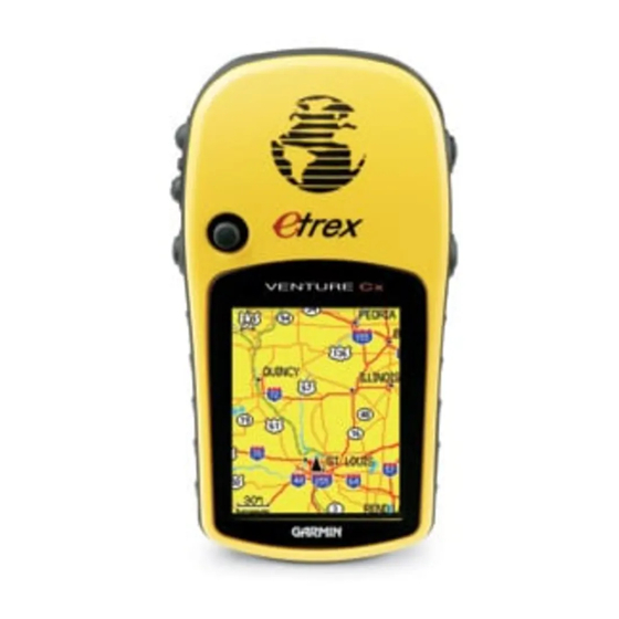
Unit Overview (eTrex Legend Cx shown) GPS antenna • Provides quick satellite acquisition Legend Cx Color LCD display Battery compartment locking D-Ring eTrex Venture Cx and Legend Cx Owner’s Manual ETTING TARTED Carry Lanyard attachment slots ETTING TARTED VERVIEW USB connector port (under weather cap) Battery compartment cover... -
Page 12: Installing The Batteries
ETTING TARTED VERVIEW Installing the Batteries The eTrex operates on two AA batteries (not included), which are installed in the back of the unit. You can use Alkaline or NiMH batteries. See page 57 for information on setting the battery type. To install the batteries: 1. -
Page 13: Key Functions
Key Functions In/Out zoom keys • From the Map Page, press to zoom the map in or out. • From any other page, press to scroll up or down a list or move a high- lighted slider. Menu/Find key • Press and release to view the Options Menu for a page. -
Page 14: Turning On The Etrex
ETTING TARTED URNING ON THE E Turning on the eTrex When you turn on the eTrex, the Welcome page appears, followed by the Satellite Page. The unit must collect satellite data and establish its current location. To turn the eTrex on and off: 1. -
Page 15: Initializing The Gps Receiver
1. Press and hold the Power key to turn on the eTrex. 2. Hold the unit in front of you with the top tilted upward. While the GPS receiver is searching for the satellite signals, a “Locating Satellites” message is replaced by an “Acquiring Satellites”... -
Page 16: Using The Etrex
ETTING TARTED SING THE E Using the eTrex This section explains how to enter and select information with the eTrex. Understanding Terms As you progress through this manual, you are directed to press a specific key or highlight a field on the screen. -
Page 17: Selecting Options And Entering Data
Selecting Options and Entering Data Use the Rocker to highlight, select, or choose an item in a list or a field on the screen. To select and activate an option: 1. From any page, press the Menu key. An Options Menu appears with a list of additional options for that page. -
Page 18: On-Screen Messages
You can purchase microSD cards at your local electronics supplier or refer to the accessory list in the Appendix. See the Garmin Web site (http://www.garmin.com/ cartography/) for compatible MapSource products. eTrex Venture Cx and Legend Cx Owner’s Manual card ™... -
Page 19: Transferring Data To A Microsd Card
Transferring Data to a microSD Card The eTrex utilizes a microSD card to store detailed MapSource map data. To install or remove the microSD card: 1. Remove the battery compartment cover from the back of the unit. 2. Locate the card slot at the upper-left edge of the battery tray, and insert the contact end of the card in the slot with the contacts facing away from the battery tray. -
Page 20: Basic Operation
ASIC PERATION REATING AND SING ASIC PERATION This section explains some of the more common operations performed with your eTrex, including creating and using waypoints, using the Find Menu, and how to create and use tracks and routes. Creating and Using Waypoints Waypoints are locations or landmarks you record and store in your GPS. -
Page 21: Creating Waypoints Using The Map
Creating Waypoints Using the Map You can quickly create a waypoint using the Map Page. When you pan the map and move the arrow over a map item, you can see a highlighted description of the item. To create a waypoint using the Map Page: 1. -
Page 22: Editing Waypoints
ASIC PERATION REATING AND SING 4. Press Quit to exit. Editing Waypoints You can edit waypoints to change the symbol, name, note, location, elevation, and depth. To edit a waypoint: 1. Press and hold the Find key to open the Find Menu. -
Page 23: Averaging The Waypoint's Location
To move a waypoint on the Map Page: 1. On the Find Menu, highlight the Waypoints icon, and press Enter to open the Waypoints Page. 2. Select the waypoint you want to move, and press Enter. The Waypoint Page opens. 3. -
Page 24: Projecting A Waypoint
ASIC PERATION REATING AND SING Average Location Mark Waypoint Page 6. Press Enter to save the location. Projecting a Waypoint You can create a new waypoint by projecting the distance and bearing from one location to a new location. To project a waypoint: 1. -
Page 25: Using Proximity Waypoints
Using Proximity Waypoints Use the Proximity Waypoints Page to define an alarm circle around a stored waypoint location. Proximity icon Proximity Alarms check box To add a proximity waypoint: 1. Press the Menu key twice to open the Main Menu. 2. -
Page 26: Using The Find Menu
ASIC PERATION SING THE To clear one or all proximity waypoints from the list: To remove or review a single entry, press Enter. To remove all waypoints from the list, press the Menu key, highlight Remove All, and press Enter. Using the Find Menu Use the Find Menu to search for waypoints, cities, and exits included in the eTrex basemap. -
Page 27: Find By Name
The options menu for each category contains a submenu of search options, such as Find By Name, Find Nearest, Select Symbol (for waypoints), Change Reference (by moving the pointer to a new location), Nearest Containing (a keyword you enter), Select Category (for those groups, such as Food &... -
Page 28: Recent Finds
ASIC PERATION SING THE Recent Finds The Recent Finds Page shows a list of the last 50 items you have searched for or gone to recently. To go to a recently found item: 1. Press and hold the Find key to open the Find Menu. - Page 29 • Project Waypoint—create a new waypoint by referencing another location by entering bearing and distance from the referenced location. See page 14 for more information. • Find Near Here—return to the Find Menu where you can search for map items near the item defined on the information page.
-
Page 30: Finding A Waypoint
ASIC PERATION SING THE 3. Press the Menu key to open the Options Menu, highlight Change Reference, and press Enter. The Map Page appears. 4. Use the Rocker to pan the arrow (pointer) to the map location you want, and press Enter. The Find list shows a list of items near the new map location. - Page 31 Geocache Setup instructions on page 61 and www.garmin.com/products/etrexLegendcx/. To find a geocache: 1. Press and hold the Find key to open the Find Menu. 2. Highlight the Geocache icon, and press Enter to open the Geocache Page. You can view either found geocaches or those that have not been found.
-
Page 32: Finding A City
ASIC PERATION SING THE Finding a City Use the Cities icon on the Find Menu to find any city listed in the mapping database (either in the basemap or from downloaded detailed mapping data). To find a city: 1. Press and hold the Find key to open the Find Menu. -
Page 33: Finding An Address
4. Select a service from the list, and press Enter to open the information page for the selected service. Exits list Exits icon Finding an Address If you downloaded detailed mapping data, use the Addresses icon on the Find Menu to find an address. When you enter the street number, street name, and city, the find feature matches that data with addresses in the map database. -
Page 34: Finding An Intersection
ASIC PERATION SING THE 3. Highlight the <Enter Number> field, and press Enter. 4. Type the street number using the on-screen keypad. When finished, highlight OK and press Enter again. 5 Highlight the <Enter Street Name> field, and press Enter. The street list opens. 6. -
Page 35: Searching For A Point Of Interest
6. Repeat steps 4 and 5 to enter a street name in the <Enter Street 2> field. When finished, a list of matches appears below. 7. Select an intersection, and press Enter to open the information page. List of matching Intersection intersections information page... -
Page 36: Custom Points Of Interest
first. Custom Points of Interest You can create your own category for points of interest by using the Garmin POI Loader utility available from the Garmin Web site: www.garmin.com/products/ poiloader/. Follow the instructions for use on the Web. - Page 37 2. Select the Tracks icon, and press Enter to open the Tracks Page 3. Highlight the Clear button, and press Enter. A confirmation message appears. To set up a track log: 1. Press Menu twice to open the Main Menu. 2.
- Page 38 ASIC PERATION SING RACKS To save the entire track log: 1. Press Menu twice to open the Main Menu. 2. Select the Tracks icon, and press Enter to open the Tracks Page. 3 Highlight the Save button and press Enter. A message appears asking you if you want to save the entire track.
- Page 39 3. Use the USB cable to connect the unit to your computer the access the USB Mass Storage feature explained on page 58. You can open the track logs using Garmin MapSource or another .gpx file-compatible application. 4. To delete these track logs from the microSD card, highlight individual logs, and then press ENTER.
-
Page 40: Navigating A Saved Track
ASIC PERATION SING RACKS 3. Press Enter to start the area calculation. As you begin to move and define the area’s boundaries, a Stop button appears at the bottom of the page. Start calculation Save calculated track 4. When finished defining the area, press Enter to open the page with a Save button. -
Page 41: Creating And Using Routes
To create a user waypoint on a saved track: 1. With a saved track shown on the map, use the Rocker to move the pointer on the track point that you want to mark as a user waypoint. 2. Press and hold the Enter key to open the Mark Waypoint Page. -
Page 42: Navigating A Route
ASIC PERATION REATING AND SING 5. Use the Find Menu to select a route waypoint from one of the Find Menu groups, and open the information page for the selected waypoint, city, exit, point of interest, and so on. 6. Highlight the Use button, and press Enter to add it to the route. - Page 43 2. Highlight the Routes icon, and press Enter to open the Routes Page. 3. Highlight a saved route, and press Enter to open the Route Page. 4. Highlight the Navigate button, and press Enter. 5. To stop navigating, press the Menu key, select Stop Navigation, and press Enter.
-
Page 44: Editing A Route
ASIC PERATION REATING AND SING Active Route Page Turn Preview Page when following roads Editing a Route After you create a route, use the Route Page to edit, change the route name, and review route points. To change the name of the route: 1. - Page 45 4. Highlight a point on the Route Page, and press Enter to open an options menu. 5. Highlight Review, and press Enter to open the information page for the route point. 6. Select Save (save the point as a waypoint), Map (show the point on the Map Page), or Go To (navigate to the point), and press Enter.
-
Page 46: Using The Route Page Options
ASIC PERATION REATING AND SING Using the Route Page Options The Route Page shows all points stored in memory for the route selected on the Routes Page. Press the Menu key to open the Route Page Options Menu. • Remove All—removes all waypoints from the route. -
Page 47: Main
The eTrex has three main pages: Map Page, Compass Page, and the Main Menu. You can cycle through these pages by pressing the Quit key. Additional pages are added using the Page Sequence option on the Main Menu. The Active Route Page appears in the sequence when you are actively navigating. The Satellite Page appears only at Start Up. -
Page 48: Satellite Page
Using the Satellite Page Options Menu Press the Menu key to open the Options Menu. • Use With GPS Off/On—enables you to turn the GPS receiver on or off. Location • Track Up/North Up—indicates whether satellites are shown with the rings oriented with North toward the top of the display or your current track toward the top of the screen. -
Page 49: Map Page
Map Page The eTrex comes with a built-in basemap that includes a database of cities, interstates, state and county highways, exit information, and lake and river outlines. The standard basemap can be enhanced using MapSource data. Two map operating modes, position mode and pan mode, determine what cartography is shown on the map. -
Page 50: Using Additional Map Data
AGES To change a data field display: 1. Press the Menu key to open the Map Page Options Menu. 2. Highlight Change Data Fields, and press Enter. The first data field is highlighted. 3. Press Enter to open the list of data field options. -
Page 51: Changing The Zoom Range
Changing the Zoom Range You can change the zoom range on the Map Page to view a smaller area in greater detail or view a larger area with less detail. Press the In key to decrease the zoom range and show an area with greater detail; press the Out key to increase the zoom range and show a larger area with less detail. -
Page 52: Guidance Text
AGES • Change Data Fields—allows you to select the type of data you want to show in the data fields. This option is available only if 2, 3, or 4 data fields is selected. Displays only when data fields are used. •... -
Page 53: Setting Up The Map Page
Setting up the Map Page Use the Setup Map option to adjust how items are shown on the Map Page. To customize the Map Page display: 1. Press the Menu key to open the Map Page Options Menu. 2. Highlight Setup Map, and press Enter to open the map setup page. - Page 54 AGES • Lock On Road—locks the map pointer to display on the nearest road, compensating for variances in map position accuracy. Map Setup – Tracks Page The Map Setup – Tracks Page contains settings for Saved Tracks, Track Log, Track Points, and the Go To Line. Map Setup –...
- Page 55 • Marine Colors—toggles marine colors on or off on the Map Page. • Spot Soundings—toggles spot soundings on or off on the Map Page • Light Sectors—select from On, Off, and Auto • Symbol Set—select the symbol set to use (Auto, GARMIN, NOAA, International). AGES...
-
Page 56: Measuring Distance
AGES Measuring Distance You can measure the distance between two map items. To measure distance between two points: 1. Press the Menu key to open the Map Page Options Menu. 2. Highlight Measure Distance, and press Enter. An on-screen arrow appears on the map display at your current location with REF below 3. -
Page 57: Turning Declutter On Or Off
Turning Declutter On or Off You can remove unwanted items from the Map Page display (declutter the display), such as map item titles and icons. This is useful when the map is zoomed to a scale that is partially obscured by titles and icons that remain the same size regardless of the map scale. -
Page 58: Compass Page
AGES OMPASS Compass Page During active navigation, the Compass Page guides you to your destination with a graphic compass display and a Bearing Pointer. Bearing pointer Compass Page When navigating, the Compass Page provides navigation data and directions. It uses a graphic compass ring, a bearing or course pointer, and digital data fields to show information, such as current speed, distance to the next point on the route, and estimated... -
Page 59: Compass Page Options
Compass Page Options Use the options menu to customize the Compass Page. With the Compass Page open, press the Menu key. To select an option, highlight it, and press Enter. Compass Page Options Menu The following options are available: • Stop or Resume Navigation—turns active navigation for a route or Go To on and off. -
Page 60: Using The Course Pointer Or Bearing Pointer
AGES OMPASS Using the Course Pointer or Bearing Pointer The bearing pointer and course pointer work independently of each other. The bearing pointer indicates the direction to your destination, and the course pointer indicates your relationship to a course line leading to the destination. If the bearing pointer arrow is pointing straight up, for example, you are going directly to your destination. -
Page 61: Data Fields
To select the course pointer or the bearing pointer: 1. Press the Menu key to open the Compass Page Options Menu. The bearing pointer is the factory set default option. When the bearing pointer option is shown, the course pointer is active and vice versa. -
Page 62: Trip Computer Page
AGES OMPUTER To change data fields: 1. Press the Menu key to open the Compass Page Options Menu. 2. Highlight Change Data Fields, and press Enter. The first data field is highlighted. 3. Press Enter to select from a list of types of navigation data to display in that field. -
Page 63: Trip Computer Page Options Menu
Trip Computer Page Options Menu The following options are available: Reset—because you want to record new data for each trip, a “Reset” option is available. You can reset the trip information by highlighting “Reset” from the menu and pressing Enter. Trip Reset Page eTrex Venture Cx and Legend Cx Owner’s Manual AGES... -
Page 64: Main Menu
RACKS The Main Menu contains settings and features not found on the main pages and sub-menus. The time and date are shown at the bottom of this page. The Main Menu is accessible from any page by pressing Menu twice. To select an item on the Main Menu, highlight the menu item, and press Enter. -
Page 65: Track Page Options
Track Page Options The Track Log Setup Page contains the following options: • Wrap When Full—enables this option when you want to record over the oldest data with new data when the track log is full. • Record Method—sets the method used to record track points. -
Page 66: Setup Menu
ETUP The Highway graphic provides visual guidance, taking you point by point to your final destination. Your course is represented by a center line down the middle of the graphic. As you move toward each point on your route, the graphic shows the direction you should move to stay on course to the next point. -
Page 67: System Setup
System Setup Use the System Setup Page to control settings for GPS, WAAS, battery type, language, external power and proximity alarms. To access the System Setup Page: On the Setup Menu Page, highlight the System icon, and press Enter. System icon •... -
Page 68: Interface Setup
ETUP To access the Display Setup Page: On the Setup Menu Page, highlight the Display icon, and press Enter. • Display Mode—sets the display to Day, Night, or Auto mode. Select Auto to automatically switch from day to night at sunset and change back at sunrise. -
Page 69: Tones Setup
4. Double-click on a PC’s My Computer to observe a new Removable Disk Drive listed. If drives are networked, see the note below. If using a Macintosh, double-click on the icon to view the directory of files on the microSD card. To transfer files to the microSD card: 1. -
Page 70: Map Page Setup
ETUP To access the Page Sequence Setup Page: On the Setup Menu Page, highlight the Page Sequence icon, and press Enter. To move a page: To move a page in the order, highlight the page, and press Enter. Select Move, and press up or down on the Rocker to move the page up or down in the list. -
Page 71: Geocache Setup
• Avoid—allows you to avoid certain road types and maneuvers on your route. Geocache Setup Use the Geocache Setup Page to find and record items hidden at geographic locations. See the Garmin Web site (www.garmin.com) for details and how to download geocache locations from the Internet. ETUP... -
Page 72: Marine Setup
ETUP NOTE: Before setting up and placing physical geocache stations on public or private land, be certain you are not in violation of ordinances or laws governing use of these properties. To access the Geocache Setup Page: On the Setup Menu Page, highlight the Geocache icon, and press Enter. -
Page 73: Units Setup
Units Setup Use the Units Setup Page to customize units of measure. To access the Interface Setup Page: On the Setup Menu Page, highlight the Units icon, and press Enter. • Position Format—sets a coordinate system to match paper maps. •... -
Page 74: Welcome Page Setup
ROXIMITY AYPOINTS AND Welcome Page Setup Use the Welcome Page Setup to insert a message, such as ownership information, that appears when you turn on your eTrex. To access the Welcome Setup Page: On the Setup Menu Page, highlight the Welcome Message icon, and press Enter. -
Page 75: Calculator
6. To remove points from a Day Page, press the Menu key to open the Options Menu. Select Remove Points, and press Enter to display the Remove Points Options List. 7. To view other calendar formats, Sun and Moon, or Hunt and Fish extended data for a specific date and location, press the Menu key, and use the Rocker to make your choice. -
Page 76: Sun And Moon
UN AND To stop the stopwatch: Highlight the Stop button, and press Enter to stop the stopwatch. To use the lap feature: With the stopwatch running, highlight the Lap button, and press Enter. To reset the stopwatch: With the stopwatch stopped, highlight the Reset button, and press Enter. -
Page 77: Hunt And Fish
To view sun and moon locations for a specified time, date, and location: 1. Press the Menu key twice to open the Main Menu. 2. Select the Sun & Moon icon, and press Enter. 3. To view the predictions for a different date and time, highlight either the Date or Time field, and press Enter to open the on-screen keypad. -
Page 78: Games Menu
AMES Games Menu The Games Menu contains six games (Memory Race, Virtua Maze, GekoSmak, Nibbons, Gekoids, and Beast Hunt) for entertainment. Some games use GPS as a virtual component during play. To select and play a game: 1. Press Menu twice to open the Main Menu. 2. -
Page 79: Virtua Maze
To adjust the grid or square size in custom mode: 1. Highlight the Grid Size or Square Size field, and press Enter to select from the options lists. Press Enter to make your selection. 2. Highlight Start, and press Enter to begin the game. -
Page 80: Nibbons
AMES Nibbons In this GPS game, you must walk around the board collecting the flags as they appear. As you walk, your “tail” grows. You may travel anywhere on the screen, but you cannot walk on your tail, or you lose a life. As an added challenge, you must also avoid the skulls that chase after you. -
Page 81: Beast Hunt
Beast Hunt Although not a true GPS game, Beast Hunt requires some navigation skills, in which you must find and defeat the dragon with an arrow before it breathes fire at you or you fall into one of the pits while navigating a maze of platforms. -
Page 82: Appendix
Selective Availability (SA) Program when activated. DGPS: 3-5 meters (10-16 feet) 95% typical* WAAS accuracy in North America. Velocity: 0.05 meter/sec steady state Interfaces: Garmin Proprietary (USB) Data Storage Life: Indefinite; no memory battery required Map Storage: ™ eTrex Venture Cx and Legend Cx Owner’s Manual Dependant on the formatted capacity of the microSD card. -
Page 83: Optional Accessories
MapSource Software Data Disks and Pre-Loaded microSD Cards—offers several detailed mapping options that are compatible with the eTrex. Visit the Garmin web site at http://garmin.com/products/etrexlegendcx/ for a list of compatible MapSource products. Carrying Case—protects the eTrex when not in use. - Page 84 PPENDIX IELD EFINITIONS Data Field Definitions The following list provides a brief definition of each data field option. Accuracy Of GPS—the current accuracy of your GPS- determined location. Bearing—the compass direction from your current position to a destination point. Course—the desired path of travel from your starting point to your destination point.
- Page 85 Speed - Moving Avg.—the average speed while your vehicle was moving. Speed—Overall Avg.—the average speed determined by both the moving and stopped time and speed. Sunrise—the time of sunrise for the current date and location. Sunset—the time of sunset for the current date and location.
-
Page 86: Connecting Your Etrex To A Computer
The USB drivers are automatically installed when you installed the MapSource Trip and Waypoint Manager software that is provided with the eTrex Legend Cx. Garmin USB drivers can also be downloaded from the Garmin Web site at: www.garmin.com/support/download_details.jsp?id=591. When you initially connect the eTrex to a USB port, your computer might prompt you to locate the destination of the drivers for the device. -
Page 87: What Is Waas/Egnos
SBAS satellite. In fact, it can degrade the accuracy to less than that provided by GPS satellites alone. For this reason, when you enable WAAS on your Garmin GPS receiver, the receiver automatically uses the method that achieves the best accuracy. For more information, go to... -
Page 88: Map Datums And Location Formats
Your current location is viewed on the GPS in the form of coordinates. Because different maps and charts use different location formats, Garmin GPS units allow you to choose the correct coordinate system for the type of map you are using. The most common format is latitude and longitude, which is used by all Garmin units. -
Page 89: Loran Td Setup
You must know your GRI chain number and secondary stations to create a LORAN TD position. For more information, read our LORAN TD Position Format Handbook, available on the Garmin Web site, at www.garmin.com/support/usermanual.jsp. Loran TD Setup Page... -
Page 90: Regulatory Compliance
• Consult the dealer or an experienced radio/TV technician for help. Declaration of Conformity Hereby, Garmin declares that this eTrex product is in compliance with the essential requirements and other relevant provisions of Directive 1999/5/EC. To view the full Declaration of Conformity, see the Garmin Web site for your Garmin product: http://www.garmin.com/products/etrexVenturecx/. -
Page 91: Limited Warranty
Limited Warranty This Garmin product is warranted to be free from defects in materials or workmanship for one year from the date of purchase. Within this period, Garmin will at its sole option repair or replace any components that fail in normal use. Such repairs or replacement... - Page 92 Distributor warranties are only valid in the area of intended distribution. Units purchased in the United States or Canada must be returned to the Garmin service center in the United Kingdom, the United States, Canada, or Taiwan for service.
- Page 93 NDEX Enter/Rocker key accessories find adjusting the backlight an address altimeter page an intersection plot over time a city a geocache a point of interest calendar by name cautions viii item information page cleaning recent finds compass waypoints bearing pointer course pointer data fields games...
- Page 94 NDEX options saving a track log satellite page setting up a track Options viewing a track selecting options and entering transferring data to a microSD data card setup menu trip computer display setup options geocache setup turning on the unit heading setup map page setup marine setup...
- Page 96 For the latest free software updates (excluding map data) throughout the life of your Garmin products, visit the Garmin Web site at www.garmin.com. © 2006 Garmin Ltd. or its subsidiaries Garmin International, Inc. 1200 East 151 Street, Olathe, Kansas 66062, U.S.A.