
Related Manuals for Garmin 3750


Summary of Contents for Garmin 3750
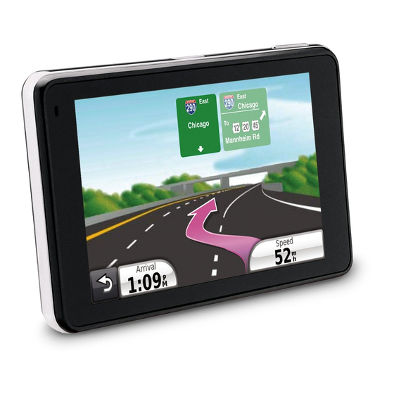
- Page 1 3700 series ® owner’s manual for use with these nüvi models: 3750, 3760, 3790...
- Page 2 Garmin. Garmin hereby grants permission to download a single copy of this manual onto a hard drive or other electronic storage medium to be viewed and to print one copy of...
-
Page 3: Table Of Contents
Table of Contents Getting Started ... Setting Up Your Device... Powering the Device... Mounting Your Device... Configuring The Device ... Front Cover... Acquiring Satellites ... Rotating the Screen ... About the Automatic Screen Lock ... Main Menu ... Using the On-screen Buttons ... Adjusting the Master Volume ... - Page 4 Table of Contents Speaking Commands ... About Voice Commands ... Setting your Wakeup Phrase ... Activating Voice Command... Tips for Using Voice Commands ... Navigating to a Popular Location Using Voice Commands ... Speaking an Address... About Icons and Tones ... About the Map Pages ...
- Page 5 Using the World Clock ... Using the Calculator ... Capturing Screen Shots ... Using the Unit Converter ... Traffic ... Traffic Receiver ... Subscription Activation ... Receiving Traffic Information ... About the Traffic Icon... Traffic on Your Route ... Viewing the Traffic Map ... Searching for Traffic Delays ...
- Page 6 Removing the Device, Cradle, and Mount ... nüMaps Guarantee ™ nüMaps Lifetime ™ Purchasing Additional Maps ... About Extras ... Contacting Garmin Product Support ... Registering Your Device ... Specifications ... Troubleshooting ... Index ... nüvi 3700 Series Owner’s Manual...
-
Page 7: Getting Started
Getting Started WARNING ‹ See the Important Safety and Product Information guide in the product box for product warnings and other important information. Setting Up Your Device When using your device for the first time, complete the following tasks. 1. Power your device (page 2. -
Page 8: Mounting Your Device
Getting Started Mounting The Device WARNING ‹ This product contains a lithium-ion battery. To prevent the possibility of personal injury or product damage caused by battery exposure to extreme heat, remove the device from the vehicle when exiting or store it out of direct sunlight. -
Page 9: Configuring The Device
Configuring The Device 1. Plug the vehicle power cable into the mount. 2. Plug the other end of the vehicle power cable into a power outlet in your vehicle. The device should turn on automatically if it is plugged in and the vehicle is running. -
Page 10: Acquiring Satellites
Getting Started Acquiring Satellites bars indicate satellite strength. 1. Go outdoors to an open area, away from tall buildings and trees. 2. If necessary, turn on your device. Acquiring satellite signals can take a few minutes. Rotating the Screen Rotate your device to view in horizontal (landscape) or vertical (portrait) mode. -
Page 11: Main Menu
Touch to stop a route. ➎ Touch to detour a route. ➏ Touch to make a call when connected to a compatible mobile phone. www.garmin.com/bluetooth for information. ➐ Touch to adjust the volume. ➑ Touch to open the menu of tools and settings. -
Page 12: Transportation Modes
Getting Started Transportation Modes Pedestrian Bicycle Automobile The device offers several transportation modes for navigation methods. Routing is calculated differently based on your mode. Changing Your Transportation Mode 1. Touch the transportation mode icon on the upper-left corner. 2. Select a mode. 3. -
Page 13: Using The On-Screen Keyboard
Finding Points of Interest in Pedestrian Mode While in pedestrian mode in certain cities, you may use cityXplorer maps to navigate using public transit. Go to www.garmin.com information on cityXplorer maps. 1. Select Pedestrian transportation mode (page 2. From the main menu, touch Where To? >... -
Page 14: Adding Points To The Active Route
Getting Started Adding Points to the Active Route 1. While navigating a route, touch to return to the main menu. 2. From the main menu, touch Where To?. 3. Select a category. 4. If necessary, select a subcategory. 5. Select a destination. 6. -
Page 15: Taking A Detour
Taking a Detour While navigating a route, you can use detours to avoid obstacles ahead of you, such as construction zones. NOTE: If the route you are currently taking is the only reasonable option, the device might not calculate a detour. -
Page 16: Finding Locations
Finding Locations Finding Locations The Where To? menu provides several different categories you can use to search for locations. To perform a simple search, see Finding an Address NOTE: Depending on the version of the built in map data on your device, the button names and the order of steps could be different than the steps below. -
Page 17: Using The Go! Page
Using the Go! Page The Go! page opens when you select a location to navigate to. ➊ ➋ ➌ ➍ ➏ ➊ Touch to call the selected location when your device is connected to phone, or to save the location to your favorites. ➋... -
Page 18: Setting A Home Location
Finding Locations Setting a Home Location You can set your home location for the location you return to most often. 1. From the main menu, touch Where To? > Go Home. 2. Select Enter My Address, Use My Current Location, or Recently Found. -
Page 19: About Favorites
Clearing the List of Recently Found Locations From the main menu, touch Where To? > Recently Found > > Clear > Yes. About Favorites vorites You can save locations in your Favorites so you can quickly find them and create routes to them. Your home location is also stored in Favorites. -
Page 20: Finding Parking
Finding Locations Editing Favorites 1. From the main menu, touch Where To? > Favorites. 2. Select a category. 3. Select a favorite. 4. Touch the information box. 5. Touch > Edit. 6. Select an option: • Name • Phone Number •... -
Page 21: Planning A Trip
Planning a Trip You can use Trip Planner to create and save a trip with multiple destinations. 1. From the main menu, touch Where To? > Trip Planner. 2. Touch 3. Touch Select Start Location. 4. Search for a location 5. -
Page 22: Using The Map Buttons
Finding Locations Using the Map Buttons 1. From the main menu, touch Where To? > Browse Map. 2. Touch anywhere on the map. • Touch and out. • Touch to switch between 2D and 3D views. • Touch to rotate the view. Browsing the Map by Touching the Screen •... -
Page 23: Setting A Simulated Location
Finding a Location Using the 1. From the main menu, touch Where To? > Browse Map. 2. Touch a location. An information box appears next to the location. 3. Touch the information box. 4. Select an option: > Save. • Touch 5. -
Page 24: Entering Coordinates
1. Connect your device to your computer (page 45). 2. Go to http://connect.garmin.com /photos. 3. Follow the instructions on the Web site to select and load pictures. 4. From the main menu, touch Where To? > Favorites >... -
Page 25: Speaking Commands
Speaking Commands About Voice Commands NOTE: The voice command feature is not available for all languages or regions. The voice command feature is available on some device models. The voice commands allow you to use your device by speaking the words you see on the screen or by speaking certain commands. -
Page 26: Tips For Using Voice Commands
Speaking Commands Tips for Using Voice Commands • Speak in a normal voice directed at the device. • Speak commands as they appear on the screen. • Respond to voice prompts from the device as needed. • To reduce the number of accidental Voice Command wake-ups, increase the length of your Wakeup Phrase. -
Page 27: Speaking An Address
Call • Speak to call the location when connected to a compatible mobile phone. Speaking an Address Voice Command. 1. Speak 2. Speak Find Address. 3. Follow the on-screen prompts. About Icons and Tones • The device sounds two tones when it enters and exits voice recognition mode. -
Page 28: About The Map
About the Map Pages Viewing the Map While Navigating Notice In no event shall Garmin be liable for any incidental, special, indirect, or consequential damages, including, without limitation, damages for any traffic fines or citations, whether resulting from the use, misuse, or inability to use the product or from defects in the product. -
Page 29: About Mytrends
➋ Touch to view the turn list. ➌ Touch to zoom in and zoom out. ➍ Touch to return to the main menu. ➎ Touch to display a different data field. ➏ Touch to view information for the location. ➐ Touch to view trip information. -
Page 30: Viewing The Turn List
About the Map Pages Resetting Trip Information 1. From the map, touch the Speed field. 2. Touch 3. Select an option: Touch Reset Trip Data to • reset the information on the trip computer, Touch Reset Max. Speed to • reset the maximum speed. -
Page 31: Viewing The Next Turn
Viewing the Next Turn Before you can view the next turn, you must be navigating a route. The next turn shows the turn on the map and the distance and time left before you reach the turn. Touch the turn indicator in the top left corner of the map. -
Page 32: Using The Pedestrian Navigation Map
➍ NOTE: cityXplorer maps are not included with your device. See http://my.garmin.com cityXplorer maps. icons indicate the navigation method used in each section of the route. For example, when you see bus at that point in the route. -
Page 33: Hands-Free Phone Calls
To determine whether your mobile phone with Bluetooth technology is compatible with the device, go to www.garmin .com/bluetooth. Pairing Your Devices The first time you use two devices together, you must pair them by establishing a relationship using a PIN or passkey. - Page 34 Hands-free Phone Calls Pairing Using the Device Settings 1. From the main menu of the device, touch Tools > Settings > Bluetooth > Enabled. 2. Touch Tools > Settings > Bluetooth > Add Phone. 3. Enable the Bluetooth component on your phone. 4.
-
Page 35: Receiving A Call
Receiving a Call • Touch Answer. The internal microphone is in the front of the device. Speak normally. • Touch Ignore to ignore the call. Using the Device During a Call During a call, appears. Depending on the screen shown on your device, the In Call icon could look different. -
Page 36: Dialing A Point Of Interest
Hands-free Phone Calls Dialing a Point of Interest 1. From the main menu, touch Phone > Points of Interest. 2. Search for a point of interest. 3. Touch Call. Dialing a Number 1. From the main menu, touch Phone > Dial. 2. -
Page 37: Placing Calls Using Voice Dial
Calling Home Before you can call home using the Call Home button, you must enter a phone number for your home location. (page 30). From the main menu, touch Phone > Call Home. Placing Calls Using Voice Dial Before you can place calls using voice dial, you may need to train your phone to recognize your voice dial commands. -
Page 38: Using The Tools
Using the Tools Using the Tools Viewing Current Location Information Use the Where Am I? page to view information about your current location. This feature is helpful if you need to tell emergency personnel your location. From the main menu, touch Tools >... -
Page 39: Maximizing Your Fuel Economy
Using ecoRoute 1. From the main menu, touch Tools > ecoRoute. 2. If prompted, enter fuel and mileage information. The first time you use the ecoRoute features, you must enter vehicle information. Calibrating the Fuel Economy Calibrate the fuel economy to receive more-accurate fuel reports for your specific vehicle and driving habits. -
Page 40: Viewing Fuel Economy Information
Using the Tools About Your ecoChallenge Score The leaf color on the ecoChallenge icon changes depending on your performance in the challenge. Overall—displays an average of the speed, acceleration, and braking score. Speed—displays your score for driving at your vehicle’s optimal speed for conserving fuel (45-60 mph for most vehicles). -
Page 41: Adjusting Your Vehicle Profile
Adjusting Your Vehicle Profile 1. From the main menu, touch Tools > ecoRoute > Vehicle Profile. 2. Select an option to manually adjust your fuel settings. • Fuel Type • City Fuel Economy • Hwy. Fuel Economy • Fuel Price TIP: For best results, calibrate your fuel economy (page... -
Page 42: Using The Picture Viewer
Using the Tools Using the Picture Viewer View pictures that you have stored in your device or on a memory card. page 44 for more information about loading pictures on your device. From the main menu, touch Tools > Picture Viewer. •... -
Page 43: Using The Calculator
Viewing the World Map From the main menu, touch Tools > World Clock > Nighttime hours appear in the shaded area. Using the Calculator From the main menu, touch Tools > Calculator. Capturing Screen Shots 1. From the main menu, touch Tools >... - Page 44 Using the Tools Setting Currency Conversion Rates Manually You can update the currency conversion rates manually so that you are always using the most- current rates. 1. From the main menu, touch Tools > Unit Converter. 2. Touch the box with a currency listed.
-
Page 45: Traffic
Traffic Notice Garmin is not responsible for the accuracy or timeliness of the traffic information. Your device can receive FM Traffic Message Channel (TMC) traffic content. For information about traffic receivers and coverage areas, go to www.garmin.com/traffic. The FM TMC traffic receiver, which... -
Page 46: Receiving Traffic Information
Traffic Receiving Traffic Information The vehicle power cable and the device must be in data range of an FM station transmitting traffic information. 1. Connect the traffic receiver to an external power source. 2. Connect the traffic receiver to the device. -
Page 47: Traffic On Your Route
Traffic on Your Route When calculating your route, the device examines the current traffic and automatically optimizes the route for the shortest time. If a severe traffic delay occurs on your route while you are navigating, the device automatically recalculates the route. You might still be routed through traffic if no better alternative routes exist. -
Page 48: About Offers
For North American units, touch 3. Write down the FM traffic receiver unit ID. 4. Go to www.garmin.com/fmtraffic to purchase a subscription and get a 25-character code. 5. Touch Next on the device. 6. Enter the code. 7. Touch Done. -
Page 49: Viewing Offers
Viewing Offers CAUTION ‹ Do not attempt to write down the coupon codes while driving. 1. Touch an offer that appears on the screen to search for the nearest location related to that offer. 2. If the offer includes an icon, touch the icon on the Go! page to receive a coupon code. -
Page 50: Data Management
You can purchase memory cards from an electronics supplier, or purchase preloaded MapSource detailed map data cards from your Garmin dealer. In addition to map and data storage, the memory card can be used to store files such as maps, images, geocaches, routes, waypoints, and custom POIs. -
Page 51: Connecting Your Device To Your Computer
Your Computer 1. Browse your computer for a file. 2. Highlight the file. 3. Click Edit > Copy. 4. Open the “Garmin” or memory card drive or volume. 5. Select Edit > Paste. The file appears in the list of files in the device memory or on the memory card. -
Page 52: Deleting Files
If you do not know the purpose of a file, do not delete it. Your device memory contains important system files that should not be deleted. 1. Open the “Garmin” drive or volume. 2. If necessary, open a folder or volume. -
Page 53: Customizing The Device
• Safe Mode—disables all functions that require significant operator attention and could become a distraction while driving. • Garmin Lock—locks the device (page 57). • About—displays the software version number, the unit ID number, and information on several other software features. -
Page 54: Automobile Navigation Settings
Customizing the Device Restoring the System Settings From the main menu, touch Tools > Settings > System > Restore. Automobile Navigation Settings From the main menu, touch Tools > Settings > Navigation > Automobile. • nüRoute (page ™ Map Detail—sets the level •... -
Page 55: Pedestrian Navigation Settings
Changing the Map Perspective 1. From the main menu, touch Tools > Settings > Navigation > Automobile > Map View. 2. Select an option: • Touch Track Up to display the map in two dimensions (2-D), with your direction of travel at the top. -
Page 56: Route Preferences
Customizing the Device Route Preferences From the main menu, touch Tools > Settings > Navigation > Automobile > nüRoute > Calculation Mode. The route calculation is based on road speeds and vehicle acceleration data for a given route. • Faster Time—calculates routes that are faster to drive but can be longer in distance. -
Page 57: Display Settings
Restoring the Original Navigation Settings From the main menu, touch Tools > Settings > Navigation > Restore. Display Settings From the main menu, touch Tools > Settings > Display. • Color Mode—sets a light background (Day), a dark background (Night), or automatically swithces between the two based on the sunrise btime and the sunset time for... -
Page 58: Language Settings
Customizing the Device Language Settings From the main menu, touch Tools > Settings > Language. • Voice Language—sets the language for voice prompts. • Text Language—sets all on-screen text to the selected language. NOTE: Changing the text language does not change the language of user-entered data or map data, such as street names. -
Page 59: Enabling Traffic
The traffic receiver is included in some device packages. From the main menu, Touch Tools > Settings > Traffic > Traffic > Enabled. About Traffic Subscriptions You can purchase additional subscriptions or a renewal if your subscription expires. Go to www.garmin.com/fmtraffic. >... -
Page 60: Restoring All Original Settings
Customizing the Device Viewing Traffic Subscriptions From the main menu, touch Tools > Settings > Traffic > Subscriptions. Restoring the Original Traffic Settings From the main menu, touch Tools > Settings > Traffic > Restore. Restoring All Original Settings From the main menu, touch Tools >... -
Page 61: Appendix
. When it loses satellite signals, the bars turn red or clear For more information about GPS, go to www.garmin.com/aboutGPS. nüvi 3700 Series Owner’s Manual Caring for Your Device • Avoid dropping your device and operating it in high-shock and high-vibration environments. -
Page 62: Cleaning The Outer Casing
Remove the residue left on the windshield by the suction cup. • Do not keep your unit in the glove compartment. • Register your device at http://my.garmin.com. • Use the Garmin Lock feature (page 57). nüvi 3700 Series Owner’s Manual... -
Page 63: Locking Your Device
PIN. NOTE: If you forget your PIN and your security location, you must send your device to Garmin to get it unlocked. You must also send a valid product registration or proof of purchase. -
Page 64: Updating The Software
If you are using a PC, double- click to open the myGarmin Agent download page. • If you are on a Mac computer, go to www.garmin.com/agent. • If the AutoPlay menu does not open go to www.garmin .com/agent. 3. Follow the on-screen instructions. -
Page 65: Changing The Fuse In The Vehicle Power Cable
To increase the accuracy of the battery gauge, fully discharge the battery and then fully charge it. Do not unplug the device until it is fully charged. Maximizing the Battery Life • Press and quickly release the power key to lock the screen and put the device in sleep mode. -
Page 66: Mounting On Your Dashboard
Appendix 3. Install a 2 A fast-blow fuse. 4. Verify that the silver tip is located in the end piece. Using a coin, replace the end piece. Mounting on Your Dashboard Notice The permanent mounting adhesive is extremely difficult to remove after it is installed. -
Page 67: Nümaps Guarantee
Lifetime For a one-time payment, you can receive up to four map updates each year for the life of your device. For more information, go to .garmin.com, and click on Maps. ™ Purchasing Additional Maps You can purchase additional maps for your device. -
Page 68: About Extras
Where To? > Extras. 2. Touch a category. Safety Cameras CAUTION ‹ Garmin is not responsible for the accuracy of, or the consequences of using, a custom point of interest or a safety camera database. Safety camera information is available in some locations. Go to http://my.garmin.com... -
Page 69: Contacting Garmin Product Support
Contacting Garmin Product Support You can contact Garmin Product Support if you have any questions about this product. • In the USA, go to www.garmin .com/support, or contact Garmin USA by phone at (913) 397.8200 or (800) 800.1020. • In the UK, contact Garmin (Europe) Ltd. -
Page 70: Specifications
Charging 32°F–113°F (0°C–45°C) temperature range Computer USB 2.0 full speed mass interface storage Operating Garmin system Charge time Up to 4 hours Power Input Vehicle power using included vehicle power cable or AC power using an optional accessory Usage... -
Page 71: Troubleshooting
Troubleshooting Problem My device is not acquiring satellite signals The suction cup will not stay on my windshield. The device does not charge in my vehicle. My battery does not stay charged for very long. How do I clear all of my user data? My battery gauge does not seem accurate... - Page 72 Bluetooth. The Bluetooth field must be set to Enabled. • Your phone must be turned on and be less than 33 feet (about 10 meters) away from your device. • Go to www.garmin.com/bluetooth for more help. nüvi 3700 Series Owner’s Manual...
- Page 73 Index Symbols 2-D, 3-D map view accessories 62–63 adding a stop additional maps addresses anti-theft feature audio version avoiding public transit types road types theft traffic battery maximizing battery life battery information 58, 65 nüvi 3700 Series Owner’s Manual Bluetooth technology 27–31 calling from Go! page...
- Page 74 (Favorites) using photos using the map free map updates fuse, changing Garmin Lock Garmin Product Support geocaching Go! page options nüvi 3700 Series Owner’s Manual go home about GPS settings simulator Help home...
- Page 75 Panoramio pictures parking pedestrian mode settings photo navigation loading pictures picture viewer Bluetooth Garmin Lock points of interest finding 6, 10 in pedestrian mode POI loader power button product support protecting your device...
- Page 76 Index public transit avoidances city maps recalculating routes recently found locations registering removing the mount renaming trips reporting map errors resetting home location the max speed trip data your device routes calculation off road 9, 50 stopping safe mode safety cameras alerts databse satellite signals...
- Page 77 troubleshooting turn-by-turn directions turning on and off the device turn list unit converter unit ID updating maps user data, deleting vehicle profile voice command activating icons and tones navigating with red icon tips for using wakeup phrase voice dial voice language voice mail nüvi 3700 Series Owner’s Manual volume...
- Page 80 For the latest free software updates (excluding map data) throughout the life of your Garmin products, visit the Garmin Web site at www.garmin.com. © 2010 Garmin Ltd. or its subsidiaries Garmin International, Inc. 1200 East 151 Street, Olathe, Kansas 66062, USA Garmin (Europe) Ltd.