Table of Contents
Advertisement
Quick Links
Advertisement
Table of Contents

Related Manuals for Navman 8084


Summary of Contents for Navman 8084
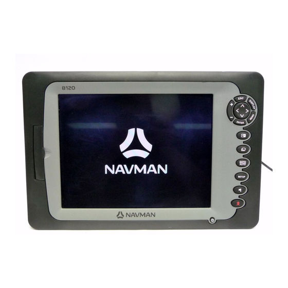
- Page 1 Navman 8120/8084 Installation and Operation Manual w w w . n a v m a n . c o m...
- Page 2 Copyright © 2006 NAVMAN New Zealand. All rights reserved. NAVMAN is a registered trademark of NAVMAN New Zealand. The 8120/8084 is set up with default units of feet, F (Fahrenheit), US gallons and knots. To change the units, see section 17-9.
-
Page 3: Table Of Contents
9-6 Gain and threshold ................. . 43 NAVMAN 8120/8084 Installation and Operation Manual... - Page 4 18-11 Using the radar guard zones ............... 70 NAVMAN 8120/8084 Installation and Operation Manual...
- Page 5 20-1 Installation: What else comes with my 8120/8084? ....... . .
- Page 6 The choice, location, and installation of transducers and other components of the system are critical to the performance of the system as intended. If in doubt, consult your NAVMAN dealer. To reduce the risk of misusing or misinterpreting this instrument, you must read and understand all aspects of this Installation and Operation Manual.
-
Page 7: Introduction
What to do when you add or remove fuel 13-1 Sounder Overview of the depth sounder Sounder Depth, bottom features, water features Sounder Fishfinder Sounder Other boats Track your buddy, polling other boats DSC VHF Distress calls DSC VHF (Continued next page) NAVMAN 8120/8084 Installation and Operation Manual... -
Page 8: Overview
Set up the radar guard zones 18-12 Radar 1-1 Overview The NAVMAN 8120/8084 is a rugged, highly • DSC/Buddy track functions require an integrated marine chartplotter and fishfinder. appropriate NAVMAN DSC VHF radio to be It is easy to use and has a high resolution installed. -
Page 9: Plug-In Cards
1-3 Plug-in cards The 8120/8084 can use two kinds of C-MAP™ CAUTION SD-Card plug-in cards: 1. Chart cards have chart details required Handle plug-in cards carefully. Keep for navigating in a particular region. them in their protective cases when not When you insert a chart card, the extra plugged into the 8120/8084. -
Page 10: Removing And Replacing The Display Unit
2 Hold the 8120/8084 in place on the 4 Store the 8120/8084 in a dry clean place. mounting bracket. Tilt it for best viewing, then hand tighten the knobs on the mounting bracket. Remove the dust cover. -
Page 11: Basic Operation
8120. – This key places a waypoint on the Active Chart Window. – Man overboard (MOB, see section 2-4). – Turn Instrument on and off (see section 2-2); adjust the backlighting (see section 2-3). NAVMAN 8120/8084 Installation and Operation Manual... - Page 12 Note: Display refers to ALL windows and the data header/Compass Window refers to a part of the display in which a particular function is shown e.g. The Chart window on a Chart + Sonar display. NAVMAN 8120/8084 Installation and Operation Manual...
-
Page 13: Using The Keys
Repeat this to change other letters or press ENTER numbers. 3 Press to accept the new value. Or ENTER press to ignore the changes. d) To change a slider value Press to decrease the value or to increase the value. NAVMAN 8120/8084 Installation and Operation Manual... -
Page 14: Turning On And Off / Auto Power
. To change only the chart ENTER When you have finished, press palette, see section 19-1. Tip: Press twice to give the brightest screen, with maximum backlight and Night mode off. NAVMAN 8120/8084 Installation and Operation Manual... -
Page 15: Man Overboard (Mob)
The Instrument has user settable alarms (see section 19-10). NAVMAN 8120/8084 Installation and Operation Manual... -
Page 16: Simulate Mode
1 The windows available depend on the optional sensors and instruments that are installed (see section 1-1). 2 Set up commonly used windows as favorites and press to switch between windows (see section 2-7-2). NAVMAN 8120/8084 Installation and Operation Manual... - Page 17 To show one of the other windows full-screen, press , select More... and select the DISPLAY window. Press to return from one of these windows to the previous window. NAVMAN 8120/8084 Installation and Operation Manual...
- Page 18 2-7-1 Multi window displays 3 Press ENTER Deleting a window from the display The 8120/8084 can show up to four windows at once, for example Chart, Sonar, Gauges 1 Press until the window you want to and Video: delete has a red border.
- Page 19 2-7-2 Favorite displays 3 Select where in the list to add the new favorite. If you select an existing favorite The 8120/8084 has a list of commonly used display then the new favorite will replace displays, called favorite displays. There can be the existing favorite in the list.
- Page 20 When you press 2-7-4 Compass to recall a favorite display, the 8120/8084 The chart, sonar and highway displays can recalls the favorite displays data header. show a compass at the top of the window.
-
Page 21: Navigation: Chart
Goto. MENU the chart or highway windows b or use navigation data displayed on the data header (see section 2-7-3) c or use COG and BRG on the compass (see section 2-7-4). NAVMAN 8120/8084 Installation and Operation Manual... - Page 22 Cancel MENU 3 Press to highlight the route to route. follow. Press ENTER 4 The Instrument asks for the direction to traverse the route. Select Forward (the order the route was created) or Reverse. NAVMAN 8120/8084 Installation and Operation Manual...
-
Page 23: Chart Window
K A typical waypoint (see section 6 ) The built-in world chart does not show enough detail for navigation. When you use the 8120/8084 to navigate, always use a chart card which covers the region. NAVMAN 8120/8084 Installation and Operation Manual... - Page 24 If the cursor has been moved in the last ten scroll the photo. seconds, then the position is the cursor’s Select Tide Station to display a tide chart for the position (see section 14). NAVMAN 8120/8084 Installation and Operation Manual...
-
Page 25: Distance And Bearing Calculator
It does not 7 Finally, press to return to the chart matter if this point is a waypoint or not. window. The window shows the bearing and length NAVMAN 8120/8084 Installation and Operation Manual... -
Page 26: Projected Course
Then if you return to harbour and visibility is poor, select the chart and navigate manually along the reference track back into the harbour. Record reference tracks in good conditions. NAVMAN 8120/8084 Installation and Operation Manual... -
Page 27: Video Window
3 To return the colors to their default settings, select Restore defaults. 4 Press Press to move the picture sideways Press to move the picture up and down Press to fi t the whole picture in the window NAVMAN 8120/8084 Installation and Operation Manual... -
Page 28: Navigation: Highway Window
The available icons are: danger radius of a danger waypoint the unit can sound an alarm (see section 19-10). A display option: Controls how the waypoint is displayed on the chart (see section 19-2): NAVMAN 8120/8084 Installation and Operation Manual... -
Page 29: Waypoints Window
1 In the waypoints window, press MENU select Create. 2 A new waypoint, with a default name and data, is created at the boat position. 3 Change the waypoint data if necessary (see section 6-2-7). NAVMAN 8120/8084 Installation and Operation Manual... - Page 30 6-2-9 Navigating to a waypoint 1 In the chart window, move the cursor to See section 3-1-2. the waypoint to delete. 2 Press and select Delete. MENU 3 Select Yes to confirm. NAVMAN 8120/8084 Installation and Operation Manual...
-
Page 31: Navigation: Routes
6-2-1). window You can not use a Danger waypoint in a While creating the route: route. Press to change the range; scroll the chart by moving the cursor to the edge of the chart. NAVMAN 8120/8084 Installation and Operation Manual... - Page 32 If the route has more 4 To remove a waypoint from the route: waypoints than will fit on the window, press to see them. i Move the cursor to the waypoint to remove from the route. NAVMAN 8120/8084 Installation and Operation Manual...
- Page 33 Edit. See section 3-1-3. 2 The selected route is displayed: the route name and a list of the waypoints. 3 Edit the route as described in section 6-2-1 B, starting at step 3. NAVMAN 8120/8084 Installation and Operation Manual...
-
Page 34: Satellites
5 m (15 ft) for 95% of the time. WAAS covers all of the USA and most of Canada. EGNOS will cover most of Western Europe when it becomes operational. NAVMAN 8120/8084 Installation and Operation Manual... -
Page 35: Satellite Window
When the pulse meets an object, such as a of pixels. fish or the bottom, it is partly reflected back up towards the boat as an echo. NAVMAN 8120/8084 Installation and Operation Manual... -
Page 36: Interpreting The Display
20 ft (6 m) it takes only about 25 seconds. D Soft bottoms such as mud, weed and sand show as narrow bands NAVMAN 8120/8084 Installation and Operation Manual... - Page 37 • Size of the fish, school of fish or other reflect the pulse, resulting in a strong echo. object. Frequency and cone width Water Depth ft/m Cone width at 50 kHz Cone width at 200 kHz 45˚ cone 11˚ cone NAVMAN 8120/8084 Installation and Operation Manual...
-
Page 38: Single And Dual Frequency Fishfinding
1 Go to a sonar window (see section 9). At 200 kHz, the narrow cone reduces any 2 Press , select Frequency and select MENU noise caused by air bubbles. 200 kHz, 50 kHz, or Mixed. NAVMAN 8120/8084 Installation and Operation Manual... - Page 39 50 kHz echoes on one sonar window, filling in detailed echoes in the centre of the sonar cone. A Narrow angle, more detailed 200 kHz cone B Wide angle, less detailed 50 kHz cone NAVMAN 8120/8084 Installation and Operation Manual...
- Page 40 Comparison of the same fish scenario displayed at different frequencies: 1 minute ago 30 seconds ago 50 kHz display 200 kHz display 200/50 Khz display Mixed display NAVMAN 8120/8084 Installation and Operation Manual...
-
Page 41: Fish Detection And Display
• Wave motion may result in distorted fish the cone-shaped ultrasonic pulse is displayed arches. as a fish arch. The 50 kHz frequency uses a wider cone than the 200 kHz frequency. This makes the fish arches easier to see. NAVMAN 8120/8084 Installation and Operation Manual... -
Page 42: Range
Manual range is useful if the bottom depth changes rapidly, because Auto range will cause the window to change range frequently. NAVMAN 8120/8084 Installation and Operation Manual... -
Page 43: Gain And Threshold
200 kHz. The gain window To display or change the current settings for gain, select a sonar window and press ENTER Select Threshold to display the thresholds. This window is called the gain window. NAVMAN 8120/8084 Installation and Operation Manual... -
Page 44: Sonar Fishfinding: Windows
B Optional compass (see section 2-7-4) C Depth D Color bar E Bottom F Range G Fish symbols with depth H Depth line The window scrolls from right (most recent echoes) to left (oldest echoes). NAVMAN 8120/8084 Installation and Operation Manual... -
Page 45: Sonar Zoom And Full Screen Zoom Displays
Bottom lock E Sonar history To turn Bottom lock on or off: 1 Press and select Bottom lock. MENU 2 Select On or Off. Or if Bottom lock is on, pressing will turn it off. NAVMAN 8120/8084 Installation and Operation Manual... -
Page 46: Sonar Bottom Window
A the 50 kHz sonar history on the left B the 200 kHz sonar history on the right. Gain can be set independently for each frequency (see section 9-6). Range applies to both frequencies (see section 9-5). NAVMAN 8120/8084 Installation and Operation Manual... -
Page 47: Sonar A-Scope Window
2 If necessary, select the sonar frequency to adjust the settings for. Press , select MENU Frequency and select 200 kHz or 50 kHz. NAVMAN 8120/8084 Installation and Operation Manual... -
Page 48: Gauges Window
ENTER items. iii Select a data item that is available on your system or select None to leave the field empty. 3 Repeat the above step to set the other data fields. 4 Press NAVMAN 8120/8084 Installation and Operation Manual... -
Page 49: Fuel Functions And Display
Each engine has a flow sensor installed to WARNING measure the engine’s fuel flow. The 8120/8084 use these flows, together with To ensure the fuel data is accurate: boat speed and engine RPM if available to When you add or remove fuel from a... -
Page 50: When You Add Or Remove Fuel
13-3 When you add or remove fuel When you add or remove fuel, you must tell Mostly use procedure B below when the 8120/8084, otherwise the fuel data will be adding fuel, but completely fill the tank meaningless. and follow procedure A about every tenth time you add fuel. -
Page 51: Low Fuel Alarm
Tip: You can select a different speed not accurate at low speeds. A paddlewheel sensor during a trip. sensor is more accurate than a pitot sensor at low speeds. NAVMAN 8120/8084 Installation and Operation Manual... - Page 52 If the boat travels for one hour, uses 3 gallons of fuel and has 50 gallons of fuel left: Speed Economy Range Using water speed: 10 knots 10 nm 3.3 nm / gal 165 nm Using ground speed: 14 knots 14 nm 4.7 nm / gal 235 nm NAVMAN 8120/8084 Installation and Operation Manual...
-
Page 53: Fuel Consumption Curves
13-6 Fuel consumption curves A fuel consumption curve shows fuel 6 The 8120/8084 then asks you to set the consumption (fuel used per unit of distance minimum RPM. Set the throttle to idle; travelled) and boat speed as a function on a multi engine boat set all engines to of engine RPM. - Page 54 (see sections 13-5-1 and 13-5). c More information about fuel consumption curves is available in NAVMAN’s Diesel flow sensors installation and operation manual. Using a curve Compare your boat’s performance now, at the current RPMs, with the boat’s...
-
Page 55: Calibration
. Repeat for the other engines. ENTER pockets, so the more fuel used, the more accurate the calibration. NAVMAN 8120/8084 Installation and Operation Manual... -
Page 56: Tides Window
M Height of cursor on the tide chart F Day N Moon phase for moon at the current time G Dusk on the chosen date H Tide height I Time cursor, a vertical dotted line. Press to move cursor sideways NAVMAN 8120/8084 Installation and Operation Manual... -
Page 57: User Card Window
Rplc all: Load all new waypoints all the Instrument’s routes or one of the which have the same names as existing Instrument’s tracks to one file on the user waypoints; the new waypoints replace card. the existing waypoints. NAVMAN 8120/8084 Installation and Operation Manual... - Page 58 Reading does not load any 2 Select sort by Name, Type or Time. file data into the Instrument. You should not need to do this. 1 Press and select Card. MENU 2 Select Read. NAVMAN 8120/8084 Installation and Operation Manual...
-
Page 59: Ais
To enable AIS from the system menu check the AIS box. (see section 16-3) 16-1 Viewing AIS Vessels A typical AIS window shows: A AIS Vessel B Dangerous Vessel C Projected Course D Data Box E Range Rings NAVMAN 8120/8084 Installation and Operation Manual... -
Page 60: Dangerous Vessels
Press either to clear the information. 16-2 Dangerous Vessels The 8120/8084 calculates the time of closest A dangerous vessel is indicated on the chart point of approach (TCPA) and closest point of by a red circle around the icon. approach (CPA) for each AIS vessel. - Page 61 (rx) list will store up to 10 messages. receiver. The oldest message is replaced when the list is full. Sorting Vessels Press , select Sort and select one of the options. This sorts the list based on the chosen category. NAVMAN 8120/8084 Installation and Operation Manual...
-
Page 62: Dsc/Buddy Track Windows
Distress: The position is the distress boat. waypoint, which is where the boat was when it sent the distress message. NAVMAN 8120/8084 Installation and Operation Manual... -
Page 63: Using The Windows
At the Distress or Poll windows: section 6-2-7). 1 Press to select a boat. 2 Press and select Delete all. All MENU boats are deleted from that window and any boat waypoints are deleted. NAVMAN 8120/8084 Installation and Operation Manual... -
Page 64: Radar
The scanner rotates through 360° so the system. Radar functions require an optional radar window shows all of the area around NAVMAN radar system to be installed. Three your boat within the range of the scanner, radar systems are available; 2 kW, 4 kW, or producing a map-like display called the PPI 6 kW. -
Page 65: Radar Modes
(blind spots) caused by obstructions such as funnels or • side lobe patterns (false echoes that masts will be minimized. If you are having appear as an arc or a broken arc) NAVMAN 8120/8084 Installation and Operation Manual... - Page 66 18-6-2 Changing the gain level relocate the scanner. Consult the Installation Use the radar gain level to adjust the Guide for your NAVMAN scanner or talk to sensitivity of the radar receiver. Ideally, your dealer or installer. the radar gain level should be set so that...
-
Page 67: Changing The Echo Expansion Setting
• Off. No echo expansion. that the quality of the display. • 1. Targets expanded x 2. • 2. Targets expanded x 3. NAVMAN 8120/8084 Installation and Operation Manual... -
Page 68: Turning The Target Trails On Or Off
6 The range and bearing of the target is shown at the bottom of the screen. 7 If you want to hide (or change the settings for) the range rings, North line, and/or heading line, press then select MENU Radar NAVMAN 8120/8084 Installation and Operation Manual... - Page 69 • °M/°T shows the EBL bearing relative to between two other locations, repeat the magnetic North or true North. sequence using the other VRM/EBL. This is shown in a different pattern in the radar window. NAVMAN 8120/8084 Installation and Operation Manual...
-
Page 70: Changing The Ppi Position
• Exit sounds the alarm only when a • 2 selects radar guard zone 2. target leaves the radar guard zone. • Both sounds the alarm when a target enters or leaves the radar guard zone. NAVMAN 8120/8084 Installation and Operation Manual... - Page 71 • BRG The bearing of a line drawn from your boat through the centre of the radar guard zone (in degrees). 4 Use < and > to select the parameter to change. 5 Then use ^ and v to change the parameter. NAVMAN 8120/8084 Installation and Operation Manual...
-
Page 72: Setting Up The 8120/8084
19 Setting up the 8120/8084 The 8120/8084 has a number of advanced Note: features which are set up through the setup 1 The Setup menu options are explained in menu. We recommend that you become the following sections. familiar with the operation of the unit using... -
Page 73: Setup > System
Select the backlight level for the keys and In the unlikely event of having to contact display (see also section 2-3) a NAVMAN dealer for service, quote the Night mode software version number and date. Night mode sets the palette for all windows... -
Page 74: Setup > Chart
This option is useful for navigating narrow harbours or rivers. The Instrument asks for a course deviation resolution; this is how much the boat direction needs to change to make the chart redraw. NAVMAN 8120/8084 Installation and Operation Manual... - Page 75 NMEA datum offset (see below). tracks, and lines of latitude and longitude on the Instrument chart window remain unchanged. WARNING When you change to a chart with a different datum, change the Instrument map datum again. NAVMAN 8120/8084 Installation and Operation Manual...
- Page 76 (requires a GPS fi x and an NT-MAX card) Land submenu Land features displays land features, for example regions, rivers, roads, railways, airports. Land elevation displays land contours, shaded like depths (requires an NT Max card) NAVMAN 8120/8084 Installation and Operation Manual...
-
Page 77: Setup > Sonar
Use this to select a color palette. Each color detail (see Section 9-2). within the palette represents a different echo strength, as shown on the sonar windows. NAVMAN 8120/8084 Installation and Operation Manual... -
Page 78: Setup > Radar
Head However, you are strongly recommended to use a good quality product (such as a NAVMAN HS02, HS03 or Autopilot) to provide heading data. If heading data is available from a compass, the options are: •... - Page 79 COG data. However, you are strongly recommended to use a good quality product Select the color scheme for the radar window. (such as a NAVMAN HS02, HS03 or Autopilot) Digit size to provide heading data. The range of the radar is shown on the radar There are two choices: window;...
- Page 80 (antenna). This means that the radar image is aligned Select Antenna height then enter the height of with the displayed chart and the compass. the antenna above sea level. NAVMAN 8120/8084 Installation and Operation Manual...
-
Page 81: Setup > Gps
A lower value averages measurements 20-11). over a shorter period of time. This gives DGPS Source the most accurate value but has the most Refer to section 20-5 fluctuations. Restart GPS A higher Refer to section 20-5 NAVMAN 8120/8084 Installation and Operation Manual... -
Page 82: Setup > Fuel
Flow filter: Most engines do not draw fuel from the tank at a steady rate. To give a stable fuel flow reading, the 8120/8084 calculates the flow by taking several measurements and averaging them. Use the Flow filter to set the period over which the fuel flow is averaged. -
Page 83: Setup > Track
Diesel sensors Fuel consumption curve If the boat has more than one diesel engine See section 13-6. and has NAVMAN diesel sensors, set up the Speed source diesel sensors: If both water speed and ground speed 1 In the fuel setup menu, select Diesel are available, select which to use for fuel sensors. -
Page 84: Setup > Ais
Vessels outside the radius selected from our Set the Closet Point of Approach limit. current position are filtered off the chart. Default value is set to 300 nm allowing all vessels to be displayed on the chart within that distance. NAVMAN 8120/8084 Installation and Operation Manual... -
Page 85: Setup > Logs
This option resets the total distance to zero. Reset engine hours Use this option to reset the engine hours to zero. This can be useful after an engine service or to count the engine hours between service intervals. NAVMAN 8120/8084 Installation and Operation Manual... -
Page 86: Setup > Alarms
Instrument can not receive the DGPS signal (beacon, WAAS or EGNOS) Loss of GPS fi x Instrument can not receive the GPS signal (this alarm is always on) Loss of AIS 8120/8084 is no longer receiving communication from the AIS receiver receiver (Alarm is on when AIS is enabled) communication... -
Page 87: Setup > Units
NMEA data Use this to specify which NMEA sentences will be transmitted (see section 20-12 and Appendix A). Lat/lon dps Select the number of decimal points used for latitude and longitude transmitted in NMEA sentences. NAVMAN 8120/8084 Installation and Operation Manual... -
Page 88: Setup > Calibrate
NavBus NavBus Group NavBus is the preferred method for Use this when a group of NAVMAN connecting the Instrument to other NAVMAN instruments are connected together using instruments. Select this if the instruments are NavBus, to specify a group of instruments connected using NavBus. -
Page 89: Setup > Time
The options are dd/MMM/yy, MMM/dd/yy, The difference between local time and UTC dd/MM/yy or MM/dd/yy. (GMT). Change local offset when daylight saving time starts and ends. The range is 0 to ± 13 hours, in 30 minute steps. NAVMAN 8120/8084 Installation and Operation Manual... -
Page 90: Setup > Favorites
Speed: The simulated boat speed to use. There are two choices for Mode: Route: The route to follow. 1 Normal Simulates the boat moving from the selected start point at the given speed and heading. NAVMAN 8120/8084 Installation and Operation Manual... -
Page 91: Installation
Ensure no connectors or exposed terminals are in wet area. If the cables supplied are too long, do not shorten the cable; instead coil the cable. Most cables can be extended with NAVMAN extension cables. Do not fit more than one extension cable. -
Page 92: Installation: What Else Comes With My 8120/8084
20-1 Installation: What else comes with my 8120/8084? NAVMAN GPS 1240 Antenna GPS 1240 Antenna bottom cone GPS 1240 Antenna gasket GPS 1240 mounting kit Sun cover for display unit Note: Place over display when not in use Front Bezel... -
Page 93: Installation: Options And Accessories
External alarms: Lights or sounders in the 20-10). boat to sound alarms through the boat (see Radar: For radar functions. A NAVMAN 2 kW, section 20-4). 4 kW or 6 kW radar system must be installed GPS or DGPS antenna: For GPS navigation, (see section 20-10). -
Page 94: Installation: The Display Unit
• For optimum performance and reliability Start by selecting a suitable mounting consider mounting the unit where it will position for the 8120/8084 display unit: not be unnecessarily exposed to direct • Consider the best possible position for sunlight, water and protected from other viewing and operating the 8120/8084. - Page 95 An alternative to flush mounting the the larger hole with the hole saw. 8120/8084 is to bracket mount the unit. This 3. Next cut all the way around the inside of method has the advantage that the display the cut-out line with a saw to remove the can be easily removed when it is not in use.
-
Page 96: Installation: Power/Data Cable
Instrument must add up the total fuel used (for example if NAVMAN petrol/gasoline fuel sensors are installed or if SmartCraft is installed without fuel tank level sensors). Otherwise wire for basic power (for more information, see section 2-2). -
Page 97: Installation: Gps Antenna
Follow the instructions For more information, contact your NAVMAN in the manual supplied with the antenna. dealer. Fit an optional NAVMAN extension cable if DGPS Source: required. Enables or disables the satellite based DGPS During setup, configure the Instrument for correction (see section 8). -
Page 98: Installation: Sonar Transducer
(see section 19-6) Normally, power the diesel sensors from the boat ignition switch. Then the Instrument does not need to be wired for auto power (see section 18-4). NAVMAN 8120/8084 Installation and Operation Manual... -
Page 99: Installation: Smartcraft
(see section 20-4). 20-10 Installation: Radar Install the NAVMAN radar as described in the Set up the radar as described in section 19-4. Installation Manual supplied with the radar. Carefully read the important safety and... -
Page 100: Installation: Other Navbus Instruments
NavBus instruments NavBus and the Instrument 20-11-1 Installation: NAVMAN VHF radio The 8120/8084 can: Fit and set up the optional NAVMAN VHF Display wind speed and direction from an radio (with NavBus functionality) following optional NAVMAN Wind instrument the instructions supplied with the radio. -
Page 101: Installation: Other Nmea Instruments
Select the language to use. radar is used. ii Change the data if necessary (see section 2-1) iii When the setup data is correct, press NAVMAN 8120/8084 Installation and Operation Manual... -
Page 102: Appendix A - Specifications
Depth acquisition time from startup: 8084 Size: 190 mm (7.48“) H x 285 mm (11.22“) W x Typically 2 seconds at 30 m (100 ft) 76.8 mm (3.02“) D. Allow 3 mm clearance on each Temperature: side for dust cover. - Page 103 Physical Dimensions NAVMAN 8120 NAVMAN 8084 NAVMAN 8120/8084 Installation and Operation Manual...
- Page 104 Sierra Leone 1960 S-JTSK South American 1969 South Asia Tananarive Observatory 1925 Timbalai 1948 Tokyo Tristan Astro 1968 Viti Levu 1916 Voirol 1874 Voirol 1960 Wake Island Astro 1952 Wake-Eniwetok 1960 WGS 84 Yacare Zanderij NAVMAN 8120/8084 Installation and Operation Manual...
-
Page 105: Appendix B - Troubleshooting
NAVMAN. If the product must be sent into a manual. service centre for repair, it is essential to send in the transducer(s) at the same time. -
Page 106: Gps Navigation Problems
Try installing a one-way valve between the e Fuel transducers wear out over time and fuel transducer and the fuel tank. should be replaced after every 5000 litres of fuel. NAVMAN 8120/8084 Installation and Operation Manual... -
Page 107: Sonar Fishfinding Problems
(0.6 m) from the bottom, the depth readings may become inconsistent and g Inspect the power cable from end to end erratic. for damage such as cuts, breaks, squashed or trapped sections. NAVMAN 8120/8084 Installation and Operation Manual... - Page 108 The Instrument may have Manual Range selected and the selected Range value is too high for the depth. Either change the Instrument to Auto Range or select another depth range (see section 8-5) NAVMAN 8120/8084 Installation and Operation Manual...
-
Page 109: Radar Problems
(see stronger the interference, the wider the section 18-6-4). interference lines. a Use the interference rejection feature to reduce interference patterns, and the width of the interference lines (see 19-4). NAVMAN 8120/8084 Installation and Operation Manual... -
Page 110: Appendix C Glossary And Navigation Data
The scale is shown in the top left corner of the radar window. DTN - Distance to the next position the 8120/8084 is navigating to, either a waypoint Range rings - Concentric circles extending or the cursor. from your boat (usually at the centre of... - Page 111 (see section 5). TTN - Time to the next position the Weather - An estimate of the weather based 8120/8084 is navigating to, either a waypoint on barometric pressure (requires NAVMAN or the cursor.
- Page 112 Velocity Made Good: The speed at which the boat is approaching the destination. Destination Destination Plotted DTG (distance) course (distance) VMG (speed) SOG (speed) Boat position CDI scale CDI scale (distance) Plotted (distance) course Boat position Start Start NAVMAN 8120/8084 Installation and Operation Manual...
-
Page 113: Appendix D Compliance Statements
(2) this device must accept any interference, including interference that may cause undesired operation of the device. Hereby, NAVMAN New Zealand, declares that this 8120/8084 is in compliance with the essential requirements and other relevant provisions of Directive 1999/5/EC. - Page 115 Thailand Uruguay Australia web: www.pronav.no Alvaro Burmudez, Nautica Thong Electronics (Thailand) Co. Ltd. NAVMAN Australia Pty. Limited Finland 923/588 Ta Prong Road, Mahachai, Puerto del Buceo Suite 2, 408 Victoria Road Vator Oy Muang, Samutsakhon 74000, Thailand. 11300 Montevideo, Uruguay.
- Page 116 Lat 36° 48.404’S Made in New Zealand MN000444C-G N av m a n 8120 / 8 0 8 4 I n s t a l l a t i o n a n d O p e r a t i o n M a n u a l...