
Related Manuals for Garmin GPS 18x Series


Summary of Contents for Garmin GPS 18x Series
-
Page 1: Specifications
GPS 18x TECHNICAL SPECIFICATIONS Garmin International, Inc. 1200 E. 151 Street Olathe, KS 66062 USA 190-00879-08, Revision B January 2008... - Page 2 Garmin. Garmin hereby grants permission to download a single copy of this manual onto a hard drive or other electronic storage medium to be viewed and to print one copy of this manual or of any revision hereto,...
-
Page 3: Table Of Contents
2.1 GPS 18x LVC & GPS 18x -5Hz Pinout......................8 2.2 GPS 18x LVC & GPS 18x -5Hz Wiring Diagrams..................8 3 Mechanical Characteristics & Mounting................10 4 GPS 18x PC, GPS 18x LVC, & GPS 18x-5Hz Software Interface ........12 4.1 Received NMEA 0183 Sentences .........................12 4.1.1 Almanac Information (ALM).......................... - Page 4 ....................21 Appendix B: Garmin Binary Output Format ................24 Appendix C: Changing the Baud Rate in Garmin Mode............28 Appendix D: GPS 18x PC/ LVC/18x-5Hz & Windows Serial Mouse Issue ......29 Appendix E: Sensor Configuration Software................31 Downloading the Sensor Configuration Software......................Selecting a Model ................................
-
Page 5: Introduction
Use these products at your own risk. To reduce the risk, carefully review and understand all aspects of these Technical Specifications before using the GPS 18x. When in actual use, carefully compare indications from the GPS to all available navigation sources including the information from other NAVAIDs, visual sightings, charts, etc. -
Page 6: Limited Warranty
Garmin retains the exclusive right to repair or replace the unit or software or offer a full refund of the purchase price at its sole discretion. SUCH REMEDY SHALL BE YOUR SOLE AND EXCLUSIVE REMEDY FOR ANY BREACH OF WARRANTY. -
Page 7: Overview
Garmin GPS receivers, the GPS 18x tracks multiple satellites at a time while providing fast time-to-first-fix, precise navigation updates (five times per second for the GPS 18x-5Hz, and once per second for the GPS 18x USB, 18x PC, and 18x LVC), and low power consumption. This generation of GPS sensors includes the capability of FAA Wide Area Augmentation System (WAAS) differential GPS. -
Page 8: Gps 18X Series
1.5 GPS 18x SERIES There are several different versions of GPS 18x available. Refer below for a list of the three major divisions of the GPS 18x Series. 1.5.1 GPS 18x USB The GPS 18x USB interfaces to a computer with an available USB port. Drivers are available for use on Windows computers. -
Page 9: Technical Specifications
GPS 18x PC: 0 Vdc to 5 Vdc (Asynchronous Serial, TIA-232-F (RS-232) Compatible Polarity) • GPS 18x LVC and GPS 18x-5Hz: 0 Vdc to Vin, between 4 and 5.5 Vdc (Asynchronous Serial, TIA-232-F (RS-232) Compatible Polarity) 1.6.2.4 GPS Receiver Sensitivity... -
Page 10: Environmental Characteristics
Refer to the Garmin Device Interface Specification found in the Garmin Device Interface SDK for information about the Garmin Interface and the Garmin USB Protocol. At the time of this printing, this document is located on the Garmin Web site at: www.garmin.com/support/commProtocol.html. -
Page 11: Gps 18X Pc, Gps 18X Lvc, & Gps 18X-5Hz Protocols
Measurement Pulse Output (or PPS) feature. • GPS 18x-5Hz: 5 Hz pulse synchronized with the time of fix. One of the five pulses will align with the UTC second boundary. The pulse width is programmable from 20 ms to 180 ms. The PGRMC sentence will indicate which pulse is at the top-of-the-second. -
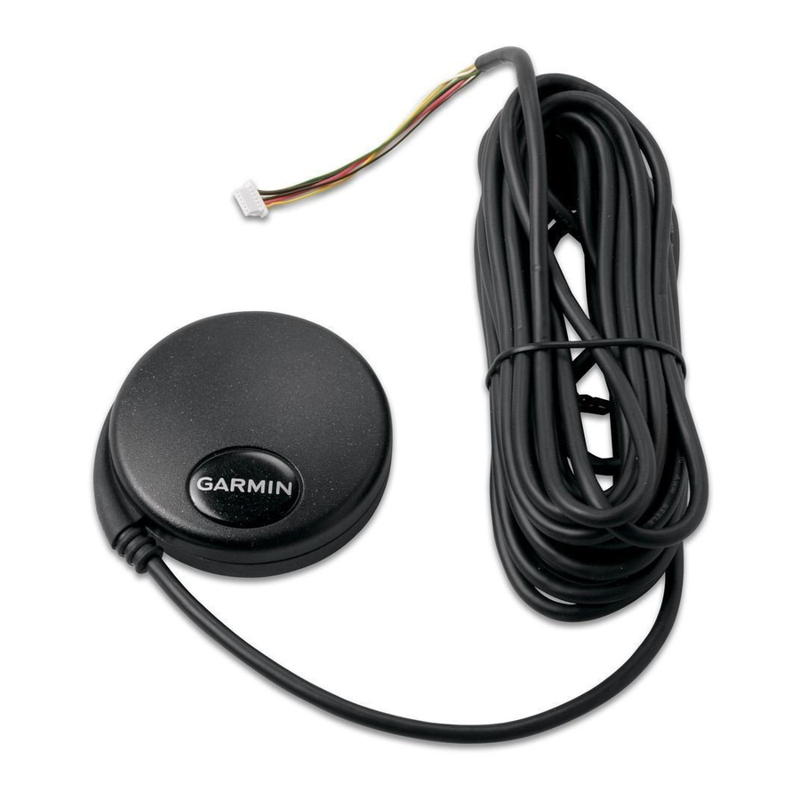
Page 12: Gpsx 18X Lvc & Gps 18X -5Hz Wiring And Pinouts
TIA-232-F (RS-232) polarity. The GPS 18x LVC/18x-5Hz wires are terminated with a six-wire connector that is used by Garmin for testing purposes. You can remove this connector without voiding your warranty (see section 1.2 Limited... -
Page 13: Figure 2. Pda Serial Port Interconnection
Figure 2. PDA Serial Port Interconnection Figure 3. Basic NMEA Device Interconnection 190-00879-08 GPS 18x Technical Specifications Rev. B Page 9... -
Page 14: Mechanical Characteristics & Mounting
Figure 6 shows the dimensions of our GPS 18x Flush Mount, part number 010-10453-00. Figure 4a. GPS 18x Bottom Case Dimensions, Under Mold UNITS: MILLIMETERS Figure 4b. -
Page 15: Figure 5. Gps 18X Suction Cup Mount Center Hole Dimensions
UNITS: MILLIMETERS Figure 5. GPS 18x Suction Cup Mount Center Hole Dimensions UNITS: MILLIMETERS Figure 6. GPS 18x Flush Mount Dimensions Figure 7. GPS 18x Flush Mount Center Hole Dimensions 190-00879-08 GPS 18x Technical Specifications Rev. B Page 11... -
Page 16: Gps 18X Pc, Gps 18X Lvc, & Gps 18X-5Hz Software Interface
GPS 18x PC, GPS 18x LVC, & GPS 18x-5Hz SOFTWARE INTERFACE The interface protocol design of the GPS 18x PC, LVC, and GPS 18x-5Hz products is based on the National Marine Electronics Association’s NMEA 0183 ASCII interface specification. This standard is fully defined in NMEA 0183, Version 2.30. -
Page 17: Sensor Initialization Information
Longitude hemisphere, E or W <5> Current UTC date, ddmmyy format <6> Current UTC time, hhmmss format for GPS 18x PC/LVC; hhmmss.s format for GPS 18x- <7> Receiver Command, A = Cold Start, R = Unit Reset 4.1.3 Sensor Configuration Information (PGRMC) The $PGRMC sentence provides information used to configure the GPS sensor’s operation. -
Page 18: Additional Sensor Configuration Information (Pgrmc1)
Current default values can also be obtained by sending $PGRMC1E to the GPS sensor. $PGRMC1,<1>,<2>,<3>,<4>,<5>,<6>,<7>,<8>,<9>,<10>,<11>,<12>,<13>*hh<CR><LF> <1> NMEA 0183 output time 1 to 900 (sec). Not applicable to GPS 18x-5Hz, which always outputs data at 5 Hz (200 ms) <2>... -
Page 19: Transmitted Nmea 0183 Sentences
The GPS 18x USB can use Spanner (an application that can provide NMEA output via a virtual COM port) to receive the same default NMEA sentences as the GPS 18x PC and LVC at a rate of once per second. Spanner is available for free on the Garmin web site. -
Page 20: Transmitted Time
GPS satellite information and are synchronized with the measurement pulse output. The GPS 18x-5Hz outputs a UTC with a tenths-of-a-second precision: 123456.8, for example. The GPS sensor uses information obtained from the GPS satellites to add or delete UTC leap seconds and correct the transmitted date and time of day. -
Page 21: Global Positioning System Fix Data (Gga)
4.2.4 Global Positioning System Fix Data (GGA) $GPGGA,<1>,<2>,<3>,<4>,<5>,<6>,<7>,<8>,<9>,M,<10>,M,<11>,<12>*hh<CR><LF> <1> UTC time of position fix, hhmmss format for GPS 18x PC or LVC; hhmmss.s format for GPS 18x-5Hz <2> Latitude, ddmm.mmmm format for GPS 18x PC/LVC; ddmm.mmmmm for GPS 18x-5Hz (leading zeros will be transmitted) <3>... -
Page 22: Recommended Minimum Specific Gps/Transit Data (Rmc)
Track Made Good and Ground Speed (VTG) $GPVTG,<1>,T,<2>,M,<3>,N,<4>,K,<5>*hh<CR><LF> <1> True course over ground, GPS 18x PC and LVC: 000 to 359 degrees, GPS 18x-5Hz: 000.0 to 359.9 degrees(leading zeros will be transmitted) <2> Magnetic course over ground, 000 to 359 degrees, GPS 18x-5Hz: 000.0 to 359.9 degrees(leading zeros will be transmitted) <3>... -
Page 23: Gps Fix Data Sentence
Time dilution of precision, 0 to 9 (rounded to nearest integer value) 4.2.12 Map Datum (PGRMM) The Garmin Proprietary sentence $PGRMM gives the name of the map datum currently in use by the GPS sensor. This information is used by the Garmin MapSource real-time plotting application. -
Page 24: Dgps Beacon Information
PPS signal, beginning with the GPRMC sentence as the lead sentence in any particular NMEA 0183 record. Regardless of the selected baud rate, the information transmitted by the GPS 18x series products is referenced to the pulse immediately preceding the NMEA 0183 RMC sentence. -
Page 25: Appendix A: Earth Datum List
APPENDIX A: EARTH DATUM LIST The following is a list of the Garmin GPS 18x Earth datum indices and the corresponding earth datum name (including the area of application): ADINDAN–Ethiopia, Mali, Senegal, Sudan AUSTRALIAN GEODETIC 1984–Australia, Tasmania Island ASTRO DOS 71/4–St. Helena Island ASTRONOMIC STATION 1952–Marcus Island... - Page 26 OLD EGYPTIAN–Egypt OLD HAWAIIAN–Mean Value OMAN–Oman PICO DE LAS NIEVES–Canary Islands PITCAIRN ASTRO 1967–Pitcairn Island PUERTO RICO–Puerto Rico, Virgin Islands QATAR NATIONAL–Qatar QORNOQ–South Greenland REUNION–Mascarene Island ROME 1940–Sardinia Island RT 90–Sweden 190-00879-08 GPS 18x Technical Specifications Rev. B Page 22...
- Page 27 VITI LEVU 1916–Viti Levu Island (Fiji Islands) WAKE-ENIWETOK 1960–Marshall Islands WORLD GEODETIC SYSTEM 1972 WORLD GEODETIC SYSTEM 1984 ZANDERIJ–Surinam CH-1903–Switzerland Hu-Tzu-Shan Indonesia 74 Austria Potsdam Taiwan–modified Hu-Tzu-Shan GDA–Geocentric Datum of Australia Dutch 190-00879-08 GPS 18x Technical Specifications Rev. B Page 23...
-
Page 28: Appendix B: Garmin Binary Output Format
Web site: www.garmin.com/support/commProtocol.html. Note: For the GPS 18x-5Hz, a baud rate of 9600 is not high enough to transmit all of the packets (since they are output at a 5 Hz rate). You will need to change the baud rate to at least 38400 to be able to transmit all of the packets. - Page 29 (USB Transport ID, 1 byte unsigned, 4 bytes reserved) - 0x72 0x00 0x00 0x00 (Record ID, 2 bytes unsigned, 4 bytes reserved) - 0x54 0x00 0x00 0x00 (Number of data bytes, 4 bytes unsigned) - 12 cpo_sat_data records 190-00879-08 GPS 18x Technical Specifications Rev. B Page 25...
- Page 30 Longitude (radians) lon_vel Longitude velocity (meters/second) lat_vel Latitude velocity (meters/second) alt_vel Altitude velocity (meters/second) msl_hght Height (mean sea level) (meters) leap_sec UTC leap seconds grmn_days Garmin days (days since December 31, 1989) 190-00879-08 GPS 18x Technical Specifications Rev. B Page 26...
- Page 31 = DAT; in_que[ in_que_ptr++ ] = data; else if ( rx_state == ETX ) if ( data == DLE_BYTE ) rx_state = DLE; if ( in_que_ptr > 255 ) in_que_ptr = 0; 190-00879-08 GPS 18x Technical Specifications Rev. B Page 27...
-
Page 32: Appendix C: Changing The Baud Rate In Garmin Mode
APPENDIX C: CHANGING THE BAUD RATE IN GARMIN MODE In certain cases, you may need to change the default baud rate of your Garmin GPS receiver while in Garmin mode. Follow these steps to temporarily change the baud rate. Refer to the Garmin Device Interface Specification found in the Garmin Device Interface SDK for details on how to form and parse Garmin packets. -
Page 33: Appendix D: Gps 18X Pc/ Lvc/18X-5Hz & Windows Serial Mouse Issue
Appendix B: Garmin Binary Output Format. If you wish to use a different navigation software application with your GPS 18x PC, you will need to de-select the “Binary Output Data” option that is discussed in Solution 3 below. Solution 1: The easiest solution is to disable the Serial BallPoint mouse in the Device Manager. This solution assumes that you do not need to use a Serial BallPoint mouse with your computer. - Page 34 4. Select the serial port to which the GPS 18x is connected. Select Auto to have the program automatically determine the baud rate, or select Manual to manually select the baud rate of the GPS 18x. Click OK when done.
-
Page 35: Appendix E: Sensor Configuration Software
Selecting a Model After opening the program (snsrcfg.exe), the Set Base Model to… Window appears. Select the radio button next to the type of Garmin sensor you are configuring. Connecting to the Sensor After selecting the type of sensor, the following window opens. This is the Main Interface Screen for the program. -
Page 36: File Menu
NMEA Sentence Selections (F7): Displays the NMEA Sentence Selections Window. If the sentence is enabled, a check mark appears in the box to the left of the sentence name. Click the box to enable or disable to the sentence. 190-00879-08 GPS 18x Technical Specifications Rev. B Page 32... -
Page 37: View Menu
Switch to NMEA Mode (F10): Switches the unit to NMEA Mode. The sensor must be in NMEA Mode when connected to this software. Switch to Garmin Mode (F11): Switches the unit to Garmin Mode. Update Software (F12): After you have downloaded a new software version for the sensor, you can update the sensor with the new software.