Sign In
Upload
Manuals
Brands
Volvo Penta Manuals
Marine Equipment
Glass Cockpit
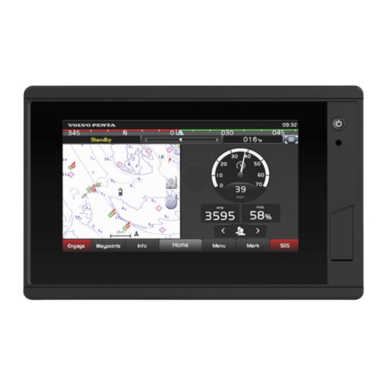
Volvo Penta Glass Cockpit System Manuals
Manuals and User Guides for Volvo Penta Glass Cockpit System. We have
4
Volvo Penta Glass Cockpit System manuals available for free PDF download: Owner's Manual
Volvo Penta Glass Cockpit Owner's Manual (134 pages)
Brand:
Volvo Penta
| Category:
Control Systems
| Size: 5 MB
Table of Contents
Table of Contents
3
Introduction
13
Device Overview
13
Status Icons
13
Using the Touchscreen
13
On-Screen Buttons
13
Locking and Unlocking the Touchscreen
14
Tips and Shortcuts
14
Protective Cover
14
Accessing Owner's Manuals on the Chartplotter
14
Accessing the Manuals from the Web
14
Garmin Support Center
15
Memory Cards
15
Inserting Memory Cards (8X10/8X12/8X16)
15
Inserting a Memory Card (8X17/8X22/8X24/87Xx/ 9X19/9X22/9X24/9X27)
16
Acquiring GPS Satellite Signals
16
Selecting the GPS Source
16
Customizing the Chartplotter
16
Home Screen
16
Pinning a Feature Button
17
Rearranging the Category Items
17
Menu Bar
17
Hiding and Showing the Menu Bar
17
Using the My Vessel Menu
17
Setting the Vessel Type
18
Adjusting the Backlight
18
Adjusting the Color Mode
18
Adjusting the Color Theme
18
Customizing Pages
18
Creating a New Combination Page
18
Adding a Smartmode Layout
18
Customizing the Layout of a Smartmode or Combination Page
18
Deleting a Combination Page
19
Customizing the Data Overlays
19
Linking a Layout to the Control and Joystick Buttons
19
Resetting the Station Layouts
19
Customizing the Startup Screen
19
Presets
19
Managing Presets
20
Saving a New Preset
20
Controlling the Chartplotter
20
Voice Control
20
Changing the Voice Control Language
20
Supported Headsets
20
Pairing a Wireless Headset with a Garmin Chartplotter
20
Using a Wireless Headset with a Garmin Chartplotter
20
Chartplotter Voice Commands
20
GRID Remote Control
22
Pairing the GRID Device with the Chartplotter from the Chartplotter
22
Pairing the GRID Device with the Chartplotter from the GRID Device
23
Pairing the GRID 20 Device with the Chartplotter from the GRID 20 Device
23
Rotating the GRID Remote Input Device
23
Activecaptain App
23
Activecaptain and Garmin Bluenet Considerations
23
Activecaptain Roles
23
Getting Started with the Activecaptain App
24
Enabling Smart Notifications
24
Receiving Notifications
24
Managing Notifications
25
Making Notifications Private
25
Updating Software with the Activecaptain App
25
Updating Charts with Activecaptain
25
Chart Subscriptions
26
Communication with Wireless Devices
26
Wi-Fi Network
26
Setting up the Wi-Fi Network
26
Connecting a Wireless Device to the Chartplotter
26
Changing the Wireless Channel
26
Changing the Wi-Fi Host
26
Wireless Remote Control
26
Pairing the Wireless Remote Control with the Chartplotter
26
Turning on and off the Remote Backlight
26
Disconnecting the Remote Control from All Chartplotters
27
Wireless Wind Sensor
27
Connecting a Wireless Sensor to the Chartplotter
27
Adjusting the Wind Sensor Orientation
27
Viewing Boat Data on a Garmin Watch
27
Viewing Boat Data on a Garmin Nautix Device
27
Charts and 3D Chart Views
27
Detailed Charts
28
Activating a Marine Chart Subscription
28
Purchasing a Chart Subscription with Activecaptain
28
Renewing Your Subscription
28
Navigation Chart and Fishing Chart
28
Chart Symbols
29
Zooming in and out Using the Touchscreen
29
Measuring a Distance on the Chart
29
Creating a Waypoint on the Chart
29
Viewing Location and Object Information on a Chart
29
Viewing Details about Navaids
29
Navigating to a Point on the Chart
29
Premium Chart Features
30
Fish Eye 3D Chart View
30
Viewing Tide Station Information
30
Animated Tide and Current Indicators
30
Showing Tides and Current Indicators
31
Showing Satellite Imagery on the Navigation Chart
31
Viewing Aerial Photos of Landmarks
31
Automatic Identification System
31
AIS Targeting Symbols
31
Heading and Projected Course of Activated AIS Targets
32
Viewing a List of AIS Threats
32
Activating a Target for an AIS Vessel
32
Viewing Information about a Targeted AIS Vessel
32
Deactivating a Target for an AIS Vessel
32
Showing AIS Vessels on a Chart or 3D Chart View
32
Setting the Safe-Zone Collision Alarm
33
AIS Aids to Navigation
33
AIS Distress Signals
34
Turning off AIS Reception
34
Chart Menu
34
Chart Layers
34
Chart Layer Settings
35
Depth Layer Settings
35
My Vessel Layer Settings
35
Laylines Settings
35
User Data Layer Settings
35
Other Vessels Layer Settings
36
Water Layer Settings
36
Depth Range Shading
36
Weather Layer Settings
36
Radar Overlay Settings
36
Chart Settings
37
Fish Eye 3D Settings
37
Supported Maps
37
Garmin Quickdraw Contours Mapping
37
Mapping a Body of Water Using the Garmin Quickdraw Contours Feature
38
Adding a Label to a Garmin Quickdraw Contours Map
38
Garmin Quickdraw Community
38
Connecting to the Garmin Quickdraw Community with Activecaptain
38
Downloading Garmin Quickdraw Community Maps Using Activecaptain
38
Sharing Your Garmin Quickdraw Contours Maps with the Garmin Quickdraw Community Using Activecaptain
38
Garmin Quickdraw Contours Settings
38
Navigation with a Chartplotter
39
Basic Navigation Questions
39
Route Color Coding
39
Destinations
40
Searching for a Destination by Name
40
Selecting a Destination Using the Navigation Chart
40
Searching for a Marine Services Destination
40
Searching for a Volvo Penta Dealer
40
Setting and Following a Direct Course Using Go to
40
Stopping Navigation
40
Waypoints
40
Marking Your Present Location as a Waypoint
41
Creating a Waypoint at a Different Location
41
Marking a man Overboard or Other SOS Location
41
Projecting a Waypoint
41
Viewing a List of All Waypoints
41
Editing a Saved Waypoint
41
Moving a Saved Waypoint
41
Browsing for and Navigating to a Saved Waypoint
41
Deleting a Waypoint or an MOB
42
Deleting All Waypoints
42
Routes
42
Creating and Navigating a Route from Your Present Location
42
Creating and Saving a Route
42
Viewing a List of Routes and Auto Guidance Paths
42
Editing a Saved Route
42
Finding and Navigating a Saved Route
42
Browsing for and Navigating Parallel to a Saved Route
43
Initiating a Search Pattern
43
Deleting a Saved Route
43
Deleting All Saved Routes
43
Auto Guidance
43
Setting and Following an Auto Guidance Path
44
Creating and Saving an Auto Guidance Path
44
Adjusting a Saved Auto Guidance Path
44
Canceling an Auto Guidance Calculation in Progress
44
Setting a Timed Arrival
44
Auto Guidance Path Configurations
44
Adjusting the Distance from Shore
44
Tracks
45
Showing Tracks
45
Setting the Color of the Active Track
45
Saving the Active Track
45
Viewing a List of Saved Tracks
45
Editing a Saved Track
45
Saving a Track as a Route
45
Browsing for and Navigating a Recorded Track
45
Deleting a Saved Track
46
Deleting All Saved Tracks
46
Retracing the Active Track
46
Clearing the Active Track
46
Managing the Track Log Memory During Recording
46
Configuring the Recording Interval of the Track Log
46
Boundaries
46
Creating a Boundary
46
Converting a Route to a Boundary
46
Converting a Track to a Boundary
46
Setting a Boundary Alarm
47
Disabling All Boundary Alarms
47
Deleting a Boundary
47
Deleting All Saved Waypoints, Tracks, Routes, and Boundaries
47
Sailing Features
47
Setting the Vessel Type for Sailing Features
47
Sail Racing
47
Starting Line Guidance
47
Setting the Starting Line
47
Using the Starting Line Guidance
47
Starting the Race Timer
48
Stopping the Race Timer
48
Setting the Distance between the Bow and the GPS Antenna
48
Laylines Settings
48
Polar Tables
48
Importing a Polar Table Manually
48
Showing Polar Data in Data Fields
48
Setting the Keel Offset
49
Heading Line and Angle Markers
49
Setting the Heading Line and Angle Markers
49
Viewing Sailing Vessel Data
50
Water Sport Controls
50
Creating a Water Sports User Preset
50
Renaming a User Preset Button
50
Setting the Boat RPM or Speed
50
Setting the Speed Source
50
Adjusting the Trim Tabs
50
Adjusting the Power Trim
51
Adjusting the Ballast Tank Levels
51
Ballast Tank Tips
51
Turning on the Trim Assist Feature
51
Adjusting the Boat Load
51
Sonar Fishfinder
51
Stopping the Transmission of Sonar Signals
51
Traditional Sonar View
51
Split-Frequency Sonar View
51
Garmin Clearvü Sonar View
52
Garmin Sidevü Sonar View
52
Sidevü Scanning Technology
52
Measuring Distance on the Sonar Screen
52
Panoptix Sonar Views
53
Livevü down Sonar View
53
Livevü Forward Sonar View
53
Realvü 3D Forward Sonar View
53
Realvü 3D down Sonar View
53
Realvü 3D Historical Sonar View
54
Livevü Layer
54
True Motion
54
Garmin Frontvü Sonar View
54
Triple Beam Sonar View
55
Livescope Sonar View
55
Zooming in a Panoptix Livevü or Livescope Sonar View
55
Perspective View
55
Sonar Views in Combo Screens
55
Selecting the Transducer Type
56
Selecting a Sonar Source
56
Renaming a Sonar Source
56
Sonar Sharing
56
Synchronizing Sonar Scroll Rates
56
Pausing and Resuming the Sonar Display
56
Viewing Sonar History
57
Creating a Waypoint on the Sonar Screen
57
Adjusting the Level of Detail
57
Adjusting the Color Intensity
57
Sonar Setup
57
Setting the Zoom Level on the Sonar Screen
58
Enabling a Split Zoom Sonar View
58
Setting the Scroll Speed
58
Adjusting the Range
58
Sonar Noise Rejection Settings
58
Sonar Appearance Settings
59
Sonar Alarms
59
Advanced Sonar Settings
60
Transducer Installation Settings
60
Sonar Frequencies
60
Selecting the Transducer Frequency
61
Creating a Frequency Preset
61
Turning on the A-Scope
61
Panoptix Sonar Setup
61
Adjusting the Realvü Viewing Angle and Zoom Level
61
Adjusting the Realvü Sweep Speed
61
Livevü Forward and Garmin Frontvü Sonar Settings
62
Setting the Livevü and Garmin Frontvü Transducer Transmit Angle
62
Setting the Garmin Frontvü Depth Alarm
62
Livevü and Garmin Frontvü Appearance Settings
62
Livevü and Garmin Frontvü Layout Settings
63
Realvü Appearance Settings
63
Panoptix Transducer Installation Settings
63
Setting the Bow Offset
63
Calibrating the Compass
64
Livescope and Perspective Sonar Settings
64
Livescope and Perspective Sonar Setup
64
Livescope and Perspective Appearance Settings
64
Livescope and Perspective Layout Settings
65
Livescope and Perspective Transducer Installation Settings
65
Radar
65
Radar Interpretation
65
Radar Overlay
66
Radar Overlay and Chart Data Alignment
66
Transmitting Radar Signals
66
Stopping the Transmission of Radar Signals
66
Setting up the Timed Transmit Mode
66
Enabling and Adjusting a Radar no Transmit Zone
66
Adjusting the Radar Range
66
Tips for Selecting a Radar Range
67
Motionscope Doppler Radar Technology
67
Echo Trails
69
Radar Settings
70
Selecting a Different Radar Source
72
Opening the Autopilot Screen
73
Engaging the Autopilot
74
Steering Patterns
74
Engaging and Disengaging Low Speed Autopilot Mode
76
Enabling the Autopilot Controls on a Garmin Watch
76
Customizing the Autopilot Button Actions
76
Controlling the Autopilot with a GRID 20
76
Remote Control
76
Reactor™ Autopilot Remote Control
76
Pairing a Reactor Autopilot Remote Control with a Chartplotter
76
Changing the Functions of the Reactor Autopilot Remote Control Action Keys
76
Updating the Reactor Autopilot Remote Control Software
76
Power Steering Mode
77
Enabling Power Steering Mode
77
Humphree Interceptor System Control
77
Adjusting the Active Trim
77
Adjusting the Active Trim Sensitivity
78
Adjusting the Load Compensation
78
Force® Trolling Motor Control
78
Connecting to a Trolling Motor
78
Adding the Trolling Motor Controls to Screens
79
Trolling Motor Control Bar
79
Trolling Motor Settings
79
Assigning a Shortcut to the Trolling Motor Remote Control Shortcut Keys
79
Calibrating the Trolling Motor Compass
80
Setting the Bow Offset
80
Calibrating the Steering Alignment
80
Advertisement
Volvo Penta Glass Cockpit Owner's Manual (110 pages)
Brand:
Volvo Penta
| Category:
GPS
| Size: 4 MB
Table of Contents
Section 1
3
Table of Contents
3
Section 2
10
Introduction
13
Device Overview
13
On-Screen Buttons
13
Status Icons
13
Using the Touchscreen
13
Locking and Unlocking the Touchscreen
14
Tips and Shortcuts
14
Protective Cover
14
Accessing Owner's Manuals on the Chartplotter
14
Downloading the Manuals from the Web
14
Garmin Support Center
14
Memory Cards
15
Inserting a Memory Card (8X17/8X22/8X24/87Xx)
15
Inserting Memory Cards (8X10/8X12/8X16)
15
Acquiring GPS Satellite Signals
15
Selecting the GPS Source
15
Customizing the Chartplotter
15
Home Screen
15
Adding an Item to Favorites
16
Customizing the Home Screen
16
Customizing Pages
16
Customizing the Layout of a Smartmode or Combination Page
16
Adding a Smartmode Layout
17
Creating a New Combination Page
17
Customizing the Data Overlays
17
Customizing the Startup Screen
17
Deleting a Combination Page
17
Recommended Startup Image Dimensions
17
Linking a Layout to the Control and Joystick Buttons
18
Resetting the Station Layouts
18
Presets
18
Managing Presets
18
Saving a New Preset
18
Setting the Vessel Type
18
Adjusting the Backlight
18
Adjusting the Color Mode
19
Turning on the Chartplotter Automatically
19
Automatically Turning off the System
19
Activecaptain App
19
Activecaptain Roles
19
Getting Started with the Activecaptain App
19
Enabling Smart Notifications
20
Making Notifications Private
20
Managing Notifications
20
Receiving Notifications
20
Updating Software with the Activecaptain App
20
Updating Charts with Activecaptain
21
Communication with Wireless Devices
21
Wi-Fi Network
21
Changing the Wi-Fi Host
21
Changing the Wireless Channel
21
Connecting a Wireless Device to the Chartplotter
21
Setting up the Wi-Fi Wireless Network
21
Wireless Remote Control
22
Disconnecting the Remote from All Chartplotters
22
Pairing the Wireless Remote Control with the Chartplotter
22
Turning on and off the Remote Backlight
22
Wireless Wind Sensor
22
Adjusting the Wind Sensor Orientation
22
Connecting a Wireless Sensor to the Chartplotter
22
Viewing Boat Data on a Garmin Watch
22
Viewing Boat Data on a Garmin Nautix Device
22
Charts and 3D Chart Views
23
Navigation Chart and Fishing Chart
23
Chart Symbols
23
Zooming in and out Using the Touchscreen
23
Creating a Waypoint on the Chart
24
Measuring a Distance on the Chart
24
Navigating to a Point on the Chart
24
Viewing Details about Navaids
24
Viewing Location and Object Information on a Chart
24
Premium Charts
24
Animated Tide and Current Indicators
25
Fish Eye 3D Chart View
25
Showing Satellite Imagery on the Navigation Chart
25
Showing Tides and Current Indicators
25
Viewing Tide Station Information
25
Viewing Aerial Photos of Landmarks
26
Automatic Identification System
26
Activated AIS Targets
26
AIS Targeting Symbols
26
Heading and Projected Course of
26
Activating a Target for an AIS Vessel
27
AIS Aids to Navigation
27
Deactivating a Target for an AIS Vessel
27
Setting the Safe-Zone Collision Alarm
27
Viewing a List of AIS and MARPA Threats
27
Viewing Information about a Targeted AIS Vessel
27
AIS Distress Signal Device Targeting Symbols
28
AIS Distress Signals
28
Enabling AIS Transmission Test Alerts
28
Navigating to a Distress Signal Transmission
28
Turning off AIS Reception
28
Chart Menu
28
Chart Layer Settings
29
Chart Layers
29
Depth Layer Settings
29
Laylines Settings
29
My Vessel Layer Settings
29
Depth Range Shading
30
Other Vessels Layer Settings
30
User Data Layer Settings
30
Water Layer Settings
30
Weather Layer Settings
30
Chart Settings
31
Fish Eye 3D Settings
31
Radar Overlay Settings
31
Supported Maps
31
Garmin Quickdraw Contours Mapping
31
Mapping a Body of Water Using the Garmin Quickdraw Contours Feature
32
Adding a Label to a Garmin Quickdraw Contours Map
32
Garmin Quickdraw Community
32
Community with Activecaptain
32
Connecting to the Garmin Quickdraw
32
Connecting to the Garmin Quickdraw Community with Garmin Connect
32
Downloading Garmin Quickdraw Community Maps Using Activecaptain
32
Sharing Your Garmin Quickdraw Contours Maps with the Garmin Quickdraw Community Using Activecaptain
32
Connect
33
Downloading Garmin Quickdraw
33
Sharing Your Garmin Quickdraw Contours Maps with the Garmin Quickdraw Community Using Garmin Connect
33
Garmin Quickdraw Contours Settings
33
Navigation with a Chartplotter
33
Basic Navigation Questions
34
Destinations
34
Searching for a Destination by Name
34
Searching for a Marine Services Destination
34
Searching for a Volvo Penta Dealer
34
Selecting a Destination Using the Navigation Chart
34
Setting and Following a Direct Course Using Go to
35
Stopping Navigation
35
Waypoints
35
Creating a Waypoint at a Different Location
35
Editing a Saved Waypoint
35
Marking an SOS Location
35
Marking Your Present Location as a Waypoint
35
Moving a Saved Waypoint
35
Projecting a Waypoint
35
Viewing a List of All Waypoints
35
Browsing for and Navigating to a Saved Waypoint
36
Deleting a Waypoint or an MOB
36
Deleting All Waypoints
36
Routes
36
Creating and Navigating a Route from Your Present Location
36
Creating and Saving a Route
36
Viewing a List of Routes and Auto Guidance Paths
36
Browsing for and Navigating a Saved Route
37
Browsing for and Navigating Parallel to a Saved Route
37
Deleting a Saved Route
37
Deleting All Saved Routes
37
Editing a Saved Route
37
Initiating a Search Pattern
37
Auto Guidance
38
Adjusting a Saved Auto Guidance Path
38
Auto Guidance Path Configurations
38
Canceling an Auto Guidance Calculation in Progress
38
Creating and Saving an Auto Guidance Path
38
Setting a Timed Arrival
38
Setting and Following an Auto Guidance Path
38
Adjusting the Distance from Shore
39
Tracks
39
Editing a Saved Track
39
Saving the Active Track
39
Setting the Color of the Active Track
39
Showing Tracks
39
Viewing a List of Saved Tracks
39
Browsing for and Navigating a Recorded Track
40
Clearing the Active Track
40
Configuring the Recording Interval of the Track Log
40
Deleting a Saved Track
40
Deleting All Saved Tracks
40
Managing the Track Log Memory During Recording
40
Retracing the Active Track
40
Saving a Track as a Route
40
Boundaries
40
Creating a Boundary
40
Converting a Track to a Boundary
41
Deleting a Boundary
41
Deleting All Saved Waypoints, Tracks, Routes, and Boundaries
41
Disabling All Boundary Alarms
41
Editing a Boundary
41
Linking a Boundary to a Smartmode Layout
41
Setting a Boundary Alarm
41
Sailing Features
41
Setting the Vessel Type for Sailing Features
41
Sail Racing
41
Setting the Distance between the Bow and the GPS Antenna
42
Setting the Starting Line
42
Starting the Race Timer
42
Stopping the Race Timer
42
Using the Starting Line Guidance
42
Laylines Settings
42
Polar Tables
42
Importing a Polar Table
42
Showing Polar Data in Data Fields
43
Setting the Keel Offset
43
Heading Line and Angle Markers
43
Setting the Heading Line and Angle Markers
43
Water Sport Controls
44
Creating a Water Sports User Preset
44
Renaming a User Preset Button
44
Setting the Boat RPM or Speed
44
Setting the Speed Source
44
Adjusting the Trim Tabs
44
Adjusting the Power Trim
44
Adjusting the Ballast Tank Levels
44
Adjusting Ballast Tank Drain and Fill Times
45
Ballast Tank Tips
45
Turning on the Trim Assist Feature
45
Adjusting the Boat Load
45
Sonar Fishfinder
45
Stopping the Transmission of Sonar Signals
45
Changing the Sonar View
45
Traditional Sonar View
45
Split-Frequency Sonar View
45
Split-Zoom Sonar View
46
Garmin Clearvü Sonar View
46
Garmin Sidevü™ Sonar View
46
Sidevü Scanning Technology
46
Measuring Distance on the Sonar Screen
46
Panoptix Sonar Views
46
Livevü down Sonar View
47
Livevü Forward Sonar View
47
Realvü 3D down Sonar View
47
Realvü 3D Forward Sonar View
47
Frontvü Sonar View
48
Panoptix Livescope™ Sonar View
48
Perspective View
48
Realvü 3D Historical Sonar View
48
Selecting the Transducer Type
48
Selecting a Sonar Source
49
Renaming a Sonar Source
49
Creating a Waypoint on the Sonar Screen
49
Pausing the Sonar Display
49
Viewing Sonar History
49
Sonar Sharing
49
Adjusting the Level of Detail
49
Adjusting the Color Intensity
49
Traditional, Garmin Clearvü, and Sidevü Sonar Setup
50
Setting the Scroll Speed
50
Setting the Zoom Level on the Sonar Screen
50
Adjusting the Range of the Depth or Width Scale
51
Sonar Appearance Settings
51
Sonar Noise Rejection Settings
51
Advanced Sonar Settings
52
Sonar Alarms
52
Traditional, Garmin Clearvü, and Sidevü Transducer Installation Settings
52
Creating a Frequency Preset
53
Selecting the Transducer Frequency
53
Sonar Frequencies
53
Turning on the A-Scope
53
Panoptix Sonar Setup
53
Zooming in a Panoptix Livevü or Livescope Sonar View
53
Adjusting the Realvü Sweep Speed
54
Adjusting the Realvü Viewing Angle and Zoom Level
54
Livevü Forward and Frontvü Sonar Menu
54
Setting the Frontvü Depth Alarm
54
Setting the Livevü and Frontvü Transducer Transmit Angle
54
Livescope and Perspective Sonar Menu
55
Livevü and Frontvü Appearance Settings
55
Livevü and Frontvü Layout Settings
55
Realvü Appearance Settings
55
Livescope and Perspective Appearance Settings
56
Livescope and Perspective Layout Settings
56
Livescope and Perspective Sonar Setup
56
Panoptix Transducer Installation Settings
56
Calibrating the Compass
57
Setting the Bow Offset
57
Radar
57
Radar Interpretation
57
Radar Overlay
58
Radar Overlay and Chart Data Alignment
58
Transmitting Radar Signals
58
Enabling and Adjusting a Radar no Transmit Zone
58
Setting up the Timed Transmit Mode
58
Stopping the Transmission of Radar Signals
58
Adjusting the Radar Range
58
Tips for Selecting a Radar Range
59
Motionscope™ Doppler Radar Technology
59
Enabling a Guard Zone
59
Defining a Circular Guard Zone
59
Defining a Partial Guard Zone
59
Marpa
59
Acquiring MARPA Targets Automatically
60
Assigning a MARPA Tag to an Object
60
MARPA Targeting Symbols
60
Removing a MARPA Tag from a Targeted Object
60
Showing AIS Vessels on the Radar Screen
60
Viewing a List of AIS and MARPA Threats
60
Viewing Information about a MARPA-Tagged Object
60
VRM and EBL
60
Associating the Camera to a Video Source
83
Controlling a Video Camera Using Gestures
83
Controlling Video Cameras Using On-Screen Controls
83
Video Camera Movement Control
83
Video Settings
83
Configuring the Video Appearance
84
Garmin VIRB Action Cameras
84
Connecting a VIRB 360 Action Camera
84
Connecting a VIRB Action Camera
84
Controlling the VIRB Action Camera Video Playback
84
Controlling the VIRB Action Camera with the Chartplotter
84
Adding the VIRB Action Camera Controls to Other Screens
85
Deleting a VIRB Video
85
Starting a VIRB Video Slideshow
85
VIRB Action Camera Settings
85
VIRB Action Camera Video Setup Settings
85
HDMI Video Considerations
85
Controlling HDMI Audio
86
Pairing the GC™ 100 Camera with a Garmin Chartplotter
86
Surround View Camera System
86
Changing a Camera
87
Viewing a Camera Feed Full Screen
87
Changing the Surround View Camera Layout
87
Showing and Hiding the Visual Bumper
87
Adjusting the Visual Bumper
87
Showing the Distance Marker
87
Renaming a Camera
87
Device Configuration
88
System Settings
88
Audio Settings
88
GPS Settings
88
Sounds and Display Settings
88
Station Settings
88
Viewing System Software Information
88
Viewing the Event Log
88
Viewing E-Label Regulatory and Compliance Information
89
Preferences Settings
89
Auto Guidance Path Configurations
89
Navigation Settings
89
Units Settings
89
Adjusting the Distance from Shore
90
Communications Settings
90
Configuring NMEA 0183 Output Sentences
90
NMEA 0183 Settings
90
Setting the Communication Format for each NMEA 0183 Port
90
EVC Network
91
Marine Network
91
Naming Devices and Sensors on the Network
91
NMEA 2000 Settings
91
Setting Alarms
91
Navigation Alarms
91
Setting the Anchor Drag Alarm
91
Sonar Alarms
91
System Alarms
91
Setting the Fuel Alarm
92
Setting Weather Alarms
92
My Vessel Settings
92
Setting the Keel Offset
92
Adding a Key
93
Calibrating a Water-Speed Device
93
Setting the Speed Factor
93
Setting the Water Temperature Offset
93
Fuel Tank Settings
94
Seven Marine Engine Installation Settings
94
Other Vessels Settings
94
Settings that Are Synced on the Garmin Marine Network
94
Restoring the Original Chartplotter Factory Settings
95
Sharing and Managing User Data
95
Selecting a File Type for Third-Party Waypoints and Routes
95
Copying User Data from a Memory Card
95
Copying User Data to a Memory Card
95
Updating Built-In Maps with a Memory Card and Garmin Express
95
Backing up Data to a Computer
96
Restoring Backup Data to a Chartplotter
96
Saving System Information to a Memory Card
96
Appendix
96
Activecaptain and Garmin Express
96
Garmin Express App
97
Installing the Garmin Express App on a Computer
97
Registering Your Device Using the Garmin Express App
97
Software Updates
97
Updating Your Charts Using the Garmin Express App
97
Loading the New Software on a Memory Card Using Garmin Express
98
Updating the Device Software Using a Memory Card
98
Touchscreen Controls for a Connected Computer (MFD Models)
98
Controlling a Computer with the Chartplotter
99
Pairing the GRID Device with the Chartplotter from the Chartplotter
99
Chartplotter from the GRID Device
99
Pairing the GRID Device with the
99
Rotating the GRID Remote Input Device
99
Cleaning the Screen
99
Viewing Images on a Memory Card
99
Screenshots
99
Capturing Screenshots
99
Copying Screenshots to a Computer
100
Troubleshooting
100
My Device Is Not Creating Waypoints in the Correct Location
100
My Device will Not Turn on or Keeps Turning off
100
Signals
100
Contacting Garmin Support
100
Specifications
100
GLASS COCKPIT 8X10 Specifications
100
GLASS COCKPIT 8X12 Specifications
101
GLASS COCKPIT 8X16 Specifications
101
GLASS COCKPIT 8X17 Specifications
102
GLASS COCKPIT 8X22 Specifications
102
GLASS COCKPIT 8X24 Specifications
103
NMEA 2000 PGN Information
103
NMEA 0183 Information
104
Engine Information Transmitted over the NMEA 2000 Bridge
105
Index
106
Volvo Penta Glass Cockpit Owner's Manual (76 pages)
Brand:
Volvo Penta
| Category:
Boating Equipment
| Size: 8 MB
Table of Contents
Table of Contents
3
Introduction
9
Device Overview
9
Using the Touchscreen
9
On-Screen Buttons
9
Locking and Unlocking the Touchscreen
9
Tips and Shortcuts (MFD Models)
9
Accessing Owner's Manuals on the Chartplotter
10
Downloading the Manuals from the Web
10
Garmin Support Center
10
Inserting Memory Cards
10
Acquiring GPS Satellite Signals
10
Selecting the GPS Source
10
Customizing the Chartplotter
10
Home Screen
10
Adding an Item to Favorites
11
Customizing the Home Screen
11
Customizing Pages
11
Customizing the Layout of a Smartmode or Combination Page
11
Changing the Background Image
11
Recommended Background Image Dimensions
11
Customizing the Startup Screen
11
Recommended Startup Image Dimensions
11
Adding a Smartmode Layout
11
Creating a New Combination Page
11
Deleting a Combination Page
12
Customizing the Data Overlays
12
Linking a Layout to the Control and Joystick Buttons
12
Resetting the Station Layouts
12
Presets
12
Saving a New Preset
12
Managing Presets
12
Setting the Vessel Type
12
Adjusting the Backlight
12
Adjusting the Color Mode
12
Turning on the Chartplotter Automatically
13
Automatically Turning off the System
13
Activecaptain App
13
Activecaptain Roles
13
Getting Started with the Activecaptain App
13
Enabling Smart Notifications
13
Receiving Notifications
13
Managing Notifications
14
Updating Software with the Activecaptain App
14
Updating Charts with Activecaptain
14
Communication with Wireless Devices
14
Wi-Fi Network
14
Setting up the Wi-Fi Wireless Network
14
Connecting a Wireless Device to the Chartplotter
14
Changing the Wireless Channel
15
Changing the Wi-Fi Host
15
Wireless Remote Control
15
Pairing the Wireless Remote Control with the Chartplotter
15
Turning on and off the Remote Backlight
15
Disconnecting the Remote from All Chartplotters
15
Wireless Wind Sensor
15
Connecting a Wireless Sensor to the Chartplotter
15
Adjusting the Wind Sensor Orientation
15
Viewing Boat Data on a Garmin Watch
15
Navigation Chart and Fishing Chart
16
Zooming in and out Using the Touchscreen
16
Chart Symbols
16
Measuring a Distance on the Chart
16
Creating a Waypoint on the Chart
16
Viewing Location and Object Information on a Chart
16
Viewing Details about Navaids
16
Navigating to a Point on the Chart
16
Premium Charts
17
Fish Eye 3D Chart View
17
Viewing Tide Station Information
17
Animated Tide and Current Indicators
17
Showing Tides and Current Indicators
17
Showing Satellite Imagery on the Navigation Chart
18
Viewing Aerial Photos of Landmarks
18
Automatic Identification System
18
AIS Targeting Symbols
18
Heading and Projected Course of Activated AIS Targets
18
Activating a Target for an AIS Vessel
18
Viewing Information about a Targeted AIS Vessel
19
Deactivating a Target for an AIS Vessel
19
Viewing a List of AIS and MARPA Threats
19
Setting the Safe-Zone Collision Alarm
19
AIS Aids to Navigation
19
AIS Distress Signals
19
Navigating to a Distress Signal Transmission
19
AIS Distress Signal Device Targeting Symbols
19
Enabling AIS Transmission Test Alerts
19
Turning off AIS Reception
19
Chart Menu
20
Chart Layers
20
Chart Layer Settings
20
Depth Layer Settings
20
My Vessel Layer Settings
20
Laylines Settings
20
User Data Layer Settings
21
Other Vessels Layer Settings
21
Water Layer Settings
21
Depth Range Shading
21
Weather Layer Settings
21
Radar Overlay Settings
21
Chart Settings
21
Fish Eye 3D Settings
22
Supported Maps
22
Garmin Quickdraw Contours Mapping
22
Mapping a Body of Water Using the Garmin Quickdraw Contours Feature
22
Adding a Label to a Garmin Quickdraw Contours Map
22
Garmin Quickdraw Community
22
Connecting to the Garmin Quickdraw Community with Activecaptain
22
Downloading Garmin Quickdraw Community Maps Using Activecaptain
22
Sharing Your Garmin Quickdraw Contours Maps with the Garmin Quickdraw Community Using Activecaptain
23
Connecting to the Garmin Quickdraw Community with Garmin Connect
23
Sharing Your Garmin Quickdraw Contours Maps with the Garmin Quickdraw Community Using Garmin Connect
23
Downloading Garmin Quickdraw Community Maps Using Garmin Connect
23
Garmin Quickdraw Contours Settings
23
Navigation with a Chartplotter
23
Basic Navigation Questions
24
Destinations
24
Searching for a Destination by Name
24
Selecting a Destination Using the Navigation Chart
24
Searching for a Marine Services Destination
24
Searching for a Volvo Penta Dealer
24
Setting and Following a Direct Course Using Go to
24
Stopping Navigation
24
Waypoints
25
Marking Your Present Location as a Waypoint
25
Creating a Waypoint at a Different Location
25
Marking an SOS Location
25
Projecting a Waypoint
25
Viewing a List of All Waypoints
25
Editing a Saved Waypoint
25
Moving a Saved Waypoint
25
Browsing for and Navigating to a Saved Waypoint
25
Deleting a Waypoint or an MOB
25
Creating and Saving a Route
26
Viewing a List of Routes and Auto Guidance Paths
26
Editing a Saved Route
26
Browsing for and Navigating a Saved Route
26
Browsing for and Navigating Parallel to a Saved Route
26
Initiating a Search Pattern
26
Deleting a Saved Route
27
Deleting All Saved Routes
27
Auto Guidance
27
Setting and Following an Auto Guidance Path
27
Creating and Saving an Auto Guidance Path
27
Adjusting a Saved Auto Guidance Path
27
Canceling an Auto Guidance Calculation in Progress
27
Setting a Timed Arrival
27
Auto Guidance Path Configurations
27
Adjusting the Distance from Shore
27
Tracks
28
Showing Tracks
28
Setting the Color of the Active Track
28
Saving the Active Track
28
Viewing a List of Saved Tracks
28
Editing a Saved Track
28
Saving a Track as a Route
28
Browsing for and Navigating a Recorded Track
28
Deleting a Saved Track
28
Deleting All Saved Tracks
28
Configuring the Recording Interval of the Track Log
29
Boundaries
29
Creating a Boundary
29
Converting a Route to a Boundary
29
Converting a Track to a Boundary
29
Editing a Boundary
29
Linking a Boundary to a Smartmode Layout
29
Setting a Boundary Alarm
29
Deleting a Boundary
29
Deleting All Saved Waypoints, Routes, and Tracks
29
Setting the Starting Line
30
Using the Starting Line Guidance
30
Starting the Race Timer
30
Stopping the Race Timer
30
Setting the Distance between the Bow and the GPS Antenna
30
Laylines Settings
30
Setting the Keel Offset
30
Heading Line and Angle Markers
31
Setting the Heading Line and Angle Markers
31
Water Sport Controls
31
Creating a Water Sports User Preset
31
Renaming a User Preset Button
31
Setting the Boat RPM or Speed
31
Setting the Speed Source
31
Adjusting the Trim Tabs
31
Adjusting the Power Trim
31
Adjusting the Ballast Tank Levels
31
Ballast Tank Tips
32
Adjusting Ballast Tank Drain and Fill Times
32
Turning on the Trim Assist Feature
32
Adjusting the Boat Load
32
Advertisement
Volvo Penta Glass Cockpit Owner's Manual (52 pages)
Brand:
Volvo Penta
| Category:
Marine Equipment
| Size: 5 MB
Table of Contents
Table of Contents
3
Introduction
7
Device Overview
7
Using the Touchscreen
7
Tips and Shortcuts
7
Locking the Touchscreen
7
Accessing Owner's Manuals on the Chartplotter
7
Downloading the Manuals
7
Getting more Information
7
Inserting a Memory Card
7
Software Update
7
Updating the Device Software
8
GPS Satellite Signals
8
Selecting the GPS Source
8
Customizing the Chartplotter
8
Home Screen
8
Adding an Item to Favorites
8
Customizing the Layout of a Smartmode or Combination Page
8
Adding a Smartmode Layout
8
Adding a Custom Combination Screen
9
Linking a Layout to the Control and Joystick Buttons
9
Resetting the Station Layouts
9
Setting the Vessel Type
9
Adjusting the Backlight
9
Adjusting the Color Mode
9
Charts and 3D Chart Views
9
Navigation Chart and Offshore Fishing Chart
9
Zooming in and out Using the Touchscreen
9
Selecting a Map
10
Measuring a Distance on the Chart
10
Chart Symbols
10
Showing a Different Chart
10
Creating a Waypoint on the Chart
10
Viewing Location and Object Information on a Chart
10
Viewing Details about Navaids
10
Navigating to a Point on the Chart
10
Premium Charts
10
Viewing Tide Station Information
11
Showing Satellite Imagery on the Navigation Chart
11
Viewing Aerial Photos of Landmarks
11
Automatic Identification System
11
AIS Targeting Symbols
11
Heading and Projected Course of Activated AIS Targets
12
Showing AIS and MARPA Vessels on a Chart or on a 3D Chart View
12
Activating a Target for an AIS Vessel
12
Viewing a List of AIS and MARPA Threats
12
Setting the Safe-Zone Collision Alarm
12
AIS Distress Signals
12
Turning off AIS Reception
13
Chart and 3D Chart View Settings
13
Navigation and Fishing Chart Setup
13
Waypoints and Tracks Settings on the Charts and Chart Views
13
Chart Appearance Settings
13
Other Vessels Settings on the Charts and Chart Views
14
Laylines Settings
14
Fish Eye 3D Settings
14
Navigation with a Chartplotter
14
Basic Navigation Questions
14
Destinations
15
Searching for a Destination by Name
15
Selecting a Destination Using the Navigation Chart
15
Searching for a Marine Services Destination
15
Searching for a Volvo Penta Dealer
15
Waypoints
15
Marking Your Present Location as a Waypoint
15
Creating a Waypoint at a Different Location
15
Marking an SOS Location
15
Viewing a List of All Waypoints
15
Deleting a Waypoint or an MOB
16
Deleting All Waypoints
16
Setting and Following a Direct Course Using Go to
16
Routes
16
Creating and Navigating a Route from Your Present Location
16
Creating and Saving a Route
16
Viewing a List of Routes
16
Editing a Saved Route
16
Browsing for and Navigating a Saved Route
16
Browsing for and Navigating Parallel to a Saved Route
16
Deleting a Saved Route
17
Deleting All Saved Routes
17
Auto Guidance
17
Setting and Following an Auto Guidance Path
17
Creating and Saving an Auto Guidance Path
17
Adjusting a Saved Auto Guidance Path
17
Canceling an Auto Guidance Calculation in Progress
17
Setting a Timed Arrival
17
Auto Guidance Line Configurations
17
Tracks
18
Showing Tracks
18
Setting the Color of the Active Track
18
Saving the Active Track
18
Viewing a List of Saved Tracks
18
Editing a Saved Track
18
Saving a Track as a Route
18
Browsing for and Navigating a Recorded Track
18
Deleting a Saved Track
18
Deleting All Saved Tracks
18
Clearing the Active Track
19
Managing the Track Log Memory During Recording
19
Configuring the Recording Interval of the Track Log
19
Stopping Navigation
19
Synchronizing User Data Across the Garmin Marine Network
19
Deleting All Saved Waypoints, Routes, and Tracks
19
Sailing Features
19
Setting the Vessel Type
19
Sail Racing
19
Starting Line Guidance
19
Starting the Race Timer
20
Stopping the Race Timer
20
Setting the Distance between the Bow and the GPS Antenna
20
Laylines Settings
20
Setting the Keel Offset
20
Sonar
20
Sonar Views
20
Traditional Sonar View
20
Downvü Sonar View
20
Sidevü Sonar View
20
Split-Zoom Sonar View
21
Split-Frequency Sonar View
21
Panoptix™ Sonar Views
21
Changing the Sonar View
22
Creating a Waypoint on the Sonar Screen
22
Measuring Distance on the Sonar Screen
22
Pausing the Sonar Display
22
Viewing Sonar History
22
Sonar Sharing
22
Selecting a Sonar Source
22
Renaming a Sonar Source
22
Adjusting the Level of Detail
22
Adjusting the Color Intensity
23
Adjusting the Range of the Depth or Width Scale
23
Setting the Zoom Level on the Sonar Screen
23
Setting the Scroll Speed
23
Sonar Frequencies
23
Selecting Frequencies
23
Creating a Frequency Preset
24
Customizing the Panoptix Sonar Views
24
Adjusting the Appearance of the Livevü Sonar Views
24
Setting the Livevü Transducer Transmit Angle
24
Adjusting the Realvü Viewing Angle and Zoom Level
24
Adjusting the Appearance of the Realvü Sonar Views
24
Adjusting the Realvü Sweep Speed
24
Turning on the A-Scope
24
Selecting the Transducer Type
24
Sonar Setup
24
Livevü Sonar Settings
25
Sonar Noise Rejection Settings
25
Sonar Appearance Settings
25
Sonar Alarm Settings
25
Advanced Sonar Settings
25
Transducer Installation Settings
26
Sonar Recordings
26
Recording the Sonar Display
26
Stopping the Sonar Recording
26
Deleting a Sonar Recording
26
Playing Sonar Recordings
26
Advertisement
Related Products
Volvo Penta 5.7 Gi 300-N
Volvo Penta GL
Volvo Penta 5.7 Gil-B
Volvo Penta 5.7 Gil-C
Volvo Penta 5.7 GXil-C
Volvo Penta 5.7 GXil-D
Volvo Penta 8.1 Gil-B
Volvo Penta 8.1 Gil-C
Volvo Penta 8.1 GXil-B
Volvo Penta 8.1 GXil-C
Volvo Penta Categories
Engine
Control Systems
Outboard Motor
Marine Equipment
Boat
More Volvo Penta Manuals
Login
Sign In
OR
Sign in with Facebook
Sign in with Google
Upload manual
Upload from disk
Upload from URL