Sign In
Upload
Manuals
Brands
Magellan Manuals
GPS
Meridian Marine
Magellan Meridian Marine Manuals
Manuals and User Guides for Magellan Meridian Marine. We have
1
Magellan Meridian Marine manual available for free PDF download: User Manual
Magellan Meridian Marine User Manual (105 pages)
Meridian Series
Brand:
Magellan
| Category:
GPS
| Size: 0.95 MB
Table of Contents
License Agreement
3
Thales Navigation Magellan Products Limited Warranty
4
Table of Contents
6
Introduction
12
About this User Manual
12
Setting up the Meridian
12
Installing the Batteries
14
Initialization for First Time Use
15
Optional Setup Functions
18
Basic Operation
18
Meridian GPS Receiver
19
Turning Power On/Off
20
Turning the Backlight On/Off
20
Adjusting the Contrast
21
Getting a Position Fix
21
Navigational Screens
21
Map Screen
22
Compass Screen
22
Large Data Screen
22
Position Screens
23
Road Screen
23
Data Screen
23
Speedometer Screen
23
Satellite Status Screen
23
Accessing the Navigation Screens
24
Saving a Waypoint
24
Using GOTO Routes
27
Creating a GOTO Route
27
Navigating on a GOTO Route
30
Reference
31
Power/Backlight/Contrast
31
Turn the Meridian on
31
Turn the Meridian off
31
Alternate Turn On/Off
31
Using the Display Backlight
32
Adjusting the Display Contrast
32
Selecting NAV Screens
33
Returning to Last Viewed NAV Screen
33
Map Screen
33
Setting the Map Detail
36
Customizing the Map Display
36
Selecting Map Items
36
Turning On/Off Display Waypoints
36
Turning On/Off Track Lines
36
Turning On/Off Topographic Lines
37
Turning On/Off Displayed Poi's
37
Globally Turning Map Items On/Off
37
Setting up Map Data Fields
38
Turning Map Info On/Off
38
Selecting the Map Information
38
Two Data Fields Description
38
Changing the Data Fields
40
Street Information Description
40
Horizontal Profile Description
40
Terrain Projection Description
42
Changing the Map Orientation
43
Selecting Primary Usage
43
Selecting Track Mode
43
Auto Vs. Auto Detailed
44
Compass Screen
45
Customizing the Data Fields
46
Large Data Screen
46
Customizing the Data Fields
47
GPS Status Messages
48
Selecting the Position Screen
48
Position Screen
49
Resetting the Trip Odometer
49
Customizing the Data Fields
49
Selecting Coordinate System, Map Datum and Elevation Mode
49
Road Screen
50
Customizing the Data Fields
50
Data Screen
51
Customizing the Data Fields
51
Speed Screen
52
Customizing the Data Fields
52
Satellite Status Screen
53
Waypoints / Database
54
Accessing Waypoints in the Database
54
Selecting User Waypoints (Alphabetic)
56
Selecting Preloaded Waypoints (Alphabetic)
56
Selecting Uploaded Waypoints (Alphabetic)
56
Selecting User Waypoints (Nearest to Position)
56
Selecting Preloaded Waypoints (Nearest to Position)
56
Selecting Uploaded Waypoints (Nearest to Position)
56
Selecting Waypoints (Nearest to Other Categories)
57
Saving Present Position as a Waypoint
58
Creating New Waypoint Manually
58
Creating New Waypoint with Map Cursor
59
Deleting a User Waypoint
59
Editing a User Waypoint
59
Viewing a Map Object on the Map
60
Viewing a User Waypoint on the Map
60
Saving a Map Object as a User Waypoint
60
Searching for a Street Address
61
Routes
62
Creating a GOTO Route
62
Creating a Backtrack Route
62
Creating a Multileg Route
63
Activating/Deactivating a Route
64
Viewing a Route
65
Editing a Route
65
Inserting a Leg
65
Deleting a Leg
66
Replacing a Leg
66
Appending a Leg
66
Appending a Newly Created Waypoint to a Route
66
Reversing a Route
67
Deleting a Route
67
Viewing a Route on the Map Screen
67
Creating a Route Using Track History
67
Using Vertical Profile
68
Selecting Vertical Profile
68
Cursor Position
68
Track History Description
69
Highlighted Road Vertical Profile Description
69
Route Vertical Profile Description
69
Path Check Description
69
Setup
70
Initializing the Meridian
70
Turning the NAV Screens On/Off
70
Selecting the Coordinate System
71
Selecting a Map Datum
71
Selecting the Elevation Mode
72
Selecting the Time Format
72
Selecting NAV Units
72
Selecting the North Reference
73
Selecting Daylight Savings
73
Power off Timer
74
Setting the Backlight Timer
74
Turning the Beeper On/Off
75
Selecting NMEA Message
75
Selecting the Baud Rate
75
Changing the Power Key Settings
76
Selecting Languages
76
Clearing Track History
77
Clearing Wpts/Routes
77
Clearing All Routes
77
Resetting Meridian to Factory Defaults
77
Clearing All Memory in the Meridian
77
Accessing the Sun/Moon Screen
78
Changing the Sun/Moon Date
78
Changing the Sun/Moon Position
78
Accessing the Fish/Hunt Screen
79
Changing the Fish/Hunt Date
79
Changing the Fish/Hunt Position
79
Alarms
80
Setting the Arrival Alarm
80
Setting the Anchor Alarm
80
Setting the XTE Alarm
80
Setting the GPS Fix Alarm
80
Turning on the Simulator - Auto Mode
81
Turning on the Simulator - User Mode
81
Turning the Simulator off
81
Save Waypoints and Routes to Memory Card
82
Save Track
82
Loading Waypoints and Routes from Memory Card
82
Loading Track from Memory Card
83
Deleting Files from Memory Card
83
Testing the Memory Card
83
Changing the Detailed Map
84
About Screen
84
Help Screen
84
Frequently Asked Questions
85
General
85
Waypoints/Database
86
Navigation Screens
87
Routes
87
Alarms
87
Output Data
88
Appendix
89
Troubleshooting
89
Waypoint Icons
90
Contacting Magellan
91
Updating Your Meridian
92
Specifications
93
Accessories
94
Mapsend® Streets
95
Using Mapsend
96
Installing Memory Card
99
Connecting to External Devices
100
Waas
102
Glossary
103
Advertisement
Advertisement
Related Products
Magellan Meridian Platinum
Magellan Meridian Series
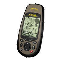
Magellan Meridian Marine - Hiking GPS Receiver
Magellan Meridian XL
Magellan Meridian Gold
Magellan Maestro 4370 - Widescreen Bluetooth Portable GPS Navigator
Magellan MobileMapper CE - Hiking GPS Receiver
Magellan MobileMapper 6 - Hiking GPS Receiver
Magellan MAP 410
Magellan MAP 330M
Magellan Categories
GPS
Car Navigation system
Security System
Keypad
Receiver
More Magellan Manuals
Login
Sign In
OR
Sign in with Facebook
Sign in with Google
Upload manual
Upload from disk
Upload from URL