Sign In
Upload
Manuals
Brands
GeoMax Manuals
Measuring Instruments
ZTS600
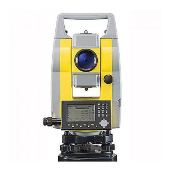
GeoMax ZTS600 Measuring Instruments Manuals
Manuals and User Guides for GeoMax ZTS600 Measuring Instruments. We have
1
GeoMax ZTS600 Measuring Instruments manual available for free PDF download: User Manual
GeoMax ZTS600 User Manual (212 pages)
Brand:
GeoMax
| Category:
Measuring Instruments
| Size: 3 MB
Table of Contents
Table of Contents
5
1 Description of the System
11
System Components
11
Container Contents
13
Instrument Components
14
2 User Interface
15
Keyboard
15
Status Icons
17
Softkeys
18
Operating Principles
20
Pointsearch
22
3 Operation
24
Instrument Setup
24
Working with the Battery
29
Data Storage
31
Main Menu
32
Measure Application
33
Distance Measurements - Guidelines for Correct Results
34
Zts600 |
34
Zts600 | 35
35
4 Configuration
37
Main Configuration
37
Communication Setup
45
EDM Configuration
47
Start Sequence
51
System Information
52
5 Calibration
54
6 Functions
55
Overview
55
Distance Offset
57
Overview
57
Z-Coordinate
59
Dist. Offset
61
Control Distance
63
Continuous-EDM Mode
65
7 Coding
66
Standard Coding
66
Rapid Coding
68
8 Applications - Getting Started
70
Starting an Application
70
Setting the Job
71
Setting the Station
73
Setting the Orientation
74
Overview
74
Manual Orientation
75
Orientation with Coordinates
76
Applications
80
Common Fields
80
Topography
81
Set out
82
Resection
87
Starting Resection
87
Measuring Information
89
Computation Procedure
90
Resection Results
91
Point Projection - Line
94
Defining the Base Line
94
Overview
94
Defining the Reference Line
96
Subapplication Measure Line & Offset
98
Subapplication Setout
100
Point Projection - Arc
104
Overview
104
Defining the Reference Arc
105
Subapplication Measure Line & Offset
107
Subapplication Setout
108
Missing Line (MLM)
113
Area
116
Remote Elevation (REM)
120
Construction
122
Construction 9.10.1
122
Starting Construction
122
As Built Check
125
Calculations
127
Intersections
127
Inverse and Traverse
127
Starting Calculations
127
Intersections
129
Offsets
132
Extension
133
Road Alignment
134
10 Data Management
140
Data Transfer
142
Working with Geomax Office Software
144
11 Check & Calibrate
145
Overview
145
Preparation
146
Calibrating Line-Of-Sight and Vertical Index Error
147
Calibrating the Circular Level of the Instrument and Tribrach
151
Inspecting the Laser Plummet of the Instrument
152
Servicing the Tripod
154
12 Care and Transport
156
Transport
156
Storage
157
Cleaning and Drying
158
13 Safety Directions
160
General
160
Intended Use
160
Limits of Use
162
Responsibilities
162
Hazards of Use
163
General
168
Distancer, Measurements with Reflectors
169
Distancer, Measurements Without Reflectors
171
Laser Plummet
174
Electromagnetic Compatibility EMC
177
FCC Statement, Applicable in U.S
179
14 Technical Data
181
Angle Measurement
181
Distance Measurement with Reflectors
182
Distance Measurement Without Reflectors (RL Mode)
184
RL to Prism
185
Conformity to National Regulations
187
General Technical Data of the Instrument
188
Scale Correction
191
Reduction Formulas
195
15 International Limited Warranty, Software License Agreement
197
16 Glossary
199
Appendix A Menu Tree
203
Index
205
Advertisement
Advertisement
Related Products
GeoMax Zoom30 Pro Series
GeoMax Zoom80 Series
GeoMax Zone60 DG
GeoMax Zoom 20 series
GeoMax Zoom3D
GeoMax Zone40 T
GeoMax Zenith60 Series
GeoMax Zoom 75 Series
GeoMax Zoom 90
GeoMax Zoom95
GeoMax Categories
Measuring Instruments
Receiver
Laser Level
Controller
Antenna
More GeoMax Manuals
Login
Sign In
OR
Sign in with Facebook
Sign in with Google
Upload manual
Upload from disk
Upload from URL