Sign In
Upload
Manuals
Brands
Garmin Manuals
Software
eTrex H - Hiking GPS Receiver
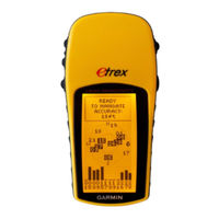
Garmin eTrex H - Hiking GPS Receiver Manuals
Manuals and User Guides for Garmin eTrex H - Hiking GPS Receiver. We have
4
Garmin eTrex H - Hiking GPS Receiver manuals available for free PDF download: Owner's Manual, Safety And Product Information, Quick Start Manual, Declaration Of Conformity
Garmin eTrex H - Hiking GPS Receiver Owner's Manual (100 pages)
vector maps creating
Brand:
Garmin
| Category:
Software
| Size: 1.62 MB
Table of Contents
1 Contents
2
Table of Contents
2
2 Introduction
5
Purpose of this Document
5
Basic Concepts
5
What Is Polish Format (PFM)
5
What Is Cgpsmapper
5
What Is Sendmap
5
Document Conventions
5
PFM Code
5
Cgpsmapper Versions
6
Manual Authors
6
3 Overview
7
4 Map Project
8
Map Creation
8
Pfm Syntax Description
8
Header
9
Declarations
14
Countries
14
Regions
14
Cities
15
Chart Info
15
Advanced Declarations
17
Background
17
Dictionary
17
Highways
18
ZIP Codes
18
Definitions
18
Body (Objects)
18
Point of Interest
18
Polygon
20
Polyline
22
Point of Interest from Oziexplorer
23
Polyline or Polygon from Oziexplorer
23
Shapes
24
Mapdekode File
28
File
29
Object Elevation
29
Road Numbers
30
Marine Charts
31
Levels
39
Introduction
39
Concepts and Terminology
40
Using Levels When Defining Map Objects
42
Tailoring Shape According to Level
43
Idiosyncrasies of GPS Hardware
44
Dictionary
44
Introduction
44
D ICTIONARY 4.5.1 Introduction
44
Concepts and Terminology
45
Using Dictionary
45
5 Creating Custom Type File
47
Creating the Source File
47
Custom Type Definition
50
Putting It All Together
57
6 Mapsource
61
Mapsource Data Structure
61
Creating Preview Map Files
61
Making the Registry Entries
61
Loading the Maps into the Gps
63
7 Faqs
65
Name Variables and Where They Show up
65
Introduction
65
PFM File
65
PFM Preview File
65
Sendmap
66
Activation of Maps in the Gps
68
Saving Objects as [Rgnx0] Vs. [POI], [POLYGON], [POLYLINE]
69
Equivalences
69
Impact of Saving Objects in One Format or the Other
69
Preferred Method
69
Relationship between Levels in the Detail Maps and the Preview Maps
69
Filling (Gas) Stations Not Showing in the Find Function of the GPS
70
Islands and Clearings
70
8 Glossary
71
9 Appendices
72
Cgpsmapper Compilation Errors and Warnings
72
Exits
76
Valid Exit Facility Types
76
Directions
76
Facilities
77
Cgpsmapper Object Types List
77
POI] Types
77
POLYLINE] Types
88
POLYGON] Types
90
Custom Types Name Substitution
92
How Do I Create XPM Definitions
93
Cgpsmapper Versions
94
Cgpsmapper Files
96
10 Index and Tables
97
Table of Figures
97
Version Control Log
97
Index
98
Http://Cgpsmapper.com/ 3 of
100
Advertisement
Garmin eTrex H - Hiking GPS Receiver Safety And Product Information (4 pages)
Important Safety and Product Information
Brand:
Garmin
| Category:
GPS
| Size: 0.34 MB
Table of Contents
Product Information
1
Battery Warnings
1
Map Data Information
2
Declaration of Conformity
2
Fcc Compliance
2
Limited Warranty
3
Industry Canada Compliance
3
Garmin eTrex H - Hiking GPS Receiver Quick Start Manual (2 pages)
Garmin eTrex eTrex: Quick Start
Brand:
Garmin
| Category:
GPS
| Size: 0.5 MB
Advertisement
Garmin eTrex H - Hiking GPS Receiver Declaration Of Conformity (1 page)
Declaration of Conformity
Brand:
Garmin
| Category:
GPS
| Size: 0.02 MB
Advertisement
Related Products
Garmin ecoRoute
Garmin eTrex - Hiking GPS Receiver
Garmin eTrex HC series
Garmin ETREX H
Garmin eTrex Vista HCx
Garmin Etrex Legend - GPS Receiver
Garmin eTrex Summit - Hiking GPS Receiver
Garmin eTrex Vista C color map navigator
Garmin eTrex Legend HCx
Garmin eTrexVista
Garmin Categories
GPS
Watch
Car Navigation system
Avionics Display
Marine GPS System
More Garmin Manuals
Login
Sign In
OR
Sign in with Facebook
Sign in with Google
Upload manual
Upload from disk
Upload from URL