Sign In
Upload
Manuals
Brands
Garmin Manuals
GPS
A03113
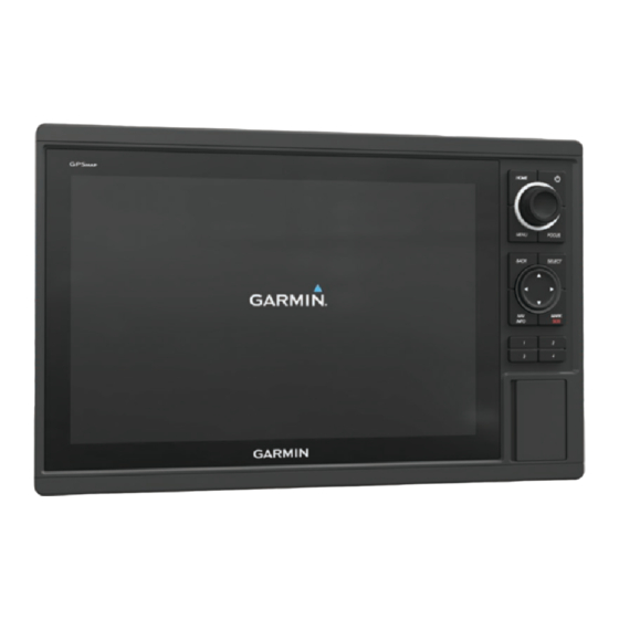
Garmin A03113 Manuals
Manuals and User Guides for Garmin A03113. We have
1
Garmin A03113 manual available for free PDF download: Owner's Manual
Garmin A03113 Owner's Manual (60 pages)
Brand:
Garmin
| Category:
GPS
| Size: 4 MB
Table of Contents
Table of Contents
4
Saving a Track as a Route
23
Browsing for and Navigating a Recorded Track
23
Deleting a Saved Track
23
Deleting All Saved Tracks
23
Retracing the Active Track
23
Clearing the Active Track
23
Managing the Track Log Memory During Recording
23
Configuring the Recording Interval of the Track Log
23
Boundaries
23
Creating a Boundary
23
Synchronizing User Data Across the Garmin Marine Network
24
Deleting All Saved Waypoints, Routes, and Tracks
24
Sailing Features
24
Setting the Vessel Type
24
Sail Racing
24
Starting Line Guidance
24
Setting the Starting Line
24
Using the Starting Line Guidance
24
Starting the Race Timer
24
Stopping the Race Timer
24
Setting the Keel Offset
25
Sailboat Autopilot Operation
25
Wind Hold
25
Setting the Wind Hold Type
25
Engaging Wind Hold
25
Engaging Wind Hold from Heading Hold
25
Adjusting the Wind Hold Angle with the Autopilot
25
Tack and Gybe
25
Tacking and Gybing from Heading Hold
25
Tacking and Gybing from Wind Hold
25
Sonar Views
26
Traditional Sonar View
26
Garmin Clearvü Sonar View
26
Sidevü Sonar View
26
Sidevü/Clearvü Scanning Technology
26
Split-Screen Sonar Views
26
Split-Zoom Sonar View
26
Split-Frequency Sonar View
26
Panoptix Sonar Views
27
Livevü down Sonar View
27
Livevü Forward Sonar View
27
Realvü 3D Forward Sonar View
27
Realvü 3D down Sonar View
27
Realvü 3D Historical Sonar View
27
Frontvü Sonar View
27
Changing the Sonar View
28
Selecting the Transducer Type
28
Creating a Waypoint on the Sonar Screen
28
Measuring Distance on the Sonar Screen
28
Pausing the Sonar Display
28
Viewing Sonar History
28
Sonar Sharing
28
Selecting a Sonar Source
28
Renaming a Sonar Source
28
Adjusting the Level of Detail
28
Adjusting the Range of the Depth Scale
29
Setting the Zoom Level on the Sonar Screen
29
Setting the Scroll Speed
29
Sonar Frequencies
29
Selecting Frequencies
29
Creating a Frequency Preset
29
Customizing the Panoptix Sonar Views
29
Adjusting the Appearance of the Livevü Sonar Views
30
Setting the Livevü Transducer Transmit Angle
30
Adjusting the Realvü Viewing Angle and Zoom Level
30
Adjusting the Appearance of the Realvü Sonar Views
30
Adjusting the Realvü Sweep Speed
30
Calibrating the Compass
30
Turning on the A-Scope
30
Sonar Setup
30
Sonar Settings
30
Realvü Sonar Settings
30
Sonar Noise Rejection Settings
31
Sonar Appearance Settings
31
Sonar Alarm Settings
31
Advanced Sonar Settings
31
Transducer Installation Settings
31
Sonar Recordings
32
Recording the Sonar Display
32
Stopping the Sonar Recording
32
Deleting a Sonar Recording
32
Playing Sonar Recordings
32
Depth and Water Temperature Graphs
32
Setting the Depth and Water Temperature Graph Range and Time Scales
32
Radar
32
Changing the Radar Mode
32
Transmitting Radar Signals
32
Stopping the Transmission of Radar Signals
33
Setting up the Timed Transmit Mode
33
Enabling and Adjusting a Radar no Transmit Zone
33
Adjusting the Radar Range
33
Tips for Selecting a Radar Range
33
Marking a Waypoint on the Radar Screen
33
Motionscope™ Doppler Radar Technology
33
Enabling a Guard Zone
33
Defining a Circular Guard Zone
33
Defining a Partial Guard Zone
33
Disabling a Guard Zone
34
Marpa
34
MARPA Targeting Symbols
34
Assigning a MARPA Tag to an Object
34
Removing a MARPA Tag from a Targeted Object
34
Viewing Information about a MARPA-Tagged Object
34
Viewing a List of AIS and MARPA Threats
34
Showing AIS Vessels on the Radar Screen
34
VRM and EBL
34
Showing the VRM and the EBL
34
Radar Overlay
35
Radar Overlay and Chart Data Alignment
35
Echo Trails
35
Turning on Echo Trails
35
Adjusting the Length of the Echo Trails
35
Clearing the Echo Trails
35
Optimizing the Radar Display
35
Radar Gain and Clutter
35
Siriusxm Satellite Radio
44
Locating a Siriusxm Radio ID
44
Activating a Siriusxm Subscription
44
Customizing the Channel Guide
44
Saving a Siriusxm Channel to the Presets List
44
Unlocking Siriusxm Parental Controls
44
Setting Parental Controls on Siriusxm Radio Channels
44
Changing a Parental Passcode on a Siriusxm Radio
44
Restoring Default Parental Control Settings Values
44
Clearing All Locked Channels on a Siriusxm Radio
44
Setting the Device Name
45
Updating the Media Player Software
45
Siriusxm Weather
45
Siriusxm Equipment and Subscription Requirements
45
Weather Data Broadcasts
45
Changing the Weather Chart
45
Viewing Precipitation Information
45
Precipitation Views
45
Storm Cell and Lightning Information
45
Hurricane Information
45
Viewing Forecast Information for Another Time Period
46
Weather Fronts and Pressure Centers
46
Viewing a Marine Forecast or an Offshore Forecast
46
City Forecasts
46
Viewing Sea Conditions
46
Surface Winds
46
Wave Height, Wave Period, and Wave Direction
46
Viewing Forecast Sea Conditions Information for Another Time Period
46
Viewing Fishing Information
46
Surface Pressure and Water Temperature Data
46
Changing the Sea Surface Temperature Color Range
47
Visibility Information
47
Viewing Forecast Visibility Information for Another Time Period
47
Viewing Buoy Reports
47
Viewing Local Weather Information Near a Buoy
47
Creating a Waypoint on a Weather Chart
47
Weather Overlay
47
Turning on the Weather Overlay on a Chart
47
Weather Overlay Settings on the Navigation Chart
47
Weather Overlay Settings on the Fishing Chart
47
Networked Video Devices
48
Using Video Presets on Networked Video Cameras
48
Saving Video Presets on a Networked Video Camera
48
Naming Video Presets on a Networked Video Camera
48
Activating Video Presets on a Networked Video Camera
48
Camera Settings
48
Video Settings
48
Associating the Camera to a Video Source
48
Video Camera Movement Control
48
Controlling Video Cameras Using On-Screen Controls
48
Configuring the Video Appearance
49
Controlling the VIRB Action Camera with the Chartplotter
49
VIRB Action Camera Settings
49
VIRB Action Camera Video Setup Settings
49
Adding the VIRB Action Camera Controls to Other Screens
49
Controlling the VIRB Action Camera Video Playback
49
Deleting a VIRB Video
49
Starting a VIRB Video Slideshow
49
Device Configuration
50
Turning on the Chartplotter Automatically
50
System Settings
50
Station Settings
50
Viewing System Software Information
50
Viewing the Event Log
50
Preferences Settings
50
Units Settings
50
Navigation Settings
50
Auto Guidance Path Configurations
50
Adjusting the Distance from Shore
51
Communications Settings
51
NMEA 0183 Settings
51
Configuring NMEA 0183 Output Sentences
51
Setting the Communication Format for each NMEA 0183 Port
51
NMEA 2000 Settings
51
Naming Devices and Sensors on the Network
52
Marine Network
52
Setting Alarms
52
Navigation Alarms
52
Setting the Anchor Drag Alarm
52
System Alarms
52
Sonar Alarm Settings
52
Setting Weather Alarms
52
Setting the Fuel Alarm
52
My Vessel Settings
52
Setting the Water Temperature Offset
53
Calibrating a Water Speed Device
53
Other Vessels Settings
53
Restoring the Original Chartplotter Factory Settings
53
Communication with Wireless Devices
53
Wi-Fi® Network
53
Setting up the Wi-Fi Wireless Network
53
Connecting a Wireless Device to the Chartplotter
53
Changing the Wireless Channel
53
Changing the Wi-Fi Host
53
Wireless Remote Control
54
Pairing the Wireless Remote Control with the Chartplotter
54
Turning on and off the Remote Backlight
54
Disconnecting the Remote from All Chartplotters
54
Using the Garmin Helm Application with the Chartplotter
54
Connecting a Quatix Watch to the Chartplotter
54
Connecting a Garmin Nautix™ Device to the Chartplotter
54
Chartplotter Data Management
54
Copying Waypoints, Routes, and Tracks from Homeport to a Chartplotter
54
Selecting a File Type for Third-Party Waypoints and Routes
54
Copying Built-In Maps to a Memory Card
55
Backing up Data to a Computer
55
Restoring Backup Data to a Chartplotter
55
Saving System Information to a Memory Card
55
Appendix
55
Registering Your Device
55
Digital Switching
55
Pairing the GRID Remote Input Device with the Chartplotter
55
Pairing the GRID Device with the Chartplotter from the Chartplotter
55
Pairing the GRID Device with the Chartplotter from the GRID Device
55
Copying Screenshots to a Computer
56
Troubleshooting
56
My Device will Not Acquire GPS Signals
56
My Device will Not Turn on or Keeps Turning off
56
My Device Is Not Creating Waypoints in the Correct
56
Location
56
NMEA 2000 PGN Information
56
NMEA 0183 Information
57
Software License Agreement
57
Index
58
Advertisement
Advertisement
Related Products
Garmin Approach G3 North and Latin America
Garmin Approach S1 North America
Garmin Beechcraft A36
Garmin Astro 220
Garmin Alpha 100
Garmin Approach G3 North Latin Americ
Garmin Alpha 200
Garmin Astro 320 DC 50
Garmin Aera 760
Garmin aera 190-01117-02
Garmin Categories
GPS
Watch
Car Navigation system
Avionics Display
Marine Equipment
More Garmin Manuals
Login
Sign In
OR
Sign in with Facebook
Sign in with Google
Upload manual
Upload from disk
Upload from URL