
Related Manuals for Syride SYS'Nav

Summary of Contents for Syride SYS'Nav
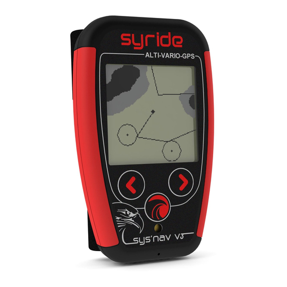
- Page 1 ® SYS’Nav Guide d’utilisation : p1 User guide : p28 Manual de usuario : p56 Benutzerhandbuch : p84...
- Page 2 Foreword Welcome in the community of Syriders! Your SYS'NAV is an extra light instrument with the most recent technologies, which will able you to improve yourself and guide your improvements. You will also be able to build a unique and highly detailed online flight book. Your practice of paragliding is...
-
Page 3: Table Of Contents
Setup the SYS PC Tool ..............31 Place the instrument ..............32 III. Recharging the battery ..............33 Information about GPS state ............34 Menu synoptic ................35 Flight screens ................36 VII. Configure your device ..............38 VIII. Advanced configuration ..............40 Customize your screens and vario sound ........ -
Page 4: Setup The Sys Pc Tool
Setup the SYS PC Tool Download the lastest version of the SYS PC Tool by checking the following webpage : http://www.syride.com/en/logiciel Follow the instructions to install it on your computer. Once installed, an icon shows in the 10:39 task bar. -
Page 5: Place The Instrument
Place the instrument Syride suggests place your instrument on the risers. 2 velcros ables you to place it on any existing riser. Take care not to « lock » your rope or pulley accelerator.This position ables you to manipulate the instrument... -
Page 6: Recharging The Battery
III. Recharging the battery Simply connect your instrument with the USB cable to a computer. A red led shows the right loading of the device. Your instrument will display Charging… “Charging…” and the percentage of charge. To complete, a charge it requires 2 hours. -
Page 7: Information About Gps State
Information about GPS state The GPS fix after a long period of inactivity, or after an important change in geographical position, can take up to 10 minutes. It is recommended to be outdoor to ease the first GPS adjustment. We suggest you to turn ON your instrument a few minutes before taking-off. -
Page 8: Menu Synoptic
Menu synoptic Flight Flight Flight Flight Backup Navigation Flights Setup screen screen screen screen screen screen menu menu menu See « VI. Flight screens » See « XIII. Display and delete a flight » Load Create Delete Create Delete Goto route route route... -
Page 9: Flight Screens
Flight screens Screens shows informations you previously choosed. If your device do not receive a GPS signal strong enough, NO GPS will appear. Pressing the central button will turn OFF and ON the sound of the vario. This is usefull when you need to concentrate on a transition or when landing. - Page 10 Screen #5 (MAP screen) displays on the whole LCD area. You can see : • Your current position and heading on the middle of the screen • The topography grayscaled (if previously uploaded to the instrument) • Airspaces (if previously uploaded to the instrument) •...
-
Page 11: Configure Your Device
VII. Configure your device Push the central button to start your instrument. Go to screen #9 with left and right buttons, and confirm by clicking on central button. The number of the screen is displayed on the top right of it. first screen shows... - Page 12 The 2 next screens allows you to set rising and falling threshold of the vario. The next screen enables to activate the “thermal sniffer” function. The instrument will produce a specific bip when you fly in an area which do not go up (<0.1m/s) or down (>0.2m/s).
-
Page 13: Advanced Configuration
• Adjust the security alarm based on the G-meter. An explanation of those functions is explained here: https://www.syride.com/en/support For this : Turn-on the instrument and connect it to your computer From SYS PC Tool, click on “configure my instrument” icon. -
Page 14: Customize Your Screens And Vario Sound
To customize your screen (tutorial video https://www.youtube.com/watch?v=D3lfZWiS13M Go to : http://www.syride.com/en/ssctool/Nav Customize your screen by selecting an item with is font size and units, and then drag and drop it to the screen. Download the config file to your computer. -
Page 15: Height Above Ground
For the older versions of the SYS’Nav, here is the process to send the topography data into your instrument : You must go to our dedicated webpage: https://www.syride.com/en/topography Then move the red rectangle to your selected fly area, and download the data. Turn on and connect your SYS’NAV with the USB cable. -
Page 16: Locate Airspaces
Locate airspaces To avoid an airspace violation, you can upload a database of airspaces with an OpenAir file format to your instrument. Here are some tips regarding airspaces : Airspaces are regularly modified (about once per month). We recommend you to check the version of file you are using and keep updated. - Page 17 Syride's online tool provides airspace databases in Open Air format by country. Download the file you want to your computer. Turn on and plug your SYS'Nav into the USB port of your computer. On the SYS PC Tool, click on the icon « send a file to my instrument ».
-
Page 18: Navigation
To build a route with the « Route maker » : Go to http://www.syride.com/en/route Build your route in a few clicks, and then download it to your computer. - Page 19 You can build a route from your instrument as well : You first need to have some waypoints in your instrument. Create a waypoint on the SYS’Nav, with menu “Navigation” (screen 7), then “Create waypoint”. The instrument will ask for a waypoint name, GPS coordinate, and altitude (optional).
-
Page 20: Display And Delete A Flight
XIII. Display and delete a flight Go to screen #8 and press the central button to enter the flights list. You will see here every recorded Vol # 1 flights, with some information about this Date : 01/02/14 flight. Time : 12h35 Flight time : 01h37 Alt max : 1346m Vario max : 5.4m/s... -
Page 21: Warnings And Reset
XIV. Warnings and reset If this happens, be sure the instrument’s memory is not full, and check the battery is charged enough. To protect from flights corruption, your instrument will automatically stop recording the flight if the battery is too low, or if memory is almost full. This is indicated when the plane icon on the top left of the screen is blinking with a cross over it If the G-Meter exceeds the value selected in “Configure my instrument”... -
Page 22: Transfer Your Flights
To use the advanced flight analyzer on syride.com, you must enter your email and password of your Syride account (create one on http://www.syride.com) Make sure "Use the advanced logbook from Syride.com” is selected to upload your flights and click “OK”. - Page 23 To watch your track, click on the picture. You can make your flight invisible for the Syride community by clicking on the eye icon on the top right. It will stay on...
- Page 24 Syride users won’t be able to see it. You can look at your personal evolution on the flight page through location and time. You can also compare your stats and performances to the other riders.
-
Page 25: Parameters
XVI. Parameters Here is a list of parameters preprogrammed in your instrument in order to improve its use and autonomy: • Flights less than a minute will be automatically deleted by the SYS PC Tool. • When flying, your instrument will automatically stop recording the flight if neither a ground speed or a vario is detected. -
Page 26: Suggestion Of Use
• Electromagnetic perturbations from VHF antennas can disturb GPS signal • If the SYS'NAV is very hot and you fly in very cold air, fog can appear on the screen. It will dissipate within minutes. • Only use the backlight if required. Otherwise the autonomy will decrease significantly (30%). - Page 27 The soaring in the Antarctic is not guaranteed!! check with local authorities Ensure that the product is well in position before taking off. Syride cannot DO NOT ATTEMPT RECHARGING THE DEVICE WITH A DIFFERENT be held responsible for the loss of the product during the flight (takeoff USB CORD THAN THE ONE PROVIDED.
Need help?
Do you have a question about the SYS'Nav and is the answer not in the manual?
Questions and answers