
Summary of Contents for ASA Electronics JRV9000
- Page 1 User Manual JRV9000 Navigation software for the JRV9000 English April 2016, ver. 1.0...
-
Page 2: Table Of Contents
Table of contents 1 Getting started ........................... 5 1.1 Initial set-up............................5 1.2 Screen controls ........................... 6 1.2.1 Using the buttons and other controls ......................7 1.2.2 Using the cursor ............................7 1.2.3 Using the keyboard ............................. 7 1.2.4 Using touch gestures ........................... 9 1.2.5 Manipulating the map .......................... - Page 3 3.1.4 Selecting a Saved Location ........................41 3.1.5 Selecting a History item ..........................42 3.1.6 Selecting a saved route ..........................44 3.1.7 Entering coordinates ..........................45 3.1.8 Selecting a location on the map ........................ 47 3.1.9 Planning a Multipoint Route ........................47 3.2 Checking Route Information and Alternatives .................
- Page 4 4.2.2 Trip Monitor ............................. 68 4.3 Settings menu ............................ 69 4.3.1 Route preferences settings ........................70 4.3.1.1 Vehicle profile ..............................70 4.3.1.2 Route Planning Method types ..........................72 4.3.1.3 Road types ................................73 4.3.2 Sound settings ............................73 4.3.3 Warnings settings ............................74 4.3.4 Navigation View settings ..........................
-
Page 5: Getting Started
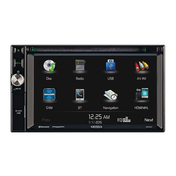
1 Getting started JRV9000 is optimized for in-car or pedestrian use. You can use it easily by tapping the screen buttons and the map with your fingertips. Latest Map Guarantee When you start using the product, you have 45 days to download the latest available map free of charge. -
Page 6: Screen Controls
If needed, modify the default route planning options. Later you can change them in Route Preferences (page 70). Tap to continue. The initial set-up is now complete, tap to enter the Navigation view. 1.2 Screen controls The following sections describe the functionality and use of buttons, sliders, and other screen controls in JRV9000. -
Page 7: Using The Buttons And Other Controls
You need to confirm selections or changes only if the application needs to be restarted, if it needs to perform a major reconfiguration, or if you are about to lose some of your data or settings. Otherwise, JRV9000 saves your selections and applies the new settings without confirmation as soon as you use the controls. - Page 8 Correcting your entry on the keyboard to remove the unnecessary character(s). Tap and hold the button to delete several characters or the entire input string. Entering a space, for example between a first name and a Tap the button at the bottom center of the screen. family name or in multi-word street names Entering upper and lower case...
-
Page 9: Using Touch Gestures
1.2.4 Using touch gestures You usually need to tap the screen only once. However, some useful features can be accessed with other gestures. See the table below. Action Function Tapping and Tap and keep pressing the following buttons to reach extra functions: holding the screen •... -
Page 10: Manipulating The Map
Zooming in and Change how much of the map is displayed on the screen. JRV9000 uses maps that let you examine the locations at various zoom levels, always with optimized content. It always displays street names and other text with the same font size, never upside-down, and you only see the streets and objects that you need. - Page 11 Changing 2D, Switch between the 3D perspective, 2D Heading up, and 2D 3D, or 2D North North up map view modes. In Heading up mode the map is up views rotated so its top always points in the current driving direction. This is the default orientation in 3D map view mode.
-
Page 12: Navigation View
1.3 Navigation view The navigation view is the main screen of JRV9000 that shows the planned route on a map. JRV9000 works with digital maps which are not simply the computerized versions of traditional paper maps. Similarly to paper road maps, the 2D mode of digital maps shows you streets and roads. Elevation is also illustrated in color. - Page 13 Navigation By tapping it, you can open the Navigation menu, where you can reach menu other parts of JRV9000. Street name It shows the current street name. By tapping it, you can open the Where Am I screen. See page 67.
-
Page 14: Streets And Roads
JRV9000 shows the streets similarly to paper road maps. Their width and colors correspond to their importance; you can easily tell a freeway from a small street. 1.3.2 GPS position markers When your GPS position is available, JRV9000 marks your current position. By default, this marker is a blue arrow. •... -
Page 15: Turn Preview And Next Street
You can choose whether you want to use or avoid certain road types are excluded from the (page 70). However, when JRV9000 cannot avoid such roads, the navigation route includes them and shows them in a color that is different from the route color. -
Page 16: Lane Information
When navigating on multi-lane roads, it is important to take the appropriate lane in order to follow the planned route. If lane information is available in the map data, JRV9000 displays the lanes and their directions using small arrows at the bottom of the map. Highlighted arrows represent the lanes and the... -
Page 17: Signposts
1.3.7 Signposts If necessary information is available, JRV9000 displays signposts at the top of the map. The color and style of the signposts are similar to the real ones you can see above roads or by roadsides. They show the available destinations and the road numbers. -
Page 18: Freeway Services
JRV9000 supports the following 3D object types: Type Description 3D terrain JRV9000 displays 3D hills and mountains in the Navigation view, and illustrates them by coloring and shading on the 2D map. Elevated roads Elevated roads are complex intersections and vertically isolated roads (such as overpasses or bridges) displayed in 3D. -
Page 19: Navigation Menu
1.4 Navigation menu On the Navigation view, tap to open the Navigation menu. You can see the following menu options when you are navigating without a planned route: Button Function Select your destination by entering an address or its coordinate, or by selecting a Place, a Saved Location, or a Saved Route. - Page 20 See route alternatives to avoid parts of the route, or to avoid a specific road from your planned route. View the route in its full length on the map and check route parameters and route alternatives. to access additional options, like Simulation or Route Preferences. Delete your route.
-
Page 21: Warnings And Safety Information
Plan the route before your departure and stop if you need to change the route. You must follow the traffic rules. If you deviate from the planned route, JRV9000 changes the instructions accordingly. -
Page 22: Using The Navigation
3 Using the navigation You can select the destination and start navigating to it right away (normal navigation) if you need a route for immediate navigation. You can also plan a route independently of your current GPS position even without GPS reception. To achieve this, you need to set a new starting point in the Multipoint Route menu. - Page 23 . You can see the input field at the top of the screen. Right next to it you can see the search area, the town around which the search is carried out. The default search area is the area where you are located. For a local search, skip the next step. (optional) To search in a different area, tap the input field with the search area, and start entering the name of the new search area on the keyboard.
- Page 24 to switch to the result screen. You can see all the results in the list, regardless of their type. Addresses, Places, Place categories, Saved locations, and recent destinations are mixed in one list. You can immediately select the result you want to use as your destination or narrow the list of results for only one type (for example, Places).
-
Page 25: Selecting An Address
Navigation view to access the Navigation menu. By default, the JRV9000 proposes the country and state where you are or in case there is no valid GPS position, the country and state of the last known position. If needed, change the country. Tap... - Page 26 (optional) In the Select City or ZIP code screen, you can immediately select a city from the list of suggestions. c. Otherwise, start entering the first few letters of the city on the keyboard. The names that match the string appear in a list. To open this list, tap and select the city.
- Page 27 If available, enter the house number by performing the following steps: Tap the House number or crossing street field. Enter the house number on the keyboard. (To enter letters, tap c. Tap the selected address to finish the address search. A full screen map appears with the selected point in the middle.
-
Page 28: Entering An Address Starting With The Street Name
Navigation view to access the Navigation menu. By default, JRV9000 proposes the country and state where you are. If needed, change the country. Tap In the Select Country screen, you can immediately select a country from the list below the... - Page 29 c. Otherwise, start entering the first few letters of the city on the keyboard. The names that match the string appear in a list. To open this list, tap and select the city. Enter the street name. Tap the Street field. (optional) On the Select Street screen, you can immediately select a street from the list of suggestions.
- Page 30 c. Tap the selected address to finish the address search. A full screen map appears with the selected point in the middle. If necessary, tap the map somewhere else to modify the destination. The cursor ( ) appears at the new location. Check the settings for road types and change them if necessary.
-
Page 31: Selecting A Town Center
3.1.2.3 Selecting a town center The town center is not the geometric center of the town but an arbitrary point the map creators have chosen. In towns and villages, it is usually the most important intersection and in larger towns, it is one of the important intersections. -
Page 32: Selecting An Intersection In A Town
Tap the Street name field. (optional) On the Select Street screen, you can immediately select a street from the list of suggestions. c. Otherwise, start entering the street name on the keyboard. The names that match the string appear in a list. to open the list of results. -
Page 33: Using The Zip Code To Select A Destination
c. Otherwise, start entering the street name on the keyboard. The names that match the string appear in a list. to open the list of results. Select the street from the list. Tap the House number or crossing street field and browse the list of crossing streets or start entering the street name in the field. -
Page 34: Selecting A Place Of Interest
Find the place you need. Continue the search as described previously (page 25). 3.1.3 Selecting a Place of Interest You can search for Places of Interest (Places) in the menu. Using the same screen, you can find a Place by selecting one of the following options: •... - Page 35 • : If a planned route exists, gas stations are searched along the route. • : If a planned route exists, accommodation is searched around the destination. • : If a planned route exists, restaurants are searched along the route. •...
-
Page 36: Searching By Category
Check the settings for road types and change them if necessary. to enable or avoid freeways, tap for roads with Period Charge or Per-use Toll, tap for ferries, or tap for carpool lanes. to confirm the destination. You can also select a nearby point on the map or tap to select a different destination. - Page 37 available, around the last known position). In this case, the following result list is ordered by the distance from this position. • to search along the planned route, and not around a given point. This is useful when you search for a later stopover that results in a minimal detour only, such as searching for upcoming gas stations or restaurants.
-
Page 38: Searching By Name
You can turn the Category View off at any level to list all Places around the selected location or along the route. (optional) The Places in the list can be ordered by the following criteria: • Name • Their distance from the current or last known position •... - Page 39 • to search for a place around the destination of the planned route. (The result list is ordered by the distance from the destination.) • to search along the planned route, and not around a given position. This is useful when you search for a later stopover that results in a minimal detour only, such as searching for upcoming gas stations or restaurants.
-
Page 40: Finding Help Nearby
Browse the list, if necessary, and tap the desired list item. A full screen map appears with the selected point in the middle. The name and address of the Place is displayed at the top of the screen. The process continues the same way as in case of any other Places search. See page 34. 3.1.3.4 Finding help nearby To quickly search for nearby assistance, perform the following steps: on the Navigation view to access the Navigation menu. -
Page 41: Selecting A Saved Location
to reorder the list. Browse the list and tap one of the list items. A full screen map appears with the selected point in the middle. The name and address of the Place is displayed at the top of the screen. The process continues the same way as in case of any other Places search. -
Page 42: Selecting A History Item
Check the settings for road types and change them if necessary. to enable or avoid freeways, tap for roads with Period Charge or Per-use Toll, tap for ferries, or tap for carpool lanes. to confirm the destination. You can also select a nearby point on the map or tap to select a different destination. - Page 43 . Two of the Smart History Items are displayed in the New Route to... screen for easy access. You can select one of them as your destination. To open all the history items, tap . The list of recent destinations appears. The list begins with the three most likely destinations that are selected based on your previous routes (Smart History).
-
Page 44: Selecting A Saved Route
The route is calculated and the map appears showing the entire route, where you can check route information and route alternatives. Tap to modify the route parameters, or tap to start your journey. 3.1.6 Selecting a saved route The routes that you have saved earlier appear in a list. To select a previous route, perform the following steps: on the Navigation view to access the Navigation menu. -
Page 45: Entering Coordinates
The route is calculated and the map appears showing the entire route, where you can check route information and route alternatives. Tap to modify the route parameters, or tap to start your journey. 3.1.7 Entering coordinates To select a destination by entering its coordinates, perform the following steps: on the Navigation view to access the Navigation menu. - Page 46 (optional) If necessary, tap then and enter the coordinate in UTM format. Tip! A full screen map appears with the selected point in the middle. If necessary, tap the map somewhere else to modify the destination. The cursor ( ) appears at the new location. Check the settings for road types and change them if necessary.
-
Page 47: Selecting A Location On The Map
3.1.8 Selecting a location on the map To select a map location, perform the following steps: Locate your destination on the map. Move and scale the map as necessary. Tap the location that you want to select as your destination. The cursor ( ) appears there. - Page 48 There is only one line in the list of route points, the starting point of the route, which is normally the current GPS position. to select the destination. The New Route to... screen appears, where you can select the destination of the route the same way as described in the previous sections.
-
Page 49: Checking Route Information And Alternatives
When you have added all the route points, tap and the planned route is automatically calculated. 3.2 Checking Route Information and Alternatives To get a map overview of the planned route and check different parameters of the planned route, perform the following steps: on the Navigation view to access the Navigation menu. -
Page 50: Setting A New Starting Point
• Selecting a route alternative for an existing route, see page 55 • Pausing guidance, see page 56. 3.3.1 Setting a new starting point For normal navigation, all routes are calculated from the current position. You can pause navigation to check future routes, simulate them or see their length in time and distance. -
Page 51: Adding An Additional Destination
to continue. The map returns with a transparent position marker (showing that there is no GPS reception). If a planned route already exists, it is now recalculated starting from the selected location. To return to normal navigation, tap 3.3.2 Adding an additional destination If you already have a planned route and you select a new destination as described in the above sections, the route to the previous destination is deleted and a new route is calculated. -
Page 52: Saving The Planned Route
In the Navigation menu, tap You have the following options on this screen: • to delete all the destinations, or optimize the waypoints or the route. • Tap the name of the intermediate destination to move it up or down in the list, to save the location, or to delete it from the list. -
Page 53: Deleting The Planned Route
Type in a name and tap The route is saved and it is available in By selecting a previously saved route, JRV9000 recalculates the route using the saved destination and/or the waypoints. 3.3.5 Deleting the planned route You have the following two options to delete the navigated route: •... -
Page 54: Selecting A Route Alternative When Planning The Route
Select one of the route alternatives and tap to return to the previous screen. JRV9000 recalculates the route. Tap to start your journey. The orange line line now shows the new planned route. -
Page 55: Selecting A Route Alternative For An Existing Route
If there are more than a few suggestions, you can tap and scroll down for routes. Select one of the route alternatives and tap to return to the previous screen. JRV9000 replaces the original route. Tap to start your journey. The orange line line now shows the new planned route. -
Page 56: Pausing Guidance
3.3.8 Pausing guidance When you are driving a planned route but you do not need guidance for a certain part of the route, you can suspend it and continue when it is needed again. In the Navigation menu, tap to suspend guidance. to resume guidance. -
Page 57: Editing A Saved Location
to save the location. To add your home and work address to the saved locations, perform the following steps: On the Navigation view, tap , and . Tap to confirm your selection. You can search for the address as described on page 22. Planning a route to one of the saved locations is described on page 41. -
Page 58: Adding An Alert Point
3.5 Adding an Alert Point You can save any map location as an Alert Point, for example a speed camera or a school zone. If you would like to save an Alert Point for the first time, switch on the . -
Page 59: Running A Simulation
3.6 Running a Simulation To run a simulated navigation that demonstrates the planned route, perform the following steps: on the Navigation view to access the Navigation menu. In the Navigation menu, tap . The simulation starts from the starting point of the route and leads you through the whole planned route using a realistic speed. -
Page 60: Off-Road Navigation
3.7 Off-road navigation When first started, JRV9000 calculates routes using the road network of the maps provided with the product. If you want to disregard roads during navigation, you can switch to off-road mode, for example when driving in a desert. - Page 61 You can see an orange line line drawn between your current position and the next destination to reach. The Turn Preview field in the top left corner shows a compass with your bearing and the distance of the next destination. When you reach the final destination, the navigation ends.
-
Page 62: Reference Guide
There is a special proximity warning for road safety cameras (like speed or red light cameras) and other proximity Alert Points (like schools or railroad crossings). These Alert Points are not part of JRV9000. You can add your own Alert Points. See page 58. -
Page 63: Route Calculation And Recalculation
The maximum speed set in the vehicle profile (page 70) is also used for this warning. JRV9000 alerts you if you exceed the pre-set value even if the legal speed limit is higher. -
Page 64: Congestion Detour On Highways
4.1.6.1 Congestion detour on highways JRV9000 may offer a detour when you slow down on a highway due to a traffic jam. The Potential congestion detour window appears and shows the length and duration of the detour. You can ignore this message and keep the original route by tapping... -
Page 65: Parking Around Destination
4.1.6.3 Parking around destination If you leave the planned route by exiting a freeway, JRV9000 tries to guess the reason for making a detour. By tapping , you can open a top-down map with the recommended parking Places around the destination. -
Page 66: Hints Upon Detour
4.1.6.4 Hints upon detour If you leave the planned route by exiting a freeway, JRV9000 tries to guess the reason for making a detour. The Reason for detour window appears and shows available gas stations, restaurants or other Places around the current position. Also, if there are avoidable parts of the original route ahead (like a tunnel, a toll road or a ferry), you can find them in the list, in case you want to bypass them. -
Page 67: Where Am I
Shows a world map with the sunlit and dark areas of the world. Tap to check the exact sunrise and sunset times for all your route points. Shows the GPS Information screen with satellite position and signal strength information. 4.2.1 Where Am I This screen contains information about the current position (or about the last known position if GPS reception is not available). -
Page 68: Trip Monitor
You can also search for assistance near your current position. Tap to open a new screen for quick search and select a category. For detailed information, see page 40. 4.2.2 Trip Monitor Trip Monitor logs information about your route. You can record a new trip by tapping and stop it by tapping By tapping on the Trip Monitor screen, you can select the following options:... -
Page 69: Settings Menu
4.3 Settings menu You can configure the navigation settings, and modify the behavior of JRV9000, by tapping Tap the arrows to view the content of other pages. Changing some of these settings may not have an effect in your current region if the map data Note! do not contain the required information. -
Page 70: Route Preferences Settings
4.3.1 Route preferences settings The following settings determine how routes are calculated: Button Function Set the type of vehicle you want to use to navigate the route. Based on this setting, some of the road types can be excluded from the route, or some of the restrictions may not be taken into account in route calculation. - Page 71 Maneuver restrictions and directional constraints (if they are applied to bicycles in the map data) are taken into account when planning a route. Roads are used only if access for bicycles or pedestrians is allowed. Controlled-access roads are excluded from routes. A private road is used only if the destination is there.
-
Page 72: Route Planning Method Types
Results in a route with fewer turns and no difficult maneuvers. With this option, you can make JRV9000 take, for example, the freeway instead of a series of smaller roads or streets. -
Page 73: Road Types
Per-use toll roads are pay roads where there is a per-use charge in the routes by default. If you disable toll roads, JRV9000 plans the best toll-free route. JRV9000 includes ferries in a planned route by default. However, a map does not necessarily contain information about the accessibility of temporary ferries. You might also need to pay a fare on ferries. -
Page 74: Warnings Settings
The maximum speed set in the vehicle profile is also used for this warning. JRV9000 alerts you if you exceed the pre-set value even if the legal speed limit is higher. This setting lets you decide whether you wish to receive visible and/or audible warnings. -
Page 75: Navigation View Settings
Tap it to receive a warning when approaching a road safety camera or other Alert Points like school zones or railroad crossings. You must make sure that using this feature is legal in the country where you intend to use it. You can set the warning type for the different Alert Point categories (alert types) individually. - Page 76 You can modify the following settings: Button Function Adjust the basic zoom and tilt levels to your needs. Three levels are available. Switch between daytime and night color modes or let the software switch between the two modes automatically a few minutes before sunrise and a few minutes after sunset.
-
Page 77: Regional Settings
3D view of the junction. Tap it to turn this feature on or let the map be displayed for the whole route. In certain situations, JRV9000 offers a detour when there is a traffic jam on a highway. See page 64. -
Page 78: Trip Monitor Settings
4.3.6 Trip Monitor settings Trip logs contain useful information about your recorded trips. You can enable and modify the following settings: Button Description Trip monitor can record statistical data of your trips. If you need these logs later, you can let the application save them automatically for you. Track logs, the sequence of the positions given by the GPS receiver, can be saved together with trip logs. -
Page 79: Troubleshooting
Cause: The digital map data may not include every single address. Solution 1: If the house number is not known or JRV9000 cannot find it, select only the street name. This way, JRV9000 will navigate you to the midpoint of the street, where you can find the exact address more easily. -
Page 80: Disabling The Speed Limit Warning
Issue: Some keyboard buttons are grayed out and cannot be used. Cause: JRV9000 has a smart keyboard for address search, which means that only those buttons are active that can be used to type a name that is available on the map. -
Page 81: The Map Is Hidden Behind An Image Of A Junction
5.6 The map is hidden behind an image of a junction Issue: The map is not visible because it is hidden behind an image of a junction. Cause: If you are approaching a freeway exit or a complex intersection and the needed information exists, the map is replaced with a 3D view of the junction. -
Page 82: Copyright Note
This manual may not, in whole or in part, be reproduced or transmitted in any form either electronically or mechanically, including photocopying and recording, without the express written consent of ASA Electronics. © 2016 - ASA Electronics Map data: © 1987 - 2016 HERE. All rights reserved. See http://corporate.navteq.com/supplier_terms.html.
Need help?
Do you have a question about the JRV9000 and is the answer not in the manual?
Questions and answers