Kenwood DNX7710BT Instruction Manual
Gps navigation system
Hide thumbs
Also See for DNX7710BT:
- Quick start manual (56 pages) ,
- Quick start manual (214 pages) ,
- Instruction manual (143 pages)

Related Manuals for Kenwood DNX7710BT


Summary of Contents for Kenwood DNX7710BT
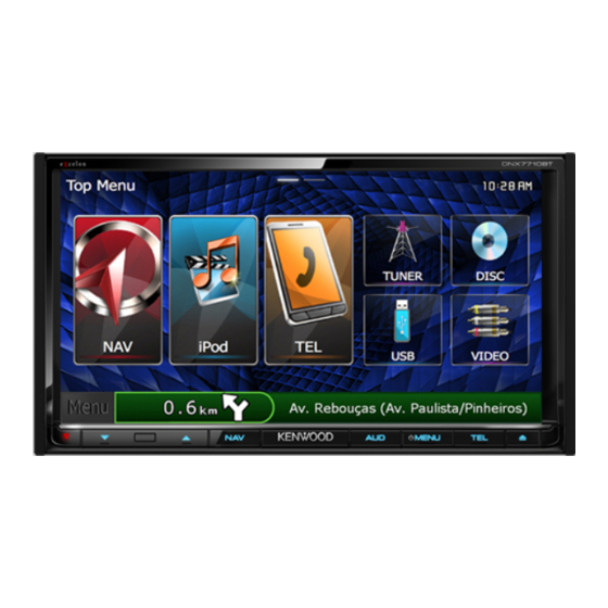
- Page 1 GPS NAVIGATION SYSTEM DNX7710BT DNX5710BT GPS NAVIGATION INSTRUCTION MANUAL © IM382_Nav_R_En_00...
-
Page 2: Table Of Contents
Contents Navigation End-User License Agreements Starting a Route Previewing Multiple Routes Following a Route Getting Started Using the Navigation Map Using the Navigation System Adding a Point to a Route Help When You Need It Taking a Detour Searching Help Topics Stopping the Route Status Bar Icons Using Suggested Routes... - Page 3 Using the Apps Traffic Information About Smartphone Link Traffic Subscription Activation Downloading Smartphone Link Understanding Traffic Connecting to Smartphone Link Traffic Data Using Smartphone Link Sending a Location from Your Phone About the Traffic Icon Disabling Calls While Connected Traffic on Your Route About Garmin Live Services Viewing Traffic on Your Route Subscribing to Garmin Live Services...
-
Page 4: End-User License Agreements
Software License Agreement (collectively, the “Garmin Products”) are protected under copyright laws and international copyright BY USING THE DNX7710BT / DNX5710BT, YOU treaties. The Garmin Products are licensed, not AGREE TO BE BOUND BY THE TERMS AND sold. The structure, organization and code of... - Page 5 products, systems, or applications installed or You agree to use the applicable Garmin Product otherwise connected to or in communication for solely personal use, or if applicable, for use in your business’ internal operations, and not with vehicles, and which are capable of dispatch, fleet management or similar applications where for service bureau, time-sharing, resale or other similar purposes.
- Page 6 End-User License Agreements the (i) useful life of the purchaser’s Garmin device, Disclaimer of Warranty. GARMIN AND ITS (ii) the useful life of the purchaser’s smartphone LICENSORS, including the licensors, service (if applicable), or (iii) as long as Garmin receives providers, channel partners, suppliers and affiliated Content from its third party content supplier, companies of Garmin and its licensors, DISCLAIM...
- Page 7 Content Providers. Reference to any products, ANY CONTENT OR MATERIAL DOWNLOADED OR UPLOADED OR OTHERWISE OBTAINED services, processes, hypertext links to third parties THROUGH THE SOFTWARE IS DONE AT YOUR or other Content by trade name, trademark, OWN DISCRETION AND RISK. YOU WILL BE manufacturer, supplier or otherwise does not SOLELY RESPONSIBLE FOR ANY DAMAGE TO YOUR necessarily constitute or imply its endorsement,...
- Page 8 End-User License Agreements terminated (by you or by Garmin) or expires, or (ii) Garmin terminates this Agreement for any The above terms and conditions shall be governed reason, including, but not limited to, if Garmin by the laws of Kansas, without giving effect to (i) its finds that you have violated any of the terms of conflict of laws provisions, or (ii) the United Nations this Agreement.
- Page 9 Additional Terms and Privacy Policy for Location Traffic End User License Agreement Platform Services. If your Application is provided Your Garmin product may be equipped to receive access to Location Platform Services, by accessing traffic data. If it is so equipped, the following terms such Location Platform Services you agree to and conditions apply to your use of your Garmin application of the Nokia Terms of Service at...
- Page 10 their respective affiliates) and Garmin Ltd. (and may not be transferred to another person or its subsidiaries) make no warranty of fitness or another Garmin product. Traffic services are in compatibility of the Traffic Data with the Garmin part geographically restricted to the reception product and no warranty that the Traffic Data will and transmission range of the radio transmitters in operate properly as integrated and interfaced...
- Page 11 legend provided herein, the Contracting Officer, federal government agency, or any federal official must notify HERE prior to seeking additional or alternative rights in the HERE Traffic Data. HERE is a trademark in the U.S. and other countries. © 1987-2014 HERE. All rights reserved. HD Radio Technology manufactured under license from iBiquity Digital Corporation.
-
Page 12: Getting Started
Getting Started The first time you use your Kenwood Navigation System, you need to set up your system. The Help menu provides additional information. Help When You Need It WARNING See "Safety Precautions and Important Information" Select Apps > Help to view information in the Quick Start Guide for product warnings and about using the device. -
Page 13: Satellite Signals
Adding a Shortcut Satellite Signals You can add shortcuts to the Where To? menu. A After your vehicle is turned on, the navigation shortcut can point to a location, a category, or a system begins acquiring satellite signals. The search tool. The Where To? menu can contain up to system may need a clear view of the sky to acquire 36 shortcut icons. -
Page 14: Finding Locations
Finding Locations The navigation system offers many methods for finding locations. The detailed maps loaded in your navigation system contain locations, such as restaurants, hotels, and auto services. You can use categories to browse for nearby businesses and attractions. Finding a Location by Category Enter a search term. -
Page 15: Finding An Address
Finding an Address Finding an Intersection Before you can find an intersection, you must ⁄ add a shortcut to the intersection search tool • The order of the steps may change depending on the (page 13). map data loaded on your device. Select Where To? > Intersections. Select Where To?. Select a state or province. -
Page 16: Finding A Location Using Coordinates
Finding Locations Finding a Location Using Coordinates Select an option: Before you can find a location using coordinates, • Select a location marker. you must add a shortcut to the coordinates • Select a point, such as a street, intersection, or search tool (page 13). -
Page 17: Going Home
Going Home Select an area on the map. Select Where To? > Go Home. The address of the location appears at the bottom of the screen. Editing Your Home Location Information Select the location description. Select Where To? > Saved > Home. Select Set Location. -
Page 18: Starting A Route To A Saved Location
Finding Locations Starting a Route to a Saved Location Assigning Categories to a Saved Location You can add custom categories to organize your Select Where To? > Saved. saved locations. ⁄ If necessary, select a category, or select All Saved Places. • Categories appear in the saved locations menu after you have saved more than 12 locations. -
Page 19: Navigation
Navigation You can create, customize, and edit your routes. Starting a Route Using the Navigation Map Search for a location (page 14). From the main menu, select View Map. Select a location. If the zoom controls are hidden, select the map to display the zoom controls. -
Page 20: Adding A Point To A Route
Navigation Adding a Point to a Route Using Suggested Routes Before you can use this feature, you must save at While navigating a route, select least one location and enable the travel history return to the main menu. feature (page 17). -
Page 21: Navigating To An Exit
Navigating to an Exit Adding a Custom Avoidance Area Custom avoidances allow you to avoid specific From the map, select > Exit Services > areas and sections of road. You can enable and disable custom avoidances as needed. Select Go!. Select Settings >... -
Page 22: Deleting Custom Avoidances
Navigation Deleting Custom Avoidances Select Settings > Navigation > Custom Avoidances. Select an option: • To delete all custom avoidances, select • To delete one custom avoidance, select the avoidance, and select > Delete. Enabling Advanced Detours Select Settings > Navigation > Advanced Detours. -
Page 23: The Map Pages
The Map Pages You can customize which data appear on the map and view upcoming turns and current location information. Customizing the Map Layers Changing the Map Perspective You can customize which data appear on the Select Settings > Map & Vehicle > Driving map, such as icons for points of interest and road Map View. -
Page 24: Viewing A List Of Turns
The Map Pages Viewing a List of Turns When you are navigating a route, you can view all of the turns and maneuvers for your entire route and the distance between turns. Select the text bar on the top of the map. Select a turn. -
Page 25: Viewing Trip Information
Viewing Trip Information Finding Nearby Services The trip information page displays your present You can use the Where Am I? page to find nearby speed and provides statistics about your trip. services, such as hospitals or police stations. From the map, select >... -
Page 26: Using The Apps
Before you can connect to Smartphone Link, you must download and install the Smartphone Link application on your phone. Start Smartphone Link on your phone. See your other Kenwood system manuals and your phone owner's manual for connection information. appears in the status bar on your device when Smartphone Link is connected. -
Page 27: About Garmin Live Services
About Garmin Live Services About ecoRoute Before you can use Garmin Live Services, your The ecoRoute™ feature calculates your vehicle device must be connected to a supported phone fuel economy, carbon footprint, and the fuel price (page 26). running Smartphone Link of navigating to a destination, and offers tools for improving fuel efficiency. -
Page 28: Taking The Ecochallenge
Using the Apps Taking the ecoChallenge Viewing Your Fuel Economy The ecoChallenge helps you maximize your fuel Select Apps > ecoRoute™ > Fuel Economy. economy by scoring your driving habits. The higher your ecoChallenge scores, the more fuel The graph along the bottom shows your you save. -
Page 29: Exporting A Mileage Report
Planning a Trip You can use the trip planner to create and save a Connect a USB mass storage device to your trip with multiple destinations. Kenwood unit. Select Apps > Trip Planner. Select Apps > ecoRoute™ > Mileage Report. -
Page 30: Editing A Trip Itinerary
Using the Apps Editing a Trip Itinerary Using the World Clock Select Apps > Trip Planner. Select Apps > World Clock. Select a saved trip. If necessary, select a city, enter a city name, and select Done. Select an option: Viewing the World Map • To change the arrival or departure time, select a location in the trip. -
Page 31: Traffic Information
Traffic Data Using Smartphone Link NOTICE You can purchase a traffic subscription to receive Garmin and JVC KENWOOD are not responsible for the accuracy or timeliness of the traffic information. traffic data using Smartphone Link. When your navigation system is connected to Smartphone... -
Page 32: Traffic On Your Route
Traffic Information Traffic on Your Route Viewing Traffic on the Map When calculating your route, the navigation The traffic map shows color-coded traffic flow system examines the current traffic and and delays on nearby roads. automatically optimizes the route for the shortest From the map, select time. -
Page 33: Customizing The Settings
Customizing the Settings You can customize the settings of your GPS navigation system. Customizing the Navigation System Changing the Navigation Settings Select Settings. Select Settings > Navigation. • Calculation Mode—sets route preference. Select a setting category. • Avoidances—sets road features to avoid on a route. • Custom Avoidances—allows you to avoid specific roads Select the setting to change it. -
Page 34: Updating The Time Settings
Customizing the Settings Updating the Time Settings Restoring Settings You can restore a category of settings or all Select Settings > Units & Time. settings to the factory default values. • Current Time—select Automatic to update the time Select Settings. automatically. -
Page 35: Appendix
Safety Cameras To update the navigation system software, you WARNING must have a USB mass storage device and an Garmin and JVC KENWOOD are not responsible for Internet connection. the accuracy of, or the consequences of using, a safety camera database. -
Page 36: Custom Pois (Points Of Interest)
WARNING Garmin and JVC KENWOOD are not responsible for the consequences of using custom POI databases, or for the accuracy of custom POI databases. After downloading your POI database, use the Garmin POI Loader to install the POIs onto a USB mass storage device. - Page 37 For the latest free software updates (excluding map data) throughout the life of your Garmin products, visit the Garmin Web site at www.garmin.com/Kenwood. © 2013-2014 Garmin Ltd. or its subsidiaries Garmin International, Inc. 1200 East 151st Street, Olathe, Kansas 66062, USA Garmin (Europe) Ltd.
Need help?
Do you have a question about the DNX7710BT and is the answer not in the manual?
Questions and answers