Table of Contents
Advertisement
Quick Links
Advertisement
Table of Contents

Subscribe to Our Youtube Channel
Related Manuals for Hesai Pandar40


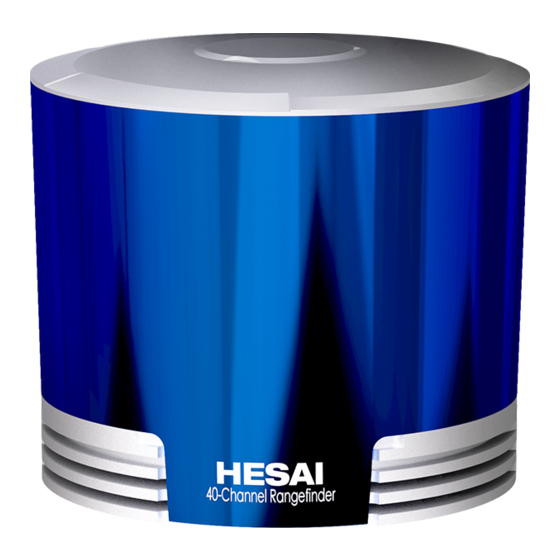
Summary of Contents for Hesai Pandar40
- Page 2 To avoid violating the warranty and to minimize the chances of getting electrically shocked, please do not disassemble the device. The device must not be tampered with and must not be changed in any way. There are no user-serviceable parts inside the device. For repairs and maintenance inquiries, please contact an authorized Hesai Technology service provider. Laser Safety Notice – Laser Class 1 This device satisfies the requirements of •...
- Page 3 LiDAR. If you suspect Repair that the LiDAR is interfering with your medical device, stop using the LiDAR DO NOT open and repair the device without direct guidance from Hesai immediately. Technology. Disassembling the LiDAR may cause degraded performance, Explosive Atmosphere and Other Air Conditions failure in water resistance, or potential injuries to the operator.
-
Page 4: Table Of Contents
Contents 1 Introduction ......................1 Appendix I Channel Distribution ................ 36 1.1 Operating Principle ....................1 Appendix II Calculation of Laser Firing Time ..........38 1.2 LiDAR Structure ......................2 Appendix III Support and Contact ..............41 1.3 Channel Distribution ....................3 1.4 Specifications ...................... -
Page 5: Introduction
1 Introduction This manual describes the specifications, installation, and data output format of Pandar40. This manual is under constant revision. Please contact Hesai for the latest version. 1.1 Operating Principle Distance Measurement: Time of Flight (ToF) A laser diode emits a beam of ultrashort laser pulses onto the object. -
Page 6: Lidar Structure
1.2 LiDAR Structure 40 pairs of laser emitters and receivers are attached to a motor that rotates horizontally. Figure 1.2 Partial Cross-Sectional Diagram Figure 1.3 Coordinate System (Isometric View) Figure 1.4 Rotation Direction (Top View) The LiDAR’s coordinate system is shown above. The Z-axis is the axis of rotation. The origin is shown as a red dot in Figure 1.6 on the next page. -
Page 7: Channel Distribution
1.3 Channel Distribution The vertical resolution is • 0.33° between Channel 6 and Channel 30 • 1° between Channel 1 and Channel 6, Channel 30 and Channel 40 • detailed in Appendix I Figure 1.5 Channel Vertical Distribution Figure 1.6 Laser Firing Position... -
Page 8: Specifications
1.4 Specifications SENSOR MECHANICAL/ELECTRICAL/OPERATIONAL Scanning Method Mechanical Rotation Wavelength 905 nm Channel Laser Class Class 1 Eye Safe Range 0.3 to 200 m (at 20% reflectivity) Ingress Protection IP6K7 ±5 cm (0.3 to 1 m) Height: 101.50 mm Range Accuracy Dimensions ±2 cm (1 to 200 m) Top/Bottom Diameter: 116.00 / 112.00 mm... -
Page 9: Setup
2 Setup 2.1 Mechanical Installation Figure 2.1 Isometric View Figure 2.2 Bottom View... - Page 10 Quick Installation Figure 2.3 Diagram of Quick Installation...
- Page 11 Stable Installation Figure 2.4 Diagram of Stable Installation...
-
Page 12: Interfaces
2.2 Interfaces Phoenix Contact is the default communication connector. Phoenix part number: SACC-M12MS-8CON-PG 9-SH - 1511857 (male, on the LiDAR) From the eye to the interface Figure 2.5 Phoenix Connector (Male) Table 2.1 Pin Description of Phoenix Connector Pin # Function Color Voltage... -
Page 13: Connection Box (Optional)
2.3 Connection Box (Optional) Users may connect the LiDAR directly or using the connection box. The connection box comes equipped with a power port, a GPS port, and a standard Ethernet port. The cable length between the connector and the connection box is 1.7 m by default. Phoenix part number: SACC-M12FS-8CON-PG 9-SH –... - Page 14 2.3.1 Connection Box Interfaces Figure 2.7 Connection Box Table 2.2 Connection Box Interfaces Port # Port Name Description Standard Ethernet Port RJ45, 100 Mbps Ethernet Power Port Use DC-005 DC power adapter Input voltage ranges from 9 V to 48 V. Power consumption is 18 W GPS Port Connector type: JST SM06B-SRSS-TB Recommended connector for the external GPS module: JST SHR-06V-S-B...
- Page 15 2.3.2 Connection Figure 2.7 LiDAR Connection When Using the Connecting Box...
-
Page 16: Get Ready To Use
2.4 Get Ready to Use The LiDAR does not have a power switch. It starts operating once connected to power and the Ethernet. • To receive data on your PC, set the PC’s IP address to 192.168.1.100 and subnet mask to 255.255.255.0 For Ubuntu-16.04: For Windows: Use the ifconfig command in the terminal:... -
Page 17: Data Structure
3 Data Structure 100 Mbps Ethernet UDP/IP is used for data output. The output data includes Point Cloud Data Packets and GPS Data Packets. Each data packet consists of an Ethernet header and UDP data. Figure 3.1 Data Structure... -
Page 18: Point Cloud Data Packet
3.1 Point Cloud Data Packet 3.1.1 Ethernet Header Each LiDAR has a unique MAC address. The source IP is 192.168.1.201 by default. The destination IP address is 0xFF FF FF FF and in broadcast form. Table 3.1 Point Cloud Data Packet – Ethernet Header Ethernet Header: 42 bytes Ethernet II MAC 12 bytes... - Page 19 3.1.2 UDP Data All the multi-byte values are unsigned and in little endian format. Ranging Data Table 3.2 Point Could UDP Data – Ranging Data Ranging Data: 1240 bytes (10 blocks) Block 1 Block 2 Block 3 … Block 10 0xFFEE 0xFFEE 0xFFEE...
- Page 20 0x42 (or 0x43) Example of UDP Data Analysis in Point Cloud Data Packets Take Pandar40’s Channel 5 in Block 3 of the UDP Data as an example: Vertical angle of Channel 5 is 3.00°, according to Appendix I Channel Distribution Horizontal angle is the current reference angle of the rotor (Azimuth of Block 3) plus the horizontal angle offset (-2.5°, according to Appendix I).
-
Page 21: Gps Data Packet
3.2 GPS Data Packet GPS Data Packets are triggered every second. All the multi-byte values are unsigned and in little endian format. Before $GPRMC messages are available from the external GPS module Each rising edge of the LiDAR’s internal 1 Hz signal triggers a GPS Data Packet. The time and date in the GPS Data Packets are unreal, starting from 00 01 01 00 00 00 (year, month, day, hour, minute, second) and increasing with the internal 1 Hz signal. - Page 22 3.2.1 Ethernet Header The source IP is 192.168.1.201 by default. The destination IP address is 0xFF FF FF FF and in broadcast form. Table 3.5 GPS Data Packet – Ethernet Header Ethernet Header: 42 bytes Ethernet II MAC 12 bytes Destination: broadcast (0xFF: 0xFF: 0xFF: 0xFF: 0xFF: 0xFF) Source: (xx:xx:xx:xx:xx:xx) Ethernet Data Packet Type...
- Page 23 3.2.2 UDP Data Table 3.6 GPS Data Packet – UDP Data GPS UDP data: 512 bytes GPS time data 18 bytes Header 2 bytes 0xFFEE, 0xFF first Date 6 bytes Year, month, and day (2 bytes each, lower byte first) in ASCII Time 6 bytes Second, minute, and hour (2 bytes each, lower byte first) in ASCII...
- Page 24 GPRMC Data Format $GPRMC, <01>, <02>, <03>, <04>, <05>, <06>, <07>, <08>, <09>, <10>, <11>, <12>*hh Field # Field Description <01> UTC Time Hour, minute, and second Can be in hhmmss (hour, minute, second) format <02> Location Status A (hex = 41) for Valid Position V (hex = 56) for Invalid Position NUL (hex = 0) for GPS being unlocked …...
- Page 25 Example of UDP Data Analysis in GPS Data Packets Figure 3.4 GPS Data Packet – UDP Data (Example) Date Field Data (ASCII Code) Characters Meaning Year 0x37 0x31 '7', '1' Month 0x32 0x31 '2', '1' 0x30 0x32 '0', '2' (UTC) Time Field Data (ASCII Code) Characters...
-
Page 26: Web Control
4 Web Control Web control is used for setting parameters, checking device info, and upgrading. To access web control Connect the LiDAR to your PC using an Ethernet cable Set the IP address according to Section 2.4 Get Ready to Use Enter this URL into your web browser: 192.168.1.201/index.html NOTE Use Google Chrome or Firefox instead of IE. -
Page 27: Settings
4.2 Settings 1. Destination IP Mode Destination IP Broadcast (default) 255.255.255.255 Multicast 239.0.0.0~239.255.255.255 Unicast Same as the PC’s IP address 2. Other Settings Spin Rate 600 rpm / 1200 rpm (GPS) Sync Angle 0~360 degrees By default, the LiDAR’s zero-degree position (defined in Section 1.2) is not in sync with PPS. -
Page 28: Device Info
4.3 Device Info Shows the device model, serial number, MAC address, and software/hardware/firmware versions. Figure 4.8 Device Info Page of Web Control... -
Page 29: Upgrade
4.4 Upgrade Click the Upload button and select an upgrade file (provided by Hesai). Reboot the LiDAR when the upgrade is complete. Below shows the software and firmware versions described in this manual. Figure 4.9 Firmware Upgrade Page of Web Control... -
Page 30: Pandarview
5 PandarView PandarView is a software that records and displays the point cloud data from Hesai LiDARs, available in 64-bit Windows 7/8/10 and Ubuntu-16.04. 5.1 Installation Copy the installation files from the USB disk included in the LiDAR’s protective case, or download these files from Hesai’s official website: www.hesaitech.com/en/download... -
Page 31: Use
5.2 Use Set the PC’s IP address according to Section 2.4 Use. Check Live Data Open a PCAP File Click on and select your LiDAR model to begin receiving data over Click on to pop up the “Choose Open File” window. Select a PCAP Ethernet. - Page 32 Play a PCAP File Button Description Jump to the beginning of the file While paused, jump to the previous frame While playing, rewind. May click again to adjust the rewind speed (2x, 3x, 1/2x, 1/4x, and 1x) After loading a point cloud file, click to play the file While playing, click to pause While paused, jump to the next frame.
-
Page 33: Features
5.3 Features Viewpoint Selection 3D Projection and Distance Measurement Users can select from the right view, front view, and top view. Both perspective projection (default) and orthographic projection are supported. The distance measurement ruler is available only under orthographic projection. After clicking on , drag your mouse while holding the Ctrl key to make a measurement in units of meters. - Page 34 Return Mode UDP Port Users can select from Block 1 Return (i.e. Last Return), Block 2 Return (i.e. Enter the UDP port number, and click “Set” to apply it. Strongest Return), and Dual Return. Channel Selection Click on to show/hide point cloud data from the selected laser channels.
- Page 35 Point Selection and Data Table Click on and drag the mouse over the point cloud to highlight an area of points. Click on to view the data of the highlighted points, as shown below. Some of the data fields are defined below: Field Description points...
- Page 36 Color Schemes. Click on to show the color legend at the lower right corner. Click on to open or close the Color Editor. The default color scheme is intensity based. Users can choose from other colors schemes based on azimuth, azimuth_calib, distance, elevation, laser_id, or timestamp.
-
Page 37: Sensor Maintenance
6 Sensor Maintenance Storage Store the device in a dry, well ventilated environment. The ambient temperature should be between -40°C and +85°C, and the humidity below 85%. Please check the specifications page in this user manual for product IP rating, and avoid any ingress beyond that rating. Transport Package the device in shock-proof materials to avoid damage during transport. -
Page 38: Troubleshooting
Check the firmware version of the sensor on the Firmware Upgrade page of web control. If the version is not shown properly but as “xxxx”, contact Hesai for further diagnostics Make sure the Destination IP and the Destination LiDAR Port are set correctly on the Settings page of web control... - Page 39 Make sure the LiDAR’s calibration file is imported. (Pandar40P automatically imports the calibration file, while (misaligned points, flashing Pandar40 requires manual importing) points, or incomplete FOV) Check for packet loss. If no packet is missing while the point cloud flashes, please update PandarView to the latest version and restart the PC.
-
Page 40: Appendix I Channel Distribution
Each channel’s horizontal angle = rotor’s current reference angle + horizontal angle offset Define clockwise in the top view as positive. Each channel’s vertical angle is a constant. 0° represents the horizontal direction. Define upward as positive. Table 1.1 Pandar40 Channel Distribution (To Be Continued) Channel # Horizontal Angle Offset... - Page 41 Table 1.1 Pandar40 Channel Distribution (Continued) Channel # Horizontal Angle Offset Vertical Angle Instrument Range Range (in meters) in UDP Data (Azimuth) (Elevation) (in meters) with Reflectivity -2.50 -2.67 200@20% 0.00 -3.00 200@20% 5.00 -3.33 200@20% -2.50 -3.67 200@20% 0.00 -4.00...
-
Page 42: Appendix Ii Calculation Of Laser Firing Time
Assuming that the absolute packing time is t0, the start time of each block (the time when the first laser starts firing) can be calculated. For Pandar40, there are 10 blocks of ranging data in each Point Cloud Data Packet, as shown below. Each block contains the ranging data from 40 channels, one return per channel. - Page 43 Single Return Mode The ranging data generated by one round of firing is stored in one block. The calculation of each block's start time is as follows: Table II.2 Start Time of Each Block – Single Return Block Start Time (μs) Block 1 Block 2 t0 + 55.56 * 1...
- Page 44 Laser firing time of each channel Assuming that the start time of Block 6 is t6, the laser firing time of each channel can be calculated. Table II.4 Laser Firing Time of Each Channel Firing Sequence Laser ID Firing Time (μs) Firing Sequence Laser ID Firing Time (μs)
-
Page 45: Appendix Iii Support And Contact
NOTE Please leave your questions under the corresponding GitHub projects. Legal Notice Copyright 2019 by Hesai Technology. All rights reserved. Use or reproduction of this manual in parts or its entirety without the authorization of Hesai is prohibited. Hesai Technology makes no representations or warranties, either expressed or implied, with respect to the contents hereof and specifically disclaims any warranties, merchantability or fitness for any particular purpose.
Need help?
Do you have a question about the Pandar40 and is the answer not in the manual?
Questions and answers