Table of Contents
Advertisement
Manual
Handling
The Global Positioning System (GPS) consists of a total 24 GPS satellites that orbit the earth,
enabling you to determine your position anywhere in the world, 24 hours a day, if you can receive
satellite signals. During actual navigation, carefully compare the position data with all available
navigation sources such as Loran C, Decca, other navigators, charts, visual navigation, depth, water
temperature and others. It is your responsibility to make navigation judgments.
The Electronic Chart :
Only official authorized charts and notices to mariners contain all the information needed for the safety
of navigation and, as always remember, the user is responsible for their prudent use.
Pictorials
This manual uses the following symbols for easy understanding safety instructions. Always follow
these instructions carefully.
WARNING
CAUTION
WARNING
Important Notice
Keep this manual in a safe place where you can access it quickly.
Always follow this safety instruction to prevent death or injury.
Follow this safety instruction to avoid possible injury or damage to your
property.
Symbol "△" is a CAUTION or WARNING label indicating the safety
instruction.
This symbol is an Electrical Shock WARNING label.
Symbol is an instruction that you must not violate.
(This symbol instructs NOT to disassemble the system components)
Symbol is an operation instruction that you must follow.
(This symbol shows the main power OFF instruction.)
- 1 -
Advertisement
Table of Contents

Summary of Contents for Haiyang Stella Series
-
Page 1: Important Notice
Important Notice Manual Keep this manual in a safe place where you can access it quickly. Handling The Global Positioning System (GPS) consists of a total 24 GPS satellites that orbit the earth, enabling you to determine your position anywhere in the world, 24 hours a day, if you can receive satellite signals. -
Page 2: Installation Cautions
Installation Cautions <For service Personnel> Follow installation instructions to avoid personal injury and system malfunction. Installation in Mount your Stella series on a rigid frame or base to prevent your unit rigid location. from working loose. Use the installation materials provided in the standard accessory Use correct pack only. -
Page 3: Maintenance Cautions
Use correct power Operate your system within the specified power voltage. An incorrect source. power supply may cause Maintenance Cautions<For Maintenance Personnel> Use the following safety precaution internal inspection. High voltage may be retained in the capacitors if the high-tension Discharge capacitors. - Page 4 Transducer must be installed by authorized Consult us for transducer installation by authorized personnel. personnel. This product is designed to assist a navigation. WARNING When you are sailing, use the certified chart from the Government or IMO. - 4 -...
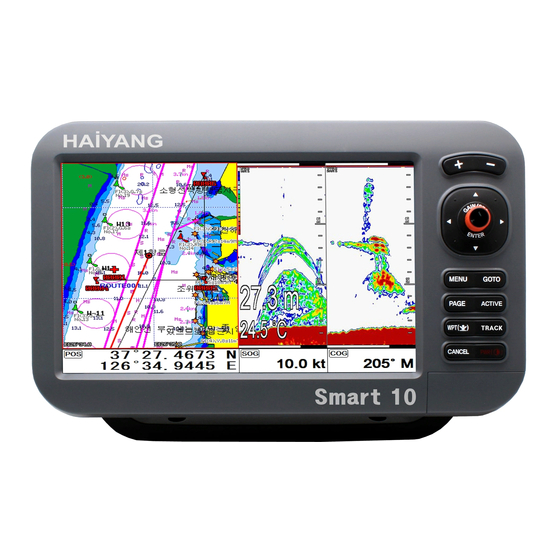
- Page 5 Stella Series System Welcome Stella series opens a new chapter of performance and integration in vessel navigation system display and management. Whether you are a Cruiser or Sport fisherman or both, Stella series gives you the information you need. CAUTION Stella series is Color LCD Charting Systems employs the latest in proven technology to provide accurate navigation information.
- Page 6 The Stella series employs the latest in proven technology to provide accurate navigation information. The Plotter functions of Stella series are totally dependent upon the capability of the navigation source to provide accurate position information. This device is only an aid to navigation. It should be used in conjunction with all other navigation accuracy.
- Page 7 Stella Series System DISPLAY BREAKAGE WARNING The LCD display module contains a liquid. If the display is broken and the liquid contacts your skin, wash it off immediately in running water for 15 minutes. If the liquid contacts your eyes, immediately flush your eyes with running water for 15 minutes.
- Page 8 - 8 -...
-
Page 9: Getting Started
Getting Started 1. The Keyboard 1.1. Chartplotter Description use this to select menu items, move the on-screen cursor Rotary: use this to select menu items Button: push the end of the everything to confirm a selection or entry Change the chart of scale Open the menu Select the Goto function Select the configuration &... - Page 10 - 10 -...
- Page 11 1.2. Chartplotter+Fishfinder Description use this to select menu items, move the on-screen cursor and Choosing the frequency Rotary: use this to select menu items and Adjustment of gain & STC level with turning. Button: push the end of the everything to confirm a selection or entry Change the chart of scale and Setting up the depth range Open the menu Select the Goto function...
- Page 12 1.3. Chartplotter+Fishfinder Description use this to select menu items, move the on-screen cursor and Choosing the frequency [FUNC1][FUNC2] Setting up Using Frequently key function. [FUNC3] [+][-] Change the chart of scale and Setting up the depth range [MENU] Open the menu [MODE] Selects the map orientation &...
- Page 13 Power “on/off”, brightness and day/night mode. 1.4. How to (Fig.1.1) 1.3.1. Turn on Switch on. 1.3.2 Turn off 1.3.2 Turn off Choose “Power off” on (Fig. 1.1). 1.3.3 Restart Choose Restart on (Fig. 1.1). 1.3.3. Adjust brightness Choose “Brightness” on (Fig.1.1). (Fig.1.2) 1.3.4.
- Page 14 1.3.6. How to lock the tough screen Keep pressing “Toughlock” on (Fig.1.1) and the color changes to orange and activate. In touchlock, touch icons disappear on the screen and deactivate. For activate, keep pressing “ToughLock”. 1.3.7. WiFi Choose “WiFi” on (Fig.1.1). 1.3.8.
- Page 15 2. Specification of the connectors 2.1. Metal connectors - 15 -...
- Page 16 2.2. Plastic connectors - 16 -...
- Page 17 3. Screen Overview 3.1. Chartplotter page ① ③ ② ⑤ ⑥ ⑦ ④ ① Vessel icon The present position. ② Cursor Showing the cursor icon. ③ AIS target Showing the received AIS target. ④ Databar Showing various data on the top or bottom. ⑤...
- Page 18 3.2. Fishfinder page ⑦ ⑤ ⑥ ③ ④ ② ① ⑤ ⑥ ⑦ ① Palette Showing the chosen colors. ② Depth bar The current depth. ③ Low Frequency Showing 50KHz. ④ High Frequency Showing 200KHz. ⑤ LF INFO The information of Low Frequency, 50KHz. ⑥...
- Page 19 3.3. Navigation Data page 3.3.1. Navigation Data Type1 3.3.2. Navigation Data Type2 - 19 -...
- Page 20 3.4. Highway page ② ① ③ ④ ⑥ ⑤ ① WPT name The current WPT name. ② Direction of steer The best direction of the steering. ③ WPT icon The remaining distance of the WPT. ④ Vessel The out of the range from the best. ⑤...
- Page 21 3.5. Steering page ② ① ③ ④ ① WPT name Name of the WPT. ② Direction of steer The best direction of the steering. ③ WPT icon Showing the WPT and the bearing ④ Navigation Data Information of the various data. - 21 -...
- Page 22 ① 3.6. GPS Status page ② ④ ③ ① Receiver status The current GPS status. ② Position of SAT. Position of the satellites. ③ SNB Graph Showing the WPT and the bearing. ④ Navigation Data Information of the various data. * Colors of the GPS status Black: Tracked, but no signal...
- Page 23 4. Databar Showing various data on the top or bottom. 4.1. Mode ▶[MENU]->Advance->Setup->Customizing->Databar->Mode Databar has three meanings as below. 4.1.1. GPS Showing the largest LAT/LOT. 4.1.2. HY Showing the LAT/LOT, SOG, COG and userdata. 4.1.3. HY2 Showing LON/LAT, mark, track and time/date. 4.1.4.Customizing Showing various data as what the user wants.
- Page 24 (Fig.1.3.1) The databar is coming as (Fig.1.3.1), and choose the frame with [◀][▶]. Four frames are available as (Fig 1.3.2). (Fig.1.3.2) When choosing the frame, setting up in each box as (Fig.1.3.3). - 24 -...
- Page 25 (Fig.1.3.3) When finishing the set up, press [CANCEL] to exit or touch “EXIT” on the screen.. (*Please, refer “Customizing” for further question.) 4.2. Display ▶[MENU]->Advance->Setup->Customizing->Databar->Display Setting the databar, “Shown/Hidden”. 4.3. Position ▶[MENU]->Advance->Setup->Customizing->Databar->Position Setting the databar position on the top or bottom. 5.
- Page 26 5.2. Moving Press [◀][▶][▼][▲], the cursor is moving to the direction. Press [◀][▼] together, the cursor is moving to “↙”. Press [▶][▼] together, the cursor is moving to “↘”. Press [◀][▲] together, the cursor is moving to “↖”. Press [▶][▲] together, the cursor is moving to “↗”. 5.3.
- Page 27 6. Page ▶[ PAGE] Choosing the various pages that set up pages or customized. Move the red box to choose the page. Rotate the knob or press [◀][▶][▼][▲] to move the red box on your page and Enter to finish. Selected (red color) (Fig.1.4) 6.1.
- Page 28 (Fig.1.4.1). (Fig.1.4.1) Choose your frame on (Fig.1.4.1). Using key: use [▼][▲] and move the red box to choose the pages and press [▶]. When you finish, press Enter. 2. Press [▶], choose with [▼][▲] 1. Choose the pages with [▼][▲] - 28 -...
- Page 29 4. Keep choosing and Enter to finish 3. press [Enter] (Fig.1.4.2) Long press: Choose the page and long press for drag the page into the frame.. (Fig.1.4.3) When complete, press [Enter] to finish. - 29 -...
- Page 30 7. Active ▶[ACTIVE] When pressing [FUNC], the red box moves to to chartplotter or fishfinder. (*All key functions change to chartplotter or fishfinder) Selected (red color) - 30 -...
-
Page 31: Navigation Data
8. Navigation Data Navigation data is available in Navigation data page, Steering page, Highway page as (Fig.1.5). (Fig.1.5) 8.1. Type ▶[MENU]->Advance->Setup->Customizing->Navigation data->Type Two types of Navigation data page. 8.1.1.Type1 Large LAT/LOT as (Fig.1.5.1). (*Editing the LAT/LOT is unavailable) 8.1.2. Type2 Various data as (Fig.1.5.2). - Page 32 8.2. Edit (*If there is no navigation data on the page, editing the navigation data is unavailable) ▶[MENU]->Advance->Setup->Customizing->Navigation data->Edit After finishing as (Fig.1.5.3), press [CANCEL] to exit. (*Please, refer “Customizing” for further question) (Fig.1.5.3) - 32 -...
- Page 33 9.MOB If a person or missing an object overboard and you need to get present position, use the MOB function. (Fig.1.6) 9.1. Inputing Keep pressing [WPT] until the window comes out as [Fig.1.6] and then “MOB” comes out with alarm. 9.2.
-
Page 34: Memory Card
10. Memory Card Inserting the SD, micro SD & USB OTG as (Fig.1.7.1). (Fig.1.7.1) - 34 -... -
Page 35: Save Userdata
11. Save Userdata ▶[MENU]->Userdata->Save Userdata Userdata is stored in the external SD/Micro SD/USB. So if you want to save the userdata, a SD/ Micro SD/USB must be inserted in the slot. (*Userdata is in “..\HY\UserData\”) 11.1. WPT WPT can be stored in a SD/Micro SD/USB. When storing, give it a name and you will be able to store many WPT’... - Page 36 Track can be stored in a SD/Micro SD/USB. When storing, give it a name and you will be able to store many tracks in the SD/Micro SD/USB. 11.3.2. Type2 Track can be stored in a SD/Micro SD/USB. Index will be a standard in Type2. After choosing the index, stored it. 11.4.
- Page 37 12.1. WPT WPT loads from the stored SD/MicroSD/USB. All of WPT in the SD/MicroSD/USB show on the list. Choose one of them and it will show. There are two ways to load WPT. First, showing the stored WPT as well as the existing on the sceen. After loading the stored, you will see the window and press [MENU].
- Page 38 Track loads from the stored SD/MicroSD/USB. Index will be a standard in Type2. After choosing the index, stored it. 12.4. User Line User line loads from the stored SD/MicroSD/USB. All of user line in the SD/MicroSD/USB show on the list. Choose one of them and it will show. 12.5.
- Page 39 - 39 -...
- Page 40 Chartplotter getting started 1. GOTO 1.1. Goto type1 1.1.1. Setting ▶[MENU]->Navigation->Goto type->type1 Setting GOTO with creating a route at the same time. Move the cursor to the position where you want to go and press [ENTER]. (*While navigating, WPT can be added in the route) 1.1.1.2.
- Page 41 2. WPT 2.1. List ▶[MENU]->Userdata->WPT->List Editing, creating, erasing and navigating are available on the WPT list. ② Selected ③ ④ ① ⑤ ⑥ ⑦ ⑧ ⑨ ① List Showing all of the stored WPT. ② Latitude/Longitude LAT/LOT of the WPT. ③...
- Page 42 2.2. Setting the WPT symbol ▶[MENU]->WPT Symbol Selected(red color) Choose the symbol and press [ENTER]. The chosen symbol will show when inputting WPT. 2.3. Setting WPT Color ▶[MENU]->WPT Color Selected(red color) - 42 -...
- Page 43 Choose the color and press [ENTER]. The chosen color will show when inputting WPT. 2.4. Creating 2.4.1. Creating on the list ▶[MENU]->Userdata->WPT->List->[2.Add] Adding WPT with pressing [2.Add]. (*When adding, LAT/LOT show the present position and current symbol/color show for the WPT) 2.4.1.
- Page 44 2.6 Erasing all of WPT ▶[MENU]->Userdata->WPT->List->[5.All Erase] On the WPT list, press [5.All Erase]. 1. Erase all: Choose “ALL” of symbol and color and “Erase” and Enter. 2. Erase by color and symbol: Choose the color and the symbol and “Erase” and Enter. Selected (Fig.1.8.) 2.7.
- Page 45 2. Choose “Move”. 3. Move the WPT to the position where you want to move, and press [ENTER]. 2.8. Navigating 2.8.1. Navigating on the list ▶[MENU]->Userdata->WPT->List->[6.Goto] Choose the WPT on the list and press [6.Goto]. 2.8.2. Navigating on the chart Call the cursor and move it on the WPT, and press [ENTER].
- Page 46 2.9. Move to vessel Call the cursor and move the WPT and Enter. Choose “Move to vessel”. - 46 -...
- Page 47 2.10. Sorting ▶[MENU]->Userdata->WPT->List->[4.Sort] Sorting the order of WPT on the list. - 47 -...
- Page 48 2.11. Editing ▶[MENU]->Userdata->WPT->List Editing the WPT on the list. Edit Selected WPT Selected 1. Choose the WPT as the blue and press [ENTER]. 2. Choose the item as the green and you may begin to edit. 3. After finishing, press [CANCEL] to exit. - 48 -...
- Page 49 3. Route 3.1. List ▶[MENU]->Userdata->Route->List ③ ② ④ ⑤ ⑥ ① ⑦ ⑧ ① List Showing the stored WPT ② Name Name of the route ③ Number of WPT Number of WPT in the route ④ Total distance Total distance of the route ⑤...
- Page 50 3.2. Route detail ▶[MENU]->Userdata->Route->List->[4.Detail] ② ③ ④ ① ⑤ ⑥ ⑦ ⑧ ⑨ ① List Showing the stored WPT ② Latitude/Longitude LAT/LOT of the WPT ③ Name Name of the WPT ④ Date & Time Date and time of the WPT when stored ⑤...
- Page 51 3.3. Creating Two ways to create route The first uses “GOTO type1” and the second is “Creating new route” on the list. 3.3.1. Using “GOTO” Use “GOTO type1” and create a route. Press [ENTER] to start. Press [GOTO] to exit and choose “Store” if needed. 3.3.2.
- Page 52 3.4. Edit ▶MENU->Userdata->Route->List Choose the route on the list to edit. 3.5. Detail edit ▶[MENU]->Userdata->Route->List->[4.Detail] Choose the route on the list and press [4.Detail]. The window of Route detail shows. 3.5.1. Adding WPT Two ways to add WPT 3.5.1.1. Adding the stored WPT ▶[MENU]->Userdata->Route->List->[PAGE]->[2.Saved WPT] - 52 -...
- Page 53 (Fig.2.1) Press [2.Saved WPT] on the Route detail and you may add the stored WPT as (Fig.2.1). 3.5.2.1. Adding new WPT Press [3.New WPT] on Rout detail and you may add new WPT. 3.5.3. Erasing WPT Choose the WPT and press [4.Erase]. 3.6.
- Page 54 4.2. Choosing the track 4.2.1. By time ▶[MENU]->Userdata->Track->Track Setup->Record Setup->Time Tracking by the set time. 4.2.2. Setting the time interval ▶[MENU]->Userdata->Track->Track Setup->Time Interval Setting the time interval. 4.2.3. By distance ▶[MENU]->Userdata->Track->Track Setup->Record Setup->Distance Tracking by the set distance. 4.2.4. Setting the distance interval ▶[MENU]->Userdata->Track->Track Setup->DIST Interval Setting the distance interval.
- Page 55 Selected(red color) Choose the color and press [ENTER]. (* The number next the color shows the number point of the track color) 4.5. Track type 4.5.1. Type1 ▶[MENU]->Userdata->Track->Track Setup->Type1 4.5.1.1. Erasing ▶[MENU]->Userdata->Track->Erase Choose the color and press [ENTER]. (*The number next the color shows the number point of the track color.) - 55 -...
- Page 56 Selected(red color) 4.5.1.2. Erasing all of track ▶[MENU]->Userdata->Track->Erase Press [1.All Erase]. 4.5.1.3. Erase with cursor ▶[MENU]->Userdata->Track->Erase->Partial Erase Choose [2.Cursor]. - 56 -...
- Page 57 Long press where you want to start erasing the track. (*1 should show on the left top.) - 57 -...
- Page 58 Choose the end of the track to erase. 4.5.2. Type2 ▶[MENU]->Userdata->Track->Track Setup->Type2 4.5.2.1. Select index ▶[MENU]->Userdata->Track->Select Index Five rooms in the index. The maximum is 10,000 points in each room. In Type2, storing, loading and erasing are available to manage in the room. 4.5.2.2.
- Page 59 ① ③ ② ④ ⑦ ⑧ ⑤ ⑥ (Fig.2.2) ① List Showing the track room ② Number of Point Total track point in the track room ③ Date&Time Date and time of the track room when stored ④ Color Color of the track room ⑤...
- Page 60 5. Measuring the distance and bearing Measuring two points, “A” and “B”. 1. Call the cursor and move it on the point, “A”. 2. Call the cursor and move it on the point, “A”. 3. Move the cursor on the point, “B”. 4.
-
Page 61: Start Point
6. User Line Adding lines directly on the chart. 1. Call the cursor. 2. Press [ENTER] and “User Line” shows. 3. Move the cursor to the beginning point and press [ENTER]. 4. Keep moving the cursor and press [ENTER] each time. 5. - Page 62 8. Correction Offset When the chart position is wrong, making it correct. 1. Call the cursor and move it to the correct position. 2. Press [ENTER] and choose “Correction Offset”. (* The maximum range of Correction Offset is 5nm.) - 62 -...
-
Page 63: Map Orientation
Chartplotter operation 1. Map Orientation ▶[MENU]->Advance->Map Setup->Map Orientation 1.1. True Motion ▶[MENU]->Advance->Map Setup->Map Orientation->True motion The True Motion is in the way the vessel position is presented. In True Motion mode, the vessel icon moves over the map while the map remains stationary. (* It is not available to operate on Course up and Head up.) 1.2. -
Page 64: Map Setup
2. Map setup ▶[MENU]->Advance->Map Setup 2.1. Map orientation 2.1.1. True motion You can select “True motion” (☞ The default setting is OFF.) 2.1.2. Up mode You can select “Map Orientation” (☞ The default setting is North Up.) 2.2. UserData Display Setting up shown/hide the user data on the display. - Page 65 2.6. LAT. Modification Though GPS information is accurate, there could be an error in the chart at latitude. The error can be modified in the chart latitude modification. 2.7. LOT. Modification Though GPS information is accurate, there could be an error in the chart at longitude. The error can be modified in the chart longitude modification.
- Page 66 2.9-1.8. Dynamic Current Setting up the Dynamic Current on the HY-MAP. ☞ The default setting is off.) 2.9-2. C-Map (*Only for *C-MAP mode.) 2. 9-2.1. SAT.Image Setting up the overlay Satellite Image on the C-MAP. ☞ The default setting is shown.) 2.9-2.2.
- Page 67 ☞ The default setting is English.) 2.9-2.6. QuickView It is available to set up. Place the cursor on buoys or icons on the C-MAP, the information window is shown up automatically. ☞ The default setting is hidden.) 3. Vessel 3.1. Vessel Icon Size The size of the present position is adjustable from 0 to 9.
- Page 68 When you approach into the waypoint range, it gives you a notice with alarm. ☞ The default setting is OFF.) 5.1.2. Arrival Radius: It is to adjust the range of arrival from your waypoint. If you have a route, it changes to the next waypoint automatically.
- Page 69 It alarms if it breaks into the setting area. ☞ The default setting is OFF.) 5.4.2. User Line Range It sets the range of the course alarm. ☞ The default setting is 0.05nm.) - 69 -...
-
Page 70: What Is Ais
AIS getting started 1. What is AIS? AIS is an Automatic Identification System. It has been introduced to improve the safety of navigation by assisting in the efficient operation of ship to ship, ship reporting and VTS applications. The system should enable operators to obtain information from the ship automatically, requiring a minimum of involvement of ship’s personnel, and should have a high level of availability. - Page 71 to red color. Target Sleeping Target located outside the Activation Range. Sleeping target is represented by a small oriented triangle. Target Lost Target When the AIS info is not received from that vessel. The presentation will be marked X on the target. 3.
-
Page 72: Quick Info On Ais Target
4. Quick INFO on AIS target Choose “AIS information window” on (Fig.3.1) and AIS data shows under the AIS target. (*Up to four kinds of data is available to choose in Quick INFO) - 72 -... -
Page 73: Ais Operation
AIS operation ▶[MENU]->AIS 1. AIS On/Off Turns the display of AIS targets overlay on the screen On or Off. ☞ The default setting is On.) 2. List Selected(blue color) 2.1. List ④ ⑤ ⑥ ① ② ③ ⑦ (Fig.3.2) ① Name Name of the AIS target ②... - Page 74 2.2. Detail Choose the AIS target and press [ENTER]. - 74 -...
- Page 75 2.3. Goto Choose the AIS target and press [4.Find]. - 75 -...
-
Page 76: Display Radius
2.4. Sort Press [3.Sort] to choose how to sort on (Fig.3.2). 3. Display radius Displays range rings centered on your current position. (☞ The default setting is OFF.) - 76 -... - Page 77 4. AIS target size Choose the size of AIS target. (☞ The default setting is Large.) 5. Display vessels by Color Different types of AIS transmissions can be selected to display different colors of icons on the chart display. 6. Display vessels by Type Different types of AIS transmissions can be selected to display different types of icons on the chart display.
- Page 78 8.4. TCPA Limit The values allowed are from 1 to 50 min. ☞ The default setting is 1 min.) 8.5. Radius Alarm When any AIS target breaks into the radius, alarming. 8.6. Radius The values allowed are from 0.1nm to 10nm. ☞...
- Page 79 10.2. Cursor Box info When you move the cursor in chart mode over an AIS target a box appears showing details of that vessel. 10.3. Messages List This window displays lists of specific AIS messages, such as Safety Messages that the unit has received.
- Page 80 Setup the Fishing net alarm range. (☞ The default setting is 0.05nm.) 10.6. Display Scale It is possible to setup AIS Targets with Scale ☞ The default setting is 60nm.) 10.7. Group Fishing Showing chosen AIS targets only in group fishing list. 10.7.1.
- Page 81 - 81 -...
- Page 82 #Fishfinder getting started 1. Choosing the frequency In dual frequency mode, choosing the frequency with [▲][▼]. Selected (*The chosen frequency shows in red) 2. Auto/Manual Gain Press [ENTER] to choose” AUTO/Manual” of Gain. 3. Gain/STC Choose “Gain” and “STC” with [◀][▶]. 4.
- Page 83 2. Choose the gain. 3. Twisting the rotary key to control the gain. 5. Controlling STC 1. Choose the frequency. 2. Choose the STC. 3. Twisting the rotary key to control the STC. 6. Mode ▶[MENU]->Mode Three kinds in Fishfinder. 6.1.
- Page 84 6.2. Bottom Zoom Bottom Zoom magnifies the sounder display from the sea bottom toward the surface for a short distance. The sea bottom contour is displayed and additional contour lines are added at intervals above the sea bottom to aid in determining distances of echoes near the bottom. Use the Sounder Menu to set the magnified Bottom Range from 2.5 to 20m (10 to 60ft.).
- Page 85 6.3. Bottom Lock Bottom Lock divides the Fishfinder main screen image for the selected Fishfinder into two sections. The left hand section displays a Normal Mode image. The right hand section of the screen displays the Fishfinder image relative to the sea bottom. The sea bottom appears as a straight line with the Fishfinder image magnified for a short distance toward the surface.
- Page 86 6.4. Part Zoom Shows an enlarged fishfinder screen of the set range. You can show the screen of left is normal screen and screen of right is part zoom - 86 -...
- Page 87 Set the depth range (it displays green) 7. VRM ▶ [WPT] The VRM (movable marker) shown by the green line can be moved up and down. It is convenient to measure the depth by aligning with the target such as school of fish. - 87 -...
- Page 88 8. Scroll ▶[MENU]->6. Scroll. This function allows the users to view the screen in the past fishfinder. When the cursor is called You can see past the screen using the [←][→] key. Then after [WPT] key is pressed, the input position is marked in the past. (★...
- Page 89 #Fishfinder operation 1.Menu ▶ [MENU] 1.1. Userdata It is same as Chartplotter. PLS refer the Chartplotter operation manual. 1.2. Depth Range Stella selects the best condition for measuring the depth automatically in the environment of the sea. ☞ The default setting is Auto.) 1.3.
-
Page 90: Advanced Menu
1.6.3. DSTC This function can rejection the noise of surface. ☞ The default setting is on.) 1.7. Scroll This function allows the users to view the screen in the past fishfinder. When the cursor is called You can see past the screen using the [←][→] key. Then after [WPT] key is pressed, the input position is marked in the past. - Page 91 2.1.5.Depth Font Select the depth range font size on the screen. ☞ The default setting is Large.) 2.1.6.TEMP Shown/Hidden the temperature on the screen. ☞ The default setting is Hidden.) 2.1.7.TEMP Font Select the temperature font size on the screen. ☞...
- Page 92 2.2.3. Screen Color Select he back ground color of the Fish finder for your convenience. 2.3. Output Power Select the output from the installed transducer. Levels are from off to 3. It should be careful about the depth. If you set high level in a sallow depth, the Fish finder screen turns to red. You see nothing expect red on the screen.
- Page 93 (☞ The default setting is 0.) 2.4.3. Fish-School 2.4.3.1. Fish-School Alarm It alrams when it detects school of fish. It will detect school of fish depend on set depth, range and level of the fishfinder. (☞ The default setting is OFF.) 2.4.3.2.
- Page 94 The tolerance of boat speed value can be corrected. When the [Speed source] is set to the [Sensor], it is corrected by %. (setting:-50~50%) When the [Speed source] is set to the [NMEA], it is corrected by numeral. (setting:-10.0~10.0) ☞The default setting is 0.) 2.5.4.
- Page 95 - 95 -...
-
Page 96: General Operation
General operation 1.GPS It is available to control and confirm information in GPS receiver. 1.1. Coordinate System It sets coordinate system of GPS or Loran. (☞The default setting is GPS.) 1.2. Datum It shows GPS Datum. WGS-84, which is the worldwide standard is only available. (☞... - Page 97 (☞ The default setting is incorrect every the country.) 1.8. LAT/LON Unit It is to select the number of the unit for Lat/Lon. (☞ The default setting is 4 unit.) 1.9. Receiving Port It is to select Inter receiver Internal, External and AIS. (☞...
- Page 98 2.2.2. Variation There could be a difference between the magnetic compass and the GPS compass. An error depends upon your area. 2.2.3. External compass You can use electronic compass by NEMA. (☞ The default setting is off.) 2.3. Time & Date 2.3.1.
- Page 99 The chartplotter allows customizing the NMEA-0183 sentence. DESCRIPTIONS CONTENTS OF DATA FIELD DEFAULT $GPGGA Global Positioning System Fix Data $GPVTG Course and Ground Speed $GPZDA Time and Date $GPRMB Recommended minimum navigation information $GPRMC Recommended Minimum Specific GPS/TRANSIT DATA $GPAPB Heading/track controller (Autopilot) sentence B $GPXTE Cross-track error, measured...
- Page 100 2.7.1.2. Position Setting up up/down the position of databar on the display. (☞ The default setting is Down.) 2.7.1.3. Edit It customizes the data bar information. 2.7.1.4 Mode It is available to set up the data bar. - Customizing : It is selectable and modifiable the data bar by user. - GPS/HY/NAV: It is fixed data bar by default.
- Page 101 (☞ Standard is Large) 2.7.5. Userdata 2.7.5.1. WPT 16 kinds of symbol and color. Choose the symbols and the colors. 2.7.5.1.1. Symbol Setup In 16 kinds of the symbols, you can choose as many as you want, and those will show on the WPT symbol window.
-
Page 102: Maintenance
3. Maintenance It is necessary to check the system or the version for maintenance and demonstrate Stella series with the simulators 3.1. Program Version It contains ID and the program version, and it has important information for maintenance and upgrade. - Page 103 (*All user data will be deleted) 3.8. Wire LAN Setting the wire LAN IP. 4. Calendar It is available to check the solar/moon calendar and tide. 5. Others 5.1. Screen capture This is the function of save the current screen Note: The capture file is stored in external SD card.
- Page 104 Data layout 1. Display Setting the data layout on the screen. Only available in “Shown”. (☞ Standard is Hidden) 2. EDIT 2.1. Move Available to move the layout data with drag and drop. Touch “EXIT” to finish. (*Available when more than one data layout on the screen) - 104 -...
- Page 105 2.2. GPS Showing the layout, Position, SOG and COG. 2.3. Time&Date Showing the layout, Time and Date. 2.4. Userdata Display Showing the layout, WPT and Track.. 2.5. Fishfinder Showing the layout, Depth and Temp. 2.6. Unspecified Showing the layout, Voltage. - 105 -...
-
Page 106: General Specification
ST-1212C General specification 1. Display Screen: 12.1inch Color LCD with LED backlight 2. Resolution: XGA (1024 X 7680 pixels) 3. Power Supply: DC 12V~36V(+-10%) 17W 4. Operating Temperature: -15°C~+50°C 5. Performance Standard: IMO Resolution MSC.112(73) 6. Option: SD/MicroSD/USB OTG, *External GPS Antenna,* Remote control [‘*’... - Page 107 Standard Equipment Configuration List Display unit External GPS ANT(option) Manual Protector Mounting Bracket Knobs Fuse & Bolt Remote control(option) Power cable Dimension - 107 -...
- Page 108 ST-1212CF General specification 1. Display Screen: 12.1inch Color LCD with LED backlight 2. Resolution: XGA (1024 X 7680 pixels) 3. Power Supply: DC 12V~36V(+-10%) 19W 4. Operating Temperature: -15°C~+50°C 5. Performance Standard: IMO Resolution MSC.112(73) 6. Option: SD/MicroSD/USB OTG, *External GPS Antenna,* Remote control [‘*’...
- Page 109 2. Frequency: 50 and 200 KHz (single or dual) 3. Output Power: 600W/1.5W 4. Range: 600W : 2.5m ~ 600m / 1.5KW: 2.5m ~ 1500m 5. Image speed: Fixed 8 speeds (4/1, 2/1, 1/1, 1/2, 1/4, 1/8, 1/16, 1/32) and stop 6.
- Page 110 ST-1010C General specification 1. Display Screen: 10.4inch Color LCD with LED backlight 2. Resolution: XGA (1024 X 768 pixels) 3. Power Supply: DC 12V~36V(+-10%) 13W 4. Operating Temperature: -15°C~+50°C 5. Performance Standard: IMO Resolution MSC.112(73) 6. Option: SD/MicroSD/USB OTG, *External GPS Antenna,* Remote control [‘*’...
- Page 111 Standard Equipment Configuration List External GPS ANT Display unit Manual (option) Protector Mounting Bracket Knobs Remote control Fuse & Bolt Power cable (option) Dimension - 111 -...
- Page 112 ST-1010CF General specification 1. Display Screen: 10.4inch Color LCD with LED backlight 2. Resolution: XGA(1024 X 768 pixels) 3. Power Supply: DC 12V~36V(±10%) 14W 4. Operating Temperature: -15°C~+50°C 5. Performance Standard: IMO Resolution MSC.112(73) 6. Option: SD/MicroSD/USB OTG, *External GPS Antenna,* Remote control [‘*’...
- Page 113 2. Frequency: 50 and 200 KHz (single or dual) 3. Output Power: 600W/1.5W 4. Range: 600W : 2.5m ~ 600m / 1.5KW: 2.5m ~ 1500m 5. Image speed: Fixed 8 speeds (4/1, 2/1, 1/1, 1/2, 1/4, 1/8, 1/16, 1/32) and stop 6.
- Page 114 Customizing items LAT/LOT of the present position. (Red: out of GPS service/Black: GPS on service/Blue: SBAS or DGPS on service) (Speed Of Ground) Boat speed. (Course Of Ground) Boat direction. DATE Date of today. TIME Present time. HDOP Horizontal Dilution Of Precision. PDOP Position Dilution Of Precision.
- Page 115 HY-MAP Icon Icon Description Icon Description Beacon with color and Anchor berths topmark No Anchoring Area Position of fog signal Pilot boarding place Radar reflector Wreck, in over 200m or depth Wreck showing any part of hull or unknown, which is not superstructure at the level of Chart considered dangerous to Datum.
-
Page 116: Display Unit Location
CAUTION The Stella series display unit is unstable when the mounting bracket is not secured. Hold the unit in place at all times. Check the suitability of the location and make any adjustments. When all is satisfactory, use the holes in the mounting bracket as a guide and mark the holes locations on the mounting surface. - Page 117 place to prevent damage during the rest of the installation process. [Mounting Bracket] [Flush Mounting] - 117 -...
-
Page 118: Power Connection
- Power Connection Power is supplied to the Stella series Charting System through a connector on the rear panel of the display unit. Route the power cable from the Stella series location to the ship’s power distribution panel. Connect the black wire to a battery negative (-) terminal of the power panel. - Page 119 Reference - NMEA A standard developed by the National Marine Electronics Association and used by most marine equipment manufacturers for data communication is known as NMEA 0183 version 1.5 and version 2.0. NMEA0183 specifications offer many recognized sentences for exchanging data between many types of marine equipment.
-
Page 120: Gps Antenna Installation
GPS Antenna Installation For centuries, sailors haven searching for a reliable and precise method of travelling the world’s waterways. From celestial navigating to the modern navigation techniques as Loran, Decca navigator, Omega or Transit Satnav, each system has had its problems with weather, range and reliability. Without doubt, the “Global Positioning System”, or GPS for short, is the most significant advance in navigation: it fives the navigator a position 24 hours a day, 365 days a year in any weather condition. - Page 121 6. Over 1m away from the scanner of the radar. 7. Over 5m away from the ANT of the inmarsat. 8. Over 3m away form the ANT of the roof. 9. Over 2m away from the engine. 10. Over 0.5m away from the metal surface. ※Warning: Not less than 0.5m away from the metal surface.
-
Page 122: How Gps Works
HOW GPS WORKS Currently, the GPS constellation consists of 26 orbiting satellites (including 3 spares), but this nu mber will increase in the future. The GPS receiver computes an accurate position by calculating the distance to the GPS satellit es that orbit the earth. Signals are required from 3 satellites for two dimensional (2D) position calculation whilst 4 satellites are required for three dimensional (3D) position calculation. - Page 123 The position calculation procedure is indicated in the following three steps: 1. GPS satellites continuously transmit their own precise orbital data and the GPS receiver com putes their locations by receiving this data. 2. In this receiving process, the GPS receiver measures very accurate distances to the satellites, using the "Spread Spectrum Modulation"...
-
Page 124: Position Fixing Accuracy: Hdop
Position Fixing Accuracy: HDOP The GPS fix accuracy is due to the locations of 3 satellites in the sky. High accuracy is obtain able when the satellites are widely scattered in the sky; on the contrary, accuracy is reduced when the satellites have gathered in a narrow space. In the follow ing figure, in both cases it is possible to obtain the GPS fix, but in the left case the accuracy will be higher than the right: [HDOP]... -
Page 125: Transducer Installation
An input designation means, in put to Fishfinder unit and an output designation means, output from Stella series. Sensors will have similar designations, but from the sensors point of view. Therefore, a sensor output will connect to an Stella series input and a sensor input will connect to an Fishfinder unit output. - Page 126 For boats with poor water flow under the transom or on in-boards, consider selecting a through-hull transducer. HAIYANG offers many styles of transducers. Determine the transducer mounting place by referring to the steps mentioned above. For best result, the transducer face should be level.
- Page 127 Through-hull transducers are recommended for in-boards and other vessels with disturbed water flow under the transom. HAIYANG offers several models of bronze through-hull transducers. To enjoy the full capability of your Sonar, select a dual frequency model with temperature sensor. Sturdy bronze construction assures a secure installation and provides a strong base for fairing blocks, if needed, to compensate for hull shape.
- Page 128 Best Location Water Line Drifting Water Line Cruising Stem Fixing Nut Hull Marine Sealant Through-hull Transducer Maintenance If your boat is kept in the water, performance of your digital fishfinder will be adversely affected by accumulations of sea growth on the face of the transducer. To prevent sea growth effects, the face of the transducer may be coated with antifouling paint specially formulated for transducers.
- Page 129 regular antifouling paint on the face of the transducer. The bronze housing may be coated with any antifouling paint. If fairing blocks are used, especially if made of wood, complete sealing prior to painting is important. Stem Marine Sealant Fixing Inner Fairing Block Outer Fairing Block Hull...
- Page 130 - 130 -...
- Page 131 - 131 -...
- Page 132 - 132 -...
- Page 133 - 133 -...
- Page 134 - 134 -...
- Page 135 - 135 -...
-
Page 136: Declaration Of Warranty
Web-site: http://www.haiyang.co.kr Guarantee for One Year Haiyang Electronic Equipment Co., LTD warrants the produced equipment, Equipment for One (1) year for guarantee as bellows. 1. Main Unit: One (1) year guarantee after a user purchases the product within one (1) year 2.
Need help?
Do you have a question about the Stella Series and is the answer not in the manual?
Questions and answers