
Subscribe to Our Youtube Channel
Related Manuals for AvMap G7 Farmnavigator

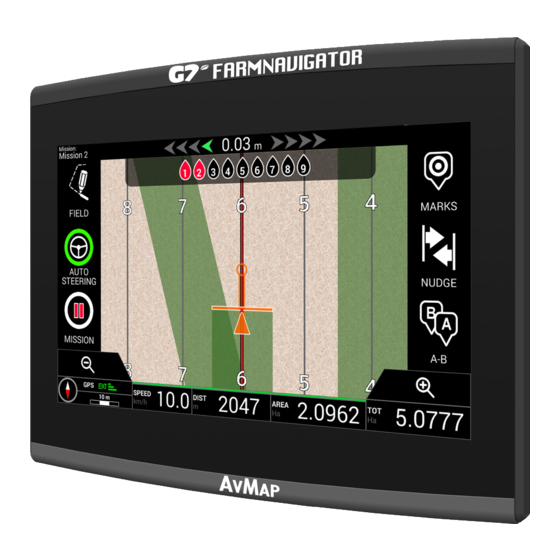
Summary of Contents for AvMap G7 Farmnavigator
- Page 1 USER MANUAL Updated to 3.10.xR software version (where x indicates all 3.10 software versions)
-
Page 3: Table Of Contents
Index 1. Introduction 3.2.6 Auto-Steering system (For G7 Plus 1.1 Ways of using G7 Farmnavigator only) 1.2 Electrical wiring harness 3.2.7 Nudge 1.3 How to install the antenna Turtle Smart 6 4. Advanced operating modes 1.3.1 How to connect Turtle Smart 4.1 Start new job, full mode... -
Page 5: Introduction
- Use Terrestrial Navigator (only for G7 Plus Farmnavigator, hereinafter referred to as G7 Plus) 1.2 Electrical connections G7 Farmnavigator is provided with a bracket and a wiring with connectors to ensure an easy and safe installation on your tractor. -
Page 6: How To Connect Turtle Smart Antenna To G7 Farmnavigator
1.3 How to install Turtle Smart antenna The procedure described below refers to Turtle Smart antenna, since it is entirely produced by AvMap and it is the most common type of antenna used by our clients. (Please, contact the assistance if you need clarifications about the installation of third-party antennas). -
Page 7: Antenna Position – Height
Table 1.3.c How to install the antenna – Height 1.4 Turning the device on Before turning G7 Farmnavigator on, make sure the display is connected to the bracket. Check that the bracket is firmly anchored to the tractor and that the power cable is plugged into 12V socket. -
Page 8: How To Use Multi-Touch Display
1. Press and hold the power button for 2 to 3 seconds; 2. Press “YES” to turn the device off. It is possible to reset G7 Farmnavigator if the device cannot be normally turned on/off. The reset button is located at the left of the power button, below the plastic cover. -
Page 9: Main Menu And Basic Operations
Below are the basic operations for the creation of a new job, system settings, the creation of a new implement and working methods. Figure 2.0 - Main menu 2.1 DATABASE menu Figure 2.1.a DATABASE menu AvMap G7 Farmnavigator – User Manual... -
Page 10: Drivers
1. Select “Add new”; 2. Enter the name, and select “OK”; 3. Tap the green arrow in the upper left corner of the screen to go back to the previous page. Figure 2.1.b Add a new driver AvMap G7 Farmnavigator – User Manual... -
Page 11: Farmers
It is essential to save FARMERS name. FARMERS refer to all customers or landowners. If a company has the ownership of all the worked lands, insert the name of the company in the FARMERS section. 1. Select “Add New”; AvMap G7 Farmnavigator – User Manual... -
Page 12: Fields
3. Tap the green arrow in the upper left corner of the screen to go back to the previous page. Figure 2.1.e List of farmers 2.1.3 FIELDS Figure 2.1.f List of fields associated with farmers or others AvMap G7 Farmnavigator – User Manual... -
Page 13: Products
4. Tap the green arrow in the upper left corner of the screen to go back to the previous page. 2.1.4 PRODUCTS G7 Farmnavigator allows you to create a list of products and save their use after each activity. 1. Select “Add New”;... - Page 14 Figure 2.1.h IMPLEMENTS menu Figure 2.1.i Implement name 3. If active, select the external controller type. Select “No section control” to use the implement without section control. AvMap G7 Farmnavigator – User Manual...
- Page 15 5. If the implement is mounted, tap “REAR FIX MOUNT”; - Offset 1 refers to the distance between the posterior axle and the implement operating point. - Offset 2 refers to an eventual misalignment between the implement and the centre of the tractor. AvMap G7 Farmnavigator – User Manual...
- Page 16 - Offset 1 is the distance between the posterior axle and the junction; - Offset 2 is the distance between the junction and the implement operating point; - Offset 3 refers to a possible misalignment between the implement and the centre of the tractor; AvMap G7 Farmnavigator – User Manual...
- Page 17 Figure 2.1.o Working width setting 9. Tap “Working width”, insert implement width, and select “OK”; 10. Tap “Minimum turning radius” and insert the turning value indicated in the tractor registration certificate, and select “OK”; AvMap G7 Farmnavigator – User Manual...
- Page 18 11. Select “OK” in the upper left corner of the page to confirm; All the information needed are now entered. From the database menu, it is always possible to add, edit and delete the information entered. Figure 2.1.q List of saved implements AvMap G7 Farmnavigator – User Manual...
-
Page 19: New Job Menu
To create a new job in fast mode, that is without entering all the working parameters and starting with your job: 1. Select “START NEW JOB”; 2. Select the implement from the “IMPLEMENT” line, tapping the downward green arrow; Figure 2.2.a Start new job page Figure 2.2.b List of implements AvMap G7 Farmnavigator – User Manual... - Page 20 4. Select “OK” to switch to the job page; Figure 2.2.c Job page Figure 2.2.d Job type selection 5. Select “A-B” to start the job; 6. Select the type of guidelines, for example A-B parallel guidelines; AvMap G7 Farmnavigator – User Manual...
- Page 21 Smart cursor The smart cursor is provided with two lines. It helps user to maintain the tractor aligned with the direction of the A-B guideline. Tabel 2.2.g Distance from guideline and smart cursor AvMap G7 Farmnavigator – User Manual...
-
Page 22: Continue Last Job Menu
2.3 Continue last job menu G7 Farmnavigator allows you to continue the last job, accessing it directly from the Main Menu: 1. Select “CONTINUE LAST JOB” from the main menu; 2. This page shows you all the information about your last job. Select “OK” to confirm;... -
Page 23: Configuration Menu
Figure 2.3.c Last job and latest position visualization 2.4 Configuration menu From the “CONFIGURATION” menu, it is possible to access different settings, parameters and customization. 2.4.1 Units of measurement Figure 2.4.a Units of measurement AvMap G7 Farmnavigator – User Manual... -
Page 24: User Preferences
Otherwise, wait at least 20 minutes in an open-space and dust the antenna with a wet rag. AvMap G7 Farmnavigator – User Manual... -
Page 25: Tractor
1. Enter the distance value accurately and select “FORWARD” if the antenna is located in front of the axel; select “BACKWARD” if it is located behind the rear axle. Figure 2.4.d Antenna position in relation to rear axle AvMap G7 Farmnavigator – User Manual... -
Page 26: Auto-Steering (For G7 Plus Only)
2.4.5 Auto-Steering (for G7 Plus only) Auto-Steering menu allows you to access G7 Farmnavigator settings when it is connected to Auto- Steering system. 1. Select “SETTINGS” > “Auto-Steering”; Figure 2.4.e Auto-Steering configuration page In this page it is possible to find: - ECU INFO: information about ECU-S1 steering controller connected to G7 Farmnavigator;... -
Page 27: Remote Control (For G7 Plus Only)
Remote control menu allows you to configure the supplied remote control. 1. Select “SETTINGS” > “Remote control” Figure 2.4.g Remote control setting page Remote control allows you to have a quick access to the main functions, such as opening the main menu, AvMap G7 Farmnavigator – User Manual... - Page 28 Auto-Steering system, placing a mark on the map (on obstacles, on specific points, etc.). To connect the remote control, make sure that it is within a range of a few metres from G7 Farmnavigator and insert batteries into the slot. Then: 1.
-
Page 29: Mirror Control (For G7 Plus Only)
Install the app Mirror Control to control G7 Farmnavigator with your smartphone or tablet. This app allows you to use the display of your Android or Apple device as if it was G7 Farmnavigator display. AvMap G7 Farmnavigator – User Manual... - Page 30 Figure 2.4.k Mirror Control configuration page It is possible to connect G7 Farmnavigator to a smartphone or tablet via WiFi network, only if G7 Farmnavigator and the smartphone or tablet are connected to the same router. 1. Select “SETTINGS” > “Mirror-Control” > “ON”;...
- Page 31 G7 Plus allows you to search for software updates automatically by selecting “Check for updates” button. In order to check for updates, you need to connect the device to a WiFi network. 1. Select “SETTINGS” > “System Info” AvMap G7 Farmnavigator – User Manual...
-
Page 32: Current Job Information
3.1.2 Connected devices At the upper right corner of the screen, there are the icons that identify the type of devices connected to G7 Farmnavigator. Devices connected to G7 Farmnavigator Connected and working remote control AvMap G7 Farmnavigator – User Manual... -
Page 33: Antenna
The compass is oriented according to tractor’s progress. The black tip of the compass indicates the North. The scale bar indicates the zoom level applied to the map. Table 3.1.e Zoom and compass AvMap G7 Farmnavigator – User Manual... -
Page 34: Area, Speed, Distance
Table 3.1.a Area, speed, distance The information displayed may vary if G7 Farmnavigator is connected to third-party devices. Long tap area value icon (second box starting from the left) to open a selection menu and change the information displayed. - Page 35 Once A-B lines are defined and created, the icon will indicate the type of guideline which is currently active during your job. A-B Parallel A+ Heading Table 3.2.c Icon with A-B guideline type During the job, tap A-B icon to access additional functions concerning A-B lines cancellation, change, or displacement. AvMap G7 Farmnavigator – User Manual...
- Page 36 Delete A-B lines This feature allows you to delete the A-B guideline created in the field. The area already worked and coloured in green will not be deleted. Table 3.2.d Functions available in the A-B menu AvMap G7 Farmnavigator – User Manual...
-
Page 37: Field
It is possible to carry on the activities even during the measurement of field boundaries. It is important to take into account that G7 Farmnavigator calculates the position of the field boarders according to the width of the chosen implement. - Page 38 Figure 3.2.e Field name modification - Field boundaries are now saved and stored in memory NOTE: It is possible to locate the field on the same perimeters next year only by using an RTK instrumentation. AvMap G7 Farmnavigator – User Manual...
-
Page 39: Headlands
Take the following steps to activate headland: - Select a field from the list and create a new job; - Move to the edge of the field; Figure 3.2.f Headland, start a new row AvMap G7 Farmnavigator – User Manual... - Page 40 - An area which corresponds to the headland will be displayed on the map. Figure 3.2.g, Headland width configuration Figure 3.2.h Headland, area Headland has different functionalities: - It allows to define the area of the contour to be worked or already worked; AvMap G7 Farmnavigator – User Manual...
-
Page 41: Obstacles
Table 3.2.f Headland specific functions 3.2.5 Obstacles G7 Farmnavigator allows users to save and view the position of a specific point on the map (e.g. an obstacle). - G7 Plus permits you to activate this option only with remote controller. - Page 42 Figure 3.2.j Obstacle on the map 3.2.6 Auto-Steering system (For G7 Plus only) G7 Farmnavifator is compatible with Auto-Steering mode. Connect G7 Farmnavigator to an external device which allows the steering wheel to be activated automatically and keep the tractor on the guideline.
-
Page 43: Nudge
Tap this icon to immediately move the line to the left, for example 5 cm (value set as nudge step). Move the line to the right Tap this icon to immediately move the line to the right, for example 5 cm (this is the value set as nudge step). AvMap G7 Farmnavigator – User Manual... - Page 44 Tap this icon to close the menu relative to nudge page. The menu will be closed automatically after 5 seconds of inactivity. Table 3.2.m Details of nudge functions ATTENTION: The maximum allowed nudge step is equal to half of the implement width. AvMap G7 Farmnavigator – User Manual...
-
Page 45: Advanced Operating Modes
- Tap “FIELD” to complete registration, when you are in proximity to the starting point; - The field takes the name defined during the new job creation page. Tap “EDIT” if you want to modify it; - Field boundaries will be saved and stored. AvMap G7 Farmnavigator – User Manual... -
Page 46: Working Again On Defined A-B Lines Using The Same Implement
NOTE: this feature is available only with RTK instrumentation. G7 Farmnavigator allows you to reload a previous job and work it again, recalling the A-B lines used during the previous activity. -
Page 47: Working On Predefined A-B Lines But With Another Implement
2. Select the “FARMER”; 3. Select the “FIELD”. It is essential to select the name of the field used during the previous activity, so that to recall the A-B lines used in that field. AvMap G7 Farmnavigator – User Manual... -
Page 48: Create More Than One A-B Line During The Same Job Session
NOTE: this function can be used only if the field is set. G7 Farmnavigator allows you to save more than one A-B lines and recall them for further activities. To save more than one A-B lines within the field, proceed as follows: 1. -
Page 49: Change A-B Lines During The Same Job
1. Tap “A-B”; 2. Tap AB List icon. Figure 4.6.a A-B line change during job AB list icon. Table 4.6.b A-B list icon 3. Select the A-B line type that you need to display; AvMap G7 Farmnavigator – User Manual... -
Page 50: Move The Line To A Specific Point Magnet" Function
4.7 Move the line to a specific point, “Magnet” function It is possible to use “Magnet” function to: - Avoid an obstacle (moat, drain, street) and move to a new parcel of field without creating a AvMap G7 Farmnavigator – User Manual... -
Page 51: Move A-B Line According A Precise Value, "Street" Function
4. Confirm to apply the movement. 4.9 Connect an external device to control sections G7 Farmnavigator allows you to connect third-party external devices to make an automatic control of the section. This feature can be used with implements such as:... - Page 52 1. Connect the external device to the G7 Farmnavigator bracket through 9-pin serial port marked as “CONTROLLER”; 2. Turn both G7 Farmnavigator and the external device on. Any other settings concerning the external device are not part of this manual;...
- Page 53 5. Select which type of external control is connected to G7 Farmnavigator; 6. Scroll through the list and select the connected device; Figure 4.9.c External device type 7. Wait for a connection between G7 Farmnavigator and the device; Figure 4.9.d Connection between G7 Farmnavigator and the external device 8.
- Page 54 9. It is possible to set the width of the spray boom either for the number of nozzles per single section or for the entire section width; Figure 4.9.f Sections configuration: section width 10. Enter the number of boom sections; AvMap G7 Farmnavigator – User Manual...
- Page 55 Below is an example of 18 metres boom with 5 sections; G7 Farmnavigator allows you to insert a time value to advance the opening and closing of the section so as to anticipate the command that must be send to the external device. This value, expressed in seconds, is equal to the time required by the device to order the opening of the sections and the actual release of product from the nozzles.
- Page 56 For example, a value of 100% means that the section will be closed in case of total overlapping. A value of 50% means that the section will be closed when the boom overlaps the total section width by 50%. AvMap G7 Farmnavigator – User Manual...
- Page 57 On the job page, there are icons that show the sections status. Boom sections status Green colour indicates that the section is active and operating. Red colour indicates that the section is active but turned off. Table 4.9.m Boom sections status AvMap G7 Farmnavigator – User Manual...
- Page 58 Table 4.9.o Section status: automatic and manual 4.10 Using “Planter” to create fields planting layout G7 Farmnavigator allows you to design and realize planting layout of vines, fruit plants, cultivation and installation of poles. In order to activate this feature, it is necessary to use “Planter”. On details: 1.
- Page 59 4. Create a new job and select A-B parallel lines (or A + Direction). Point A will represent the position of the first plant; 5. Define the distance between rows and plants and tap OK to confirm; Figure 4.10.b Distance between plants and rows configuration page AvMap G7 Farmnavigator – User Manual...
- Page 60 Figure 4.10.d Plant distribution on A-B line 8. When the position of the antenna coincides with the position of the plant, the circle will change its colour from orange to green; AvMap G7 Farmnavigator – User Manual...
- Page 61 It allows user to know how many plants have actually been worked from the beginning of the work. Table 4.10.f Information about “Planter” NOTE: third-party accessories will be available for the motions of the tractor, both for Auto-Steering and for planter automation. AvMap G7 Farmnavigator – User Manual...
-
Page 62: Importing And Exporting Data
5. Importing and exporting data 5.1 Download a job and view it in the office G7 Farmnavigator allows you to download a job in KMZ format and visualize it on your Personal Computer (PC). NOTE: in order to use this function, Google Earth™ software must be installed on your PC. -
Page 63: Format
5.2 Import the field boundaries in KMZ format G7 Farmnavigator allows you to import field boundaries in KMZ format. This feature is useful when you want to move field registration from one G7 Farmnavigator to another or if the field boundaries AvMap G7 Farmnavigator – User Manual... - Page 64 Create a new folder called “Import” and put it in the USB stick. Inside the folder “Import”, copy the KMZ files you want to import. Connect the USB stick to G7 Farmnavigator using the supplied cable. 1. Tap “DATABASE” > “FIELD”> “Import”;...
-
Page 65: Importing A Map In Shp File Format
Figure 5.2.d Preview of a field imported from KMZ 5.3 Importing a map in SHP file format Create a new folder called “Import” and put it in the USB stick. Inside the folder “Import”, copy the AvMap G7 Farmnavigator – User Manual... - Page 66 KMZ files you want to import. Connect the USB stick to your G7 Farmnavigator using the cable supplied. - Tap “DATABASE” > “CAMPI” > “Import”; Figure 5.3.a File SHP import menu - Select the file which you need to import;...
- Page 67 - All the field boundaries contained in the SHP file are now visible in “FIELD” menu; Figure 5.3.d – List of fields loaded from SHP file - It is now possible to see a preview of each field; AvMap G7 Farmnavigator – User Manual...
-
Page 68: Format
Above is an example of saving field boundaries in SHP format starting from Google Heart™. - Drawn a polygon in Google Earth™ Figure 5.3.f Example of a polygon drawn with Google Earth™ - Save the file with “Save place as..”; AvMap G7 Farmnavigator – User Manual... - Page 69 - Use one of the online software available to convert a KMZ file into a SHP format (for example; MyGeodata Cloud); - Import the SHP file into G7 Farmnavigator following the import procedure (Par 5.2). Figure 5.3.g SHP file created with Google Earth™...
-
Page 70: Other Functions
6. Other functions 6.1 G7 Farmnavigator software updates The updates for G7 Farmnavigator are available every year. Follow the above procedure to update the software of your device. 6.1.1 Software Update via WiFi (G7 Plus only) G7 Farmnavigator is provided with an automatic search for available updates when the device is connected to a WiFi network. -
Page 71: Video Camera
6.2.2 Connect a video camera It is possible to connect a video camera to G7 Farmnavigator via the ‘USB cable/Video in’ (G7 Ezy, P/N: K2CYFS0600) or ‘USB cable / Video in /Ethernet’ (G7 Plus, P/N: K2CYFS1000). The cable is provided with an analog RCA female video input. -
Page 72: G7 Navi (Only For G7 Plus)
To switch to this modality: - In the main page, tap the button located at the upper left side of the page; Figure 6.3.a Access to G7 Navi - Tap “YES” AvMap G7 Farmnavigator – User Manual... -
Page 73: Activate A Virtual Nmea Output On The Generic" Port
Some third-party devices used on the tractor in complementary mode to G7 Farmnavigator, require the use of GPS antenna for a correct functioning. G7 Farmnavigator gives the possibility to generate and share a GPS code in NMEA format to be sent to a third-party device, without using a second GPS antenna. -
Page 74: Activate The Demo Mode
1. Tap “SETUP” > “Satellites” 2. Tap “NMEA on Generic port” and select “ON”. 6.5 Activate the demo mode G7 Farmnavigator is provided with a Demo mode, very useful for outdoor demonstrations without GPS. To enable the demo mode (Demo): 1. - Page 75 ATTENTION: do not use demo mode if the GPS antenna is connected to the connector of the G7 Farmnavigator bracket marked as “GPS ANTENNA”. To disable Demo mode: - Tap “Demo mode stop”; Figure 6.5.c Demo mode stop AvMap G7 Farmnavigator – User Manual...
-
Page 76: Contacts/Customer Support
- User manual guide - Warranty - Replacements, malfunctions - Repairs - Updates Telephone: +39 0585 784044 Mail: support@avmap.it To get second-level assistance regarding: - Autosteering - RTK systems - Settings Telephone: +39 334 6033178 Mail: support.farm@avmap.it AvMap G7 Farmnavigator – User Manual... -
Page 77: Appendix
8. Appendix List of third-party devices compatible with G7 Farmnavigator: Antenna - AvMap Smart Turtle - Novatel AgStar - Novatel Smart6 - Novatel Smart7 - Harxon TS108Pro Sprayer - Agral AGSIG - Agromehanika AG-Tronik - Bertolini Buono - Caffini CB9... -
Page 78: Analytic Index
Analytic Index Antenna 3, 5, 6, 7, 24, 25, 33, 36, 51, 60, 61, 73, 75 Obstacle 28, 41, 42, 50 Auto-Steering 3, 5, 26, 28,33, 41, 42, 61 Planter 58, 59, 61, 77 Customer Support 3, 76 Products 3, 13, 45 Demo mode 3, 74, 75 Remote control 3, 27, 28, 29, 32, 41 Distance from the plant 61... - Page 80 MAG7XAM0AE010 ÑMAG7XAM0AE0109Ó...
Need help?
Do you have a question about the G7 Farmnavigator and is the answer not in the manual?
Questions and answers