Table of Contents
Advertisement
Advertisement
Table of Contents

Summary of Contents for Geonav 4 gipsy
- Page 2 4 4 4 4 4 GIPSY User and Installation Guide Manuale d’uso e d’installazione Notice d’emploi et d’installation Bedienungsanleitung und Installationshinweise...
- Page 4 4 4 4 4 4 GIPSY User and Installation Guide...
-
Page 6: Introduction
(IPX7), the unit is equipped with a daylight visible, color TFT display. Thanks to the GEONAV and a NAVIONICS Platinum™ or Gold™ electronic chart, you will never get lost even in case of fog, bad weather or dark. - Page 7 Introduction currents data. NAVIONICS Platinum™ or Gold™ electronic charts are available worldwide from authorized NAVIONICS dealers. NOTE: The technical characteristics and functions described in this manual are subject to change as a result of improvements or changes to the product. English...
-
Page 8: Characteristics
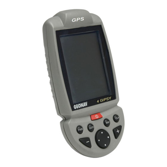
Characteristics CHARACTERISTICS General characteristics • Portable chart plotter with built-in GPS receiver and an- tenna • 12-channel internal GPS supporting WAAS/EGNOS • Satellite acquisition time: 15 seconds (hot start) 2 minutes (cold start) • GOTO function (Port, Nearest Service, Marker, Lat/Lon) •... - Page 9 Characteristics • Built-in battery charger • Power consumption: 4 W • Operating temperature: -10° to +50° C. Humidity 93% • Storage temperature: -20°C to +70°C. Humidity 93% • Color LCD, transflective, TFT 3.5”, sunlight visible • Adjustable display backlight • Backlit keypad •...
- Page 10 English...
-
Page 11: Installation And Precautions
Installation The GEONAV allows using either the built-in antenna for outdoor installation or an external GPS antenna for indoor use. NOTE: At start-up, the plotter will select the internal GPS by default. - Page 12 NOTE: The external GPS receiver works provided that the unit is connected to the external power supply. Fixed mounting The plotter can be mounted on any surface using the mounting bracket provided with the unit (see figure). Use 4 countersunk head screws (4mm) to fix the bracket to the desired mount- ing surface.
-
Page 13: Connections
Connections CONNECTIONS Power supply The GEONAV can be powered by us- ing the appropriate power supply cable with car lighter plug or the built-in battery pack. Install the power supply cable with the jack connector into the plug 1 as shown in the figure, then exert a light pressure until clicking. - Page 14 Battery pack The rechargeable battery pack allows using the GEONAV as a portable unit. The unit can be powered by the batteries only or connected to an external power supply.
- Page 15 Connections Connection of the external GPS receiver The connector 2 allows linking the unit to the external GPS receiver supplied as an accessory. English...
-
Page 16: Cartridge Installation
Cartridge Installation CARTRIDGE INSTALLATION Installing the CompactFlash™ Make sure that the unit is switched off and perfectly dry. Remove the cartridge slot cover located on the unit’s rear side. Insert the cartridge into the appropriate slot, with the label side backwards and push it. Replace the cover and check that it is perfectly closed, in order to avoid any water infiltration. -
Page 17: Keyboard
/ pages. submenu. • Cursor mode: Allows switching from Cursor mode to Naviga- • Switches the GEONAV tion mode. on/off. • Allows adjusting the GOTO screen backlight. Allows plotting a route to- wards a manual cursor po-... -
Page 18: Diagnostic
WARNING: The unit’s internal memory can be cleared by holding the CLR key pressed when switching the unit on. This operation will delete all the settings stored in the GEONAV and restore factory settings. Moreover, the routes, tracks and mark- ers not saved on the CompactFlash™ cartridge will be deleted. - Page 19 English...
-
Page 20: Marine Navigation
Marine Navigation MARINE NAVIGATION English... - Page 21 ONLY OFFICIAL GOVERNMENT CHARTS AND NOTICES TO MARINERS CONTAIN ALL INFORMATION NEEDED FOR THE SAFETY OF NAVIGATION AND, AS ALWAYS, THE CAPTAIN IS RESPONSIBLE FOR THEIR PROPER USE. The use of the GEONAV implies knowledge and accep- tance of this warning by the user. English...
-
Page 22: Navionics Electronic Charts
NAVIONICS Electronic Charts NAVIONICS ELECTRONIC CHARTS The GEONAV includes a built-in world map. Additional car- tography details relative to a specific area of navigation are available from the CompactFlash™ cartridges storing NAVIONICS Platinum™ or Gold™ electronic charts. To display chart boundaries, press the GOTO key to display the menu, select SETUP, SET CHART DETAIL and then, by the CURSOR key, select the USER or ALL mode. - Page 23 NAVIONICS Electronic Charts making them appear like those reported in the official nautical charts (see the figure). Displaying abbreviated navaid charac- teristics Position the manual cursor on the navaid symbol. A window will show the abbreviated char- acteristics of the navaid selected. Description of abbreviated navaid characteristics: ABBREVIATIONS FOR LIGHT ABBREVIATIONS FOR COLOR...
- Page 24 By querying the lights and navaids, the X-Plain™ function will give the description of the object in natural language, thus avoiding the use of abbreviations and symbols that are difficult to understand. By querying the symbols for wrecks or obstructions, NAVIONICS Platinum™...
- Page 25 NAVIONICS Electronic Charts Select PHOTOS, choose one item from the list to display one of the photographs available for the marina, then use the ZOOM key to enlarge or reduce the image, and CURSOR to pan it. Select PILOTS to gain access to the main information on the marina.
- Page 26 Displaying Tides and Currents data NOTE: This function is available only with the NAVIONICS cartridges containing Tides and Currents data. Position the cursor on the icon of a Tide or Cur- rent station, then press ENTER. If the zoom level is adequate, the present tide or current value will show in the vicinity of the cursor position, together with the curve estimated in the subsequent hours.
- Page 27 NAVIONICS Electronic Charts Displaying aerial / satellite charts NOTE: This function is available only with the NAVIONICS Platinum™ cartridges stor- ing aerial and satellite photographs. Press GOTO to display the menu, select SETUP, PHOTO OVER- LAY and then LAND or FULL. From a given zoom level on- wards, where available, aerial or satellite photographs will over-...
-
Page 28: Graphic Items
Graphic Items GRAPHIC ITEMS Besides chart data, the GEONAV displays some graphic items use- ful during navigation. The figure below shows some of these items. 1 - Marker Indicates a point of interest associated with a symbol and a name. - Page 29 Graphic Items To delete this band, press the PAGE key and switch to Naviga- tion mode. 5 - Route leg Part of route between two waypoints. 6 - Waypoint Waypoints are identified by a circle and a number. The route start- ing point is marked by the “X”...
-
Page 30: Functional Characteristics
Functional Characteristics FUNCTIONAL CHARACTERISTICS This chapter describes some of the most important functions of the GEONAV, as well as the terms most commonly used in this document. Switching on/Switching off the unit To switch the GEONAV on, keep the PWR key pressed until the unit issues a beep sound to confirm the operation. - Page 31 Autozoom With Autozoom function GEONAV will always display automati- cally the boat’s position and the target waypoint at the best available chart range. As the boat approaches the tar- get waypoint, the unit will automatically zoom in. Once the waypoint is passed,...
- Page 32 “AUTOZOOM ? ENTER = YES” message is displayed, then press ENTER to confirm the operation. To deactivate the Autozoom func- tion, press the ZOOM key once. When the GEONAV is turned on, and if at least one waypoint has been previously entered, the Autozoom function is automati- cally activated.
- Page 33 Functional Characteristics To activate or deactivate the Overzoom function, press GOTO to display the menu bar, then select SETUP, OVERZOOM and ON/OFF. Position calibration All position sensors have intrinsic errors that make the boat’s position incorrect (from few meters to several hundred meters) with respect to the background display of the chart.
- Page 34 Chart presentation This function allows the user to select the symbols and colors of chart presentation between International mode and US mode. To change the chart presentation mode, press GOTO to display the menu, select SETUP, PRESENTATION and then choose the option desired.
- Page 35 Press the PWR key to display the LIGHT window. To adjust the brightness level, press CURSOR. Press PAGE to exit. Easy View mode The GEONAV allows doubling the visibility of the electronic chart. Once the Easy View mode has been enabled, the chart will be magnified.
- Page 36 selected distance from its anchoring position, that is the ship’s position when the alarm is enabled. The reference distance value for the alarm can also be set. After the alarm is issued, press any key to reset it by using the current ship’s position as the new anchor position.
-
Page 37: Getting Started
The window situated in the lower part of the screen will display the boat’s speed, route and chart scale. The GEONAV is in Navigation mode; by pressing the CURSOR key, it is possible to switch to Cursor mode (editing mode). - Page 38 To plot a route starting from the boat’s position, move the cursor to the position desired, and press ENTER to insert a waypoint at the cursor’s position. A circle con- taining the number 1 will show. The info windows show the dis- tance, bearing, time to reach the target waypoint and time of ar- rival.
-
Page 39: Operating Modes
Navigation, each giving access to different functions. CURSOR MODE When the GEONAV is in Cursor mode, the crosshair cursor is displayed. The CURSOR key allow browsing through the elec- tronic chart, as well as editing or creating the route. See the Route Section for more details. -
Page 40: Range Window
Range Window RANGE WINDOW This window, always present, shows the following information: • Zoom status (top left corner): - Z+ means the chart can be further enlarged by pressing ZOOM+; - no indication means the chart is shown at the best pos- sible level;... -
Page 41: Navigation Window
Navigation Window NAVIGATION WINDOW This window is activated automatically as soon as the GPS receiver has obtained the boat’s position (FIX OK). If no route is present, speed, course and chart range are dis- played at the bottom of the screen. -
Page 42: Trip Window
Trip Window TRIP WINDOW The trip window shows the data relating to the route followed and, in particular: • Average speed • Time elapsed from departure • Partial distance covered • Total distance covered To reset partial counters before starting a new journey, press CLR. -
Page 43: Satellite Window
Additional information: • Day, month, year, local or Greenwich time (at the first start-up the GEONAV is initialized to Greenwich Time). • Boat’s position (lat/lon) (or the latest valid fix if the GPS receiver is still searching for satellites). - Page 44 The altitude value is available only if four satellites are tracked and a 3D fix is obtained. As soon as a valid fix is available, the GEONAV will automati- cally switch to Navigation mode and display the boat’s posi- tion at the best chart range available; the window at the bot- tom of the screen will indicate the boat’s course and speed.
-
Page 45: Info Window
Info Window INFO WINDOW This window displays the following information on the boat’s current position: • Geographical coordinates (latitude/longitude) • The position correction ap- plied to the latitude and lon- gitude (option SETUP, CALI- BRATION) • Magnetic variation value re- ceived by the GPS •... -
Page 46: Tide Info Window
Tide Info Window TIDE INFO WINDOW When a NAVIONICS cartridge featuring Tides and Currents data is present, this window displays further information, besides the forecast data sup- plied by selecting the Tides and Currents station. The following data is displayed: •... -
Page 47: Runway Window
Runway Window RUNWAY WINDOW This window displays the following information on the target waypoint: • Name of the target waypoint • Distance from the target waypoint • Estimated time of arrival to the target waypoint • Bearing • Course • Steering angle •... -
Page 48: 3D Window
3D Window 3D WINDOW NOTE: This function is available only with the NAVIONICS Platinum™ cartridges. This window allows displaying a 3D chart image of the area sur- rounding the current boat’s po- sition. Press the PAGE key repeatedly to display the 3D navigation win- dow, then use the CURSOR key to move the viewing angle and the ZOOM key to enlarge or reduce the... -
Page 49: Main Menu
Main Menu MAIN MENU The menu bar, displayed at the top of the screen, allows selecting from the following options: TRACK: To activate/deactivate the track function and to save, recall and delete the track saved. ROUTE: To delete, reverse, store, recall a route and display route information. -
Page 50: Route
Route ROUTE EDITING A ROUTE (CURSOR MODE) Creating a waypoint Using the CURSOR key, move the cursor on the position de- sired and press ENTER to insert a waypoint. To enter further waypoints, move the cursor and press ENTER. The new waypoint will be appended to the existing route. Up to 20 waypoints per route can be entered by using the GOTO function as well (see the Route to a waypoint Section). - Page 51 Route EDITING A ROUTE (NAVIGATION MODE) If the manual cursor is displayed, press the PAGE key to enter Navigation mode. Changing the target waypoint Use the “Route to a waypoint” function. WARNING: The route will be modified and the new target waypoint selected will be the first waypoint in the route.
- Page 52 FUEL: Estimated fuel consumption (liters) BRG: Bearing from previous waypoint to current waypoint The arrival time at the waypoint and the fuel consumption will be displayed provided that estimated speed and fuel con- sumption values have been inserted previously (see the Enter- ing speed and fuel consumption data Section).
- Page 53 Press ENTER and select the target waypoint by CURSOR. Press ENTER to confirm the selection, or PAGE to exit. As the GEONAV plots a new route, the waypoint selected be- comes the first waypoint in the route, whereas previous waypoints are deleted.
-
Page 54: Track
Track TRACK The Track function allows re- cording the track actually fol- lowed by the boat. The Track function can be enabled and dis- abled several times during navi- gation. Starting a track To enable the Track function, press the GOTO key to display the menu bar, select TRACK, START and press ENTER to confirm. - Page 55 Track Recalling a track from the CompactFlash™ Press the GOTO key to display the menu bar, select TRACK, OLD and press ENTER to open the track catalog. Select the track desired, then press ENTER to confirm the op- eration or PAGE to exit. Deleting a track To delete the track displayed, press the GOTO key to show the main menu, select TRACK, CURRENT, DELETE and press EN-...
-
Page 56: Marker
Marker MARKER Markers are used to identify points of interest to which names and symbols can be assigned. NOTE: Marker names are displayed starting from the 32 NM chart range. CURSOR MODE Inserting a marker Move the cursor to the position desired and hold the ENTER key pressed for more than 2 seconds. - Page 57 ENTER to confirm. Once the desired marker has been selected, the GEONAV will insert a waypoint at the marker position and append the new leg to the existing route (if no route is available, the new waypoint will be connected to the boat’s position).
- Page 58 RENT, SAVE ALL and press EN- TER to confirm. Use the CURSOR key to change the default name and press ENTER to confirm. A message will confirm that markers have been stored cor- rectly. Once stored, markers will disappear from the screen. Each time a set of markers is stored in the CompactFlash™, the plotter memory is cleared and the...
-
Page 59: Goto Port
CURSOR and confirm its se- lection by pressing ENTER. Once the desired port has been selected, the GEONAV will in- sert a waypoint in the port posi- tion and append the new leg to the existing route (if no route is available, the new waypoint will be connected to the boat’s posi-... -
Page 60: Goto Nearest
(estimated on the boat’s current speed). Press ENTER to confirm the selection. The GEONAV will insert a waypoint in the port selected, de- lete automatically the existing route (if in Navigation mode), or append the waypoint to the existing route (if in Cursor mode), then go back to Navigation mode and enable automatically the Autozoom function. - Page 61 Press GOTO, select NEAREST by the CURSOR key, choose the Tides or Currents service, then press ENTER to confirm. The GEONAV will allow selecting one of the three nearest Tides and Currents stations. Use the CURSOR key to choose the sta- tion desired and press ENTER to confirm.
- Page 62 • Time, speed and direction with respect to the cursor’s position in the graph • Time, speed, direction and slack time of daily flood and ebb streams • Dawn and sunset time • Moonrise and moonset time • Moon phase •...
-
Page 63: Setup
Setup SETUP The Setup menu allows setting the available options. To access the Setup menu, press GOTO to display the main menu, then select SETUP by using the CURSOR key. The menu items are grouped in six sets. When selecting a set by the CURSOR key, the list of the available options will be displayed. - Page 64 By choosing USER, enables/disables the display of the single items. • Easy View (ON/OFF) Enables/disable the Chart Magnification function. • Overzoom (ON/OFF) Enables/disable the Overzoom function. • Presentation (INTER./U.S.) Selects the symbols and colors of chart presentation. • Own Ship Icon Selects the icon that will identify the ship’s position on the screen.
- Page 65 Setup UNITS AND LANGUAGE • Set Time (LOCAL/GMT) Enters local time. • Distance Units (NAUT/ METR/STAT) Selects distance units. • Depth Units (M/FT/FA) Selects depth units. • Bearing (TRUE/MAG) Sets the magnetic mode for all bearings. • Language (EN/FR/ES/DE/ DK/IT/SV/NL/SU/NO/GR) Selects the language.
- Page 66 • Chart Info By selecting ON, a window will show the catalog of the charts stored in the cartridge. Select one chart by the CUR- SOR key and press ENTER to display the information associ- ated with the chart (chart number, authority that issued it and date of issue), or PAGE to exit.
-
Page 67: Goto Lat/Lon
Press the GOTO key and select L/L by the CURSOR key. Enter the geographical coordinates desired by using CURSOR and con- firm the insertion. The GEONAV will move the manual cursor to the position selected, allowing the insertion of a waypoint or a marker. English... -
Page 68: Road Navigation
Road Navigation ROAD NAVIGATION English... - Page 69 TIONS, NOT AS DRIVING INDICATIONS WHICH COULD RESULT INCORRECT DUE TO INACCURATE MAP DATA OR CHANGES TO ROAD PRACTICABILITY. The use of the GEONAV implies knowledge and accep- tance, by the user, of this warning and the warnings re- ported in the manual.
-
Page 70: Road Maps
Road Maps ROAD MAPS During navigation, the unit displays the map of the area sur- rounding the vehicle, highlighting the way to follow in order to reach the destination set. The map also shows the sur- rounding roads, as well as all the point of interest available in the area. - Page 71 Road Maps Place of worship Embassy Police Entertainment Post office Ferry boats Railway station Ferry boat terminal Car rental Golf Car rental parking lot Government office Rest area Hospital/General hospital Restaurant Hotel/Motel Restaurant area Major tourist attraction Panoramic viewpoint Institute Shop Library Shopping mall...
-
Page 72: Functional Characteristics
Functional Characteristics FUNCTIONAL CHARACTERISTICS This chapter describes some of the most important functions of the GEONAV, as well as the terms most commonly used in this document. Switching on/Switching off the unit To switch the GEONAV on, keep the PWR key pressed until the unit issues a beep sound to confirm the operation. - Page 73 Functional Characteristics • Confirmation of arrival at destination. To repeat the message concerning the following manoeuvre, press the ENTER key. Voice messages are enabled also in Simu- lation mode. English...
-
Page 74: Getting Started
Getting Started GETTING STARTED At start-up, the unit displays a welcome message and warn- ing. The warning message reminds the user that the instruc- tions provided by the car navigator should be considered as suggestions, and not as real indications, which could not take, for example, changes to road practicability into account. -
Page 75: Navigation Window
Navigation Window NAVIGATION WINDOW The navigation window is enabled from the Setup menu by means of the CURSOR key. This window is available provided that a position is present and looks differently, depending on whether a destination has been previously set. With destination Without destination English... -
Page 76: Trip Window
Trip Window TRIP WINDOW The trip window shows the data relating to the distance covered, time elapsed from departure, av- erage speed and maximum speed reached from the latest reset op- eration or from the latest desti- nation set. English... -
Page 77: Satellite Window
Satellite Window SATELLITE WINDOW The satellite window displays the current configuration of the satellites tracked. As soon as the unit has tracked at least three satellites, the data relative to position, current date and time are available. English... -
Page 78: Route Info Window
Route Info Window ROUTE INFO WINDOW The route info window displays the data relative to departure and arrival, route type, distance and traveling time, as defined ac- cording to the speed set in the Setup menu. English... -
Page 79: Main Menu
Main Menu MAIN MENU The menu bar, displayed at the top of the screen, allows ac- cessing the following options: MARKER: To insert, select, define and delete markers. ADDRESSES: To insert, select, define and delete addresses. NEAR: To display the list of the services available, search for the nearest service, select and define the service. -
Page 80: Marker
Marker MARKER Markers allow identifying points of interest and are stored in the unit’s memory. Inserting a marker Move the cursor to the position desired, then press the ENTER key. By the CURSOR key, select MARKER from the dialog box and confirm the choice by EN- TER. - Page 81 Marker Deleting a marker from the list Press GOTO, then select a marker from the list by CURSOR. Press CLR to delete the marker and confirm the operation by pressing ENTER. Deleting a marker from the screen Move the CURSOR key on the marker and, after diplaying the page with the marker’s symbol and name, press CLR to delete...
-
Page 82: Addresses
Addresses ADDRESSES To display the list of the addresses available, press the GOTO key. A window will show the addresses already saved or will give the opportunity of entering a new address. Once con- firmed, the addresses will be displayed in the list. Entering a new address (without virtual keyboard) To enter a new address with-... - Page 83 Addresses NOTE: If a Starting point and Destination are present, the itinerary will be calculated and highlighted in green on the map. Entering a new address (with virtual key- board) To enter a new address by means of the virtual keyboard, select SETUP, KEYBOARD and then enable the keyboard by se- lecting ABC or QWERTY, accord-...
- Page 84 NAME, the list of the possible choices will be shown. To con- firm a selection, press ENTER. After entering the address, define it as Destination, Marker or Staring point in the dialog box. Confirm the operation by EN- TER. NOTE: If a Starting point and Destination are present, the itinerary will be calculated and highlighted in green on the map.
-
Page 85: Near
Near NEAR To display the list of the services available and to search for the service nearest your position or cursor’s position, select NEAR and press the GOTO key. Selecting/defining a service By means of the CURSOR key, scroll the list of the services available, select the service and press ENTER to confirm the op- eration. -
Page 86: Cursor
Cursor CURSOR An itinerary can also be defined only by means of the cursor. In the absence of a valid Fix (GPS position not detected), both the starting point and destina- tion shall be set, as described below. By means of the CURSOR key, po- sition the cursor on a point on the screen and press ENTER. -
Page 87: Setup
Setup SETUP The Setup menu allows setting the available options. To ac- cess the Setup menu, press GOTO to display the main menu, then select SETUP by using the CURSOR key. The menu items are grouped in six sets. When selecting a set by the CURSOR key, the list of the available options will be displayed. - Page 88 • Roads (ALL/NO TOLL ROADS) Enables all the roads or excludes toll roads. • Usage (CAR/WALK) Defines the unit’s use (whether on car or on foot) • Road Speeds Sets the speed limits according to the road followed. UNITS AND LANGUAGE •...
- Page 89 English...
-
Page 90: Table Of Contents
Table of Contents TABLE OF CONTENTS INTRODUCTION ..................3 CHARACTERISTICS ..................5 INSTALLATION AND PRECAUTIONS ............8 CONNECTIONS ..................10 CARTRIDGE INSTALLATION ..............13 KEYBOARD ....................14 DIAGNOSTIC ....................15 MARINE NAVIGATION ................17 NAVIONICS ELECTRONIC CHARTS ............19 GRAPHIC ITEMS ..................25 FUNCTIONAL CHARACTERISTICS ............ - Page 91 Table of Contents TRACK ......................51 MARKER ..................... 53 GOTO PORT ....................56 GOTO NEAREST ..................57 SETUP ......................60 GOTO LAT/LON ................... 64 ROAD NAVIGATION ................... 65 ROAD MAPS ....................67 FUNCTIONAL CHARACTERISTICS ............69 GETTING STARTED ..................71 NAVIGATION WINDOW ................
Need help?
Do you have a question about the 4 gipsy and is the answer not in the manual?
Questions and answers