Table of Contents
Advertisement
Quick Links
Advertisement
Table of Contents

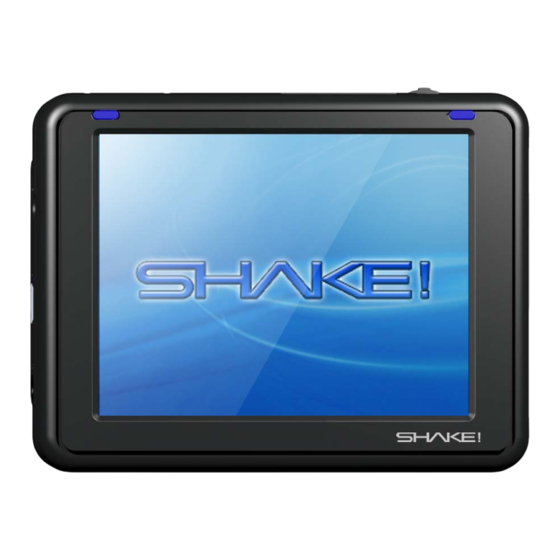
Summary of Contents for Shake! 350
- Page 1 Instruction Manual Flash Memory Navigation ・Thank you for purchasing SHAKE! 350. ・Before use, read this instruction manual carefully. Use only after you have thoroughly understood everything. ・After reading, please carefully store this manual where it can be viewed at any time.
-
Page 2: Table Of Contents
Table of Contents 1. Introduction 2. Precautions 3. Product Composition 4. Part Names 5. The Reset Function 6. Mounting in Vehicle 7. Initial Operation Check 8. Various Settings 8.1 Setting Volume 8.2 Screen and Language Settings 8.3 Setting the Time/System Information 9. Navigation 9.1 How to Use Navigation 9.2 Check GPS Performance 9.3 The Flow of Operations 9.4 Restrictions... - Page 3 Table of Contents 9.6 General Road Guidance 9.7 Expressway Guidance 9.8 Split Navi Screen 9.9 Intersection Zoom Guidance 9.10 Operation of the Various Search Menus 9.10.1 Search by Address 9.10.2 Search by Station 9.10.3 Search by Phone Number 9.10.4 Search by Map Code 9.10.5 Search by POI 9.10.6 Search by Mark Point...
-
Page 4: Introduction
1. Introduction SHAKE! 350 is a portable navigation system that contains a GPS receiver. In this instruction manual, in order that the product may be used safely and correctly, warnings, cautions and disclaimers are clearly specified. After you have thoroughly understood these, please read the main text. -
Page 5: Precautions
2. Precautions ● Warnings ・This machine is a precision electronic device. Please do not moisten with water, shock, leave in hot places, disassemble, or alter. Doing so may cause damage, accident, fire, or electric shock. ・When installing this machine in a vehicle, do so in a safe place, and do not install where it would interfere with the field of vision, the operation of the vehicle, or the action of airbags. -
Page 6: Product Composition
3. Product Composition Before using this machine, please check the main body and accessories. ⑤ ① Main Body (battery, Carrying Case built-in navigation system) ⑥ USB Cable ② AC Power Cable ⑦ Instruction Manual (This Booklet) ③ Vehicle Mount Stand, Device Holder, and Round Tray ⑧... -
Page 7: Part Names
4. Part Names Power Button Volume Button Power Lamp Color Yellow: Charging Orange: Battery Low Green: Charging Complete Power Lamp SD Slot GPS Antenna GPS External Port USB Port Earphone Jack Speaker Power Jack Hard Reset Soft Reset... -
Page 8: The Reset Function
5. Reset Functions ●Hard Reset Note: To carry out a hard reset when some disorder arises in this machine, use a stylus pen etc. to slide the hard reset switch to the right, turning it OFF, then move the switch to the left ON position. After a hard reset, the time will be reset. -
Page 9: Mounting In Vehicle
6. Mounting in Vehicle Please note that if you do not mount in this sequence, the power plug may come off easily. ① Mount suction cap A, and lock the mounting surface with lever B. Fit the cigar lighter power cable behind the device holder as shown in the figure. -
Page 10: Initial Operation Check
7. Initial Operation Check (1) Main Menu ① Attach the cigar lighter power or AC adaptor plug to the power jack on the main body. *When using for the first time, before using, please charge the battery for over two hours. It is best to start use after the power lamp has turned green (charging complete). -
Page 11: Various Settings
8. Various Settings ●Carry out various settings. Touch the “Setup” icon on the main menu. By touching each menu icon, volume, brightness, time and language etc. can be adjusted. ●The Setup Menu Finish and return 8.1 Setting Volume ●The volume may be adjusted. “+”... -
Page 12: Screen And Language Settings
8.2 Screen and Language Settings ●Screen brightness can be adjusted. * When the power button is pushed for a short time, the screen darkens and power-saving mode is entered. When pushed again, the original brightness level is restored. Calibrate the touch point. “+”... -
Page 13: Setting The Time/System Information
8.3 Setting the Time/System Information ● The time can be adjusted. ① Set the time zone ② Set the date and time *When navigating, the current time received from the satellite is displayed, which may differ from the time set here. Move time Choose Tokyo. -
Page 14: Navigation
9.1 How to Use Navigation (1) Starting Navigation ① Start navigation by touching the navigation button Navigation is mainly done by touching the touch panel with a finger. Detailed areas that are difficult to touch with a finger may be touched with something that won’t damage the screen, such as a stylus pen ②... -
Page 15: Check Gps Performance
9.2 Check GPS Performance ① Push the “Current Location” button on the Navi Top Menu. GPS Button ② When the GPS button changes to an antenna button and become “Fair” or better, the current location will be displayed and reception is possible. -
Page 16: The Flow Of Operations
9.3 The Flow of Operations With this navigation software, goal point, start point, and waypoint flags etc. are set on the map to operate four navigation functions. For how to set flags, see page 16. ● Navi Drive (A goal point is set and the vehicle is driven) Set a goal point on Search for a Begin Navi Drive... -
Page 17: Restrictions
9.4 Restrictions This product is subject to the following restrictions: ① This product uses GPS positioning to navigate. Accordingly, when GPS positioning cannot be carried out (indoors and at outdoor locations with poor vantage points), it cannot be used. ② Due to GPS reception conditions, the position of the vehicle on the roads drawn on the map may be incorrect. -
Page 18: The Map Display
9.5 The Map Display ① When navigation is active and the map screen is displayed, the type of button on the map can be changed by pressing the upper right switching arrow button. (Order: Set > Run > Map) ② To capture current location using GPS, press the GPS button in the upper left. -
Page 19: Setting The Various Flags
9.5.1 Set Button Operation: Setting the Various Flags When the map is displayed for the search function, it is necessary to set a Goal Flag. Using the “Set” buttons on the right, each kind of flag can be set. ① Set a Goal Point A goal flag will be set on the map. -
Page 20: Setting Mark Points
9.5.1 Set Button Operation: Setting Mark Points ④Set Mark Points Set mark points such as pins on the map. Touch the pins to make fine adjustments in position. *To change the names of mark points, please refer to page 34. Set a Pin Pins and flags than have been set can be searched as mark points... -
Page 21: Navi Drive
9.5.2 Run Button Operation: Navi Drive ① Navi Drive After setting a goal point, touch the Navi button on the screen and start driving. A goal flag must be set beforehand. * Absolutely do not drive when in Walk Navi mode To compute Goal Flag Way Flag... -
Page 22: Free Drive
9.5.2 Run Button Operation: Free Drive ②Free Drive To drive freely with no set goal point, touch the Free button and begin driving. Your current location will be continuously displayed. There is no need to set a goal point flag etc. Flags to Set: No Flags Needed GPS is active, but no route is... -
Page 23: Walk Navi
9.5.2 Operation of the Walk Button: Walk Navi ③ Walk Navi After setting a goal point, press the Walk button on the map to start Walk Navi. A goal flag must be set beforehand. * Absolutely do not drive a vehicle when in Walk Navi mode Goal Flag Flag to Set: Activate GPS and... -
Page 24: Test Navi
9.5.2 Run Button Operation: Test Navi ④Test Navi With this function, before actually running, the route to be followed may be checked. After setting a goal point and start point, touch the Test button on the map to start a theoretical Test Navi. -
Page 25: Map Button Operation
9.5.3 Map Button Operation With the Map Button, detailed display, wide-area display, map rotation, and a switch to bird’s eye view can be displayed. To move the map screen, touch the map screen anywhere other than the displayed buttons, and that point will move to the center of the screen. -
Page 26: General Road Guidance
9.6 General Road Guidance When there are left or right turns on general roads, a left or right turn guidance arrow will be displayed on the bottom left of the screen, and at the same time audio assist will begin. Audio assist will be given just before, at 300 m, and at 500 m before at turn. -
Page 27: Expressway Guidance
9.7 Expressway Guidance For left and right expressway turns, a guidance arrow for the next turn will be displayed at the bottom left of the screen. Expressway exit guidance is displayed on the bottom right of the screen. Verbal assist will be given just before, at 300 m, 500 m, and at 1 km before a turn. -
Page 28: Split Navi Screen
9.8 Split Navi Menu During navigation, by touching the map screen map, operation buttons can be displayed, and navigation may be interrupted to move the map. Map Single Touch ① When the map is touched once, navigation continues as is and map operation buttons are displayed. -
Page 29: Intersection Zoom Guidance
9.9 Intersection Zoom Guidance During navigation, when intersection zoom is set to ON the map will be fixed and your vehicle’s position will move on the map. *In initial settings, “intersection zoom” must be ON. Map position is fixed 12:01 12:00 Reduced Scale The Vehicle... -
Page 30: Operation Of The Various Search Menus
9.10 Operation of the Various Search Menus When Search is pressed on the Navi Top Menu, six sub-menus will be displayed. Note: Search result data is not guaranteed to be accurate or up-to-date, and may differ from current conditions. Please use as a reference only. With this product, six search methods can be used to set goal points. -
Page 31: Search By Address
9.10.1 Search by Address Touch the Search button and select “Address.” Names are classified alphabetically. Refine your search by pressing the letters, and then select using the bar buttons on the right. Return to Previous screen Previous Page Next Page Return to Menu Area/Block... -
Page 32: Search By Station
9.10.2 Search by Station Touch the Search button and select “Station.” Names are classified alphabetically. Refine your search by pressing the letters, and then use the bar buttons to the right, make a selection and display a map. All train stations, expressway interchange ramps, and airports in the country are included. -
Page 33: Search By Phone Number
9.10.3 Search by Phone Number Touch the Search button and select Phone Number * Company phone numbers can be searched (for most companies), but private residence phone numbers cannot. When a phone number is entered and the Set button pressed, a name is displayed. -
Page 34: Search By Map Code
9.10.4 Search by Map Code Touch the Search button and select ”Map Code.” Enter a map code and press the OK button to display a map. Map Codes up to high-resolution Map Codes are accepted. Delete 1 Display Map Character (a mark will be on the map) For detailed information about map code, please see the following URL: http://guide2.e-mapcode.com/... -
Page 35: Search By Poi
9.10.5 Search by Point of Interest (POI) Touch the Search button and select “POI” (Point of Interest). When a POI category is selected, up to 100 POIs within 10 km will be listed in order of distance from the center of the map that was displayed just beforehand. -
Page 36: Search By Mark Point
9.10.6 Search by Mark Point Touch the Search button and select “Mark Point.” By putting a pin or flag mark on a map, the points that have been set can be looked up (refer to p. 17 for the mark point set method). When a mark is selected from the left, set points are listed on the right. -
Page 37: Editing Mark Points
9.10.7 Editing Mark Points When the Edit button on the Mark Point search screen is touched, the name of the corresponding mark can be edited, and the map code for that point will be displayed. With the “⇔” button, character type may be changed in the order of hiragana >... -
Page 38: Displaying Set Points
9.11 Displaying Set Points Navi Top Menu ① When the “To Map” button is pushed on the Navi Top Menu and each buttons is pressed, a map with the respective set locations will be displayed. ② When goal point, start point and waypoint flags are set, the most recent group will always be marked. -
Page 39: Route Confirmation Function: Displaying A Route Outline
9.12 Route Confirmation Function: Display a Route Outline Navi Top Menu: Touch the Route button and select “Route Outline.” Information on the latest route created will be listed. When a goal point and start point is set and you drive or do Test Navi, the route file is automatically saved. -
Page 40: Displaying A Gps Track
9.12 Route Confirmation Function: Displaying a GPS Track Navi Top Menu Touch the Route button and select “GPS Track.” When “Record GPS Track Log” is set to ON, your location is recorded as you drive (see page 38 for how to set). GPS Track -37-... -
Page 41: Navi Settings
9.13 Navi Settings Navi Top Menu Touch the Settings button and select “Set Navi.” Various settings can be adjusted. A record of settings is saved, so even when the power is turned off settings are preserved. (Red letters = ON) Return to Previous Screen... -
Page 42: Satellite Information
9.14 Satellite Information Navi Top Menu Touch the settings button and select “GPS Info.” In navigation, signals are received from over four GPS satellites and your current location is positioned. Distance and time to your goal point, and its direction, are displayed to provide guidance. Use this function to confirm, if the GPS is receiving or not and display GPS information. -
Page 43: Navi Update
9.15 Navi Update Navi Top Menu Touch the Settings button and select “Update.” Update by SD Card: (Recommended!) ① Get ready by copying new programs or data that you have downloaded from the net onto an SD Card. (http://www.grandmap.jp/shake) ② Insert your SD Card into the SD Card slot of this device, and press OK on the next screen. -
Page 44: Functions Other Than Navigation
10. Functions Other Than Navigation Besides navigation, two other functions can be used from the main menu. 1) MP3 Player 2) Photo Album To use these functions, please obtain a data-recording Secure Digital (SD) Card (not included). ● Main Menu Screen Photo Album MP3 Player Note: The photo album is a picture viewer only... -
Page 45: Mp3 Player
10.1 MP3 Player ● Playing music (MP3s, WMAs) ① Touch the MP3 icon on the main menu. ② Touch “Open Play List” Repeat Display Shuffle Display Operation Screen: Play Time Volume Current Symphony No.9 (Scherzo).wma Song Name Next Song Previous song Stop Play... -
Page 46: Photo Album (Photo Viewer Only)
10.2 Photo Album (Photo Viewer Only) ● Show images (JPEG and BMP) ① Touch the Photo Album icon on the main menu. ② When you touch the “SDMMC” folder, the pictures on the SD Card will automatically be imported to the Photo Album play list. -
Page 47: Appendix 1: Poi Icon Legend
Appendix 1: POI Icon Legend Radio Tower Leisure Facilities Ferry Landing Prefectural/Government Oil Well, Gas Well Lighthouse City Hall/Ward Office Mine/Copper Mine Botanical Gardens Major Port Town Office/Ward Office Tall Tower Aquarium Local Port Police Station... -
Page 48: Appendix 2: Software Specifications
Appendix 2: Software Specifications Item Content Item Content Route search Vehicle route, walking route, reroute Road net Main roads, narrow streets Search by Prefecture, municipality, block (chome), Address data address lot number (ban-chi) 4.8 million around Japan Search by JR, private railway, subway, monorail, station etc. -
Page 49: Appendix 3: Hardware Specifications
Appendix 3: Hardware Specifications Product Portable Navigator (SHAKE!350) Centrality Atlas II, 300Mhz Memory 1GB Flash ROM, 64MB SDRAM Display High-intensity 3.5“ TFT touch panel liquid crystal QVGA (320 × 240) 65,536 colors Resolution Centrality GPS Receiver Microsoft Windows CE. NET V5.0 ... -
Page 50: Appendix 4: Gps Basics
Appendix 4: GPS Basics GPS: Global Positioning System A global positioning system that uses satellites. It is composed of a space segment (24 NAVSTAR satellites in six different orbits), control segment (five monitoring stations, a master control station, and three upload stations) and user segment (GPS receiver). -
Page 51: Appendix 5: Common Problems
Appendix 5: Common Problems Before requesting repair, please read this list. ●Power and Batteries The power will not come on It’s possible that the battery is low. Please charge sufficiently. P. 7 (Battery is charged when the power light is green.) ... -
Page 52: Software License Agreement
1. Conditions of Use The customer may use this software product with the computer that is in the SHAKE! 350 body (hereafter referred to as the “Customer’s Computer”). The component of this software product shall not be detached for the use on multiple computers. - Page 53 Enquiries User Support Center MapNet Ltd. Home Page : http://www.grandmap.jp/shake E-mail :mapque@mapnet.co.jp :+81-3-3516-6080 :+81-3-3516-6387 Business Hours: Weekdays 10 am to 12 pm 1 pm to 5 pm...
- Page 54 17 JUL 2007...
Need help?
Do you have a question about the 350 and is the answer not in the manual?
Questions and answers