Sign In
Upload
Manuals
Brands
Lowrance Manuals
GPS
LMS-520C
Lowrance LMS-520C Manuals
Manuals and User Guides for Lowrance LMS-520C. We have
1
Lowrance LMS-520C manual available for free PDF download: Installation And Operation Instructions Manual
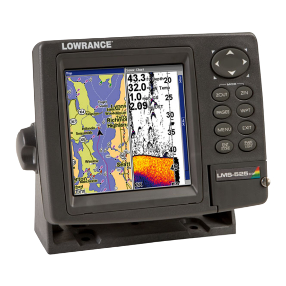
Lowrance LMS-520C Installation And Operation Instructions Manual (252 pages)
Fish-finding Sonar & Mapping GPS
Brand:
Lowrance
| Category:
GPS
| Size: 7.2 MB
Table of Contents
Table of Contents
3
Section 1: Read Me First
11
Specifications: LMS-520C and LMS-525Cdf
13
How Lowrance Sonar Works
15
How Lowrance Gps Works
16
Introduction to Gps and Waas
17
How to Use this Manual: Typographical Conventions
20
Menu Commands
21
Preparations
23
Section 2: Installation
23
Transducer Installation
23
Single-Frequency Transom Installations
24
Dual-Frequency Transom Installations
24
Single-Frequency Trolling Motor Installations
24
Shoot-Through Hull Installations
24
Selecting a Transducer Location
24
How Low Should You Go
26
Shoot-Thru-Hull Vs. Transom Mounting
26
Transom Transducer Assembly and Mounting
27
Trolling Motor Bracket Installation (Single-Frequency Only)
33
Transducer Orientation and Fish Arches
33
Shoot-Thru-Hull Preparation
34
Hulls with Flotation Materials
34
Testing Determines Best Location
35
Shoot-Thru-Hull Installation
37
Speed/Temperature Sensors
38
Optional Speed Sensor Installation
38
Power Connections
40
Powering Your Display Unit
41
Power Diagram a
42
Power Diagram B
43
Powering a NMEA 2000 Network Bus
43
GPS Antenna/Receiver Module
44
Connecting to a NMEA 2000 Network
45
NMEA 0183 Wiring (Data Cable)
46
Mounting the Unit: Bracket, In-Dash or Portable
49
MMC or SD Card Memory Card Installation
52
Portable Installation
52
Other Accessories
54
Cleaning Towel
54
Face Cover
55
Section 3: Basic Sonar Operation
57
Keyboard
57
Power/Lights on and off
58
Main Menu
58
Satellite Status Page
60
Navigation Page
61
Map Page
61
Sonar Page
62
Basic Sonar Quick Reference
65
Sonar Operations
66
To Adjust Sensitivity
67
Fish Symbols Vs. Full Sonar Chart
68
ASP™ (Advanced Signal Processing)
71
Section 4: Sonar Options
71
Alarms
72
Depth Alarms
72
Zone Alarm
73
Fish Alarm
74
GPS Alarms
75
NMEA 2000 Alarms
76
Calibrate Speed
77
Chart Speed
78
Colorline
79
Depth Cursor
80
Depth Range - Automatic
81
Depth Range - Manual
81
Depth Range - Upper and Lower Limits
82
Fastrack
83
Fish I.D.™ (Fish Symbols & Depths)
84
Fishtrack
86
Frequency (Change Transducer Frequency)
86
Hyperscroll
87
Log Sonar Chart Data
88
Noise Rejection
89
Overlay Data
89
To Remove Overlaid Data
91
Ping Speed & Hyperscroll
92
Reset Options
93
Reset Water Distance
94
Set Keel Offset
94
Sensitivity & Auto Sensitivity
95
Automatic Sensitivity
96
Sonar Chart Mode
97
Sonar Page & Sonar Chart Display Options
98
Full Sonar Chart
98
Split Zoom Sonar Chart
99
Split Frequency Sonar Chart (LMS-525Cdf Only)
99
Digital Data/Chart
100
Customize Page Displays
100
Flasher
102
Sonar with Custom Gauges
102
Map with Sonar Split Screen
104
Sonar Simulator
105
Stop Chart
107
Surface Clarity
108
Transparency
109
Upper and Lower Limits
110
Zoom & Zoom Bar
110
Zoom Pan
110
Section 5: Sonar Troubleshooting
111
Keyboard
115
Section 6: Basic GPS Operations
115
Main Menu
116
Sonar Page
118
Satellite Status Page
118
Navigation Page
120
Map Page
123
Map with Sonar
127
Map with Custom Gauges
128
Power/Lights on and off
116
Radar
129
Basic GPS Quick Reference
131
Find Your Current Position
132
Moving Around the Map: Zoom & Cursor Arrow Keys
132
Searching
133
Selecting any Map Item with the Cursor
133
Set a Waypoint
135
Navigate to a Waypoint
137
Set man Overboard (MOB) Waypoint
137
Navigate Back to MOB Waypoint
138
Navigate to Cursor Position on Map
138
Creating and Saving a Trail
140
Navigate to a Point of Interest
140
Displaying a Saved Trail
142
Navigating Trails
143
Visual Trailing
143
Navigate a Trail
143
Navigate a Back Trail (Backtrack)
145
Transfer Custom Maps and GPS Data Files
146
Cancel Navigation
148
Section 7: Advanced GPS Operations
149
Find Distance from Different Locations
149
Find Distance from Point to Point
149
Icons
150
Create Icon on Map
150
Create Icon at Current Position
150
Delete an Icon
150
Navigate to an Icon
151
Routes
151
Create and Save a Route
152
Delete a Route
154
Edit a Route Name
155
Edit Route Waypoints
155
Navigate a Route
156
Navigate a Route in Reverse
156
Trails
157
Delete a Trail
157
Edit a Trail Name
158
Edit a Trail Color
158
Edit a Trail Pattern
158
Utilities
159
Alarm Clock
159
Sun/Moon Rise & Set Calculator
159
Trip Calculator
159
Trip down Timer
159
Trip up Timer
159
Waypoints
159
Edit a Waypoint
160
Selecting a Waypoint
160
Create Waypoint by Entering a Position
161
Set a Waypoint by Average Position
162
Set a Waypoint by Projecting a Position
162
Alarms
163
Section 8: System & GPS Setup Options
163
Auto Satellite Search
164
Check MMC Files and Storage Space
165
Communications Port Configuration
165
Configure NMEA
166
Coordinate System Selection
166
Map Fix
168
Customize Page Displays
169
GPS Simulator
170
Hide GPS Feature
172
Initialize GPS
172
Map Auto Zoom
173
Map Data
173
Map Datum Selection
175
Map Detail Category Selection
176
Map Orientation
176
Nauticpath™ USA Marine Charts
178
Nautical Chart Notes
178
Port Information
179
Tidal Current Information
180
To View Tidal Current Information
181
Tide Information
182
Navionics ® Charts
183
Overlay Data
184
To Overlay Information on Your Screen
185
Pop-Up Help
188
Reset Options
189
Screen Contrast and Brightness
190
Set Language
191
Set Local Time
191
Show WAAS Alarm
192
Software Version Information
193
Sounds and Alarm Sound Styles
194
Track Smoothing
195
Trail Options
195
Update Trail Option
196
Trail Visible/Invisible and Other Trail Options
198
Transparency
198
Units of Measure
199
Section 9: Searching
203
Find Streets
204
Find any Item Selected by Map Cursor
205
Find Interstate Highway Exits
205
Find Map Places or Points of Interest (POI)
208
Find Streets or Intersections
210
Find an Intersection
211
Find Waypoints
213
Bus Setup
217
Engine & Tank Configuration
218
Tank Select
219
Tank Size
219
Set Configuration Button
219
Device Configuration Menu
220
Device Information and Device Data
220
Fuel Management Menu
221
Tank Location
221
Fuel Added
221
Add Fuel
222
Fill Tank
222
Adding Fuel to Tank
222
Engine Operations
222
Engine Select
222
NMEA 2000 Menu
217
Section 10: NMEA 2000 Device Configuration
217
NMEA 2000 Alarms
223
Backlight Synchronization
224
Waypoint Sharing
224
Configuring EP Sensors
225
EP-35 Temperature Configuration
225
Advanced Options Menu
226
Instance
226
Restore Defaults
226
EP-10 Fuel Flow Configuration
226
Advanced Options Menu
227
Instance
227
Restore Defaults
227
To Restore Default Settings
228
EP-15 Fluid Level Configuration
228
Advanced Options Menu
230
Instance
230
Restore Defaults
230
Suzuki Engine Interface Configuration
231
Advanced Options Menu
232
Instance
232
Restore Defaults
232
Calibrating EP Sensors
233
EP-10 Fuel Flow Calibration
233
EP-15 Fluid Level Calibration
234
Fuel Flow Calibration in a Suzuki Engine Interface
237
Engine Trim Calibration
238
Reset Trim Calibration
239
Bennett Trim Tabs Calibration
239
Section 11: Supplemental Material
241
Fcc Compliance
245
Databases Limited Warranty
248
How to Obtain Service
250
Accessory Ordering Information
251
Visit Our Web Site
252
2 Point Calibration
234
3 Point Calibration
235
5 Point Calibration
236
Advertisement
Advertisement
Related Products
Lowrance LMS-525C DF
Lowrance LMS-522c iGPS
Lowrance LMS-527cDF iGPS
Lowrance LMS-160
Lowrance LMS 330C
Lowrance LMS-332C
Lowrance LMS-480DF
Lowrance LMS-480M
Lowrance LMS-480
Lowrance LMS-334c iGPS
Lowrance Categories
GPS
Sonar
Fish Finder
Marine Equipment
Accessories
More Lowrance Manuals
Login
Sign In
OR
Sign in with Facebook
Sign in with Google
Upload manual
Upload from disk
Upload from URL