Sign In
Upload
Manuals
Brands
Garmin Manuals
Marine Equipment
GPSMAP 8000 Glass Helm Series
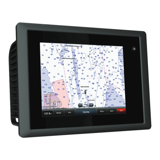
Garmin GPSMAP 8000 Glass Helm Series Manuals
Manuals and User Guides for Garmin GPSMAP 8000 Glass Helm Series. We have
1
Garmin GPSMAP 8000 Glass Helm Series manual available for free PDF download: Instruction Manual
Garmin GPSMAP 8000 Glass Helm Series Instruction Manual (48 pages)
Brand:
Garmin
| Category:
Marine Equipment
| Size: 5.29 MB
Table of Contents
Table of Contents
3
Introduction
7
GPSMAP 8000 Series Front View
7
Using the Touchscreen
7
Locking the Touchscreen
7
Downloading the Manuals
7
Getting more Information
7
Tips and Shortcuts
7
Inserting a Memory Card
7
Loading the New Software on a Memory Card
7
Updating the Device Software
7
GPS Satellite Signals
8
Selecting the GPS Source
8
Stations and Home Screens
8
Customizing the Home Screen
8
Resetting the Station Layouts
8
Using the Garmin Helm™ Application with the Chartplotter
8
Setting the Vessel Type
8
Customizing the Layout of a Page
8
Adjusting the Backlight
8
Adjusting the Color Mode
8
Navigation Chart and Offshore Fishing Chart
9
Zooming in and out Using the Touchscreen
9
Measuring a Distance on the Chart
9
Chart Symbols
9
Showing a Different Chart
9
Viewing Location and Object Information on a Chart
9
Viewing Details about Navaids
9
Navigating to a Point on the Chart
9
Premium Charts
10
Viewing Tide Station Information
10
Animated Tide and Current Indicators
10
Showing and Configuring Tides and Currents
10
Showing Satellite Imagery on the Navigation Chart
10
Viewing Aerial Photos of Landmarks
11
Automatic Identification System
11
AIS Targeting Symbols
11
Heading and Projected Course of Activated AIS Targets
11
Showing AIS and MARPA Vessels on a Chart or on a 3D Chart View
11
Activating a Target for an AIS Vessel
11
Viewing Information about a Targeted AIS Vessel
11
Deactivating a Target for an AIS Vessel
12
Viewing a List of AIS and MARPA Threats
12
Setting the Safe-Zone Collision Alarm
12
AIS Distress Signals
12
Navigating to a Distress Signal Transmission
12
AIS Distress Signal Device Targeting Symbols
12
Enabling AIS Transmission Test Alerts
12
Turning off AIS Reception
12
Chart and 3D Chart View Settings
12
Navigation and Fishing Chart Setup
12
Waypoints and Tracks Settings on the Charts and Chart Views
13
Chart Appearance Settings
13
Other Vessels Settings on the Charts and Chart Views
13
Laylines Settings
13
Fish Eye 3D Settings
13
Waypoints, Routes, and Tracks
13
Waypoints
13
Marking Your Present Location as a Waypoint
13
Creating a Waypoint at a Different Location
13
Marking an SOS Location
13
Viewing a List of All Waypoints
14
Editing a Saved Waypoint
14
Moving a Saved Waypoint
14
Browsing for and Navigating to a Saved Waypoint
14
Deleting a Waypoint or an MOB
14
Deleting All Waypoints
14
Routes
14
Creating and Navigating a Route from Your Present Location
14
Creating and Saving a Route
14
Viewing a List of Routes
14
Browsing for and Navigating a Saved Route
15
Browsing for and Navigating Parallel to a Saved Route
15
Deleting a Saved Route
15
Deleting All Saved Routes
15
Tracks
15
Showing Tracks
15
Setting the Color of the Active Track
15
Saving the Active Track
15
Viewing a List of Saved Tracks
15
Editing a Saved Track
15
Deleting All Saved Tracks
16
Retracing the Active Track
16
Clearing the Active Track
16
Managing the Track Log Memory During Recording
16
Configuring the Recording Interval of the Track Log
16
Synchronizing User Data Across the Garmin Marine Network
16
Deleting All Saved Waypoints, Routes, and Tracks
16
Navigation with a Chartplotter
16
Basic Navigation Questions
16
Destinations
16
Searching for a Marine Services Destination
17
Courses
17
Setting and Following a Direct Course Using Go to
17
Setting and Following a Course Using Auto Guidance
17
Autopilot Navigation
17
Recalculating the Auto Guidance Route
17
Stopping Navigation
17
Sonar
17
Sonar Views
18
Full-Screen Sonar View
18
Downvü Sonar View
18
Sidevü Sonar View
18
Sidevü/Downvü Scanning Technology
18
Split-Zoom Sonar View
18
Split-Frequency Sonar View
18
Changing the Sonar View
18
Creating a Waypoint on the Sonar Screen
18
Viewing Sonar History
18
Pausing the Sonar Display
19
Viewing Sonar History
19
Sonar Sharing
19
Selecting a Sonar Source
19
Renaming a Sonar Source
19
Adjusting the Level of Detail
19
Adjusting the Color Intensity
19
Adjusting the Range of the Depth or Width Scale
19
Setting the Zoom Level on the Sonar Screen
19
Setting the Scroll Speed
20
Sonar Noise Rejection Settings
21
Sonar Recordings
22
Zooming in and out of the Radar Screen
23
Showing AIS Vessels on the Radar Screen
24
Adjusting Gain on the Radar Screen Manually
25
Front-Of-Boat Offset
26
Enabling Shadow Drive
27
Setting the Wind Hold Type
28
Position Tracking
29
Gauges and Graphs
30
Viewing Engine and Fuel Gauges
30
Configuring the Heading Source of the Wind Gauge
31
Setting the Keel Offset
32
Warning Manager
33
Sorting and Filtering Messages
33
Adjusting the Volume
34
Siriusxm Weather
35
Weather Fronts and Pressure Centers
36
Changing the Sea Surface Temperature Color Range
37
Viewing Video
38
Alternating Among Multiple Video Sources
38
Device Configuration
39
Station Settings
39
Communications Settings
40
Setting the Fuel Alarm
41
Chartplotter Data Management
42
Appendix
43
Appendix
43
Digital Switching
43
NMEA 2000 PGN Information
44
Index
45
Advertisement
Advertisement
Related Products
garmin GPSMAP 8700
Garmin GPSMAP 8000 Series
Garmin GPSMAP 8008 MFD
Garmin GPSMAP 8012 MFD
Garmin GPSMAP 8015 MFD
Garmin GPSMAP 800 Series
Garmin GPSMAP 8012
Garmin GPSMAP 8008
Garmin GPSMAP 87 Series
Garmin GPSMAP 8422
Garmin Categories
GPS
Watch
Car Navigation system
Avionics Display
Marine GPS System
More Garmin Manuals
Login
Sign In
OR
Sign in with Facebook
Sign in with Google
Upload manual
Upload from disk
Upload from URL