Sign In
Upload
Manuals
Brands
Garmin Manuals
GPS
GPSMAP 235 Sounder
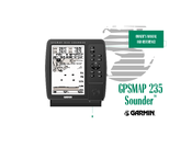
Garmin GPSMAP 235 Sounder Manuals
Manuals and User Guides for Garmin GPSMAP 235 Sounder. We have
2
Garmin GPSMAP 235 Sounder manuals available for free PDF download: Owner's Manual, Specification
Garmin GPSMAP 235 Sounder Owner's Manual (120 pages)
Marine GPS Navigation
Brand:
Garmin
| Category:
GPS
| Size: 1.48 MB
Table of Contents
Warning
3
Features
5
Limited Warranty
6
Packing List
8
Table of Contents
9
Table of Contents/Keypad Usage
10
Initializing the Receiver
11
Getting Started
11
Power On/Screen Contrast
13
Status Page
14
To Put the Sounder in Simulator Mode
14
Position Page
15
Page Sequence
15
Marking a Position
16
Sounder Page
17
Range Modes
18
Underwater Waypoints
18
To Switch from Auto to Manual Mode
18
Zoom Feature
19
Map Page
20
Using the Map Cursor
21
Using the GOTO Feature
22
Going to a Destination
22
Simulator Setup
23
Reviewing and Creating Waypoints on the Map
24
Navigation Page
25
To Adjust the Simulated Boat Speed
26
To Steer the Boat
26
To Change the Highway Scale Display
26
To Change a Data Field
26
Active Route Page
27
Main Menu Page
28
To Select the Track Submenu
28
To Delete the Track Log
28
To Turn the Sounder off
28
Receiver Status, EPE and DOP
30
Section 1: GPSMAP Status Page
30
Section 2: Position
31
Initialize Position, Autolocate, North Up, and Setup Simulator
31
Satellite Status Page Options
31
Section 2: Position
32
Position Page Options
33
Trip Distance, Date Fields, Restore Defaults, and Simulator Setup
33
Section 2: Position Page
33
Section 3: Sounder Page
34
Switching between Ranges and Modes
35
Zoom Window Depth Scale
37
Map/Sounder Page Split Screen
38
Sensitivity
39
Sounder Page Options
39
To Change the Chart Speed
40
To Change the Whiteline Setting
40
Whiteline, Chart Speed, Range Mode
40
Range Mode and Page Display
41
Data Fields and Restore Defaults
42
Fish ID Setup
43
Sounder Setup Page
43
Fish ID and Water Temperature Setup
44
To Select Target Depth
44
To Select Water Temperature or Composition
44
Noise Rejection and Keel Offset Setup
45
Transducer Frequency and Speed Calibration Setup
46
To Calibrate the Unit
46
Section 3: Sounder
47
Speed Calibration Setup Using the GOTO Key
47
To Use Auto Calibration
47
Speed Calibration and Simulator Setup
48
To Use Manual Calibration
48
Section 4: Map
48
Map Page Overview
49
Section 4: Map Page
49
Map Modes
50
Using the Cursor
51
To Select an On-Screen Waypoint or Navaid with the Cursor
51
To Eliminate the Cursor and Re-Center Your Position On-Screen
51
To Create a Waypoint with the Cursor
51
Selecting Map Scales
52
Getting Start
53
Map Page Options
53
To Measure the Bearing and Distance between Two Points
53
Maximize Map, Outline, and Measure Bearing and Distance
53
To Configure the Map
54
To Change the Map Orientation
54
Enable/Disable Rows and Map Calibration
55
To Select a Map Colors Option
56
To Restore the Map Configuration Options to the Factory Defaults
56
Split Screen Option
57
To Select a Page Display Option
57
Section 4: Map
57
Data Fields, Restore Defaults, Setup Simulator
58
Section 5: Navigation
58
Navigation Page Overview
59
Appendix B: . . . . . . . . . . . . . . . . . . . . . . . . .95-97
59
Section 5: Navigation Page
59
Navigation Page Options
60
Data Fields, Configure Highway, Auto COG
61
Main Menu Page Overview
62
Section 6: Main Menu Page
62
Creating and Using Waypoints
63
Mark Key
63
To Mark Your Present Position
63
Using the Mark Key
64
To Mark the Cursor or Navaid Position with the Mark Key
64
Section 7: Waypoints
64
Creating Waypoints Graphically
65
Creating Waypoints by Text Entry
65
Reference Waypoints
66
To Create a New Waypoint Using a Reference Waypoint
66
Reviewing and Editing Waypoints
67
To Access the Waypoint Definition Page
67
To Change the Waypoint Symbol
67
To Change the Position Coordinates/To Change the Waypoint Comment
67
Waypoint Definition Page Options
68
To Rename the Selected Waypoint
68
To Delete the Selected Waypoint
68
To Select a Nearest Waypoint as a GOTO Destination
69
To Scroll through and Review the Nearest Waypoint List
69
Waypoint Submenus
69
Nearest Waypoints and GOTO Navigation
69
Proximity Waypoints
70
To Turn Proximity Alarms on or off
70
To Remove a Proximity Waypoint from the List
70
Waypoint List
71
Create Waypoint Submenu
71
To Delete an Individual Waypoint from the List
71
To Delete All Tracback Waypoints or the Entire Waypoint List
71
Goto/Mob
72
Selecting a GOTO Destination
72
Navigation Methods
72
Selecting a GOTO Graphically
72
GOTO Options
73
To Select a Route to Navigate
73
To Turn on the MOB Feature
74
To Clear the Track Log/Define a Starting Point for a Tracback Route
74
To Turn on a Tracback Route
74
MOB and Tracback Navigation
74
Section 9: Routes
75
Routes
76
To Create a Route Graphically
76
Editing Routes Graphically
77
To Edit a Route Waypoint
77
To Remove a Route Waypoint
77
To Insert New Route Waypoint(S) at the Beginning or End of the Route
77
To Edit a Route by Text Entry
78
Route Edit Mode
78
To Select a Menu Option
78
To Display the Route Edit Options
78
Editing Routes and Route Edit Options
79
To Review the Selected Waypoint
79
To Insert a New Waypoint before the Selected Route Waypoint
79
To Change the Selected Route Waypoint
79
Route List Page
80
To Enter a Custom Route Comment
80
To Display the Route Options
80
To Clear the Selected Route
81
To Copy a Route
81
To Display the Active Route Options
82
Active Route Page Options
83
Track Log Submenu
84
To Reset All Track Options to the Default Settings
84
Trip and Fuel Planning
85
To Use the Point-To-Point Planning Mode
85
Route and Trip Planning
86
To Use the Route Planning Mode
86
To Plan Multiple Route Legs
86
To Use the Sunrise/Sunset Planner
87
Setup Submenus
87
System Setup and System Setup Options
88
Setup Menus
89
To Enter a User Magnetic Variation
89
Navigation Setup
89
To Enter a User Defined Velocity Filter Value
90
Section 10: Setup Menus
90
Timers and Alarms Setup
91
To Use the Countdown Timer
91
Input/Output Setup
92
NMEA and DGPS Setup
93
Using NMEA and DGPS Interface Settings
93
Tuning DGPS Stations
93
To Tune a DGPS Frequency
93
Installing and Removing G-Chart Cartridges
94
To Remove a G-Chart Cartridge
94
Using G-Chart Cartography
95
LORAN C Basics
96
Section 12: LORAN Tds
96
Using the LORAN TD Position Display Format
97
Selecting and Setting up the LORAN TD Format
97
Section 12: LORAN Tds
98
Creating Waypoints in the LORAN TD Format
99
Sounder Installation
100
Mounting the GPS Antenna
100
Appendix A
100
Mounting the Sounder
101
To Surface Mount the Sounder
101
To Flush Mount the Sounder
102
Transducer Installation
104
Wiring
105
Connecting the Power/Data Cable
105
NMEA Supported Sentences
106
Specifications
107
Messages
108
Map Datums
110
Appendix D
110
D Map Datums
112
Glossary
113
Time Offset Chart
115
Index
116
Appendix G
117
Advertisement
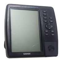
Garmin GPSMAP 235 Sounder Specification (2 pages)
for unmatched accuracy and G-chartTM digital cartography for chartplotting on inland or offshore waters
Brand:
Garmin
| Category:
Marine Equipment
| Size: 0.06 MB
Advertisement
Related Products
Garmin GPSMAP 232
Garmin Forerunner 230
Garmin nuvi 2340LMT
Garmin nuvi 2300LT
Garmin nuvi 2370LT
Garmin nuvi 2360LMT
Garmin nuvi 2360LT
Garmin nuvi 2350LMT
Garmin nuvi 2350LT
Garmin nuvi 2300LM
Garmin Categories
GPS
Watch
Car Navigation system
Avionics Display
Marine GPS System
More Garmin Manuals
Login
Sign In
OR
Sign in with Facebook
Sign in with Google
Upload manual
Upload from disk
Upload from URL