Sign In
Upload
Manuals
Brands
Garmin Manuals
GPS
GPSMAP 420
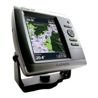
Garmin GPSMAP 420 Manuals
Manuals and User Guides for Garmin GPSMAP 420. We have
8
Garmin GPSMAP 420 manuals available for free PDF download: Owner's Manual, Installation Instructions Manual, Quick Reference Manual, Reference Manual, Declaration Of Conformity
Garmin GPSMAP 420 Owner's Manual (72 pages)
GPSMAP 400 Series; GPSMAP 500 Series
Brand:
Garmin
| Category:
GPS
| Size: 2.91 MB
Table of Contents
Tips and Shortcuts
3
Manual Conventions
3
Quick Links
3
Table of Contents
4
Declaration of Conformity (Doc)
6
Product Registration
6
Contact Garmin
6
Getting Started
7
Unit Overview
7
Turning the Unit on or off
9
Initializing Unit Settings
9
Adjusting the Backlight
10
Using the Keypad
11
Acquiring GPS Satellite Signals
11
Using Simulator Mode
12
Viewing System Information
12
Restoring the Original Factory Settings
12
Inserting and Removing SD Cards
12
Understanding the Home Screen
13
Using Charts
14
Using the Navigation Chart
14
Navigation Chart Menu
15
Understanding Chart Data
16
Navigating to a Point on the Chart
17
Changing the Navigation Chart Settings
18
Changing the Chart Appearance
19
Using the Split Navigation Chart
20
Using Perspective 3D
21
Using Mariner's Eye 3D
22
Using Fish Eye 3D
23
Using Fishing Charts
24
Enabling High Resolution Satellite Imagery
25
Viewing Aerial Photos
26
Viewing Current-Station Information
26
Detailed Road and POI Data
27
Using Automatic Guidance
27
Using the Chart/Sonar Screen
27
Where to
28
Navigating to a Destination
28
Creating and Using Waypoints
30
Creating and Using Routes
31
Using Tracks
32
Using Bluechart G2 Vision
34
Navigating with a Garmin Autopilot
35
Viewing Information
36
Viewing a Compass
36
Viewing Numbers
36
Viewing Trip Information
37
Viewing Fuel Gauges
37
Viewing Tide-Station Information
38
Viewing Current Information
38
Viewing User Data
39
Viewing Other Vessels
41
Configuring the Chartplotter
43
Configuring System Settings
43
Configuring Units of Measure
43
Changing the System Language
44
Configuring Navigation Preferences
44
Configuring Communications Settings
45
Setting Alarms
46
Setting the Total Fuel Onboard Alarm
47
Configuring My Boat
48
Configuring Other Vessels
49
Using Sonar
50
Understanding the Full Screen
50
Understanding the Split Frequency Screen
50
Understanding the Split Zoom Screen
51
Understanding the Temp Log Screen
51
Setting up Sonar
52
Advanced Sonar Settings
53
Digital Selective Calling (DSC)
55
Using the Chartplotter with a VHF Radio
55
Adding a DSC Contact
56
Viewing the DSC List
56
Receiving Distress Calls
56
Man-Overboard Distress Calls Initiated from a VHF Radio
57
Man-Overboard Distress Calls Initiated from the Chartplotter
57
Position Tracking
57
Placing an Individual Routine Call
58
Calling an AIS Target
59
Appendix
60
Specifications
60
Alarms and Messages
61
Capturing Screenshots
64
Caring for the Unit
65
Software License Agreement
66
Index
67
Advertisement
Garmin GPSMAP 420 Owner's Manual (72 pages)
GPSMAP 400 Series
Brand:
Garmin
| Category:
GPS
| Size: 5.32 MB
Table of Contents
Tips and Shortcuts
3
Manual Conventions
3
Quick Links
3
Table of Contents
4
Warnings
6
Important Information
6
Getting Started
7
Unit Overview
7
Turning the Unit on or off
8
Adjusting the Backlight
8
Using the Keypad
9
Acquiring GPS Satellite Signals
10
Using Simulator Mode
10
Restoring Factory Settings
11
Viewing System Information
11
Inserting and Removing SD Cards
11
Understanding the Home Screen
12
Using Charts
13
Using the Navigation Chart
13
Navigation Chart Settings
14
Understanding Chart Data
14
Using the Split Navigation Chart
17
Using Bluechart G2 Vision
17
Using Mariner's Eye 3D
18
Using Fish Eye 3D
19
Using Fishing Charts
19
Enabling High Resolution Satellite Imagery
20
Viewing Aerial Photos
21
Viewing Current Station Information
22
Detailed Road and POI Data
22
Using Automatic Guidance
22
Changing the Chart Settings
22
Changing the Chart Appearance
23
Using the Chart/Sonar Screen
24
Where to
25
Navigating to a Destination
25
Creating and Using Waypoints
27
Creating and Using Routes
29
Viewing Information
31
Viewing Numbers
31
Viewing Tide Station Information
32
Viewing Current Information
32
Viewing Celestial Information
33
Viewing User Data
33
Viewing Other Boats
34
Configuring the Unit
35
Configuring System Settings
35
Changing Units of Measure
35
Configuring Communications Settings
36
Setting Alarms
37
Configuring My Boat
38
Configuring Other Boats
40
Configuring XM Audio
40
Using Sonar
41
Understanding the Full Screen
41
Understanding the Flasher
41
Understanding the Split Freq Screen
42
Understanding the Split Zoom Screen
42
Understanding the Temp Log Screen
43
Setting up Sonar
43
Advanced Sonar Settings
44
Installing the Unit
45
Step 1: Select a Location
45
Step 2: Mount the Unit
46
Step 3: Install the Transducer
48
Step 4: Install the Wiring Harness
54
Step 5: Test the Installation
57
Appendix
59
Specifications
59
Product Registration
60
Caring for the Unit
60
Alarms and Messages
61
Weather Data Warranty
65
XM Satellite Radio Service Agreement
66
Software License Agreement
66
Limited Warranty
67
FCC Compliance
68
Industry Canada Compliance
68
Optional Accessories
68
Index
69
Garmin GPSMAP 420 Owner's Manual (72 pages)
GPSMAP 400 Series
Brand:
Garmin
| Category:
GPS
| Size: 5.08 MB
Table of Contents
Tips and Shortcuts
3
Manual Conventions
3
Quick Links
3
Table of Contents
4
Warnings
6
Important Information
6
Getting Started
7
Unit Overview
7
Turning the Unit on or off
8
Adjusting the Backlight
8
Using the Keypad
9
Acquiring GPS Satellite Signals
10
Using Simulator Mode
10
Restoring Factory Settings
11
Viewing System Information
11
Inserting and Removing SD Cards
11
Understanding the Home Screen
12
Using Charts
13
Using the Navigation Chart
13
Navigation Chart Settings
14
Understanding Chart Data
15
Using Bluechart G2 Vision
17
Using Mariner's Eye 3D
18
Using Fish Eye 3D
19
Using Fishing Charts
19
Enabling High Resolution Satellite Imagery
20
Viewing Aerial Photos
21
Viewing Current Station Information
22
Detailed Road and POI Data
22
Using Automatic Guidance
22
Changing the Chart Settings
22
Changing the Chart Appearance
23
Using the Chart/Sonar Screen
24
Where to
25
Navigating to a Destination
25
Creating and Using Waypoints
27
Creating and Using Routes
29
Viewing Information
31
Viewing Numbers
31
Viewing Tide Station Information
32
Viewing Current Information
32
Viewing Celestial Information
33
Viewing User Data
33
Viewing Other Boats
34
Configuring the Unit
35
Configuring System Settings
35
Changing Units of Measure
35
Configuring Communications Settings
36
Setting Alarms
37
Configuring My Boat
38
Configuring Other Boats
40
Using Sonar
41
Understanding the Full Screen
41
Understanding the Flasher
41
Understanding the Split Freq Screen
42
Understanding the Split Zoom Screen
42
Understanding the Temp Log Screen
43
Setting up Sonar
43
Advanced Sonar Settings
44
Installing the Unit
45
Step 1: Select a Location
45
Step 2: Mount the Unit
46
Step 3: Install the Transducer
48
Step 4: Install the Wiring Harness
54
Step 5: Test the Installation
57
Appendix
59
Specifications
59
Product Registration
60
Caring for the Unit
60
Alarms and Messages
61
Weather Data Warranty
65
XM Satellite Radio Service Agreement
66
Software License Agreement
66
Limited Warranty
67
FCC Compliance
68
Industry Canada Compliance
68
Optional Accessories
68
Index
69
Advertisement
Garmin GPSMAP 420 Installation Instructions Manual (30 pages)
Flush Mount Kit Instructions and Template (Multilingual)
Brand:
Garmin
| Category:
GPS
| Size: 1 MB
Garmin GPSMAP 420 Installation Instructions Manual (12 pages)
GPSMAP 400 Series; GPSMAP 500 Series
Brand:
Garmin
| Category:
GPS
| Size: 2.64 MB
Table of Contents
Selecting a Mounting Location
2
Mounting the Chartplotter
2
Shoot-Thru-Hull Installation
5
Installing the Wiring Harness
6
Connecting the Wiring Harness to Power
6
Testing the Installation
9
Physical Specifications
10
Garmin GPSMAP 420 Quick Reference Manual (2 pages)
Garmin GPSMAP 400: Reference Guide
Brand:
Garmin
| Category:
GPS
| Size: 0.92 MB
Garmin GPSMAP 420 Reference Manual (2 pages)
Garmin GPSMAP 431: Reference Guide
Brand:
Garmin
| Category:
GPS
| Size: 0.76 MB
Garmin GPSMAP 420 Declaration Of Conformity (1 page)
Marine Navigation Equipment
Brand:
Garmin
| Category:
GPS
| Size: 0.02 MB
Advertisement
Related Products
Garmin GPSMAP 4208 - Marine GPS Receiver
Garmin GPSMAP 4210
Garmin GPSMAP 4212 - Marine GPS Receiver
Garmin GPSMAP 420s - Marine GPS Receiver
Garmin GPSMAP 421
Garmin GPSMAP 421s
Garmin GPSMAP 421/421s
Garmin GPSMAP 420/420s
Garmin nuvi 42LM
Garmin nuvi 40LM
Garmin Categories
GPS
Watch
Car Navigation system
Avionics Display
Marine GPS System
More Garmin Manuals
Login
Sign In
OR
Sign in with Facebook
Sign in with Google
Upload manual
Upload from disk
Upload from URL