Table of Contents
Advertisement
Quick Links
Download this manual
See also:
Installation Manual
Advertisement
Table of Contents

Related Manuals for Clarion NX504E


Summary of Contents for Clarion NX504E
- Page 1 Owner's manual N X 504E Navigation...
- Page 2 It is easy to keep the navigation system up to date. Simply download new map data from Clarion’s portal site, store them on a microSD card and insert it into the Clarion NX504E via the front card slot. Unpleasant surprises are now avoided as navigation maps will match the real world.
-
Page 3: Table Of Contents
3.1.2.5 Entering an address with a postal code ..................40 3.1.2.6 Tips on entering addresses quickly ....................42 3.1.3 Selecting the destination from the Places of Interest ............43 3.1.3.1 Quick search for a Place of Interest....................43 NX504E English 3... - Page 4 5.1.1 Smart Zoom .......................... 78 5.1.2 Daytime and night colour themes ..................78 5.1.3 Tunnel view .......................... 78 5.1.4 Route calculation and recalculation ..................79 5.1.5 Green routing ........................80 5.1.6 Road safety cameras and other proximity alert points ............81 4 NX504E English...
- Page 5 5.3.7 Visual guidance settings ....................... 93 5.3.8 Display settings ........................94 5.3.9 Regional settings ........................94 5.3.10 Trip monitor settings ......................95 5.3.11 Log collection settings ......................95 6 Glossary ........................96 7 Copyright note ......................98 NX504E English 5...
-
Page 6: Warnings And Safety Information
You must obey the traffic signs and follow the road geometry. If you deviate from the recommended route, Clarion Mobile Map changes the instructions accordingly. Never place Clarion NX504E where it obstructs the driver's view, where it is in the deployment zone of an airbag or where it might cause injuries in an accident. -
Page 7: Getting Started
2 Getting started Clarion Mobile Map is optimised for in-car use. You can use it easily by tapping the screen buttons and the map with your fingertips. When using the navigation software for the first time, an initial setup process starts automatically. -
Page 8: Navigation Menu
The initial setup is now complete. The Configuration wizard can be restarted later from the Settings menu (page 85). After the initial setup, the Navigation menu appears and you can start using Clarion Mobile Map. 2.1 Navigation menu You can reach all parts of Clarion Mobile Map from the Navigation menu. - Page 9 Slider When a feature can be Drag the handle to set to different values in move the slider to a range, Clarion Mobile its new position. Map shows an indicator • Tap the slider where on a gauge that displays you want the handle and sets the value.
-
Page 10: Using Keyboards
Finalising the keyboard entry (accepting the suggested search result) Finalising the keyboard entry (opening the list of search results) Finalising the keyboard entry (saving your input) Cancelling the keyboard entry (returning to the previous screen) 10 NX504E English... -
Page 11: Beyond Single Screen Tap
Depending on the speed of the sliding, the list will scroll fast or slow, only a bit or till the end. • Moving the map in map browsing mode: grab the map, and move it in the desired direction. NX504E English 11... -
Page 12: Map Screen
2.3 Map screen 2.3.1 Navigating on the map The Map screen is the most frequently used screen of Clarion Mobile Map. A small live map is displayed on the Navigation menu, as a part of the button. To enlarge this small map and open the Map screen, tap This map shows the current position (the Vehimarker, a blue arrow by default), the recommended route (an orange line), and the surrounding map area. - Page 13 Shows the time needed to reach the final destination of the route based on information available for the remaining segments of the route. If Clarion NX504E is capable of receiving live traffic information, the calculation takes into account traffic delays affecting your route if they are received.
-
Page 14: Position Markers
2.3.3 Objects on the map 2.3.3.1 Streets and roads Clarion Mobile Map shows the streets in a way that is similar to how the paper road maps show them. Their width and colours correspond to their importance: you can easily tell a motorway from a small street. -
Page 15: Turn Preview And Next Street
The same symbols are used in both fields: Icon Description Turn left. Turn right. Turn back. Bear right. Turn sharp left. Keep left. Continue straight in the intersection. Go left on the roundabout, 3rd exit (next manoeuvre). Enter roundabout (second next manoeuvre). NX504E English 15... -
Page 16: Lane Information And Signposts
When navigating on multilane roads, it is important to take the appropriate lane in order to follow the recommended route. If lane information is available in the map data, Clarion Mobile Map displays the lanes and their directions using small arrows at the bottom of the map. -
Page 17: Junction View
Tap any of them to display the exit area on the map. You can now easily add this exit as a waypoint to your route if needed. If you want to display other types of Places for the exits, you can change the icons in Visual Guidance settings (page 93). NX504E English 17... -
Page 18: Object Types
Normally if GPS position is available, the route starts from the current position. If there is no valid GPS position, Clarion Mobile Map uses the last known position as the start point. -
Page 19: Traffic Events
If there are traffic events on the recommended route that the application has not Note! bypassed, the icon will open the list of significant traffic events to let you quickly check them. NX504E English 19... -
Page 20: Manipulating The Map
Changes how much of the map is displayed on the and out screen. Clarion Mobile Map uses high-quality vector maps that let you examine the map at various zoom levels, always with optimised content. It always displays street names and other text with the same font size, never upside- down, and you only see the streets and objects that you need. -
Page 21: Quick Menu
/ Quick Search (page 43) The search is carried out either along your route or around your current location if there is no route calculated. Find / Favourite (page This button opens the list of your Favourite destinations. NX504E English 21... - Page 22 My Route / Avoidances This button lets you bypass parts of the recommended route. More / Trip Monitor This button opens the Trip Monitor screen where you can (page 84) manage your previously saved trip logs and track logs. 22 NX504E English...
-
Page 23: Checking The Details Of The Current Position (Where Am I?)
If the current street is displayed below the Vehimarker (the current position on the map), tap it to open the Where Am I? screen. • Open the Quick menu and tap the button. Information on this screen: NX504E English 23... - Page 24 • : Car repair and roadside assistance services • : Police stations • : Medical and emergency services • : Petrol stations Tap any of the buttons, select a Place from the list, and navigate to it. 24 NX504E English...
-
Page 25: On-Road Navigation
3 On-road navigation When first started, Clarion Mobile Map calculates routes using the road network of the high quality vector maps provided with the product. You can set up your route in different ways: • If you need a route for immediate navigation, you can select the destination and start navigating to it right away (normal navigation). - Page 26 The background search is carried out while you enter letters so this number may keep on increasing if you wait a few seconds. Keep on entering new letters while this number is high. 26 NX504E English...
- Page 27 After a short summary of the route parameters, the map appears showing the entire route. The route is automatically calculated. Tap to modify route parameters, or tap and start your journey. NX504E English 27...
-
Page 28: Combined Search - Navigating To A Recent Destination (History)
Note! The alternative way to search for a recent destination is to tap the button in the Quick menu or in the Destination menu. The rest of the procedure is similar to the above. 28 NX504E English... -
Page 29: Combined Search - Navigating To A Favourite Destination
Scroll down the list if necessary and then select one of the addresses from the list. Once the destination is selected, a full screen map appears with the selected point in the middle. If necessary, tap the map somewhere else to modify the destination. The NX504E English 29... -
Page 30: Combined Search - Navigating To An Intersection
Scroll down the list if necessary and then select one intersection from the list. Once the destination is selected, a full screen map appears with the selected point in the middle. If necessary, tap the map somewhere else to modify the destination. The 30 NX504E English... -
Page 31: Combined Search - Navigating To A Place Of Interest
Once the destination is selected, a full screen map appears with the selected point in the middle. If necessary, tap the map somewhere else to modify the destination. The Cursor ( ) appears at the new location. Tap to confirm the destination, or tap to select a different destination. NX504E English 31... -
Page 32: Combined Search - Navigating To A Place Of Interest By Its Category
Once the destination is selected, a full screen map appears with the selected point in the middle. If necessary, tap the map somewhere else to modify the destination. The Cursor ( ) appears at the new location. Tap to confirm the destination, or tap to select a different destination. 32 NX504E English... -
Page 33: Entering An Address Or A Part Of The Address
Using the same screen, you can find an address by entering: • the exact address, including house number • the centre of a city/town • an intersection • the midpoint of a street • any of the above, starting the search with the postal code (page 40) NX504E English 33... -
Page 34: Entering An Address
Navigation menu. In the Navigation menu, tap the following buttons: By default, Clarion Mobile Map proposes the country and city/town where you are. If needed, tap , enter the first few letters of the country name on the keyboard, and select one country from the list of results. - Page 35 A full screen map appears with the selected point in the middle. If necessary, tap the map somewhere else to modify the destination. The Cursor ( ) appears at the new location. Tap to confirm the destination, or tap to select a different destination. NX504E English 35...
-
Page 36: Entering The Midpoint Of A Street As The Destination
If the desired name does not show up, the names that match the string appear in a list after entering a couple of characters (to open the list of results before it appears automatically, tap ). Select the street from the list. 36 NX504E English... -
Page 37: Selecting An Intersection As The Destination
In the Navigation menu, tap the following buttons: If necessary, modify the country and city/town as described earlier (page 34). Enter the street name: Start entering the street name on the keyboard. c. Find the street you need: NX504E English 37... - Page 38 A full screen map appears with the selected point in the middle. If necessary, tap the map somewhere else to modify the destination. The Cursor ( ) appears at the new location. Tap to confirm the destination, or tap to select a different destination. 38 NX504E English...
-
Page 39: Selecting A City/Town Centre As The Destination
If the desired name does not show up, the names that match the string appear in a list after entering a couple of characters (to open the list of results before it appears automatically, tap ). Select the city/town from the list. NX504E English 39... -
Page 40: Entering An Address With A Postal Code
Navigation menu. In the Navigation menu, tap the following buttons: If necessary, modify the country as described earlier (page 34). Enter a new city/town using its postal code: to open the numeric keypad. 40 NX504E English... - Page 41 (to open the list of results before it appears automatically, tap ). Select the street from the list. Enter the house number: Enter the house number on the keyboard. (To enter letters, tap NX504E English 41...
-
Page 42: Tips On Entering Addresses Quickly
• You can speed up finding an intersection: • Search first for the street with a less common or less usual name; fewer letters are enough to find it. 42 NX504E English... -
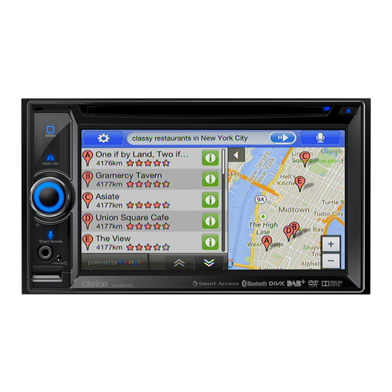
Page 43: Selecting The Destination From The Places Of Interest
3.1.3 Selecting the destination from the Places of Interest You can select your destination from the Places of Interest included with Clarion Mobile Map. Using the same screen, you can find a Place in different ways: •... - Page 44 After a short summary of the route parameters, the map appears showing the entire route. The route is automatically calculated. Tap to modify route parameters, or tap and start your journey. 44 NX504E English...
-
Page 45: Searching For A Place Of Interest Using Preset Categories
• If the current position is not available either (no GPS signal), they are searched around the last known position. • • If an active route exists, accommodation is searched around the destination of the route. NX504E English 45... - Page 46 After a short summary of the route parameters, the map appears showing the entire route. The route is automatically calculated. Tap to modify route parameters, or tap and start your journey. 46 NX504E English...
-
Page 47: Searching For A Place Of Interest By Category
(The result list will be ordered by the length of the necessary detour.) (optional) If you have selected , select the city/town to search in. NX504E English 47... - Page 48 Browse the list if necessary and tap one of the list items. A full screen map appears with the selected point in the middle. The name and address of the Place is displayed at the top of the screen. 48 NX504E English...
-
Page 49: Searching For A Place Of Interest By Name
• to search for a place around the destination of the active route. (The result list will be ordered by the distance from the destination.) NX504E English 49... - Page 50 Select one of the main Place categories (e.g. Accommodation) to search in or tap to search among all Places. Select one of the Place subcategories (e.g. Hotel or Motel) to search in or tap to search in the selected Place category. 50 NX504E English...
- Page 51 Place. Tap to return to the map. If necessary, tap the map somewhere else to modify the destination. The Cursor ) appears at the new location. Tap to confirm the destination, or tap to select a different destination. NX504E English 51...
-
Page 52: Searching For A Place Of Interest By Its Phone Number
The name and address of the Place is displayed at the top of the screen. (optional) Tap to see the details of the selected Place. Tap to return to the map. 52 NX504E English... -
Page 53: Selecting Nearby Assistance From 'Where Am I
Preset search categories appear, all for searching around the current position (or around the last known position if the current position is not available): • : Car repair and roadside assistance services • : Medical and emergency services NX504E English 53... - Page 54 After a short summary of the route parameters, the map appears showing the entire route. The route is automatically calculated. Tap to modify route parameters, or tap and start your journey. 54 NX504E English...
-
Page 55: Selecting A Map Location As The Destination
Cursor as the destination. After a short summary of the route parameters, the map appears showing the entire route. The route is automatically calculated. Tap to modify route parameters, or tap and start your journey. NX504E English 55... -
Page 56: Selecting The Destination From Your Favourites
After a short summary of the route parameters, the map appears showing the entire route. The route is automatically calculated. Tap to modify route parameters, or tap and start your journey. 56 NX504E English... -
Page 57: Selecting Your Home Location
After a short summary of the route parameters, the map appears showing the entire route. The route is automatically calculated. Tap to modify route parameters, or tap and start your journey. NX504E English 57... -
Page 58: Selecting A Recent Destination From The History
After a short summary of the route parameters, the map appears showing the entire route. The route is automatically calculated. Tap to modify route parameters, or tap and start your journey. 58 NX504E English... -
Page 59: Entering The Coordinate Of The Destination
A full screen map appears with the selected point in the middle. If necessary, tap the map somewhere else to modify the destination. The Cursor ( ) appears at the new location. Tap to confirm the destination, or tap to select a different destination. NX504E English 59... -
Page 60: Navigate To A Location Stored In A Photo
Only geotagged JPG files contain location information. That is why these kind of files can only be used in navigation. Other picture files do not appear in the list. Note! Files must be located on an inserted microSD card, either in the root folder or in a "pictures" folder. 60 NX504E English... -
Page 61: Building A Route From The List Of Destinations (Create Route)
When the new destination is selected, the list returns. To add more destinations, tap where you want to insert the new route point in the list, and repeat the above procedure. NX504E English 61... -
Page 62: Viewing The Entire Route On The Map
3.3 Checking route parameters and accessing route related functions You can check different parameters of the route recommended by Clarion Mobile Map. If you are on the Map screen, tap to return to the Navigation menu. -
Page 63: Modifying The Route
The previous destination and waypoint(s) are deleted. • to add the newly selected location as an intermediate destination to your route. The other destinations of the route remain intact. Note: the new waypoint is NX504E English 63... -
Page 64: Setting A New Starting Position For The Route
If you already have a route, tap . If you are starting a new route, The first line is the start of the route, normally the current GPS position. Tap confirm your action at the warning message. 64 NX504E English... -
Page 65: Editing The List Of Destinations (Edit Route)
If you are on the Map screen, tap to return to the Navigation menu. In the Navigation menu, tap You have the following options: • to add a new destination. NX504E English 65... -
Page 66: Pausing The Active Route
3.4.4 Pausing the active route You do not need to pause the active route: when you start driving again, Clarion Mobile Map restarts the voice instructions from your position. 3.4.5 Cancelling the active route To cancel the navigated route, do one of the following: •... - Page 67 Select one of the route alternatives and tap to return to the previous screen. Clarion Mobile Map recalculates the route. The orange line now shows the new recommended route. NX504E English 67...
-
Page 68: Checking Route Alternatives For An Existing Route
If you are on the Map screen, tap to return to the Navigation menu. In the Navigation menu, tap You see the basic details of three route alternatives with the selected route planning method. Tap any of them to see it on the map. 68 NX504E English... -
Page 69: Changing The Vehicle Used In Route Planning
Select one of the route alternatives then tap and hold for a few seconds to return to the Map screen. Clarion Mobile Map recalculates the route. The orange line now shows the new recommended route. 3.4.8 Changing the vehicle used in route planning To recalculate the active route for a different vehicle, do as follows. -
Page 70: Changing The Road Types Used In Route Planning
Clarion Mobile Map plans the best toll-free route. • - Clarion Mobile Map includes ferries in a planned route by default. However, a map does not necessarily contain information about the accessibility of temporary ferries. You might also need to pay a fare on ferries. -
Page 71: Saving A Location As A Favourite Destination
When the full screen map appears with the selected location in the middle, tap (optional) Using the keyboard, you can change the name offered for the Favourite. Tap to enter numbers or symbols. to save the location as a new Favourite destination. NX504E English 71... -
Page 72: Editing The Details Of A Favourite Destination
A full screen map appears with the selected point in the middle. to see the details of the selected Place. Tap any of the data fields and modify its content. Tap and hold to return to the map. 72 NX504E English... -
Page 73: Saving A Map Location As An Alert Point
On the newly opened screen, select the type of the alert point, the direction from which you expect the alert, and (if applicable) the speed limit for this alert point. to save the location as a new alert point. NX504E English 73... -
Page 74: Editing An Alert Point
On the newly opened screen, modify the type of the alert point, the direction from which you expect the alert, or (if applicable) the speed limit for this alert point. to save the changes to the alert point. 74 NX504E English... -
Page 75: Watching The Simulation Of The Route
(optional) You have the following controls during the simulation (the control buttons disappear after a few seconds but you can open them again if you tap the map): • : Jump to the next route event (manoeuvre). • : Pause the simulation. NX504E English 75... - Page 76 : Jump to the previous route event (manoeuvre). • : Tap to increase the speed of the simulation to 4, 8 or 16 times faster. Now tap again to return to the normal speed. b) Tap to stop the simulation. 76 NX504E English...
-
Page 77: Off-Road Navigation
4 Off-road navigation When first started, Clarion Mobile Map calculates routes using the road network of the high quality vector maps provided with the product. You can switch the application to off-road mode in Route settings in one of the following ways: •... -
Page 78: Reference Guide
While driving without an active route: Smart Zoom will zoom in if you drive slowly and zoom out when you drive at high speed. 5.1.2 Daytime and night colour themes Clarion Mobile Map uses different colour themes during the day and during the night for both the map and the menu screens. •... -
Page 79: Route Calculation And Recalculation
• : Results in a route with fewer turns and no difficult manoeuvres. With this option, you can make Clarion Mobile Map to take, for example, the motorway instead of a series of smaller roads or streets. • Vehicle types: •... -
Page 80: Green Routing
Real-time Traffic events are also taken into account and sometimes greatly modify the route. Clarion Mobile Map automatically recalculates the route if you deviate from the proposed itinerary or if a newly received Traffic event concerns a part of the recommended route. -
Page 81: Road Safety Cameras And Other Proximity Alert Points
There is a special proximity warning for road safety cameras (like speed or red light cameras) and other proximity alert points (like schools or railroad crossings). These alert points are not part of Clarion Mobile Map. You can download them from www.naviextras.com or you can upload points in a specific text file if needed. -
Page 82: Speed Limit Warning
Clarion NX504E contains the TMC receiver that is needed to receive Traffic events. If public Traffic data is broadcast at your location, Clarion Mobile Map automatically takes into account the traffic events received. You do not need to set anything in the program. The receiver will automatically search the FM radio stations for TMC data, and the decoded information will immediately be used in route planning. - Page 83 If there are traffic events on the recommended route that the application has not Note! bypassed, the icon will open the list of significant traffic events to let you quickly check them. NX504E English 83...
-
Page 84: More' Menu
Button Description You can configure the program settings, and modify the behaviour of Clarion Mobile Map. Fine-tune route planning options, change the look of the Map screen, turn on or off warnings, or restart the Configuration wizard, and so on. -
Page 85: Settings Menu
5.3 Settings menu You can configure the program settings, and modify the behaviour of Clarion Mobile Map. On the map screen, tap the following buttons: The Settings menu has several options. Tap or scroll with your finger to see the full list. -
Page 86: Sound And Warnings
Tap any of these to hear a sample voice prompt. Just tap when you have selected the new spoken language. Tap this button to set the verbosity of the voice instructions: how much they tell and how often they speak. 86 NX504E English... - Page 87 Maps may contain information about the speed limits of the road segments. Clarion Mobile Map is able to warn you if you exceed the current limit. This information may not be available for your region (ask your local dealer), or may not be fully correct for all roads in the map.
-
Page 88: Customise Quick Menu
The rest of the buttons below are all related to the TMC function and are available only if the receiver is enabled. This setting determines how Clarion Mobile Map uses the received real- time traffic information in route calculation. When calculating a new... - Page 89 They can be enabled or disabled separately from toll roads. Clarion Mobile Map includes toll roads (pay roads where there is a per- use charge) in the routes by default. If you disable toll roads, Clarion Mobile Map plans the best toll-free route.
- Page 90 Gives a quick but fuel efficient route based on the fuel consumption data given in Route settings (page 88). Travel cost and CO emission calculations are estimations only. They cannot take elevations, curves and traffic conditions into account. 90 NX504E English...
-
Page 91: User Profiles
5.3.5 User profiles If more drivers use Clarion Mobile Mapfor navigating, their settings can be remembered by using one of the user profiles. Rename the profiles after tapping the edit button on the right so that all users know which profile to use and switch between profiles by tapping its name. - Page 92 Tap the name of the Place category to open the list of its subcategories. • to save the current Place visibility set or to load a previously saved one. Here you can also revert to the default visibility settings. 92 NX504E English...
-
Page 93: Visual Guidance Settings
When you slow down while driving on a motorway, there is a chance that you are in a traffic jam so Clarion Mobile Map offers you a detour using the next exit. The message shows you distance of the exit and the difference in distance and estimated time compared to the original route. -
Page 94: Display Settings
Also, if there are avoidable parts of the original route ahead (like a tunnel, a toll road or a ferry), you will find them in the list in case you want to bypass them with the help of Clarion Mobile Map. -
Page 95: Trip Monitor Settings
Understanding how different people use the application can help us improve the user interface and the program workflow. Anonymous track logs are collected for later development purposes. Your trips can help us improve the quality and coverage of maps. NX504E English 95... -
Page 96: Glossary
Colour theme Clarion Mobile Map comes with different colour themes for daytime or night use of the map and menu screens. Themes are custom graphic settings and they can have different colours for streets, blocks or surface waters in 2D and 3D modes, and they display shades or shadows in different ways in 3D mode. - Page 97 Road Safety Camera Special alert points for speed, red light or bus lane cameras. Different data sources are available. You can configure Clarion Mobile Map to warn you when you approach one of these cameras. Detecting the location of Road Safety Cameras is prohibited in certain countries. It is the sole responsibility of the driver to check whether this feature can be used during the trip.
-
Page 98: Copyright Note
This manual may not, in whole or in part, be reproduced or transmitted in any form either electronically or mechanically, including photocopying and recording, without the express written consent of Clarion. © 2014 - Clarion Map data: © 1987 - 2014 HERE. All rights reserved. - Page 99 QY-1120E All Rights Reserved. Copyright © 2014: Clarion Co., Ltd. QCA-305-110 2014/7...