Garmin GPSMAP 76CSx Owner's Manual
Mapping gps with sensors
Hide thumbs
Also See for GPSMAP 76CSx:
- Manual de l'utilisateur (118 pages) ,
- Owner's manual (64 pages) ,
- Quick reference manual (2 pages)

Related Manuals for Garmin GPSMAP 76CSx


Summary of Contents for Garmin GPSMAP 76CSx
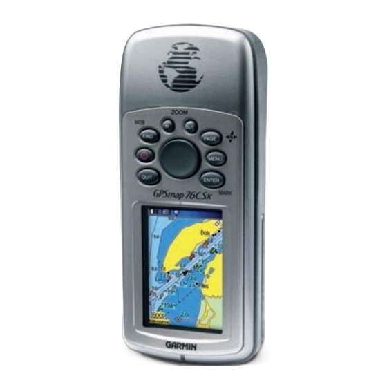
- Page 1 GPSMAP 76CSx ® mapping gps with sensors owner’s manual Shown with optional MapSource data. ®...
- Page 2 Garmin. Garmin hereby grants permission to download a single copy of this manual onto a hard drive or other electronic storage medium...
-
Page 3: About This Manual
NTRODUCTION Thank you for choosing the Garmin GPSMAP 76CSx. The GPSMAP 76CSx uses the proven performance of Garmin GPS and full-featured mapping to create an unsurpassed portable GPS receiver. Take a moment now to compare the contents of this package with the packing list on the box. -
Page 4: Table Of Contents
About This Manual ...i Manual Conventions ... i Software License Agreement ...v Product Registration ...v Contact Garmin ... v Caring for the GPSMAP 76CSx ...vi Cleaning the Case ... vi Cleaning the Screen ... vi Storage ... vi Water Immersion ... vi Warning ...vii... - Page 5 Map Orientation ... 40 Map Page Options ... 40 Guidance Text ... 41 Setting up the Map Page ... 42 GPSMAP 76CSx Owner’s Manual NTRODUCTION Measuring Distance ... 45 Turning Declutter On or Off ... 46 Restoring Defaults ... 47 Compass Page ...47...
- Page 6 Hunt and Fish ...86 Games Menu ...87 Appendix ...91 Specifications ...91 Interfacing ...92 Optional Accessories ...93 Connecting Your GPSMAP 76CSx to a Com- puter ...94 Map Datums and Location Formats ...95 What is WAAS/EGNOS? ...97 Data Field Definitions ...98 FCC Compliance ...101 Limited Warranty ...102...
-
Page 7: Software License Agreement
Software License Agreement BY USING THE GPSMAP 76CSx, YOU AGREE TO BE BOUND BY THE TERMS AND CONDITIONS OF THE FOLLOWING SOFTWARE LICENSE AGREEMENT. PLEASE READ THIS AGREEMENT CAREFULLY. Garmin grants you a limited license to use the software embedded in this device (the “Software”) in binary executable form in the normal operation of the product. -
Page 8: Caring For The Gpsmap 76Csx
Avoid chemical cleaners and solvents that may damage plastic components. Cleaning the Screen The GPSMAP 76CSx screen should be cleaned using a soft, clean, lint-free cloth. Water, isopropyl alcohol, or eyeglass cleaner can be used if needed. If these are used, apply the liquid to the cloth and then gently wipe the screen with the moistened cloth. -
Page 9: Warning
WARNING: This product, its packaging, and its components contain chemicals known to the State of California to cause cancer, birth defects, or reproductive harm. This Notice is being provided in accordance with California’s Proposition 65. If you have any questions or would like additional information, please refer to our Web site at http://www.garmin.com/prop65. GPSMAP 76CSx Owner’s Manual... -
Page 10: Caution
Map Data Information: One of the goals of Garmin is to provide customers with the most complete and accurate cartography that is available to us at a reasonable cost. We use a combination of governmental and private data sources, which we identify in product literature and copyright messages displayed to the consumer. -
Page 11: Getting Started
Unit Overview Internal antenna Interface keys GPSMAP 76CSx Owner’s Manual ETTING TARTED ETTING TARTED VERVIEW Auxiliary GPS Antenna Connector (under weather cap) Battery compartment cover Battery compartment locking D-ring External Data/Auxilary Power Port (under weather cap) USB connector port (under weather cap) - Page 12 TARTED VERVIEW Installing the Batteries, MicroSD Card, and Lanyard The GPSMAP 76CSx operates on two AA batteries (not included), which are located in the back of the unit. You can use Alkaline or NiMH batteries. See page 66 for information on setting the battery type.
-
Page 13: Using The Gpsmap 76Csx Keypad
Using the GPSMAP 76CSx Keypad IN/OUT Zoom Keys • Press to zoom in or out on the Map Page. • Press to scroll up or down a list on any other page. FIND/MOB Key • Press at any time to view the Find Menu. -
Page 14: Turning On The Gpsmap 76Csx
Introduction Page appears, followed by the Satellite Page. Introduction Page Satellite Page 2. To turn off the GPSMAP 76CSx, press and hold the POWER key again. Adjusting the Backlight You might want to adjust the backlight to see the screen better. -
Page 15: Initializing The Gps Receiver
Initializing the GPS Receiver The first time you turn on your GPSMAP 76CSx, the GPS receiver must collect satellite data and establish its current location. To ensure proper initialization, the GPSMAP 76CSx is shipped from the factory in AutoLocate mode, which allows the receiver to “find itself”... -
Page 16: Initialization Options
Using the GPSMAP 76CSx This section explains how to enter and select information with the GPSMAP 76CSx. Understanding Terms As you progress through this owner’s manual, you are directed to press a specific key or highlight a field on the screen. -
Page 17: Selecting Options And Entering Data
(default) settings when you select Restore Defaults. Field On-screen buttons GPSMAP 76CSx Owner’s Manual ETTING Selecting Options and Entering Data Use the ROCKER to highlight, select, or choose an item in a list or a field on the screen. -
Page 18: Using The Status Bar
PC USB. ) shows the • Electronic compass icon ( the electronic compass is turned on. ), when a 2D fix ) is ) appears when the ) appears when GPSMAP 76CSx Owner’s Manual... -
Page 19: On-Screen Messages
SING THE Using the Databases Optional MapSource CD-ROMs enhance the versatility of your GPSMAP 76CSx. This data is loaded to the MicroSD Card already installed in the unit. With optional MapSource City Navigator data, you can view listings of nearby restaurants, lodging,... -
Page 20: Basic Operation
PERATION This section explains some of the more common operations you will perform with your GPSMAP 76CSx including creating and using waypoints, tracks, and routes using the Find Menu. Creating and Using Waypoints Waypoints are locations or landmarks you record and store in your GPS. -
Page 21: Creating Waypoints Using The Map
4. To change any information on the Waypoint Page, highlight the appropriate field, and press ENTER to open the on-screen keypad. After entering and confirming your changes, highlight OK, and press ENTER. GPSMAP 76CSx Owner’s Manual ASIC PERATION REATING AND Information page for a... -
Page 22: Editing Waypoints
ENTER. The Waypoint Page opens. 4. Highlight the Delete button, and press ENTER. A confirmation message appears. 5. Highlight Yes, and press ENTER to delete the waypoint. NOTE: When you delete a waypoint, you cannot recover it from the unit. GPSMAP 76CSx Owner’s Manual... -
Page 23: Averaging The Waypoint's Location
5. Use the ROCKER to move the waypoint to a new location on the map, and press ENTER. Original location Moving a waypoint GPSMAP 76CSx Owner’s Manual ASIC PERATION Averaging the Waypoint’s Location You can average a new waypoint location over time to produce a more accurate location. -
Page 24: Projecting A Waypoint
Project Waypoint Page. 6. Enter the distance and bearing to the projected waypoint in the appropriate fields at the bottom of the page, and press QUIT when finished. Enter bearing distance Project Waypoint Projected Page waypoint on the GPSMAP 76CSx Owner’s Manual... -
Page 25: Proximity Waypoints
ENTER to open the Proximity Waypoints Page. 3. Highlight an empty line, and press ENTER to open the Find Menu. GPSMAP 76CSx Owner’s Manual ASIC PERATION 4. Select a waypoint from the Waypoints List or from any other group of map points, and press ENTER to open the information page for the item. -
Page 26: Man Overboard (Mob)
MOB point. Using the Find Menu Use the Find Menu to search for waypoints, cities, and exits included in the GPSMAP 76CSx basemap. You can also find saved waypoint and geocache points. Additional icons appear depending on the optional BlueChart or MapSource data loaded to the unit. -
Page 27: Find By Name
To search the entire database, select the All Points of Interest icon, and press ENTER. 3. Press MENU, highlight Find By Name, and press ENTER. GPSMAP 76CSx Owner’s Manual ASIC PERATION SING THE 4. Use the ROCKER and ENTER keys to operate the on-screen keypad and enter the name of the location you want to find. -
Page 28: Recent Finds
See Project Waypoint—create a new waypoint by entering bearing and distance from a reference location. See page 13 for more information. page 14 for more information. GPSMAP 76CSx Owner’s Manual... - Page 29 Map Information—show the map from which the map item originated. See the Appendix for information about downloading detailed maps. GPSMAP 76CSx Owner’s Manual ASIC To find an item near another item: 1. Press FIND to open the Find Menu.
-
Page 30: Finding A Waypoint
1. Press FIND to open the Find Menu. 2. Highlight the Waypoints icon, and press ENTER to open the Waypoints Page. 3. Use the ROCKER to select a waypoint, and press ENTER. The Waypoint Page opens. Waypoints icon GPSMAP 76CSx Owner’s Manual... -
Page 31: Finding A Geocache
Finding a Geocache Use the Geocache icon to view the list of geocache locations created using your GPSMAP 76CSx or downloaded from your computer. A geocache location is a waypoint with a special geocache symbol assigned to give special significance and to allow it to be separated from others on the waypoints list. -
Page 32: Finding An Interstate Exit
4. Select a service from the list, and press ENTER to open the information page for the selected service. 5. Select Save, Map, or Go To from the bottom of the page. GPSMAP 76CSx Owner’s Manual... - Page 33 In place of a city, you can use extended postal codes in select European areas. Addresses icon Addresses Page GPSMAP 76CSx Owner’s Manual ASIC PERATION SING THE 3. Highlight the <Enter Number> field, and press ENTER. 4. Type the street number using the on-screen keypad.
-
Page 34: Finding An Intersection
Searching for a Point of Interest If you downloaded MapSource detailed mapping, you can use the All Points of Interest icon on the Find Menu to locate items such as nearby restaurants, lodging, landmark, and public building. Intersection information page GPSMAP 76CSx Owner’s Manual... -
Page 35: Custom Points Of Interest
first. Custom Points of Interest You can create your own category for points of interest by using the Garmin POI Loader utility available from the Garmin Web site www.garmin.com/products/poiloader/. SING THE... -
Page 36: Using Tracks
1. Press MENU twice to open the Main Menu. 2. Select the Tracks icon, and press ENTER to open the Tracks Page. 3. Highlight the Setup button, and press ENTER Percentage to open the Track Log Setup Page. of memory used GPSMAP 76CSx Owner’s Manual... - Page 37 A message appears asking you if you want to save the entire track. 4. Select Yes, and press ENTER to save the track. A “Saving Track” message appears followed by the Saved Track Page. GPSMAP 76CSx Owner’s Manual ASIC PERATION Track distance...
- Page 38 As you begin to move and define the area’s boundaries, a Stop button appears at the bottom of the page. 4. When finished defining the area, press ENTER to open the page with a Save button. GPSMAP 76CSx Owner’s Manual...
-
Page 39: Track Profiles
Track Profiles After save a track, you have a record of the path you traveled and altitude profile. NOTE: This option is available only if Garmin MapSource U.S. Topo 24K map data is used. To view a track profile: 1. Open the Saved Track Page, and press MENU. -
Page 40: Navigating A Saved Track
Move in the direction of the first turn. When you reach the first turn, directions to the next turn are shown, and so on, until you reach your destination. 4. To stop the TracBack, press MENU, and select Stop Navigation. GPSMAP 76CSx Owner’s Manual... -
Page 41: Creating And Using Routes
Creating and Using Routes Route navigation allows you to create a sequence of intermediate waypoints that lead you to your final destination. The GPSMAP 76CSx lets you store 50 routes with up to 250 points each. Creating a Route You can create or modify a route using the Routes Page, and you can add waypoints to a route from the Find Menu. -
Page 42: Navigating A Route
ENTER to open the Route Page for the selected route. 2. Highlight the Navigate button, and press ENTER to begin navigation and show the route on the Map Page. Route Page page Route on the Map Page GPSMAP 76CSx Owner’s Manual... -
Page 43: Editing A Route
ROCKER. Press QUIT close the Turn Preview Page and return to the Active Route Page. GPSMAP 76CSx Owner’s Manual Editing a Route After you create a route, use the Route Page to edit, change the route name, and review route points. - Page 44 ENTER to open the Off Route Transition Page. 5. Highlight the Route Leg Transition field, and press ENTER to view the list of options. 6. Select the method to use (Manual or Distance) when advancing the route to the next point. GPSMAP 76CSx Owner’s Manual...
-
Page 45: Using The Route Page Options
Select Distance to enter a radius so that when you are within the entered distance, the GPSMAP 76CSx will lead you to the next point on your route. Select Manual to transition to the next waypoint anytime while navigating a route. -
Page 46: Main
AGES VERVIEW The GPSMAP 76CSx has six main pages: Satellite Page, Trip Computer Page, Map Page, Compass Page, Altimeter Page, and the Main Menu. You can cycle through these pages by pressing the PAGE key to move forward or pressing the QUIT key to reverse. Additional pages can be added using the Page Sequence option on the Main Menu. -
Page 47: Satellite Page
Satellite location Satellite signal strength Satellite Page GPSMAP 76CSx Owner’s Manual Using the Satellite Page Options Menu Press MENU to open the Options Menu. Location Use With GPS Off/On—enables you to turn the GPS receiver on or off. Track Up/North Up—indicates whether satellites are... -
Page 48: Map Page
AGES Map Page The GPSMAP 76CSx comes with a built-in basemap that includes a database of cities, interstates, state and county highways, exit information, and lake and river outlines. The standard basemap can be enhanced with MapSource or BlueChart data. -
Page 49: Using Additional Map Data
GPSMAP 76CSx Owner’s Manual Using Additional Map Data Optional Map Source CD-ROMs enhance the versatility of your GPSMAP 76CSx. With MapSource CD-ROMs, you can view listings such as nearby restaurants, lodging, shopping centers, attractions, and entertainment, and you can retrieve addresses and phone numbers for any listed location. -
Page 50: Changing The Zoom Range
ENTER. The following options are available: Stop (Resume) Navigation—stops navigation and is disabled when there is no active navigation. Recalculate—recalculates a route and is disabled when there is no active navigation. GPSMAP 76CSx Owner’s Manual... -
Page 51: Guidance Text
Restore Defaults—returns the map to the factory set map defaults. GPSMAP 76CSx Owner’s Manual Guidance Text When navigating, guidance text above the map. Guidance text To show guidance text: 1. -
Page 52: Setting Up The Map Page
Below—set the map scale at which the Track Up Marine feature shown, all scales above that revert to the North Up map orientation. Map Setup – General Page GPSMAP 76CSx Owner’s Manual... - Page 53 Saved Tracks, Track Log, Track Points, and the Go To Line. Map Setup – Tracks Page GPSMAP 76CSx Owner’s Manual Saved Tracks—set the maximum zoom range at which saved tracks are shown on the map. Track Log—set the maximum zoom range at which active track logs are shown.
- Page 54 The Map Setup—Text Page shows a list of downloaded detailed maps such as topographic, marine charts, and MapSource maps with auto-routing capability. Use ROCKER to highlight a map and press ENTER to show it on the map screen or turn it off. GPSMAP 76CSx Owner’s Manual...
-
Page 55: Measuring Distance
MapSource BlueChart marine mapping data. Map Setup – Marine Page GPSMAP 76CSx Owner’s Manual Marine Colors—toggles marine colors on or off on the Map Page. Spot Soundings—toggles spot soundings on or off on the Map Page. -
Page 56: Turning Declutter On Or Off
1. Press MENU to open the Map Page Options distance menu. 2. Highlight Turn Declutter On, and press End point of measurement ENTER. labeled REF 3. To turn Declutter off, press MENU, select Turn Declutter Off, and press ENTER. GPSMAP 76CSx Owner’s Manual... -
Page 57: Restoring Defaults
Declutter on Restoring Defaults Use the Restore Defaults option to return the map settings to factory settings. GPSMAP 76CSx Owner’s Manual Compass Page During active navigation, the Compass Page guides you to your destination with a graphic compass and a bearing pointer. -
Page 58: Using The Electronic Compass
When you stop (after a pre-set time), it again operates like a magnetic compass. The compass ring is especially helpful when using a paper map or chart in conjunction with your GPSMAP 76CSx for navigation. When the electronic compass is on, a compass icon appears in the status bar. -
Page 59: Calibrating The Electronic Compass
When it is turned off, the unit uses the GPS receiver for navigation. 2. Hold the GPSMAP 76CSx level to get an accurate electronic compass reading. A “Hold Level” message appears if you are not holding the electronic compass correctly, or if it is not calibrated. -
Page 60: Compass Page Options
(on the case above the screen) and the destination you can see in the distance. Stop (Resume) Navigation—stops or starts navigation to your destination. This option is not available if you do not have an active go to or route. GPSMAP 76CSx Owner’s Manual... -
Page 61: Sight 'N Go Navigation
Calibrate Compass—allows you to calibrate the electronic compass. Restore Defaults—restores the default settings for the Compass Page. GPSMAP 76CSx Owner’s Manual Sight ‘N Go Navigation Sight ‘N Go allows you to set a course to a point you see in the distance. -
Page 62: Using The Course Pointer Or Bearing Pointer
The Bearing Pointer always points to the destination, regardless of the direction you are moving. The Bearing Pointer always indicates the direction to your destination from your current location. GPSMAP 76CSx Owner’s Manual... - Page 63 It also helps you avoid hazards to either side of the course such as shoals or submerged rocks. The Course Pointer indicates your course of travel from your original location and the distance off course. GPSMAP 76CSx Owner’s Manual...
-
Page 64: Data Fields
The Status field at the bottom of the page shows the current elevation and your current rate of ascent or descent when moving. It can also show the ambient pressure and time of measurement. GPSMAP 76CSx Owner’s Manual Selectable data fields Elevation profile... -
Page 65: Altimeter Page Options
Altimeter Page. With the Altimeter Page open, press MENU to open the Options Menu. Altimeter Page Options Menu GPSMAP 76CSx Owner’s Manual AGES The following options are available: Plot Over Time (Plot Over Distance)—plots the elevation over time or distance. -
Page 66: Plot Over Time (Distance)
ENTER to show the plot. 2. Adjust time and distance measurement using the Elevation Plot Zoom Ranges explained on following pages. 3. To clear the plot and start again, you must clear the Track Log. GPSMAP 76CSx Owner’s Manual... -
Page 67: Zoom Ranges
Zoom ranges for Elevation over Pressure over time distance plot GPSMAP 76CSx Owner’s Manual Ranges for View Pressure Plot pressure values are shown when you press up or down on the ROCKER. Values for time and distance are shown in the same manner as for elevation plots. -
Page 68: View Points
You can view the location of points on the Map Page. To view altitude points on the Map Page: 1. With the Altimeter Page open, use the ROCKER to move the red crosshairs to the point you want to view. GPSMAP 76CSx Owner’s Manual... -
Page 69: Reset
Reset You can reset the elevation data and the maximum elevation data by selecting these options from the Reset Page. GPSMAP 76CSx Owner’s Manual AGES To reset the elevation data and max elevation fields: 1. Press MENU to open the Altimeter Page Options Menu. -
Page 70: Calibrate Altimeter
6. To reset all categories shown on the page, highlight Select All, and press ENTER. Calibrate Altimeter Because the GPSMAP 76CSx relies on the Barometric pressure to determine the elevation and the pressure at any given elevation can fluctuate, you can calibrate the altimeter to increase its accuracy. -
Page 71: Change Data Fields
ENTER to view a list of available data field options. Data field options GPSMAP 76CSx Owner’s Manual 4. Press up or down on the ROCKER to highlight an option, and press ENTER to place it in the data field. -
Page 72: Trip Computer Page Options Menu
Big Numbers—shows fewer fields with larger numbers. Change Data Fields—allows you to select the type of data you want to show in the data fields. Restore Defaults—allows you to return the page to factory settings. GPSMAP 76CSx Owner’s Manual... -
Page 73: Main Menu
Main Menu NOTE: If a page is added to the page sequence, the icon does not appear on the Main Menu. GPSMAP 76CSx Owner’s Manual Tracks The Tracks Page shows the percentage of track memory used and a list of saved tracks. Use the Tracks Page to set up, clear, or save a track log, or activate the TracBack feature for the current track log. -
Page 74: Track Page Options
As you move toward each point on your route, the graphic show the direction you should move to stay on course to the point. Five scale settings allow you to Zoom In or Out on the highway. page page GPSMAP 76CSx Owner’s Manual... -
Page 75: Setup Menu
GPSMAP 76CSx Owner’s Manual Setup Menu Use the Setup Menu to customize your GPSMAP 76CSx to your personal preferences. To access the Setup Menu: 1. Press MENU twice to open the Main Menu. 2. Use the ROCKER to highlight the Setup icon, and press ENTER. -
Page 76: System Setup
System Setup Options Menu The System Setup Options Menu contains Restore Defaults and Software Version. Use Restore Defaults to return the System Setup fields to their original values. Software Version shows the Software Version and Unit ID number. GPSMAP 76CSx Owner’s Manual... -
Page 77: Display Setup
To access the Display Setup: On the Setup Menu, highlight the Display icon, and press ENTER. GPSMAP 76CSx Owner’s Manual Display Mode—sets the display to Day, Night, or Auto mode. Select Auto to automatically switch from day to night at sunset and change back at sunrise. -
Page 78: Interface Setup
On the Setup Menu Page, highlight the Interface icon, and press ENTER. Serial Data Format—sets the data format to one of the following: • GARMIN—the proprietary format used to exchange waypoint, route, track log and MapSource data with a PC. • NMEA In/NMEA Out—Supports input and output of standard NMEA 0183 version 3.01... -
Page 79: Page Sequence Setup
To access the Page Sequence Setup Page: On the Setup Menu Page, highlight the Page Sequence icon, and press ENTER. GPSMAP 76CSx Owner’s Manual To move, insert, or remove a page: 1. To move a page in the order, highlight the page, and press ENTER. -
Page 80: Routing Setup
• Faster Time—routes calculated are faster to drive but might be longer in distance. • Shorter Distance—routes calculated are shorter in distance but take more time to drive. Next Turn Pop-up—turns the Next Turn pop-up window on or off. GPSMAP 76CSx Owner’s Manual... -
Page 81: Geocache Setup
Geocache Setup Use the Geocache Setup Page to find and record items hidden at geographic locations. See the Garmin Web site (www.garmin.com) for details and how to download geocache locations from the Internet. NOTE: Before setting up and placing physical... -
Page 82: Marine Setup
Off Course Alarm—sets an alarm to sound when you are off your course. Deep Water Alarm/Shallow Water Alarm—sets an alarm to sound when you enter an area of water that is too deep or too shallow. GPSMAP 76CSx Owner’s Manual... -
Page 83: Time Setup
ENTER. Time icon Time Zone—choose the time zone for your city so the GPSMAP 76CSx will show the correct local time. Select Other to enter a UTC Offset. GPSMAP 76CSx Owner’s Manual Units Setup Use the Units Setup Page to customize the measurement units. -
Page 84: Heading Setup
NOTE: Unless you have a working knowledge of Headings and North Referencing, it is recommended that you use the default values. To access the Heading Setup Page: On the Setup Menu Page, highlight the Heading icon, and press ENTER. GPSMAP 76CSx Owner’s Manual... -
Page 85: Calibration Setup
Switch to compass heading when below (for more than)—Select speed and time delay for electronic compass switching. See page GPSMAP 76CSx Owner’s Manual Calibration Setup The Calibration Setup Page allows you to calibrate both the Compass and Altimeter for increased accuracy in navigation. -
Page 86: Altimeter Setup
The accuracy varys depending on the position of satellites overhead. It is not as accurate as an elevation entered from a known source, but is sufficient for most navigation applications. 2. When finished, a Completed or Failed message will display. GPSMAP 76CSx Owner’s Manual... -
Page 87: Welcome Setup
Welcome Setup Use the Welcome Setup Page to insert a message, such as owner information, that appears when you turn on your GPSMAP 76CSx. Adding a welcome message To access the Welcome Setup Page: On the Setup Menu Page, highlight the Welcome Message icon, and press ENTER. -
Page 88: Jumpmaster
12,000 to 24,000 feet AGL. For HALO jumps, the required information is the same as the HAHO jump type, plus an opening altitude. This altitude may not be a larger value than GPSMAP 76CSx Owner’s Manual... - Page 89 Selecting the Goto HARP button begins the navigation process and takes you to Wind Setup. If Wind Setup information is missing, the GPSMAP 76CSx automatically sets up the route with the calculated HARP and the selected DIP before taking you to the Navigation page.
- Page 90 Entries less than 100% decrease drift distance to the DIP while those greater than 100% increase drift distance. More experienced jumpmasters may choose to use smaller numbers while those less experienced may use larger numbers. GPSMAP 76CSx Owner’s Manual...
- Page 91 Common values may range from 3.0 for K-freefall to 48.0+ for HAHO K-open. Select Restore Defaults from the Option Menu of this page to reset the values. GPSMAP 76CSx Owner’s Manual The following is a list of abbreviations and acronyms commonly used: AGL—Above Ground Level Altitude measure CD—Canopy Drift drift while parachute is open...
-
Page 92: Proximity Waypoints
2. Select the Calendar icon, and press ENTER. The Calendar Page opens with the current week shown. 3. Use the ROCKER to highlight the day you want to add waypoints to and press ENTER to show the page for that day. page GPSMAP 76CSx Owner’s Manual... -
Page 93: Calculator
Remove Points Options List. GPSMAP 76CSx Owner’s Manual Calculator Select the Calculator icon to use your GPSMAP 76CSx as a calculator. You can select either a Standard or Scientific calculator and Degrees or for details on Radians from the Options Menu. -
Page 94: Stopwatch
TOPWATCH Stopwatch Select the Stopwatch icon to use the GPSMAP 76CSx as a stopwatch, which includes a lap timer. You can also have the unit record the lap time based on distance. To access the stopwatch: 1. Press MENU twice to open the Main Menu. -
Page 95: Sun And Moon
To view sun and moon locations for a specified time, date, and location: 1. Press MENU twice to open the Main Menu. 2. Select the Sun & Moon icon, and press ENTER. GPSMAP 76CSx Owner’s Manual Press to animate moon phases Press to... -
Page 96: Hunt And Fish
Use at the bottom of the item information page, and press ENTER. The Location field now shows the name of the find item. 5. To return to the current date, press MENU, and then ENTER. GPSMAP 76CSx Owner’s Manual... -
Page 97: Games Menu
Beast Hunt) for entertainment. Some games use GPS as a virtual component in the play. Games Menu GPSMAP 76CSx Owner’s Manual To select and play a game: 1. Press MENU twice to open the Main Menu 2. Select the Games icon, and press ENTER. -
Page 98: Memory Race
Viewing less of the maze makes the game more difficult. TIP: Press MENU, and select Cheat to start cheat mode. Enabling this mode penalizes you by five minutes and counts seconds by ten instead of two. Press ENTER to turn off cheat mode. GPSMAP 76CSx Owner’s Manual... - Page 99 These levels determine how often Gekos appear. The pace quickens and values vary as difficulty levels increase. GPSMAP 76CSx Owner’s Manual Nibbons In this GPS-based game, you must walk around the board collecting the numbers as they appear. As you walk, your “tail”...
-
Page 100: Beast Hunt
5. To defeat the dragon, press ENTER to place an arrow in a shaded platform. Use the ROCKER to point and press ENTER to shoot. GPSMAP 76CSx Owner’s Manual... -
Page 101: Appendix
Case: Rugged, fully gasketed, water resistant, IEC-529, IPX7 Temp Range: 5 to 158 F (-15 to 70 *The temperature rating of the GPSMAP 76CSx may exceed the usable range of some batteries. Some batteries can rupture at high temperatures. Performance... -
Page 102: Interfacing
Approved sentences—GPGGA, GPGLL, GPGSA, GPGSV, GPRMB, GPRMC, GPRTE, GPVTG, GPWPL, GPBOD, GPAPB The USB Interface Cable provided with this unit allows you to connect your GPSMAP 76CSx to a PC- compatible computer’s USB port. Unit Power/Data Port View GPSMAP 76CSx Owner’s Manual... -
Page 103: Optional Accessories
GPSMAP 76CSx and void the terms of the warranty. Auto Navigation Kit—provides the parts and map data to use the GPSMAP 76CSx in an automobile. Cigarette Lighter Adapter—provides auxiliary power from an automobile cigarette lighter. -
Page 104: Connecting Your Gpsmap 76Csx To A Computer
PPENDIX ONNECTING Connecting Your GPSMAP 76CSx to a Computer You can connect your GPSMAP 76CSx to your computer using either a serial port or USB connector cable. NOTE: Fully install the supplied MapSource program, Trip & Waypoint Manager, on your computer before connecting the USB cable to the computer. -
Page 105: Map Datums And Location Formats
Every chart has a map datum reference and the GPSMAP 76CSx can be set to match most of those commonly used. If you are navigating and comparing the GPS... -
Page 106: Loran Td Setup
You must know your GRI chain number and secondary stations to create a LORAN TD position. For more information, read our LORAN TD Position Format Handbook, available on the Garmin Web site, at www.garmin.com/support/userManual.jsp. GPSMAP 76CSx Owner’s Manual... -
Page 107: What Is Waas/Egnos
SBAS system should be capable of providing your GPS unit with increased accuracy at any location in the world. Currently, enabling WAAS on your GPSMAP 76CSx in regions that are not supported by ground stations, may not improve accuracy, even when receiving signals from an SBAS satellite. -
Page 108: Data Field Definitions
ETA At Next—The estimated time of arrival at the next point on your route, if you maintain your current speed and course. Elevation—The distance above or below mean sea level. Elevation - Maximum—The highest elevation reached. Elevation - Minimum—The lowest elevation reached. GPSMAP 76CSx Owner’s Manual... - Page 109 Speed—Your current vehicle speed can be measured in miles per hour, kilometers per hour or knots. GPSMAP 76CSx Owner’s Manual PPENDIX Speed - Maximum—The maximum speed you have attained since the Trip Computer was reset.
- Page 110 Water Temperature—The temperature of water at a measured depth using measurement devices interfaced to the GPSMAP 76CS. Waypoint At Destination—The last point on a route, your destination. Waypoint At Next—The next point on your route. GPSMAP 76CSx Owner’s Manual...
-
Page 111: Fcc Compliance
FCC Compliance The GPSMAP 76CSx complies with Part 15 of the FCC interference limits for Class B digital devices FOR HOME OR OFFICE USE. These limits are designed to provide more reasonable protection against harmful interference in a residential installation, and are more stringent than “outdoor”... -
Page 112: Limited Warranty
IMITED ARRANTY Limited Warranty This Garmin product is warranted to be free from defects in materials or workmanship for one year from the date of purchase. Within this period, Garmin will at its sole option repair or replace any components that fail in normal use. - Page 113 States, Canada, or Taiwan for service. The Garmin GPSMAP 76CSx has no user-serviceable parts. Should you ever encounter a problem with your unit, please take it to an authorized Garmin dealer for repairs. The GPSMAP 76CSx is fastened shut with screws.
-
Page 114: Index
GPS off/on 37 initializing the GPS 5, 6 GRI Chain 96 interface setup 68 guidance text 41 interfacing 92 intersections 24 heading setup 74 highlight 6 GPSMAP 76CSx Owner’s Manual altimeter 60 fields 59 gate 51 tion 58 plots 56... - Page 115 56 marine 45 points points 44 track 43 text 44 view 58 tracks 43 GPSMAP 76CSx Owner’s Manual point of interest 24 recalculate 40 pojecting waypoints 14 saved 32 position format 73 setup 70 Power key 3...
- Page 116 27, 64 welcome setup 77 track up 37, 40, 42 trip computer 61, 62 zoom ranges 40, 43, 57 turning on/off 4 unit setup 73 WAAS 66, 97 warning i, vii warranty 102 water immersion vi GPSMAP 76CSx Owner’s Manual...
- Page 118 For the latest free software updates (excluding map data) throughout the life of your Garmin products, visit the Garmin Web site at www.garmin.com. © Copyright 2005 Garmin Ltd. or its subsidiaries Garmin International, Inc. 1200 East 151 Street, Olathe, Kansas 66062, U.S.A.