Table of Contents
Advertisement
Quick Links
Advertisement
Table of Contents

Related Manuals for Garmin A03113


Summary of Contents for Garmin A03113
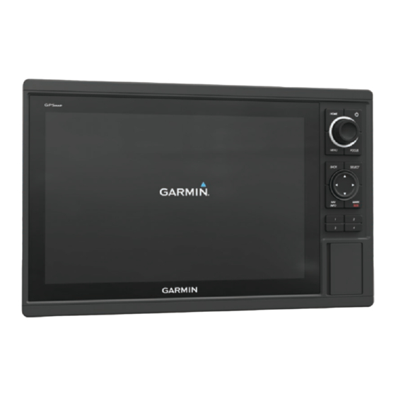
- Page 1 A03113 Owner’s Manual...
- Page 2 © 2016 Garmin Ltd. or its subsidiaries All rights reserved. Under the copyright laws, this manual may not be copied, in whole or in part, without the written consent of Garmin. Garmin reserves the right to change or improve its products and to make changes in the content of this manual without obligation to notify any person or organization of such changes or improvements.
- Page 3 Customizing the Chartplotter........2 Contours Feature ................ 9 Home Screen ................2 Adding a Label to a Garmin Quickdraw Contours Map ....9 Adding an Item to the Favorites Screen ........ 2 Garmin Quickdraw Community ........... 9 Customizing Pages ..............2 Accessing the Garmin Quickdraw Community .......
-
Page 4: Table Of Contents
Setting a Boundary Alarm ............ 15 Adjusting the RealVü Sweep Speed ........22 Deleting a Boundary ............15 Calibrating the Compass ............22 Synchronizing User Data Across the Garmin Marine Turning On the A-Scope ............22 Network ..................16 Sonar Setup ................22 Deleting All Saved Waypoints, Routes, and Tracks .... - Page 5 Adjusting Gain on the Radar Screen Automatically ..27 Selecting the Number of Engines Shown in Gauges ... 32 Adjusting Gain on the Radar Screen Manually ....27 Customizing the Engines Shown in Gauges ......32 Minimizing Nearby Large-Object Interference ....27 Enabling Status Alarms for Engine Gauges ......
- Page 6 Disconnecting the Remote from All Chartplotters ....46 Networked Video Devices ............40 Using the Garmin Helm Application with the Chartplotter ..46 Using Video Presets on Networked Video Cameras ... 40 Connecting a quatix® Watch to the Chartplotter ...... 46 Saving Video Presets on a Networked Video Camera ...
- Page 7 Digital Switching ............... 47 Pairing the GRID Remote Input Device with the Chartplotter ... 47 Pairing the GRID Device with the Chartplotter from the Chartplotter ................47 Pairing the GRID Device with the Chartplotter from the GRID Device .................. 47 Rotating the GRID Joystick ..........
- Page 9 You can use blank memory cards to record sonar data and transfer data such as waypoints, routes, and Power key À tracks to another compatible Garmin chartplotter or a computer. Knob Á Open the access flap or door on the front of the chartplotter.
- Page 10 HOME. • To assign a preset to a portion of the SmartMode screen, When multiple displays are installed on the Garmin Marine select Presets > Include, and select a preset from the list Network, you can group them together into a station. A station on the right.
- Page 11 Creating a Shortcut with a Shortcut Key Adding a SmartMode Layout You can add SmartMode layouts to suit your needs. Each You can quickly open commonly used screens by creating a customization made to one SmartMode layout for the home shortcut.
- Page 12 Charts and 3D Chart Views Selecting a Map If your product has both BlueChart g2 and Garmin LakeVü ® ™ The charts and 3D chart views that are available depend on the built-in maps, you can select which map to use. Not all models map data and accessories used.
- Page 13 Select an option: clearance. Carefully compare the course to all visual sightings, and avoid any land, shallow water, or other obstacles that may • To navigate to the selected location, select Navigate To. be in your path. • To mark a waypoint at the cursor location, select New NOTE: Not all models support all charts.
- Page 14 AIS Targeting Symbols Showing Tides and Current Indicators NOTE: This feature is available with premium charts, in some Symbol Description areas. AIS vessel. The vessel is reporting AIS information. The You can show static or animated tide and current station direction in which the triangle is pointing indicates the indicators on the Navigation chart or Fishing chart.
- Page 15 Showing AIS and MARPA Vessels on a Chart or on a For example, to be notified of a pending intersection 10 minutes before it will likely occur, set Time To to 10, and the 3D Chart View alarm will sound 10 minutes before the vessel intersects the Before you can show AIS vessels on a chart, you must have an safe zone.
- Page 16 Chart and 3D Chart View Settings Waypoints and Tracks Settings on the Charts and Chart Views NOTE: Not all settings apply to all charts and 3D chart views. From a chart or a 3D chart view, select MENU > Waypoints Some options require premium maps or connected accessories, and Tracks.
- Page 17 Contours Map From the Fish Eye 3D chart view, select MENU. You can add labels to a Garmin Quickdraw Contours map to Fisheye View: Sets the perspective of the 3D chart view. mark hazards or points of interest. Tracks: Shows tracks.
- Page 18 If you do not have a Garmin Connect account, create one. User Display Offset: Sets differences in contour depths and depth labels on your own contours maps to compensate for Sign in to your Garmin Connect account. changes in the water level of a body of water, or for depth Select Marine in the upper-right to open the Garmin errors in recorded maps.
- Page 19 Marking an SOS Location Searching for a Destination by Name You can mark an SOS location. When a Garmin VHF radio is You can search for saved waypoints, saved routes, saved connected using NMEA 2000, you can select different SOS tracks, and marine services destinations by name.
- Page 20 Indicate a new location for the waypoint: If you are off course, follow the purple line (corrected course) to go to your destination, or steer back to the magenta line • To move the waypoint while using the chart, select Use (direct course).
- Page 21 Auto Guidance Select NAV INFO > User Data > Routes. Select a route. CAUTION Select Navigate To. The Auto Guidance feature is based on electronic chart information. That data does not ensure obstacle and bottom Select an option: clearance. Carefully compare the course to all visual sightings, •...
- Page 22 Auto Guidance Path Configurations If you selected Near or Far in step 6, review the placement of the Auto Guidance line, and determine whether the line CAUTION safely avoids known obstacles and the turns enable efficient The Preferred Depth and Vertical Clearance settings influence travel.
-
Page 23: Saving A Track As A Route
Saving a Track as a Route • To record the track based on a distance between points, select Distance > Change, and enter the distance. Select NAV INFO > User Data > Tracks > Saved Tracks. • To record the track based on a time interval, select Time > Select a track. -
Page 24: Synchronizing User Data Across The Garmin Marine Network
• To mark the port and starboard starting line marks by You can share waypoints, tracks, and routes with all compatible entering their coordinates, select Enter Coordinates. devices connected to the Garmin Marine Network (Ethernet) automatically. • To switch the position of the port and starboard marks after you have set them, select Swap Port &... -
Page 25: Setting The Keel Offset
0183 compatible wind sensor to perform ® a wind hold or a wind-based tack or gybe. When properly connected to an optional Garmin sounder module and a transducer, your compatible chartplotter can be Setting the Wind Hold Type used as a fishfinder. Different sonar views can help you view the Before you can enable the wind hold type, you must connect a fish in the area. -
Page 26: Sonar Views
Á Bottom of the body of water  Garmin ClearVü Sonar View NOTE: To receive Garmin ClearVü scanning sonar, you need a compatible chartplotter or fishfinder and a compatible transducer. Garmin ClearVü high-frequency sonar provides a detailed picture of the fishing environment around the boat in a detailed representation of structures the boat is passing over. -
Page 27: Panoptix Sonar Views
Panoptix Sonar Views stationary and you need to see the bottom and the fish approaching the boat. NOTE: Not all models support Panoptix transducers. To receive Panoptix sonar, you need a compatible chartplotter and a compatible transducer. The Panoptix sonar views allow you to see all around the boat in real time. -
Page 28: Changing The Sonar View
Select an option: sonar view. For example, if you have two sources for Garmin ClearVü, you can select the source to use from the Garmin • If you have a 200/77 kHz, dual-beam transducer, select ClearVü... -
Page 29: Adjusting The Range Of The Depth Scale
When viewing Select an option: Garmin ClearVü or SideVü sonar views, it is recommend • While in the Garmin ClearVü or SideVü sonar view, select to use the Auto setting. Contrast. • To use a very fast scroll speed, select Ultrascroll®. -
Page 30: Adjusting The Appearance Of The Livevü Sonar Views
Adjusting the Appearance of the LiveVü Sonar Views NOTE: Compass calibration is available only for transducers with an internal compass. From a LiveVü sonar view, select MENU > Sonar Setup. You can begin turning your boat before calibrating, but you must Select an option: fully rotate your boat 1.5 times during calibration. -
Page 31: Sonar Noise Rejection Settings
Sonar Alarm Settings Trails: Sets the how long the trails appear on the screen. The trails show the movement of the target. NOTE: Some settings require external accessories. Grid Overlay: Shows a grid of range lines. Select Settings > Alarms > Sonar. Noise Reject: Reduces the interference and the amount of Shallow Water: Sets an alarm to sound when the depth is less clutter shown on the sonar screen. -
Page 32: Sonar Recordings
You can record sonar until the card reaches capacity. When you connect your compatible chartplotter to an optional Garmin marine radar, such as a GMR Fantom 6 radar or a ™... -
Page 33: Stopping The Transmission Of Radar Signals
Select a radar mode. • Select the shortest effective range, given your reason for using radar and the present environmental conditions. A countdown message appears while the radar is starting up. Select MENU > Transmit Radar. Marking a Waypoint on the Radar Screen Stopping the Transmission of Radar Signals From a radar screen, select a location. -
Page 34: Disabling A Guard Zone
From a radar screen, select a targeted object. Select MARPA Target. Viewing a List of AIS and MARPA Threats From any Radar screen or the Radar overlay, you can view and customize the appearance of a list of AIS and MARPA threats. From a Radar screen, select MENU >... -
Page 35: Radar Overlay
NOTE: Depending upon the radar in use, the gain setting configured for use in one radar mode may or may not be applied When you connect your chartplotter to an optional Garmin to other radar modes or to the Radar overlay. - Page 36 Adjusting Sea Clutter on the Radar Screen Automatically Pulse Exp.: Increases the duration of the transmit pulse, which helps maximize the energy directed toward targets. This You can set the chartplotter to automatically adjust the helps to enhance the detection and identification of targets. appearance of clutter caused by choppy sea conditions.
- Page 37 Front-of-Boat Offset Select A/V, Gauges, Controls > Autopilot. The front-of-boat offset compensates for the physical location of Autopilot Screen the radar scanner on a boat, if the radar scanner does not align with the bow-stern axis. Measuring the Potential Front-of-Boat Offset The front-of-boat offset compensates for the physical location of the radar scanner on a boat, if the radar scanner does not align with the bow-stern axis.
- Page 38 Select Engage Zigzag. position reports. Following the Williamson Turn Pattern If you have a Garmin NMEA 2000 VHF radio connected to your You can use the Williamson turn pattern to steer the boat chartplotter, these features are also enabled. around with the intent of running alongside the location where •...
- Page 39 Individual Routine Calls quickly initiate a distress call. When you connect the chartplotter to a Garmin VHF radio, you For information on placing distress calls from your radio, see the can use the chartplotter interface to set up an individual routine VHF radio owner’s manual.
- Page 40 The chartplotter sends information about the call to the radio. Viewing Engine and Fuel Gauges On your Garmin VHF radio, select Call. Before you can view engine and fuel gauges, you must be Making an Individual Routine Call to an AIS Target connected to a NMEA 2000 network capable of sensing engine From a chart or 3D chart view, select an AIS target.
- Page 41 Synchronizing the Fuel Data with the Actual Vessel • To view true or apparent wind, select Wind, and select an option. Fuel You can synchronize the fuel levels in the chartplotter with the Viewing Trip Gauges actual fuel in the vessel when you add fuel to your vessel. Trip gauges show information for odometer, speed, time, and Select A/V, Gauges, Controls >...
- Page 42 Tide, Current, and Celestial Select a message. Information Select Review. Sorting and Filtering Messages Tide Station Information Select NAV INFO > Warning Manager > Sort Filter. You can view information about a tide station for a specific date Select an option to sort or filter the message list. and time, including the tide height, and when the next high and low tides will occur.
- Page 43 Changing the Tuning Mode Enabling Alphabetical Search You can enable the alphabetical search feature to find a song or You can change how you select a station for some media types, album in a large list. such as FM or AM radio. From the media screen, select MENU >...
-
Page 44: Siriusxm Satellite Radio
Selecting a DAB Station from a List If the service is not activated within the hour, go to http://care.siriusxm.com/refresh or contact SiriusXM by phone From the DAB media screen, select Browse > Stations. at 1-855-MYREFRESH (697-3373). Select a station from the list. Customizing the Channel Guide Selecting a DAB Station from a Category SiriusXM radio channels are grouped in categories. -
Page 45: Setting The Device Name
To view information about the warning or bulletin, select the feature. For example, radar is broadcast at five-minute intervals. shaded area. When the Garmin receiver is turned on, or when a different weather feature is selected, the receiver must receive new data Color Marine Weather Group before it can be shown. -
Page 46: Viewing Forecast Information For Another Time Period
Surface Winds weather fronts and pressure centers, surface pressure, and weather buoys. Surface wind vectors appear on the Sea Conditions chart using wind barbs that indicate the direction from which the wind is Viewing Forecast Information for Another Time Period blowing. -
Page 47: Changing The Sea Surface Temperature Color Range
Compatible devices include video devices connected to the Viewing Local Weather Information near a Buoy ports on the chartplotter or to the Garmin Marine Network, as You can select an area near a buoy to view forecast information. well as supported network (IP-based) video cameras, encoders, and thermal cameras. -
Page 48: Networked Video Devices
FLIR camera, to a Garmin Marine Network. ® Connecting a PoE device directly to a Garmin Marine Network From the video screen, select MENU > Video Setup. chartplotter damages the Garmin chartplotter and may damage Set Input: Associates the camera with a video source. -
Page 49: Configuring The Video Appearance
VIRB Action Camera Video Setup Settings Select an area to assign a function to, select Video, and select a video source. Select A/V, Gauges, Controls > VIRB® > MENU > Video Setup. Repeat step 3 for all video functions in the combination screen. -
Page 50: Device Configuration
Auto Guidance Path Configurations supplemental map information (if applicable), the software CAUTION version for an optional Garmin radar (if applicable), and the unit The Preferred Depth and Vertical Clearance settings influence ID number. You may need this information to update the system how the chartplotter calculates an Auto Guidance path. -
Page 51: Adjusting The Distance From Shore
AIS receivers, select NMEA High Speed. • If the placement of the Auto Guidance line is satisfactory, • To support the input or output of Garmin proprietary data select MENU > Navigation Options > Stop Navigation, for interfacing with Garmin software, select Garmin. -
Page 52: Naming Devices And Sensors On The Network
Setting Weather Alarms Naming Devices and Sensors on the Network You can name devices and sensors connected to the Garmin Before you can set weather alarms, you must have a compatible Marine Network and the NMEA 2000 network. chartplotter connected to a weather device, such as a GXM device, and have a valid weather subscription. -
Page 53: Setting The Water Temperature Offset
Select Settings > Communications > Wi-Fi® Network > If the wheel turns freely, check the cable connections. Advanced > Channel. If you continue to get the message, contact Garmin product Enter a new channel. support. You do not need to change the wireless channel of devices Other Vessels Settings connected to this network. -
Page 54: Wireless Remote Control
NOTE: You can pair a Garmin Nautix device to multiple compatible devices for better coverage on larger vessels. Follow the on-screen instructions. Bring the a Garmin Nautix device within range (3 m) of the Wireless Remote Control chartplotter. The device automatically looks for all compatible devices Pairing the Wireless Remote Control With the within range. -
Page 55: Copying Built-In Maps To A Memory Card
Insert a memory card into the card slot. Gently wipe the screen with a soft, clean, lint-free cloth. Select Settings > System > System Information > Garmin Viewing Images on a Memory card Devices > Save to Card. -
Page 56: Copying Screenshots To A Computer
Find out which map datum and position format was used From Windows Explorer, open the Garmin\scrn folder on the ® when the original waypoint was created. memory card. -
Page 57: Nmea 0183 Information
“Software”) in binary executable form in the normal operation of the product. Title, ownership rights, and intellectual property rights in and to the Software remain in Garmin and/or its third- party providers. You acknowledge that the Software is the property of Garmin... -
Page 58: Index
VHF 35 Garmin ClearVü 18 standby 40 zones 35 Garmin Marine Network 16, 44 celestial information 34 memory card 46, 47 Garmin product support, contact information 1 charts 4, 6, 8, 9 detailed maps 47 gauges 32 appearance 8 installing 1 engine 32 built-in 4 MOB, device 7 fuel 32, 33 details 4 music player 34, 36,... - Page 59 FrontVü 19 custom park position 29 messages 34 gain 20 echo trails 27 water Garmin ClearVü 18 field of view 28 speed 45 interference 23 front-of-boat offset 29 temperature log 33 measuring distances 20 gain 27 temperature offset 45 noise 20 guard zone 25, 26 water temperature log 24...
- Page 60 wind speed graph 33 wireless devices 41, 45, 46 device 45, 46 connecting a wireless network configuration 45 zoom, sonar 21 Index...