Garmin GPSMAP 902 Series Owner's Manual
Hide thumbs
Also See for GPSMAP 902 Series:
- Installation instructions manual (8 pages) ,
- Installation instructions manual (9 pages) ,
- Owner's manual (83 pages)
Table of Contents
Advertisement
Quick Links
Advertisement
Table of Contents

Related Manuals for Garmin GPSMAP 902 Series


Summary of Contents for Garmin GPSMAP 902 Series
- Page 1 GPSMAP® 702/902 SERIES Owner’s Manual...
- Page 2 All rights reserved. Under the copyright laws, this manual may not be copied, in whole or in part, without the written consent of Garmin.
-
Page 3: Table Of Contents
Tips and Shortcuts Garmin Quickdraw™ Contours Mapping Locking the Touchscreen Accessing Owner's Manuals on the Chartplotter Mapping a Body of Water Using the Garmin Quickdraw Contours Feature Downloading the Manuals Adding a Label to a Garmin Quickdraw Contours Map Getting More Information... - Page 4 Turning On the A-Scope Setting a Boundary Alarm Selecting the Transducer Type Deleting a Boundary Sonar Setup Synchronizing User Data Across the Garmin Marine Network Sonar Settings Deleting All Saved Waypoints, Routes, and Tracks RealVü Sonar Settings LiveVü Sonar Settings...
- Page 5 Selecting a Different Radar Source Tide Station Information Current Station Information Autopilot Celestial Information Opening the Autopilot Screen Viewing Tide Station, Current Station, or Celestial Information for a Different Date Autopilot Screen Viewing Information for a Different Tide or Current Station Adjusting the Step Steering Increment Viewing Almanac Information from the Navigation Chart Setting the Power Saver...
- Page 6 Calibrating a Water Speed Device Visibility Information Other Vessels Settings Viewing Forecast Visibility Information for Another Time Period Settings that are Synced on the Garmin Marine Network Viewing Buoy Reports Restoring the Original Chartplotter Factory Settings Viewing Local Weather Information near a Buoy...
-
Page 7: Introduction
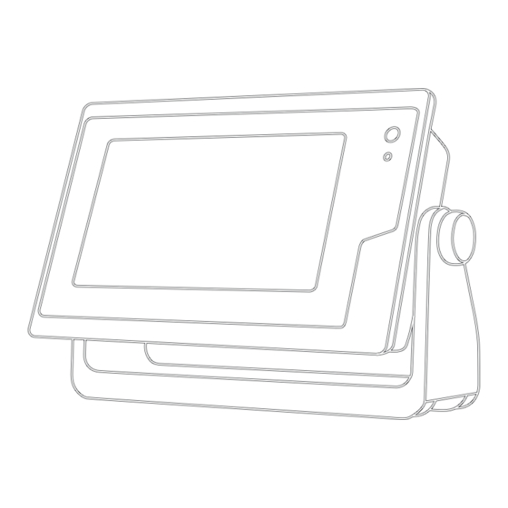
The support pages will provide answers to frequently asked support questions, and you can Select Lock Touchscreen. download software and chart updates. There is also contact information to Garmin support should you have any questions. Accessing Owner's Manuals on the Chartplotter Device Overview Select Info >... -
Page 8: Software Update
This device supports up to a 64 GB memory card, formatted to screen by selecting Home. FAT32. When multiple displays are installed on the Garmin Marine Loading the New Software on a Memory Card Network, you can group them together into a station. A station Insert a memory card into the card slot on the computer. -
Page 9: Adding A Custom Combination Screen
Saving a New Preset Select an option: After you have customized the settings and view of a screen, • To change the name, select Name & SymbolName, enter you can save the customization as a new preset. a new name, and select Done. From a compatible screen, change the settings and view. -
Page 10: Navigation Chart And Offshore Fishing Chart
Selecting a Map Viewing Details about Navaids If your product has both BlueChart ® g2 and Garmin LakeVü ™ From the Navigation chart, Fishing chart, Perspective 3D chart built-in maps, you can select which map to use. Not all models view, or Mariner’s Eye 3D chart view, you can view details about... -
Page 11: Heading Line And Angle Markers
NOTE: The offshore Fishing chart is available with premium Optional premium charts, such as BlueChart g2 Vision ® , allow charts, in some areas. you to get the most out of your chartplotter. In addition to detailed marine charting, premium charts may contain these NOTE: Auto Guidance is available with premium charts, in some features, which are available in some areas. -
Page 12: Showing Satellite Imagery On The Navigation Chart
AIS Targeting Symbols You can show static or animated tide and current station indicators on the Navigation chart or Fishing chart. Symbol Description From the Navigation or Fishing chart, select Menu > Chart AIS vessel. The vessel is reporting AIS information. The Setup >... -
Page 13: Showing Ais And Marpa Vessels On A Chart Or On A 3D Chart View
Showing AIS and MARPA Vessels on a Chart or on a For example, to be notified of a pending intersection 10 minutes before it will likely occur, set Time To to 10, and the 3D Chart View alarm will sound 10 minutes before the vessel intersects the Before you can show AIS vessels on a chart, you must have an safe zone. -
Page 14: Navigation And Fishing Chart Setup
Chart Appearance Settings Quickdraw Contours: Turns on bottom contour drawing, and allows you to create fishing map labels. You can adjust the appearance of the different charts and 3D chart views. Each setting is specific to the chart or chart view Surface Radar: Shows surface radar details on the Perspective being used. -
Page 15: Laylines Settings
Fish Eye 3D Settings Contours Map NOTE: This feature is available with premium charts, in some You can add labels to a Garmin Quickdraw Contours map to areas. mark hazards or points of interest. From the Fish Eye 3D chart view, select Menu. -
Page 16: Downloading Garmin Quickdraw Community Maps
Navigation with a Chartplotter Select Share Your Contours. Browse to your memory card, and select the /Garmin folder. CAUTION Open the Quickdraw folder, and select the file named If your vessel has an autopilot system, a dedicated autopilot ContoursLog.svy. control display must be installed at each steering helm in order After the file is uploaded, delete the ContoursLog.svy file from... -
Page 17: Destinations
Marking an SOS Location Question Answer You can mark an SOS location. When a Garmin VHF radio is Can the device create a path If you have premium maps that support for me? Auto Guidance and are in an area... -
Page 18: Deleting A Waypoint Or An Mob
cannot calculate part of the Auto Guidance line. This is due to Select Info > User Data > Routes & Auto Guidance Paths the settings for minimum safe water depth and minimum safe > New > Route Using Chart. obstacle height. Select the starting location of the route. -
Page 19: Deleting A Saved Route
Indicate how to navigate the route: Select a destination, and select Next. • To navigate the route from the starting point used when Select an option: the route was created, to the left of the original route, • To view a hazard and adjust the path near a hazard, select Forward - Port. -
Page 20: Adjusting The Distance From Shore
ensure that the Auto Guidance line is placed the appropriate Tracks distance from shore, you can assess the placement of the A track is a recording of the path of your boat. The track Auto Guidance path using one or more familiar destinations currently being recorded is called the active track, and it can be that require navigation through a narrow waterway (Adjusting... -
Page 21: Clearing The Active Track
Backing Up Data to a Computer, page Boundaries You can share waypoints, tracks, and routes with all compatible devices connected to the Garmin Marine Network (Ethernet) Boundaries allow you to avoid or remain in designated areas in automatically. a body of water. You can set an alarm to alert you when you NOTE: This feature is not available on all models. -
Page 22: Starting Line Guidance
countdown timer, you are alerted at one-minute intervals as the Stopping the Race Timer race start approaches. When you combine the race timer with From the Sail Racing combination screen, select Stop. the virtual start line, the device measures your speed, bearing, Setting the Distance between the Bow and the GPS and remaining time on the countdown timer. -
Page 23: Sailboat Autopilot Operation
NMEA 2000 or NMEA 0183 compatible wind sensor to perform ® When properly connected to an optional Garmin sounder a wind hold or a wind-based tack or gybe. module and a transducer, your compatible chartplotter can be used as a fishfinder. Different sonar views can help you view the Setting the Wind Hold Type fish in the area. -
Page 24: Garmin Clearvü Sonar View
Depth information Suspended targets or fish Bottom of the body of water Garmin ClearVü Sonar View NOTE: To receive Garmin ClearVü scanning sonar, you need a compatible chartplotter or fishfinder and a compatible transducer. Garmin ClearVü high-frequency sonar provides a detailed picture of the fishing environment around the boat in a detailed representation of structures the boat is passing over. -
Page 25: Livevü Forward Sonar View
Selecting the Transducer Type Before you can select the transducer type, you must know what kind of transducer you have. This chartplotter is compatible with the Garmin ClearVü ™ transducer as well as a range of accessory transducers including Garmin GT transducers, which are available at www.garmin.com. -
Page 26: Calibrating The Compass
You can begin turning your boat before calibrating, but you must sonar view. For example, if you have two sources for Garmin fully rotate your boat 1.5 times during calibration. -
Page 27: Adjusting The Range Of The Depth Or Width Scale
Select an option: aspect ratio and appear less distorted. When viewing Garmin ClearVü or SideVü sonar views, it is recommend • While in the Garmin ClearVü or SideVü sonar view, select to use the Auto setting. Contrast. • To use a very fast scroll speed, select Ultrascroll®. -
Page 28: Setting The Livevü Transducer Transmit Angle
• To adjust the length of the trails that show target This chartplotter is compatible with the Garmin ClearVü movement, select Trails, and select an option. transducer as well as a range of accessory transducers including Garmin GT transducers, which are available at •... -
Page 29: Sonar Noise Rejection Settings
Bottom Fill: Colors the bottom brown to distinguish it from the columns of information on the screen per sounder return, and water returns. so on for the 4/1 and 8/1 settings. Trails: Sets the how long the trails appear on the screen. The Sonar Alarm Settings trails show the movement of the target. -
Page 30: Sonar Recordings
Install Depth: Sets the depth below the water line where the When you connect your compatible chartplotter to an optional Panoptix transducer is mounted. Entering the actual depth at Garmin marine radar, such as a GMR ™ Fantom ™... -
Page 31: Adjusting The Radar Range
From a radar screen, select Menu > Radar Setup > away from you. On most color schemes, green indicates the Installation > Enable No Transmit Zone. target is moving away from you and red indicates the target is moving toward you. The no-transmit zone is indicated by a shaded area on the radar screen. -
Page 32: Marpa Targeting Symbols
MARPA-tagged object. Radar Overlay From a radar screen, select a targeted object. When you connect your chartplotter to an optional Garmin Select MARPA Target. marine radar, you can use overlay radar information on the Navigation chart or on the Fishing chart. -
Page 33: Echo Trails
Echo Trails Select Down to lower the gain until the speckles disappear. If boats, land, or other targets are within range, select Down The echo trails feature enables you to track the movement of to lower the gain until the targets begin to blink. vessels on the radar display. -
Page 34: Adjusting Rain Clutter On The Radar Screen
Select Up or Down to adjust the appearance of sea clutter Appearance: Sets the color scheme, look-ahead speed, and until other targets are clearly visible on the radar screen. navigation appearance. Clutter caused by sea conditions may still be visible. Installation: Allows you to configure the radar for the installation, such as setting the front of the boat and the Adjusting Rain Clutter on the Radar Screen... - Page 35 From the radar screen, select Menu > Radar Setup > Setting the Power Saver Installation > Antenna Configuration > Park Position. You can adjust the level of rudder activity. Use the slider bar to adjust the position of the antenna when From the autopilot screen, select Menu >...
- Page 36 If necessary, select Amplitude, and select a degree. position reports. If necessary, select Period, and select a length of time. If you have a Garmin NMEA 2000 VHF radio connected to your Select Engage Zigzag. chartplotter, these features are also enabled.
- Page 37 For information on placing distress calls from your radio, see the VHF radio owner’s manual. For information about marking an When you connect the chartplotter to a Garmin VHF radio, you MOB or SOS location, see Marking an SOS Location, page can use the chartplotter interface to set up an individual routine call.
- Page 38 Viewing the Gauges Customizing the Engines Shown in Gauges Before you can customize how the engines are shown in the Select A/V, Gauges, Controls. gauges, you must manually select the number of engines Select a gauge. (Selecting the Number of Engines Shown in Gauges, page 32).
- Page 39 • To show true or apparent wind speed, select Wind Speed, Setting the Graph Range and Time Scales and select an option. You can indicate the amount of time and the range of depth that appear in the depth and water temperature graphs. Configuring the Speed Source From a graph, select Graph Setup.
- Page 40 Viewing Tide Station, Current Station, or Opening the Media Player Celestial Information for a Different Date Before you can open the media player, you must connect a compatible device to the chartplotter. Select Info > Tides & Currents. Select A/V, Gauges, Controls > Media. Select Tides, Currents, or Celestial.
- Page 41 VHF Radio DAB Playback When you connect a compatible Digital Audio Broadcasting Scanning VHF Channels (DAB) module and antenna, such as the FUSION ® Before you can scan VHF channels, you must set the source to DAB100A to a compatible stereo, you can tune in to and play VHF.
- Page 42 • To remove all presets, select Remove All Presets. Setting Parental Controls on SiriusXM Radio Channels Before you can set parental controls, the parental controls must SiriusXM Satellite Radio be unlocked. When you have a FUSION-Link ™ capable stereo and SiriusXM The parental control feature allows you to limit access to any Connect Tuner installed and connected to the chartplotter, you SiriusXM channels, including those with mature content.
- Page 43 For example, radar is broadcast at five-minute intervals. advisories. When the Garmin receiver is turned on, or when a different To view information about the warning or bulletin, select the weather feature is selected, the receiver must receive new data shaded area.
- Page 44 Viewing Forecast Sea Conditions Information for Pressure- Description Center Another Time Period Symbol Select Charts > Sea Conditions. Indicates a low-pressure center, which is a region of Select an option: relatively lower pressure. Moving away from a low- pressure center results in increased pressure. Winds •...
- Page 45 Select Buoy. Compatible devices include video devices connected to the ports on the chartplotter or to the Garmin Marine Network, as Viewing Local Weather Information near a Buoy well as supported network (IP-based) video cameras, encoders, You can select an area near a buoy to view forecast information.
- Page 46 Saving Video Presets on a Networked Video Camera Video Camera Movement Control From a video screen, touch the screen. NOTICE The video controls appear on the screen. Do not aim the camera at the sun or extremely bright objects. Damage to the lens may occur. Hold a video preset button.
- Page 47 the dimensions provided by the connected video device, VIRB Action Camera Video Setup Settings and it may not fill the entire screen. Select A/V, Gauges, Controls > VIRB® > Menu > Video Setup. • To show the video using a standard aspect ratio, select Aspect >...
- Page 48 You can view the software version, the basemap version, all restart the chartplotter. supplemental map information (if applicable), the software version for an optional Garmin radar (if applicable), and the unit System Settings ID number. You may need this information to update the system Select Settings >...
- Page 49 autopilot when navigating a route or an Auto Guidance line • If the placement of the Auto Guidance line is satisfactory, with many frequent turns or at higher speeds. For straighter select Menu > Navigation Options > Stop Navigation, routes or slower speeds, lowering this value can improve and proceed to step 10.
- Page 50 AIS receivers, select NMEA High Speed. suspended target within the specified depth from the surface • To support the input or output of Garmin proprietary data of the water and from the bottom. for interfacing with Garmin software, select Garmin.
- Page 51 If the wheel turns freely, check the cable connections. • If the transducer is installed at the water line , measure If you continue to get the message, contact Garmin product the distance from the transducer location to the keel of the support.
- Page 52 Chartplotter The chartplotters can create a Wi‑Fi network to which you can Before you can control the chartplotter with the Garmin Helm connect wireless devices. The first time you access the wireless application, you must download and install the application, and network settings, you are prompted to set up the network.
- Page 53 NOTE: You can pair a Garmin Nautix device to multiple compatible devices for better coverage on larger vessels. Insert a memory card into the card slot. Bring the a Garmin Nautix device within range (3 m) of the Select Info > User Data > Data Transfer. chartplotter.
- Page 54 Insert a memory card into the card slot. Gently wipe the screen with a soft, clean, lint-free cloth. Select Settings > System > System Information > Garmin Devices > Save to Card. Viewing Images on a Memory card If necessary, select the memory card to save system You can view images that are saved on a memory card.
- Page 55 127488 Engine parameters: Rapid update • If the device is receiving enough power but does not turn on, 127489 Engine parameters: Dynamic contact Garmin product support at www.garmin.com/support. 127493 Transmission parameters: Dynamic My device is not creating waypoints in the correct...
- Page 56 “Software”) in binary executable form in the normal operation of the product. Title, ownership rights, and intellectual property rights in and to the Software remain in Garmin and/or its third- party providers. You acknowledge that the Software is the property of Garmin...
- Page 57 41 radio 36 home position 40 repeating 34 Garmin ClearVü 18 pausing 40 shuffling 34 Garmin Marine Network 15, 44 standby 40 SiriusXM Satellite Radio 36 Garmin product support, contact information 1 celestial information 33, 34 source 34 gauges 32 charts 3, 5, 8, 9 tuner region 35 engine 32 appearance 8 tuning mode 35 fuel 32 built-in 4 VHF 35...
- Page 58 FrontVü 19 gain 27 WAAS 42 gain 20 guard zone 25 warning manager 34 Garmin ClearVü 18 MARPA 7 messages 34 interference 23 optimizing display 27 water measuring distances 20 overlay screen 26 speed 45 noise 20 range 25 temperature log 33 numbers 3 range rings 28 temperature offset 45...
- Page 59 subscription 36, 39 surface pressure 38 visibility 38, 39 water temperature 38 wave information 38 winds 38 Wi‑Fi technology 46 wind angle graph 33 wind gauges 32, 33 wind hold 17 adjusting 17 wind sensor 46, 47 wind speed graph 33 wireless devices 41, 46, 47 connecting a wireless device 46, 47 network configuration 46 zoom chart 4 radar 25 sonar 21...
- Page 60 00800 4412 454 +47 815 69 555 +44 2380 662 915 +35 1214 447 460 +386 4 27 92 500 0861 GARMIN (427 646) +34 93 275 44 97 +27 (0)11 251 9800 + 46 7744 52020 +886 2 2642-9199 ext 2...