Table of Contents
Advertisement
Quick Links
Advertisement
Table of Contents

Related Manuals for Eagle Expedition


Summary of Contents for Eagle Expedition
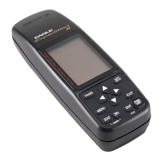
- Page 1 PAGES Eagle Expedition INSTALLATION AND OPERATION INSTRUCTIONS...
- Page 2 For more information, consult the factory customer ser- vice department. All features and specifications subject to change without notice. Eagle Electronics may find it necessary to change or end our policies, regulations, and special offers at any time. We reserve the right to do so without notice.
-
Page 3: Table Of Contents
INTRODUCTION ... 1 INSTALLATION ... 2 BATTERY INSTALLATION ... 2 EXTERNAL POWER ... 3 KEYBOARD ... 3 OPERATION ... 4 TURNING POWER ON ... 4 MENUS ... 4 FINDING YOUR POSITION ... 4 COLD START ... 4 INITIALIZATION ... 5 POSITION/NAVIGATION DISPLAYS ... - Page 4 DGPS ... 34 SERIAL COMMUNICATION SETUP ... 35 RESET OPTIONS ... 35 RESET GROUPS ... 35 SYSTEM INFO ... 35 GPS SETUP ... 36 COLD START ... 36 POSITION FORMAT ... 37 DATUM ... 38 PCF ... 39 POSITION PINNING ... 40 ALARMS ...
-
Page 5: Introduction
The Government’s accuracy specification is 100 meters horizontally and 150 meters vertically 95% of the time. In other words, the position shown on your Eagle Expedition could be up to 100 meters in any direction from your actual position, and the altitude could be plus or minus 150 meters from what’s shown on the screen,... -
Page 6: Installation
® comes with the Eagle BR-1B recharger. This charger lets you recharge the DR-121 battery while it’s in the unit, plus you can use the Expedition while the battery is charging.) If you use alkaline batteries, we recom- ® mend DURACELL brand, but other brands will work. -
Page 7: External Power
The Expedition is now ready for use. EXTERNAL POWER Instead of batteries, the Expedition can operate on 5 to 16 volts DC from an external power source. To use external power, an adapter cable must be purchased (model CA-2) that will plug into your vehicle’s cigarette... -
Page 8: Operation
Finding Your Position Cold Start When the Eagle Expedition is turned on for the very first time, it doesn’t know where it is, nor what the local time or date is. If you tell it your position, time, and date, the unit should take less time to lock-on to the satellites and give you a fix or position. -
Page 9: Initialization
To use your Expedition, first make certain you have a clear view of the sky, free from any obstructions such as trees or buildings. Also, don’t try to use it under a carport, covered boat dock, or inside a building. Turn the power on, press the EXIT key to erase the opening message and watch the display. - Page 10 (Note: This position does not have to be very accurate. If you can get it within one degree of your actual position, that will be fine.) When it’s set, press the ENT key. The Expedition accepts your entry and returns to the GPS setup menu.
-
Page 11: Position/Navigation Displays
You can customize the navigation screens to show differ- ent data than the ones chosen by Eagle. See the “Customize Screen” section for more details. - Page 12 Nav Screen #1 This screen is dominated by a compass rose (See the screen at right.) Your position is in the center of the circle, designated by an arrow that always points straight up. Your track (direction of travel) is indicated by an arrow pointing down toward the compass rose at the top center of the screen.
-
Page 13: Cdi
0.2 mile to the left of the desired course. You can adjust the CDI’s range through the “ALARMS/CDI” menu. Using the CDI with the plotter helps you visualize your position in relation to the course. The CDI is on several of the Expedition’s windows. -
Page 14: Plotter
Plotter The plotter lets you see your course and track from a “birds-eye” view. If you’ve recalled a waypoint, the plotter show your starting location, present position, and destination. However, you don’t have to recall a waypoint to use the plotter. To use the plotter, simply press the PAGES key, then press the up or down arrow keys until the “Plot”... -
Page 15: Plotter Options
To correct this problem, the Eagle Expedition has a track-up mode that rotates the plotter as you turn. Thus, what you see on the left side of the screen should always be to your left, and so on. -
Page 16: Clear Plot Trail
A message box appears, asking you if you really want to erase the plot trail. Follow the directions on this message box. The Expedition returns to the plotter screen with the plot trail erased from the screen. -
Page 17: Recall Plot Trail
Grid Lines The Eagle Expedition can place grid lines on the plotter to help you see your position, or the posi- tion of waypoints and icons. -
Page 18: Plotter Update
Press the EXIT key to erase this menu. ICONS The Eagle Expedition has fifteen symbols or “icons” available. These icons can be placed anywhere on the plotter screens. These can be used to mark fishing or hunting spots, boat ramps, rest stops, or whatever. You can place an icon at your present position, or at the cursor’s location. -
Page 19: Place Icon - Cursor Location
Place Icon - Cursor Location To place an icon at cursor's location, first use the arrow keys to move the cursor to the position that you want to place the icon. Next, press the ENT key. Now select the desired icon using the arrow keys. When it's selected, press the ENT key again. -
Page 20: Windows
To remove only icons of a certain type, highlight the “DEL ICON TYPE” label. Press the right ar- row key. The icon selection menu appears. Use the arrow keys to highlight the icon style that you wish to erase. Press the ENT key when you’re ready to erase the icons. -
Page 21: Satellite Information Screen
Satellite Information Screen (Group O) This screen shows technical information about the status of the GPS receiver. The receiver has twelve channels. Data for each channel is shown as bar graphs on the right side of the display. Every sat- ellite in the constellation has a number assigned to it, called the PRN. -
Page 22: Clock Alarm
Expedition will have to be on at 7:00 a.m., also. Timers The Eagle Expedition has two timers built in. One is a countdown timer and the other is a count-up timer. The countdown timer counts down from the time you put in to zero. The count-up timer starts at zero and counts up to the time you entered. -
Page 23: Reprogram Boxes
shown in the display is correct, then press the ENT key. To start the timer, press the MENU key, then move the black box to the “Dn Tmr Off On” label. Press the right arrow key to start the timer. The timer continues counting until you stop it. -
Page 24: Waypoints
NAV screens. WAYPOINTS The Eagle Expedition gives you the capability of creating your own data- base of locations, called “waypoints”. You can save your present position, cursor position, or enter a latitude/longitude and save it as a waypoint. -
Page 25: Saving Your Present Position
waypoint number it just used. Wait a few seconds and the menu will clear automatically. Press the EXIT key to erase the cursor. Saving Your Present Position as a Waypoint (Select Number Method) The method shown above doesn’t let you choose the waypoint number. -
Page 26: Edit Waypoint Lat/Lon
WAYPOINT NAMES The Expedition automatically assigns the waypoint number as a name when the waypoint position is saved. You can find a waypoint by highlight- ing the name on the waypoint menu as shown below left. Now press the right arrow key. -
Page 27: Move A Waypoint
Edit Name The Eagle Expedition also lets you assign a name to each waypoint. The name can have up to eight characters. To name a waypoint, first select the waypoint number that you wish to name. Now high- light the “WPT Options” label and press the right arrow key. -
Page 28: Distance Between Wayponts
DISTANCE BETWEEN WAYPOINTS The Eagle Expedition can easily give you the dis- tance between two user waypoints. To do this, first press the WPT key, highlight the “Options” menu and press the right arrow key, then highlight the “Dist Btwn WPTS” label and press the right arrow key. -
Page 29: Delete A Waypoint
ROUTES You can connect several user waypoints together to form a route. When you recall the route, the Eagle Expedition will show you navigation infor- mation to the first waypoint in the route, then when you reach that way- point, it switches to the next waypoint, and so on until you reach the last waypoint in the route. -
Page 30: Select Waypoints For Route
that form the route. To select the first waypoint in the route, press the right arrow key. A new menu appears as shown below right. This menu lets you go to the waypoint selection menu, delete a waypoint from the route, or see details about any waypoint in the route. Since we want to add a waypoint to the route, press the right arrow key on the “Insert From WPTS”... -
Page 31: Finishing The Route
As you add waypoints to the list, their bearing and distance from each other is shown to the right of the waypoint name. On the screen at right, waypoint 2 is on a bearing of 133° and 4.68 miles from waypoint 1. The total route distance is shown at the bottom of this screen. -
Page 32: Follow A Route
WPT key. When you have everything on this screen set as desired, press the ENT key to start the Eagle Expedition navigating to the first waypoint on the route. As you travel to the first waypoint, the unit shows navigation data to the waypoint. -
Page 33: Delete A Route
“1”, and our present position. Navigating to a cursor location The Eagle Expedition lets you navigation to a location without storing it in the waypoint database by using the plotter and cursor. To do this, first switch to the plotter screen. Now move the cursor to the location that you want to navigate to. -
Page 34: Navigating To A Waypoint Using The Plotter
CAUTION! The Eagle Expedition does NOT take land features, altitudes, restricted or prohibited areas, or any other feature into account when it projects the track line on the screen. Therefore, you must use care when navigating on the track line and avoid any object that may be in your path to the destination. -
Page 35: System Setup
PWR key again. An indicator on the satellite status screen (Group “O”) shows when the lights are on. The Expedition automatically turns the lights off after 30 seconds to pre- serve the battery power. It will do this even if the external power is applied to the unit. -
Page 36: Units Of Measure
EXIT key. NMEA / DGPS The Eagle Expedition transmits data through the data port in the back of the unit using NMEA 0183 format, version 1.5 or 2.0. This data is used by other electronic devices such as marine autopilots for position and steer- ing information. - Page 37 TO EXPEDITION EXPEDITION’S WIRES WHITE WIRE RED WIRE TO +12V BLACK WIRE GROUND WIRES OTHER DEVICE’S WIRES OTHER DEVICE’S RECEIVE DATA WIRE TO EXPEDITION EXPEDITION’S GREEN WIRE WIRES WHITE WIRE RED WIRE TO +12V BLACK WIRE GROUND WIRES DGPS RECEIVER’S...
-
Page 38: Nmea Output
If your other equipment doesn’t recognize the NMEA data being sent by the Eagle Expedition and the wiring is correct, then you may need to change the NMEA or the serial communication settings. -
Page 39: Serial Communication Setup
RESET OPTIONS To return the Eagle Expedition to its original factory settings, highlight the “Preset Options” menu on the System Setup screen. Now press the right arrow key. A message appears, asking if you want to restore the original options. -
Page 40: Gps Setup
The screen at right appears. GPS Cold Start When the Eagle Expedition is turned on for the first time “out of the box”, it automatically sends a “cold-start” message to the GPS receiver. You can also send a cold start message to the receiver at any time. -
Page 41: Position Format
Position Format The Eagle Expedition can show the position in degrees, minutes, and thousandths of a minute (36° 28.700') or degrees, minutes, seconds, and tenths of a second (36° 28' 40.9"). It can also show position in UTM (Universal Transverse Mercator) projection, British, Irish, Swedish, Swiss, Finnish, and Military Grid systems. -
Page 42: Datum
ENT key. This selects the datum and erases the select datum menu. To erase the menu without changing the datum, simply press the EXIT key. A list of the datums used by the Expedition is in the back of this manual. -
Page 43: Pcf
In this example, we en- tered 0 degrees, 0.047 minutes north latitude and 0 degrees, 0.244 minutes east longitude. That is the difference between the present position shown by the Eagle Expedition and the one on our chart. -
Page 44: Position Pinning
After you’ve entered the latitude/longitude correction, press the ENT key to accept it. The Eagle Expedition erases the PCF entry screen and re- turns to the navigation or mapping screens with the correction factor ap- plied. POSITION PINNING When using a GPS receiver at extremely low speeds, it can have trouble determining your course over ground, or direction you’re travelling. -
Page 45: Messages
Arrival Alarm - If you set the arrival alarm’s distance to a small number, and you run a route (see the routes section), the Eagle Expedition may not show navigation data to the next waypoint, once you arrive at the first one, since you may not be able to come close enough to the first waypoint to trip the arrival alarm. -
Page 46: Simulator
SIMULATOR A simulator is built into the Eagle Expedition that has several options. You can use nearly all of the unit’s features - even save and recall waypoints. This is useful for trip planning. To use the simulator, press the MENU key, then press the up or down arrow keys until the “Simu-... -
Page 47: Definition Of Terms/Abbreviations
crease the speed. Use the right and left arrow keys to change the track. Press the EXIT key to erase these menus. When you’re finished changing the track and speed, press the EXIT key to erase the menus. To turn the simulator off, press the MENU key, then move the black box to the “Simulator Setup”... -
Page 48: Window Groups
WINDOWS The following is a listing of windows groups A through O. GROUP “A” GROUP “D” GROUP “G” GROUP “B” GROUP “E” GROUP “H” GROUP “C” GROUP “F” GROUP “I”... - Page 49 GROUP “J” GROUP “M” GROUP “K” GROUP “N” GROUP “L” GROUP “O”...
-
Page 50: List Of Datums
DATUMS WGS 84 ... WGS 1984 DEFAULT Default ADINDAN ... Adindan MEAN Mean for Ethiopia, Sudan ADINDAN ... Adindan BURKINA Burkina Faso FASO ADINDAN ... Adindan CAMEROON Cameroon ADINDAN ... Adindan ETHIOPIA Ethiopia ADINDAN ... Adindan MALI Mali ADINDAN ... Adindan SENEGAL Senegal... - Page 51 CARTHAGE ... Carthage - Tunisia TUNISIA CH-1903 ... Switzerland CHATHAM ... Chatham Island Astro 1971 ISLAND ASTRO New Zealand (Chatham Island) NEW ZEALAND CHUA ASTRO ... Chua Astro PARAGUAY Paraguay CORREGO ... Corrego Alegre ALEGRE Brazil BRAZIL DABOLA ... Dabola GUINEA Guinea DJAKARTA ...
- Page 52 IRELAND ... Ireland 1965 1965 Ireland ISTS 061 ... ISTS 061 Astro 1968 ASTRO 1968 South Georgia Islands S GEORGIA ISTS 073 ... ISTS 073 Astro 1969 ASTRO 1969 Diego Garcia DIEGO GARCIA JOHNSTON ... Johnston Island 1961 ISLAND Johnston Island 1961 KANDAWALA ...
- Page 53 N AMERICAN ... North American 1927 1927 CANAL Canal Zone ZONE N AMERICAN ... North American 1927 1927 CUBA Cuba N AMERICAN ... North American 1927 1927 Greenland (Hayes Peninsula) GREENLAND N AMERICAN ... North American 1927 1927 MEXICO Mexico N AMERICAN ...
- Page 54 RT 90 ... Sweden SANTO (DOS) ... Santo (DOS) ’65 ESPIRITO 1965 Espirito Santo Island SANTO ISLAND SAO BRAZ ... Sao Braz AZORES Azores (Sao Miguel, Santa Maria Islands) SAPPER HILL ... Sapper Hill 1943 1943 EAST East Falkland Island FALKLND ISLE SCHWARZECK ...
-
Page 55: Warranty Statement
EAGLE ELECTRONICS FULL ONE-YEAR WARRANTY “We", “our”, or “us” refers to EAGLE ELECTRONICS, a division of LEI, the manufacturer of this product. “You” or “your” refers to the first person who purchases this product as a con- sumer item for personal, family, or household use. -
Page 56: Ups Return Service
There are six easy steps: 1. Call Eagle at the toll-free number on the back of this manual for a Return Authorization (RA) number and instructions about what ac- cessories to return. Do not return a product to the factory with- out a Return Authorization (RA) Number! 2. -
Page 57: Accessory Ordering Information
2) LEI Extras, Inc. P.O. Box 129 Catoosa, OK 74015-0129 or call 800-324-0045 (USA orders only.) Eagle Electronics may find it necessary to change or end our shipping policies, regulations, and special offers at any time. We reserve the right to do so without notice. - Page 58 PAGES Press the PAGES key to view the pages menu, then using the up and down arrow keys to switch between nav, plot, and groups screens. Use the right or left ar- row keys to switch between differ- ent screens on each page MODE GROUPS SCREENS...
- Page 59 SCREENS NAV-1 NAV-2 PLOT SCREENS PLOT-1 PLOT-2 GRP E GRP F GRP G GRP D GRP L GRP M GRP N GRP O...
-
Page 61: How To Obtain Service - International
How to Obtain Service (Canadian Customers Only) We back your investment in quality products with quick, expert service and genuine Eagle replacement parts. If you need service or repairs, contact the Eagle Factory Customer Service Department at the toll-free number listed below. A technician may be able to solve the problem and save you the inconvenience of returning your unit. -
Page 62: How To Obtain Service - U.s.a. Only
Your unit is covered by a full one-year warranty. (See page 51 inside this manual for complete warranty details.) If your unit fails and the failure is not covered by the original warranty, Eagle has a flat-rate repair policy that covers your unit and accessories packed with the unit at the factory.