Table of Contents
Advertisement
Quick Links
Advertisement
Table of Contents

Related Manuals for AvMap Geosat 4x4


Summary of Contents for AvMap Geosat 4x4
- Page 1 GPS Navigator QUICK GUIDE...
- Page 2 • The Secure Digital memory card should not be formatted nor the content modified. • Only AvMap branded Secure Digital memory cards are compatible with Geosat. • Avoid knocking against the display. • Do not use oil based products to clean the LCD surface.
-
Page 3: Product Registration
We suggest you to visit the download area in the Support section at least once a month to be always up-to-date with AvMap technological innovation. In the support section you can also find all the answers to the Frequently Asked Questions on all the AvMap products. -
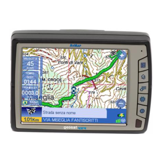
Page 4: Hardware Description
Geosat 4x4 is the GPS for OFF ROAD navigation • Audio video cable Geosat 4x4 can guide you in the city as well as off road. With Geosat 4x4 you can: • Calculate a route on the Tele Atlas maps •... - Page 5 Geosat (the battery is completely discharged when you first start it) and press the POWER hard key on the keyboard. Geosat 4x4 will power up and greet you with a vocal message “Welcome on board”! Accept the conditions pressing the Accept button on the Touch screen.
- Page 6 specific address, insert a new address as if you were setting a destination, then in the Start navigation page press Add to contacts. Insert the name for the contact, and choose an icon. To save your current location, press the WHERE TO GO hard key, press the Contacts button, and then press Add contact.
- Page 7 to the settings page. Press on the Map button to go back to the map. 1.10 Setting the brightness and volume Brightness: Geosat is equipped with a sensor for the automatic regulation of brightness of the display. You can modify the brightness manually by pressing the POWER hard key to open the Display Options.
- Page 8 2.3. Saving Contacts, Marks and Waypoints You can save in your Geosat 4x4 up to 1000 contacts, among marks, waypoints and addresses. You can access the contact list by clicking on the contacts button in the 4x4 Functions menu. The Contacts database has two default folders: marks and waypoints.
- Page 9 PC and then import these files in GPS Mapping Software such as Ozi Explorer. You can also import tracks from Ozi Explorer to your Geosat 4x4. Besides this, GeosatUpdate allows you updating the Geosat4x4 navigation software for free. You can download GeosatUpdate for free from www.avmap.it...
- Page 10 1. Click in the same GeosatUpdate window the “Import from Ozi Explorer” button, 2. Choose on your PC the file of the track you wish to import in your Geosat 4x4. GeosatUpdate will convert the track in a Geosat 4x4 compatible format and will save it in the navigator’s SD card.
-
Page 11: Technical Specifications
If your PC does not have a serial port, but only USB ports, you can also buy our Serial - USB cable adapter. To buy optional cables visit www.avmap.it 1. Switch Geosat 4x4 on and connect the serial cable to the Geosat 4x4 serial port, and to the PC serial port . -
Page 12: Repair And Replacement Under Warranty
64 MB RAM USB Port Maps Raster charts for off road background navigation are available for some countries, check www.avmap. it for availability and prices. 4. Repair and replacement under warranty When a Conformity Defect has been confirmed, the Purchaser must contact the authorised Support... -
Page 13: Tele Atlas End User Agreement
• Creation of a derivative product that competes with the Licensed Products ADDITIONAL PROVISIONS TO BE INCLUDED BY LICENSEE: 1. TA is a third party beneficiary of AvMap rights under the EULA, but is not a party thereto and shall have no obligations hereunder. - Page 14 5. Require End User to comply with all applicable export laws and regulations of the United States / the European Community. 6a. (Applicable for US data Only) Include the following: U.S. GOVERNMENT RIGHTS. If End User is an agency, department, or other entity of the United States Government, or funded in whole or in part by the United States government, then use, duplication, reproduction, release, modification, disclosure or transfer of this commercial product and accompanying documentation, is restricted in accordance with FAR 12.212 and DFARS 227.7202, and by a license agreement.
- Page 15 Dynamap®/Municipal Boundaries, as one of the Licensed Products, then Licensee shall not use the Municipal Boundaries product to create or derive applications which are used for the purpose of tariff or tax rate determination for a particular address or range of addresses. 11.
- Page 16 AvMap s.r.l. V.le Zaccagna 6, 54033 Avenza - Carrara (MS) - Italia info@avmap.it...