Sign In
Upload
Manuals
Brands
Honeywell Manuals
Avionics Display
KMD 250
Honeywell KMD 250 Manuals
Manuals and User Guides for Honeywell KMD 250. We have
1
Honeywell KMD 250 manual available for free PDF download: Pilot's Manual
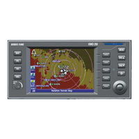
Honeywell KMD 250 Pilot's Manual (274 pages)
Multi-Function Display/GPS
Brand:
Honeywell
| Category:
Avionics Display
| Size: 4.58 MB
Table of Contents
Table of Contents
10
Introduction
20
Navigation Terms
21
Introduction
22
General Information
22
Function Select Keys
23
Menu Key
23
Range Keys
23
Direct-To/Nrst (Nearest) Key
23
Soft Keys
23
Joystick
24
Rotary Knob
24
Stormscope ® Option
24
Demo Mode
24
Function Status Icons
24
Startup Displays
27
Pop-Up Help Displays
29
Power down
29
Data Fields
29
Course Deviation Indicator (CDI)
32
Great Circle Courses and Magnetic Variation
33
Internal Gps Status
35
Quicktune™
35
Map Operation
36
Selecting a Map Display
37
VFR Map
37
Relative Terrain Map
38
Baro Correction
40
Obstacle Labels
41
Using the Map
42
Map Data Interrogation
43
Airport Information
44
Navaid Information
46
Airspace Interrogation
47
Airspace Alerting
48
Display Flight Plan Data on Map
52
Temporarily Decluttering the Map
53
Find Nearest (Units Without Internal GPS)
54
Find Nearest (Units with Internal GPS)
56
Waypoint Alert
57
Turn Anticipation
57
User Waypoints
60
Entering a User Waypoint
60
Entering a User Airport
66
Editing a User Waypoint
71
Deleting a User Waypoint
72
Direct-To Operation
74
Direct-To a Database or Stored Waypoint
74
Direct-To Using the Joystick Pointer
75
Obs Course Mode
75
Flight Plan Operation
78
Viewing the Active Flight Plan
78
Viewing Flight Plan Data
79
Fuel Flow
80
Changing the Data Columns
80
Creating a Flight Plan
81
Activating a Stored Flight Plan
83
Editing a Stored Flight Plan
85
Deleting a Waypoint in the Stored Flight Plan
85
Inserting a Waypoint in the Flight Plan
86
Changing the Name of the Flight Plan
88
Deleting a Stored Flight Plan
89
Deleting the Active Flight Plan
90
Using Direct-To in the Active Flight Plan
91
Proceeding Direct-To an Active Flight Plan Waypoint
91
Manually Selecting an Active Flight Plan Leg
92
Deleting a Direct-To Within the Active Flight Plan
93
Using Obs Course Mode in the Active Flight Plan
94
Setting an OBS Course to an Active Flight Plan Waypoint
94
Deleting an OBS Course Within the Active Flight Plan
96
Trip Planning Using Present Position
97
System Setup
100
Map Setup
100
Navigation Setup
103
Demo Mode & Setup
105
Demo Mode for Non-GPS Versions
106
Demo Mode for GPS Versions
107
Changing Demo Mode Settings
107
Software Versions
108
Database Versions
109
Map Display Icons
110
Datacards
114
Data Areas
114
Inserting a New Datacard
115
Transferring Data between Datacards
116
Store Current User Data on Another Datacard
116
Retrieve User Data from Another Datacard
117
Database Information
119
Database Cycle Information
119
Fis Vdl or XM Operation
120
Introduction
120
Concept of Operation
120
Equipment Overview
123
Datalink Weather Function Status Icons
124
Basic Weather Products
126
Metar
126
Speci
127
Taf
127
Pirep (Vdl Only)
128
Airmet
129
Sigmet
130
Convective Sigmet
130
Alert Weather Watches (Vdl Only)
131
Value Added Service Weather Products
132
Nexrad
132
NEXRAD Abnormalities
133
NEXRAD Limitations
134
Intensity
135
Graphical Metar
136
Graphical Airmet
137
Graphical Sigmet
138
Graphical Convective Sigmet
138
Graphical Alert Weather Watches (Vdl Only)
139
Subscriptions
140
Vdl Subscriptions
140
Setting up a VDL Subscription
142
Checking FIS VDL Subscriptions
144
XM Wx Subscriptions
145
Setting up an XM WX Subscription
145
Checking XM WX Subscriptions
146
Normal Operation
148
Nexrad Page
150
NEXRAD Page Operational Controls
151
Using the NEXRAD Page
151
Graphical Metars Page
153
Graphical Metars Page Operational Controls
154
Using the Graphical Metars Page
154
Graphical Airmets Page
156
Graphical Airmets Page Operational Controls
157
Using the Graphical Airmets Page
157
Graphical Sigmets Page
159
Graphical Sigmets Page Operational Controls
160
Using the Graphical Sigmets Page
160
Graphical Convective Sigmets Page
162
Graphical Convective Sigmets Page Operational Controls
163
Using the Graphical Convective Sigmets Page
163
Graphical Alert Weather Watches Page (Aww) (Vdl Only)
165
Graphical Weather Watches Page Operational Controls
166
Using the Graphical Weather Watches Page
166
Fis Network Status Page (Vdl Only)
168
FIS Network Status Page Operational Controls
169
Using the FIS Network Status Page
169
Fis Textual Weather Products
171
FIS Textual Products Operational Controls
172
Using the FIS Text Page
173
Changing Weather Products
174
Changing Filter Area
175
Fis Notifications
182
(Graphical Product) Data Has Not Been Received
182
No Metars Available in Selected Area
182
No Metars Available, Data Not Received
183
Invalid Subscription Code, Please Check and Re-Enter Code
183
Understanding Aviation Weather Reports
184
Understanding Metars
184
Understanding Tafs
187
Understanding Pireps
189
Understanding Airmets
191
Understanding Sigmets
193
Understanding Convective Sigmets
195
Understanding Alert Weather Watches (Aww)
197
Traffic Avoidance Operation
200
Introduction
200
Traffic Function Status Icons
201
Tas/Tcas
202
Tas/Tcas Normal Operation
202
Operational Controls for Tas/Tcas
203
Tas/Tcas Symbology
204
Non-Threat Traffic
204
Proximity Intruder Traffic
204
Traffic Advisory (TA)
204
Resolution Advisory (RA)
204
"Off-Scale" Traffic
205
No Bearing" Traffic
205
Ta/Ra While in Map or Weather Display
205
Auto-Pop-Up
206
Viewing Traffic in Adata Field
206
Tas/Tcas System Faults
207
No Data Received
207
System Test
207
Traffic Information Service (Tis)
208
Tis Limitations
209
Tis Normal Operation
211
Tis Operational Controls
212
Tis Symbology
213
Proximity Intruder Traffic
213
Proximity Intruder Non-Altitude Reporting (Nar)Traffic
213
Traffic Advisory (TA)
213
Traffic Advisory Non-Altitude Reporting (NAR)
213
"Off-Scale" Traffic
213
Traffic Advisory While in Map Display
214
Auto-Pop-Up
214
Viewing Traffic in Adata Field
214
Coast Mode
215
Tis System Faults
216
System off
216
No Data Received
216
Transponder Not Reporting Altitude
216
Wx-500 Stormscope ® Operation
218
Introduction
218
Functional Description
218
Stormscope® Functions Status Icons
218
Operation
219
Power-Up
219
Heading Stabilization
219
Clear All Discharge Points
219
Switch between Weather Views
220
Switch between Display Modes
220
Cell Display Mode
220
Strike Display Mode
221
Changing Display Range
221
Operation in Stormscope® Mode with Flight Plan
222
Operation in Map Display
222
System Messages
224
Viewing System Messages
224
Appendix A
228
Definitions
228
Acronyms and Abbreviations
229
Definitions, Acronyms and Abbreviations
228
Appendix B
234
Common Weather Abbreviations
234
Appendix C
256
Background
256
Gps Position Determining Concept
256
Gps Data Signals
256
Gps System Segments
257
GPS Primer
256
Appendix D
258
Navigation Terms
258
Index
273
Advertisement
Advertisement
Related Products
Honeywell KMD-150
Honeywell KMD 550/850
Honeywell KGP 560
Honeywell Bendix/King KTA970
Honeywell Bendix/King KMH980
Honeywell BENDIXKing KFD 840
Honeywell Bendix/King KMD850
Honeywell Bendix/King KMD 550
Honeywell KMA 29
Honeywell KMA 28B
Honeywell Categories
Thermostat
Controller
Control Unit
Security Camera
Accessories
More Honeywell Manuals
Login
Sign In
OR
Sign in with Facebook
Sign in with Google
Upload manual
Upload from disk
Upload from URL