Garmin Volvo Penta Glass Cockpit B7 Manuals
Manuals and User Guides for Garmin Volvo Penta Glass Cockpit B7. We have 1 Garmin Volvo Penta Glass Cockpit B7 manual available for free PDF download: Owner's Manual
Garmin Volvo Penta Glass Cockpit B7 Owner's Manual (106 pages)
Brand: Garmin
|
Category: Control Panel
|
Size: 4.07 MB
Table of Contents
-
Section 2
10-
Introduction13
-
Status Icons14
-
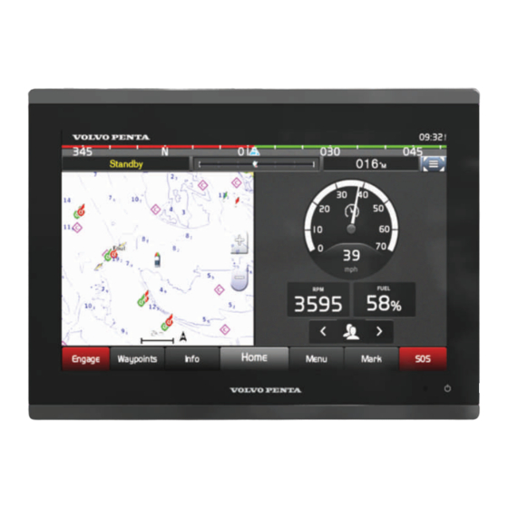
Home Screen15
-
Presets18
-
Chart Layers28
-
Chart Menu28
-
Destinations34
-
Waypoints35
-
Routes36
-
Tracks39
-
Boundaries40
-
Sail Racing41
-
Polar Tables42
-
Sonar Alarms52
-
Radar57
-
Marpa59
-
VRM and EBL60
-
GPS Settings87
-
EVC Network90
-
Adding a Key92
-
Appendix95
-
Screenshots98
-
Signals98
-
Index103
Advertisement