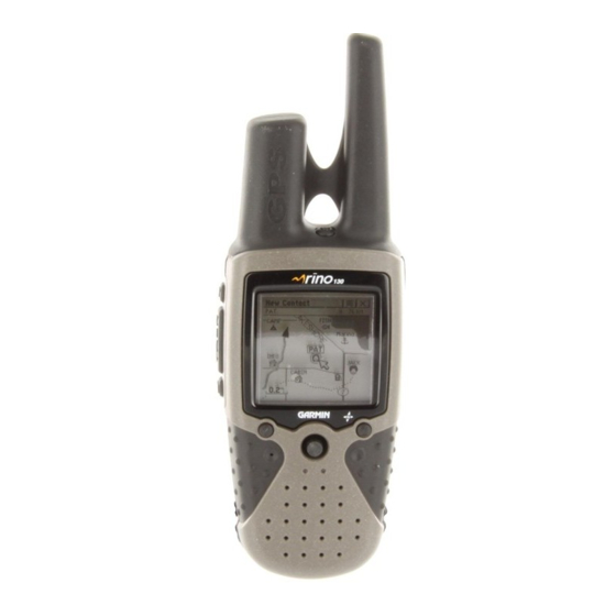
Garmin Rino 130 Owner's Manual
2-way radio & personal navigator
Hide thumbs
Also See for Rino 130:
- Owner's manual and reference manual (88 pages) ,
- Owner's manual (132 pages) ,
- Quick start manual (2 pages)
Table of Contents
Advertisement
Advertisement
Table of Contents
Troubleshooting

Related Manuals for Garmin Rino 130


Summary of Contents for Garmin Rino 130
- Page 1 ® ® 2-way radio & personal navigator owner’s manual...
- Page 2 Information in this manual is subject to change without notice. Garmin reserves the right to change or improve its products and to make changes in the content without obligation to notify any person or organization of such changes. Visit the Garmin web site (www.Garmin.com) for current updates and supplemental information concerning the use and operation of this and other Garmin products.
-
Page 3: Introduction
Thank you for choosing the Garmin Rino 130 (Radio Integrated with Navigation for the utdoors). To get the most from your new Rino 130, read through the Quick Start Guide first, then this Owner’s Manual to understand all of the operating features. -
Page 4: Fcc Compliance
Warranty Information FCC Compliance The Rino 130 complies with Part 15 of the FCC regulations and with Canadian RSS-210 and ICES-003 for Class B digital devices. Operation of this device is subject to the following conditions: (1) This device may not cause harmful interference, and (2) this device must accept any interference received, including interference that may cause undesired operation. -
Page 5: Fcc Licensing Information
FCC Licensing Information The Rino 130 two-way radio operates on General Mobile Radio Service (GMRS) frequencies regulated by the Federal Communications Commission (FCC) in the United States. Operation on the GMRS frequencies is subject to additional rules as specified in 47 CFR Part 95. -
Page 6: Limited Warranty
This Garmin product is warranted to be free from defects in materials or workmanship for one year from the date of purchase. Within this period, Garmin will at its sole option repair or replace any components that fail in normal use. Such repairs or replacement will be made at no charge to the customer for parts or labor, provided that the customer shall be responsible for any transportation cost. - Page 7 Garmin dealer for repairs. The Rino 130 is fastened shut with screws. Any attempt to open the case to change or modify the unit in any way will void your warranty and may result in permanent damage to the equipment.
-
Page 8: Software License Agreement
Software are valuable trade secrets of Garmin and that the Software in source code form remains a valuable trade secret of Garmin. You agree not to decompile, disassemble, modify, reverse assemble, reverse engineer or reduce to human readable form the Software or any part thereof or create any derivative works based on the Software. -
Page 9: Safety Information
Use the Rino 130 at your own risk. To reduce the risk of unsafe operation, carefully review and understand all aspects of this Owner’s Manual—and thoroughly practice operation using the Demo mode prior to actual use. - Page 10 Introduction For body-worn operation, this radio demonstrates compliance and meets the FCC RF exposure guidelines when used with approved accessories supplied with or designed for this product. Use of other accesssories may not ensure compliance with FCC RF exposure guidelines. Safety Information Antenna Care - Use only the supplied antenna.
- Page 11 Blasting Areas - To avoid interfering with blasting operations, turn your radio OFF when in a “blasting area” or in areas posted: “Turn off two-way radio.” Obey all signs and instructions. Potentially Explosive Atmospheres - Turn your radio OFF and do not remove your battery when you are in any area with a potentially explosive atmosphere.
-
Page 12: Table Of Contents
Safety Information ... vii Warnings and Precautions ... vii Overview ...1 Rino 130 Overview ...1 Getting to Know your Rino 130 ... 1 Main Display Pages ... 2 Operating the Rino 130 ... 3 Status Bar Overview ... 4 Reference ...5 Radio Page...5... - Page 13 Altimeter Page Options ... 36 Viewing Pressure/Elevation Plots ... 37 Adjusting the Zoom Ranges ... 37 Viewing Points ... 38 Resetting Data ... 38 Calibrating the Altimeter ... 39 Programming Data Fields ... 39 Trip Computer Page...40 Trip Computer Page Overview ... 40 Trip Computer Page Options ...
- Page 14 Introduction Table of Contents Satellite Page Overview ... 74 Skyview graphic ... 74 WAAS ... 75 Satellite Strength ... 75 Satellite Page Options ... 76 Setup Pages...78 Setup Menu ... 78 Time Setup Page ... 78 Units Setup Page ... 79 Display Setup Page ...
-
Page 15: Overview
GMRS is not approved for use by the Canadian government and this feature is disabled. You can keep track of up to 50 contacts from Rino users. The Rino 130 can store up to 500 waypoints with a 10-character name and graphic symbol. The active track log stores up to 10,000 points and allows you to save up to 20 tracks with 250 points per track. -
Page 16: Main Display Pages
Main Menu Main Display Pages All of the information you need to operate the Rino 130 can be found on six default main pages (or display screens). Simply press and release the PAGE button to cycle through the Radio Page, Map Page, Navigation Page, Altimeter Page, Trip Computer, and Main Menu Page. -
Page 17: Operating The Rino 130
Operating the Rino 130 For best results, you should initialize the GPS receiver in your Rino 130 unit before you use it the first time. See page 5 for instructions on initializing the unit. For most accurate results, the compass and altimeter should also be calibrated. Refer to the Calibrating the Compass and Calibrating the Altimeter sections for complete information. -
Page 18: Status Bar Overview
Overview Rino 130 Overview Main Page Menu button/ Exit button Option Menu button Status Bar Status Bar Overview The Status Bar at the top of the screen displays on all the available Main Pages. As you move around any of the Main Pages, the current page’ s title briefly displays (3 seconds) and then is replaced by the Status Bar. -
Page 19: Reference
first time the unit is used. To initialize the unit: 1. Take the Rino 130 outside where it has an unobstructed view of the sky and turn it on. 2. The unit begins to search for satellite signals. “Tracking Satellites” is displayed while the unit is initializing. -
Page 20: Using 'My Id' And Symbol Fields
Reference Radio Page ‘My ID’ Field Symbol Using ‘My ID’ and Symbol Fields The ‘My ID’ field allows you to enter a name and symbol that appears on other Rino units as you communicate with them. You may enter a name using a combination of up to 10 letters, numbers, or spaces. - Page 21 To change the user symbol: 1. Using the , highlight the face symbol to the right of the ‘My ID’ field. Press THUMB STICK IN to show a list of available face icons. THUMB STICK 2. Move the THUMB STICK UP or DOWN to scroll through the selections.
-
Page 22: Setting The Channel And Squelch Code
Channels enabled). Setting the Channel and Squelch Code The Rino 130 has a total of 22 channels (not including GMRS repeater channels) and 38 squelch codes to select from using the ‘Channel’ and ‘Code’ fields. Channels 1–14 are for FRS, 15–22 are for GMRS (disabled by default) 15R–22R are for GMRS repeater channels (disabled... -
Page 23: Scanning And Monitoring
(or if you transmit), it stops on that channel/squelch code for a few seconds, then continues scanning. When the Rino 130 is scanning and it receives an incoming signal, the Rino 130 automatically decodes the Squelch Code used by the incoming signal. - Page 24 Reference Radio Page The Code field is blank when the unit is scanning or monitoring channels. The ‘Monitor’ option lets you listen to a single channel for any activity, including static and weak voice signals. The Rino series automatically squelches a frequency to filter out unwanted noise.
- Page 25 To setup a Scanlist: 1. Using the , highlight the Option Menu on-screen button THUMB STICK Highlight ‘Setup Scanlist’ and press the 2. To add/remove a channel from the list, highlight the channel and press the IN to add/remove the check mark in front of the name. Only channels that are checked will be scanned.
-
Page 26: Radio Page Option Menu
Send Location - Enables/disables the peer-to-peer positioning feature. See the Peer-to-Peer section for more on this feature. Allow Polling - Enables/disables you Rino 130’ s ability to respond to a poll from another Rino. VOX Level - Controls the sensitivity level of any Voice Operated Transmission (VOX) accessory. - Page 27 GMRS Radio - Use this option to turn On/Off GMRS channels 15–22. Peer-to-peer position- ing is not available on GMRS channels. See the FCC Licensing Information section and the Appendix for more information on using GMRS channels. Repeater Channel - Use this option to turn On/Off GMRS repeater channels 15R–22R. This option is only available when GMRS is enabled.
-
Page 28: Setup Tones
Reference Setup Tones Call Tone - When the CALL button is pressed, an attention tone is transmitted. This option allows you to choose one of ten tones. Radio Page Roger Tone - When the button is released, a tone is sent to signify the end of the trans- TALK mission. -
Page 29: Use Weather Radio
You can then turn the Weather Radio off and continue normal FRS/GMRS radio op- erations. When a Weather Alert tone is detected, the Rino 130 will break into any FRS/GMRS transmission to automatically turn on the Weather Radio and broadcast the Weather Alert. -
Page 30: Turn Radio/Gps On/Off
THUMB STICK INFORMATIONAL PICTURE The Informational Picture on the bottom half of the Radio Page features Garmin’ s Mr. Mark Waypoint showing current GPS and radio status, and radio actions. As you operate the unit, the graphics change depending on what actions you are taking and the unit settings. - Page 31 GPS and FRS/GMRS Radio On; Ready to transmit Position GPS and Weather Radio On (FRS/GMRS Radio Off) GPS and FRS/GMRS Radio On; Ready to transmit Position; Transmitting on FRS GPS and FRS/GMRS Radio On; Position not ready; Transmitting on GMRS GPS and FRS/GMRS Radio On;...
-
Page 32: Using The Rino 130 Radio Features
Rino 130. Peer-to-Peer Positioning The Rino 130’ s most unique feature is being able to send its location to another Rino, which is called Peer-to-Peer positioning. With peer-to-peer positioning enabled (see the Setup Radio section) and you have a GPS position (see page 5 and 74-77), whenever you press and release... - Page 33 The Rino 130 can manage up to 50 contacts at any time. Each time that you receive a signal from a contact, your map is updated showing their new position. A Track Log of their move- ment is created and shown on your map (see the Track Logs section). After a contact has been established, a “<contact name>...
-
Page 34: Sending A Location
Reference Radio Page To send a location, highlight the Option Menu from the Waypoint Review Page and press IN. To change contact details: 1. The Elevation, Position and Note fields may be manually edited. Select the desired field and press the THUMB STICK 2. - Page 35 To send a location: 1. Press the IN and hold it until the Shortcuts Menu is displayed. THUMB STICK 2. Highlight ‘Find ‘N’ Go’ and press the THUMB STICK 3. Highlight the desired category and press the select the desired contact and press the 4.
-
Page 36: Map Page
In many instances the map displays an ‘Accuracy Circle’ surrounding the ‘Position Icon’. The Rino 130 uses both map resolution and GPS accuracy in defining your location to a point within the circle. The smaller the circle, the more accurate your location. - Page 37 To view a Contact from the Map Page: 1. Highlight the Contact icon using the the Contact Bar, the Map page centers the map on that contact and displays its name, direction, and distance near the top of the screen. 2.
-
Page 38: Map
MAP PAGE OPTIONS Map Page options allow a variety of operating and custom features for your Rino 130. The Map Page options are: Highlight an option then press the Pan Map - Allows you to move the Panning Arrow (Map Pointer) about on the map. Refer to the Using the Pan Map Option section for complete instructions. -
Page 39: Using The Pan Map Option
2. Select ‘Find ‘N Go’ to display items. Select the category you wish to search (waypoints, contacts, etc.), then select ‘Near Map Pointer’ from the pop-up list. The Rino 130 then searches for the items nearest the location of the map pointer instead of your actual location. -
Page 40: Programming The Data Fields
Data Field Options Thee data field options apply to the Map Page data fields and the Trip Computer data fields. For definitions of these all data fields used in the Rino 130, refer to the Appendix. Bearing Heading Course... -
Page 41: Setting Up The Map
Setting up the Map The ‘Setup Map’ option displays the five Map Setup Pages, each accessed by an on-screen button. To use Map Setup options: 1. Select ‘Setup Map’ from the Option Menu display the Map Setup Page. 2. Press UP or DOWN on the THUMB STICK displays the options list for that sub-page to the left. - Page 42 Reference Map Page General Setup Lines Setup Points Setup Text Setup Map Data Setup Text Setup Display Mode - Land or Water. Tracks Setup Saved Tracks and Track Log - Scale options; ‘Off’, ‘Auto’, or 20 ft.–500 miles, sets the maximum scale at which the feature should appear on the screen.
-
Page 43: Measuring Distance
Measuring Distance To use the Measure Distance option: 1. Select ‘Measure Distance’ from the Option Menu to display the Panning Arrow. ‘Ref’ displays under the arrow. 2. Use the to move about on the Map Page until you reach the point to which THUMB STICK you want to measure. -
Page 44: Navigation Page
Reference Navigation Page NAVIGATION PAGE OVERVIEW The Navigation Page provides active guidance with a rotating compass ring that shows your course (track) while you are moving and a bearing pointer to indicate the current direction to your destination (bearing) relative to the course. The Data Field at the top of the page, by default shows you the name of your destination. -
Page 45: Using The Navigation Page
Using the Navigation Page The two main components of the Navigation page are the Bearing Pointer and Compass Ring. The Bearing Pointer always points directly to the destination, no matter what your cur- rent location might be. The Compass Ring displays your heading. While you are navigating a route, the pointer indicates the direction (a bent arrow) of the turn to the next point in the route as well as the direction to the current point when you get within 15 seconds Estimated Time of Arrival of the current point. -
Page 46: Navigation Page Options
Reference Navigation Page Navigation Page Option Menu Navigation Page with Bearing Pointer and Big Compass.. NAVIGATION PAGE OPTIONS Sight ‘N Go - Use the Sight ‘N Go feature to locate a landmark visually and then lock in a magnetic heading to it. Stop Navigation - Cancels navigation (“Grayed out”... -
Page 47: Using Sight 'N Go
THUMB STICK with pointer is in-line with the two sighting marks on the case. 3. Hold the Rino 130 at eye level and line up the two sighting marks on the case with the distant object. Press the THUMB STICK 4. -
Page 48: Calibrating The Compass
Turn the unit around as shown above. Calibrating the Compass The Electronic Compass must be calibrated outdoors when you first use the Rino 130 and after new batteries have been installed. The accuracy of the Electronic Compass is adversely affected if the unit is not held level or is held near items that generate magnetic fields, such as... -
Page 49: Altimeter Page
ALTIMETER PAGE OVERVIEW The Altimeter Page provides the current elevation, rate of ascent/descent, a profile of eleva- tion changes over distance or time, or a profile of pressure changes over time. The Altimeter Page’ s Option Menu allows you to select from a variety of display options such as plotting over time, plotting over distance, displaying the zoom ranges of measurement, viewing eleva- tion or pressure points, and resetting data displays. -
Page 50: Altimeter
Reference ALTIMETER PAGE OPTIONS The Altimeter Page Option Menu allows you to select the type of information and how it is to be displayed. Altimeter Page Options include: Altimeter Page Plot Over Time/Distance - Plots the changes in elevation or pressure over a length of time or over a distance. -
Page 51: Viewing Pressure/Elevation Plots
Viewing Pressure/Elevation Plots When selecting the ‘View Elevation Plot’ option you can plot a profile of elevation changes that occur as you navigate over a set distance or period of time. When you select ‘View Pressure Plot’ you can view a record of changes in barometric pressure for a set period of time. When one option is active the other displays on the Altimeter Page Option Menu To view elevation or pressure plots: 1. -
Page 52: Viewing Points
Reference Altimeter Page View Points Option Page Viewing Points The ‘View Points’ option allows you to scroll through the stored elevation profile and to view a single point along the profile. When the pointer is stopped at a location along the pro- file, the display shows the elevation, time of day and date the point was created. -
Page 53: Calibrating The Altimeter
Calibrating the Altimeter Because the Rino 130 relies on the Barometric pressure to determine the elevation and the pressure at any given elevation can fluctuate, you can calibrate the altimeter to increase its ac- curacy. You must know the elevation or pressure at your current location, information you can obtain from a map or other reliable source. -
Page 54: Trip Computer Page
Reference Trip Computer Page Trip Computer Page, Small Numbers Trip Computer Page, Big Numbers TRIP COMPUTER PAGE OVERVIEW The Trip Computer Page by default displays up to seven different types of navigation data. Choosing ‘Big Numbers’ will display 2 large data fields. -
Page 55: Main Menu Page
Main Menu or select it from the Main Page Menu at the top of each main page. Using the Main Menu The Main Menu allows access to many features and pages in the Rino 130. Please refer to the Features section for a complete description of the items accessed through the Main Menu. - Page 56 Reference Setup Page - Allows tailoring of items such as time format, units of measure, display backlight- ing timeout and contrast adjustment, heading selection, interface setups, and system software information. Main Menu Page Calendar Page - Provides you with a monthly calendar with programmable reference notes. Alarm Clock - Provides a settable 24-hour alarm clock.
-
Page 57: Main Menu Options
MAIN MENU OPTIONS Through the Main Menu you can establish the sequence of pages. Page Sequence Setup You may add, remove, or reorder any of the Main Pages, plus additional pages. The default Main pages are Radio, Map, Navigation, Altimeter, Trip Computer, and Main Menu. The Main Menu cannot be removed from the page sequence. -
Page 58: Features
MapSource product is loaded into the Rino 130. Weather Radio - Toggles between the Weather Radio and the FRS/GMRS Radio. Send Note - Sends a note to other Rino 130 users. Enable Keylock - Enables keylock so buttons are not inadvertently pushed. Press and hold PAGE button to unlock the buttons. -
Page 59: Waypoints
There are numerous ways to create, edit, and use waypoints. Using the Mark Waypoint Page and the Find ‘N Go Menu are two common pages for creating and editing waypoint. You can also create a waypoint using the Map Page. The Rino 130 holds up to 500 waypoints. Mark Waypoint Page The Mark Waypoint Page allows you to mark and record your current location as a waypoint and appears with a graphic name block (man with a flag) that displays the assigned... -
Page 60: Creating Waypoints
Features Waypoints Saving a map feature as a waypoint Creating a waypoint by entering the coordinates Creating Waypoints To create a waypoint for a map feature: 1. With the Pan Map feature active, move the panning arrow (map pointer) to the map item you want and highlight it. -
Page 61: Projecting A Waypoint
Projecting a Waypoint Projecting a waypoint from any map item (another waypoint, etc.) allows you to establish a new waypoint on a bearing and distance projected from that map item. To project a waypoint: 1. Select a map item from the Find ‘N Go Menu. 2. - Page 62 Features Waypoints Deleting a waypoint Saving an item as a waypoint To delete a waypoint or contact: 1. Use the Find ‘N Go feature to display the point. 2. Highlight the ‘Delete’ button and then press the To move a waypoint by dragging it: 1.
-
Page 63: Find 'N Go
FIND ‘N GO MENU The Find ‘N Go Menu allows you to find stored locations (waypoints) and map items (cities, exits, etc.). They can be found by name or by those nearest to your current location. If you are using certain MapSource data, the list of find locations is expanded to include categories for Points of Interest, Street Addresses, and Intersections. -
Page 64: Finding A Waypoint
Find N’ Go Menu Finding a Waypoint Waypoints that you have created and stored in the Rino 130 can be found by selecting the “Waypoint’ option from the Find ‘N Go Menu. You can find a waypoint from the list of waypoints using the ‘By Name’... - Page 65 To find a waypoint by name: 1. Use the to select ‘Waypoint’ from the Find ‘N Go Menu. Press the THUMB STICK IN to select ‘By Name’ from the pop-up menu. Press the STICK display the Waypoints List. 2. Use the THUMB STICK to enter the name of the waypoint that you would like to find.
-
Page 66: Finding A Contact
Find ‘N Go Contact List Finding a Contact Contacts that you have received in the Rino 130 can be found by selecting the ‘Contacts’ option from the Find ‘N Go Menu. To find a contact: 1. From the Find ‘N Go Menu, highlight ‘Contacts’ and press the 2. -
Page 67: Finding A City
Finding a City Cities can be found by selecting the ‘Cities’ option of the Find ‘N Go Menu, selecting the city from the list of ‘Nearest’ or ‘By Name’, and then displaying the City Information Page. The City Information for the selected city displays, including the city name, the size by population, and distance from your location. -
Page 68: Finding An Exit
Features Find ‘N Go Exit Information Page Finding an Exit You can use the Find Exit option to locate a nearby exit on an interstate highway. Exits are listed only by ‘Nearest’. Exit information pages provide a variety of information about services near each exit, such as rest stops, lodging, restaurants, and service stations. -
Page 69: Finding A Point Of Interest
Finding a Point of Interest You can use the Find Points of Interest option to locate a nearby restaurant, lodging, landmark, public building, park, etc. However, you must have transferred a MapSource MetroGuide map to the unit map database. Otherwise, this option, plus Address and Intersec- tion options, are grayed out and are not functional. - Page 70 Features Find ‘N Go Points of Interest Nearest Food & Drink To find a point of interest: 1. Use the to highlight ‘Points of Interest’ and then press it IN to display the THUMB STICK Points of Interest Categories List. 2.
-
Page 71: Finding An Address Or Intersection
Finding an Address or Intersection You can enter a street number, choose a street name from a list and find an address within the area of map data coverage or enter two street names and locate the intersection. To use these options, however, you must be using a MapSource product that provides this type of map data. - Page 72 Features Find ‘N Go Finding an Intersection To locate an intersection: 1. Display the Find ‘N Go Menu and use the category and press it IN to display the ‘Find Intersection’ page. 2. Highlight the first ’Street’ field and then press the list.
-
Page 73: Finding A Last Found Place
Finding a Last Found Place You can use the Recently Found Places option to locate Points of Interest, Cities, Waypoints or Contacts and Intersections and other locations you have recently retrieved. The process for finding recent points from the Find ‘N Go list is the same as finding a regular waypoint. To find a ‘Last Found Place’: 1. -
Page 74: Weather Radio
You can then turn the Weather Radio off and continue normal FRS/GMRS radio operations. When a Weather Alert is detected, the Rino 130 will break into any FRS/GMRS transmission to automatically turn on the Weather Radio and broadcast that alert. Select ‘Dis- able Weather Alert’... -
Page 75: Send Note
SENDING A NOTE You may send a note to other Rino 130 users. When you send a note, it appears along the bottom of the display on every Rino 130 user who is using the same Channel and Squelch Code that you are using. -
Page 76: Goto
Features Goto Activating a Goto Viewing a Goto on the Map Page USING A GOTO The Goto function allows you to create a direct route to a destination, (waypoint, city, or point of interest). Once you have accessed the Information Page for an item, use the ‘Goto’ button at the bottom of the page to initiate travel, using the Map and Navigation Pages for guidance. -
Page 77: Routes Page
Route navigation allows you to create a sequence of intermediate waypoints that leads you to your final destination. The Rino 130 stores 20 routes, each with up to 50 waypoints. A route can be created and modified from the Route Page, and waypoints can be added to a route from the Find ‘N Go Menu. -
Page 78: Editing A Route
Features Routes Page Route Page Route Options To add a Find ‘N Go Menu item to a route: 1. Select an item from the Find ‘N Go Menu and display its Information Page. If a contact is used in a route, the route changes as the contact’s position is updated, or it may be saved as a Waypoint to serve as a stationary point. - Page 79 To copy the route: 1. From the Route Page, select the on-screen page Option Menu button IN to access the Option Menu. THUMB STICK 2. Highlight the ‘Copy Route’ option and then press the route displays on the Routes Page and is named the same but followed by the numeral 1 (one).
- Page 80 Features Routes Page Route point review options To insert a new point on the route list: 1. Select the row where you want the new point inserted before. Press the 2. Highlight ‘Insert’ and press the THUMB STICK a new waypoint, city, exit, point of interest, etc. 3.
-
Page 81: Adding Or Editing From The Route Map Page
Adding or Editing from the Route Map Page You can use the panning arrow with the Route Map Page displayed to add or edit route waypoints. To add a point at either end of a route: 1. Select the Route from the Routes List. Press the Page. -
Page 82: Navigating A Route
Features Routes Page Route Navigation To review or remove a route point: 1. Select the Route from the Routes List. Press the Page. 2. Use the THUMB STICK to highlight the desired route and press IN to display the Route Page. -
Page 83: Stopping Navigation
Stopping Navigation To stop navigation, highlight the ‘Stop Navigation’ option on either the Navigation or Map page’ s Option Menu or select the ‘Stop’ button on the Route Page. Data Fields for the Route Page When navigating a Route, the data displayed in the data fields on the Route Page may be customized to provide useful navigation information. -
Page 84: Tracks Page
Tracks Page TRACKS PAGE OVERVIEW The Rino 130 draws an electronic bread crumb trail on the Map Page as you travel along. This bread crumb trail is the ‘Track Log’. The Track Log contains information about points along its path, including time, and position. The Rino 130 uses this information to allow you to navigate using the saved track. -
Page 85: Using The Tracback Feature
When you are ready to return to where you started, the Rino 130 takes you back by following the ‘Track Log’ that you left behind. You can save a total of 20 tracks in the unit memory. The Track Log starts recording as soon as the unit gets a satel- lite location fix and the Track Log feature is turned on. -
Page 86: Setting Up The Track Log
Features Tracks Page Setting up the Track Log You can set the track recording interval to Distance, Time, or Automatic. You can set the Track display resolution to High, Medium, Low, and Lowest. You can also use the Option Menu to delete all saved tracks. To use Track Log Setup options: 1. -
Page 87: Proximity Page
Proximity Points The Proximity Page lets you define an alarm circle around a stored waypoint/contact posi- tion, and can be used to help you avoid dangerous areas or to alert you when you have strayed too far away from other Rino users. Up to ten waypoints may be listed, with a maximum alarm radius of 99.99 nautical or statute miles or kilometers. -
Page 88: Satellite Page
Features Satellite Page Satellite Page icon Signal Strength Skyview Bars Graphic Satellite Page SATELLITE PAGE OVERVIEW The Satellite Page provides a picture of satellite signal tracking, tells you when the unit is ready for navigation, and shows your location coordinates. To access the Satellite Page: 1. -
Page 89: Waas
WAAS System, refer to the Federal Aviation Administration web site (http://gps.faa.gov/). Because the Rino 130 relies on satellite signals to provide you with navigational guidance, the unit’ s view of the sky determines how fast you achieve navigational status. GPS signals do not travel through heavy objects or people: For best results, keep the unit in clear view of the sky. -
Page 90: Satellite Page Options
‘Use With GPS Off’ option and then press it IN. The Rino 130 stops tracking satellites and should not be used for navigation. However, the next time you turn the unit on, it returns to Normal GPS operation. - Page 91 2. Highlight ‘New Location’ and press the ‘Use Map’. If you choose ‘Automatic’ the Rino 130 determines your new location automatically. If you choose ‘Use Map’ a map page displays with instructions stating, “Point to your approximate location and press ENTER”. Use the...
-
Page 92: Setup Pages
Time Setup Page SETUP MENU The Setup Pages allow you to customize the Rino 130 to your personal preferences. You can choose time settings, units of measure, display backlighting and contrast settings, heading measurement, interface options and system operating mode. -
Page 93: Units Setup Page
Daylight Savings Time - Can be turned On or Off or set to Automatic. To set the time: 1. Use the button to access the Main Menu. PAGE 2. Use the THUMB STICK to highlight the Setup Icon. Press the the Setup Menu. - Page 94 TD setup window. To change the settings of any fields, highlight the field, press the IN. When done, highlight ‘Save’ and press IN. STICK For more information on Loran TDs, you may download Garmin’ s Loran TD Position Format Handbook from the Garmin web site at http://www.Garmin.com/support/userManual.html. THUMB...
-
Page 95: Display Setup Page
Map Datum - Offers a selection of nearly all map datums in common use. Every map is based on a map datum (a reference model of the earth’ s shape) and is usually listed in the title block of the map. If you are comparing GPS coordinates to a paper map, chart, or other reference, the map datum in this field must match the horizontal map datum used to generate the map or other reference. -
Page 96: Heading Setup Page
Features Setup Page Display Setup icon Display Setup Page Heading Setup icon Heading Setup Page Contrast Adjustment - Can be adjusted from light to dark using the slider adjacent to the contrast bar. To access the Display Setup page: 1. Press the PAGE button or the Menu icon 2. -
Page 97: Interface Setup Page
Magnetic Variation. The Electronic or GPS compass uses the North Reference setting to create a bearing. Switch to Compass Heading when Below - Enter the desired speed for the Rino 130 to switch from using GPS to using the compass for guidance. - Page 98 If ‘Garmin DGPS’ or ‘RTCM In/NMEA Out’ format is selected, additional fields are provided to control a Garmin differential beacon receiver (e.g. GBR 23) directly from your unit. Tuning is automatic with ‘Scan’ or you can enter the beacon frequency and bit rate when you select ‘User’...
-
Page 99: System Setup Page
Unit I.D. Number. Software updates and instructions for download- ing are available from the Garmin web site (www.Garmin.com). Choose one of the four GPS options other than ‘Normal’ to significantly save battery power. -
Page 100: Calendar
Features Calendar Calendar Page Calendar options Using the Calendar This feature provides you with a monthly calendar with programmable reference notes. You can display one monthly calendar at a time and add reference notes using the data entry keypad. Days that are shaded have notes added. You can create reference notes for multiple months and for months in years yet to come. - Page 101 To edit or delete a note: 1. To edit or delete a note previously created, highlight the date and press the 2. Select ‘Edit Note’, or ‘Delete Note’, from the pop-up menu. To complete the deletion of the note, press the THUMB STICK IN when ‘Yes’...
-
Page 102: Alarm Clock
Features Alarm Clock Alarm Clock icon Alarm Clock Page Using the Alarm Clock This feature provides an alarm for the system clock. Enter a time in the time field and turn the alarm on and off from the control field menu. Remember to enter alarm times in the same time format (UTC or local) you are using for your system. -
Page 103: Calculator
You can perform most calculations identified by the function symbols along the sides of the keypad and can save the results temporarily in the memory. The memory is cleared either manually or when you turn off the Rino 130. To access the Calculator: 1. -
Page 104: Stopwatch
Features Stopwatch Stopwatch icon Stopwatch Page Using the Stopwatch This feature allows you to use the unit as a stopwatch, including using it as a lap timer. You may also have the unit record the lap time based on distance. For example, if you set the lap distance to one mile, the unit records the time it takes you to travel one mile. -
Page 105: Sun & Moon
Using the Sun & Moon Page This feature provides you with a graphic display of both sun and moon positioning for a certain date, time and location with times for sunrise, sunset, moonrise, and moonset. To access the Sun & Moon Page: 1. -
Page 106: Hunt & Fish
Features Hunt & Fish Hunt & Fish icon Hunt & Fish Page Using the Hunt & Fish Page This feature provides you with a listing of best times for hunting and fishing for a chosen location and date. To access the Hunt & Fish Page: 1. -
Page 107: Area Calculator
2. In the Main Menu, scroll down and select the Area Calculator icon. To calculate the area: 1. Be sure the Rino 130 has a GPS fix. 2. Press ‘Start’ when you are ready to begin. 2. Begin walking or traveling the perimeter (edge) of the area you want to measure. -
Page 108: Games
Features Games Games Menu icon Games Menu GAMES MENU The Games Page includes Memory Race, Waypoint Bomber, Clothesline, Assimilation and Beast Hunt. Highlight the appropriate icon and then press the desired game. Brief instructions are displayed when you start each game. All players must be on the same channel/squelch code to play. -
Page 109: Waypoint Bomber
Waypoint Bomber In this game, it is good to stay on the move! Two or more players attempt to “bomb” each other. Move your cursor around on the map page using your think an opponent is close to your cursor, drop a bomb. The receiving radio shows an ‘Incom- ing”... -
Page 110: Clothesline
Features Games Assimilation Beast Hunt Clothesline Team members select the same user symbol and then attempt to “hit” or “clothesline” other players by pressing the when an opposing team member is between them. You may also mark a point and assign it a symbol to be used as a stationary team member. -
Page 111: Appendix
WHAT IS FRS? FRS, or Family Radio Service, is a UHF radio frequency band allocated by the FCC for general public use. The operating frequency ranges from 462.5625 to 467.7125 MHz, with a maximum transmitting power of one half watt. FRS radios are small and lightweight, making them ideally suited for outdoor activities. -
Page 112: Frs Limitations
Appendix FRS Explained Remember though, these are public-use frequencies and everyone has a right to talk or listen in. Channel scan allows your FRS radio to scan all FRS frequencies for signals. After scan- ning briefly to see what channels other users are on, simply set your FRS radios to an unused channel and enjoy less interference. -
Page 113: Specifications
Physical Case: Fully-gasketed, high-impact plastic alloy, waterproof to IPX7 standards (waterproof to one meter for 30 minutes) Size: 4.5” H x 2.3” W x 1.6” D; 7” H with antenna (11.4 x 5.8 x 4.1; 17.8 cm) Weight: Approx. 7.6 ounces (236 g) with batteries Temperature Range: -4°... - Page 114 With optional Garmin Differential Beacon Receiver Input (such as Garmin GBR 23). The temperature rating for the Rino 130 may exceed the usable range of some batteries. Alkaline batteries can rupture at high temperatures. External power can only be applied using the Garmin Auto Power Adapter or PC Interface Cable with Auto Power Adapter.
-
Page 115: Accessories
Appendix To obtain accessories, see your local dealer or visit the Garmin web site at www.Garmin.com. 12-volt Adapter Cable: Provides unit power from an automobile cigarette lighter. Accessories 2.5 to 3.5 mm Jack Adapter: Allows you to use 3rd party headsets with your Rino unit. -
Page 116: Mapsource Setup
Find features and mapping capability. The Rino 130 accepts up to 24 MB of map data from most MapSource products. It is not possible to transfer 3rd party maps into Garmin products. -
Page 117: Mapsource Setup
2. Connect the serial port connection on the cable to the PC serial port. 3. Connect the remaining cable connector to the back of the Rino 130 by orienting the slot on the connector with indexing bar on the back of the unit. Then, slide the connector in place. -
Page 118: Gps Troubleshooting Guide
Cannot exit a menu or page by moving the THUMB STICK to the LEFT. GPS Troubleshooting Guide To resolve problems that cannot be remedied using this guide, contact Garmin Customer Service at 913-397-8200 or 800-800-1020 Probable Cause Batteries are exhausted. -
Page 119: Radio Troubleshooting Guide
Radio Troubleshooting Guide To resolve problems that cannot be remedied using this guide, contact Garmin Customer Ser- vice at 913-397-8200 or 800-800-1020. Symptom Radio not transmitting. Messages not being received by others. Limited talk range. You can hear others, but they cannot hear you or you see an incoming transmission, but nothing is heard. -
Page 120: Data Field Definitions
Appendix Data Field Definitions The following data field options are available on the Map, Navigation, Altimeter, and Trip Computer Pages. Ambient Pressure - The uncalibrated current pressure. (Altimeter Page Only.) Average Ascent - The average vertical distance of ascents. (Altimeter Page Only.) Average Descent - The average vertical distance of descents. - Page 121 The highest elevation reached. (Altimeter Page Only.) Maximum Elevation - Maximum Speed - The maximum speed the unit has moved. The lowest elevation reached. (Altimeter Page Only.) Minimum Elevation - Moving Avg. Speed - Average speed of the unit while moving. A running tally of distance travelled, based upon the distance between second-by- Odometer - second position readings.
-
Page 122: Interface Information
GPS unit. The Rino 130 may be hard-wired to a serial connector using a Data Only Cable. Refer to the wiring diagram and the Rino 130 unit data connection illustrated below. -
Page 123: Frequency Charts
FRS Frequency Chart Transmit Frequency Receive Frequency Channel # (MHz) (MHz) 462.5625 462.5625 462.5875 462.5875 462.6125 462.6125 462.6375 462.6375 462.6625 462.6625 462.6875 462.6875 462.7125 462.7125 467.5625 467.5625 467.5875 467.5875 467.6125 467.6125 467.6375 467.6375 467.6625 467.6625 467.6875 467.6875 467.7125 467.7125 Weather Radio Frequency Chart Transmit Frequency Receive Frequency Channel #... -
Page 124: Gmrs Frequency Chart
Appendix Frequency Charts NOTE: GMRS is not currently approved for use in Canada. For use in countries outside of the U.S., please check with that government for any restrictions on FRS or GMRS use. GMRS Frequency Chart Transmit Frequency Receive Frequency Channel # (MHz) (MHz) -
Page 125: Index
Battery Life 100 Battery types 85 Accessories 101 Bearing 30 Accuracy 99 Bearing Pointer 30, 31, 32, 62 Acquisition time 99 Big Compass 32 Address 57 BlueChart 102 Add to Route 50, 51, 53, 54, 56 Bread crumb trail 70 Alarm 73, 88 Broken signals 16 Alarm Clock 88... - Page 126 Frequency Charts 109, 110 Keylock 3, 44 FRS 1, 5, 8, 97, 109 Land 28 Games 94 Lap 90 GARMIN sentences 108 Last Found Place 59 General Mobile Radio Service 1 Line of sight 98 GMRS 1, 5, 8, 13, 97 Lithium 85...
- Page 127 New Contact 18 Postal Code 57 New Location 76, 77 Pressure 37 NiCad 85 Changes 35 NiMH 85 Plot 36, 37 NMEA 0183 108 View Plot 37 North heading 27 Program a data field 26, 39 North Up 27, 76 Project Waypoint 33, 47, 50, 51, Note 61, 86 52, 53, 54, 56...
- Page 128 Edit 47 Turn compass Off/On 34 Move 48 Turn GPS Off/On 16 Project 47 Two-way Radio iii, 1, 97 Weather Alert 15, 60 Weather Radio 15, 60 Radio Page 60 U. S. Waterways & Lights 102 Shortcut Menu Access 60...
- Page 130 For the latest free software updates (excluding map data) throughout the life of your Garmin products, visit the Garmin web site at www.garmin.com. © Copyright 2003 Garmin Ltd. or its subsidiaries Garmin International, Inc. 1200 East 151 Street, Olathe, Kansas 66062, U.S.A.